Category:Axe Edge
Jump to navigation
Jump to search
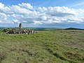
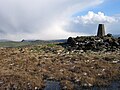
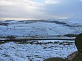
English: Axe Edge is a moor and hill in the civil parish of Hartington Upper Quarter, in the High Peak district, in the county of Derbyshire, England.
moorland and hill in Derbyshire, England, UK  | |||||
| Upload media | |||||
| Instance of | |||||
|---|---|---|---|---|---|
| Location | Hartington Upper Quarter, High Peak, Derbyshire, East Midlands, England | ||||
| Mountain range | |||||
| Elevation above sea level |
| ||||
 | |||||
Media in category "Axe Edge"
The following 43 files are in this category, out of 43 total.
-
 A54 from Axe Edge Moor - geograph.org.uk - 161374.jpg 640 × 480; 109 KB
-
 Axe Edge - geograph.org.uk - 1384070.jpg 640 × 498; 35 KB
-
 Axe Edge - geograph.org.uk - 161382.jpg 640 × 480; 126 KB
-
 Axe Edge - geograph.org.uk - 161404.jpg 640 × 480; 112 KB
-
 Axe Edge - panoramio.jpg 4,608 × 3,456; 4.88 MB
-
 Axe Edge hillside towards Stanley Moor - geograph.org.uk - 1571789.jpg 640 × 480; 137 KB
-
 Axe Edge Moor - geograph.org.uk - 1571774.jpg 640 × 480; 122 KB
-
 Axe Edge Moor - geograph.org.uk - 2946904.jpg 1,280 × 853; 308 KB
-
 Axe Edge Moor - geograph.org.uk - 3323837.jpg 1,600 × 1,200; 704 KB
-
 Axe Edge Moor - geograph.org.uk - 98606.jpg 640 × 480; 134 KB
-
 Axe Edge trig point - geograph.org.uk - 161401.jpg 640 × 480; 99 KB
-
 Axe Edge trig, looking south - geograph.org.uk - 3005730.jpg 1,142 × 857; 336 KB
-
 Axe Head Moor - geograph.org.uk - 4548498.jpg 3,648 × 2,736; 4.12 MB
-
 Capped mine on Axe Edge Moor - geograph.org.uk - 600460.jpg 640 × 480; 144 KB
-
 Coal spoil heap - geograph.org.uk - 600528.jpg 640 × 480; 68 KB
-
 Dane Head - geograph.org.uk - 1521048.jpg 640 × 426; 108 KB
-
 Dane Head - geograph.org.uk - 98609.jpg 640 × 480; 113 KB
-
 Dane Valley Way - north - geograph.org.uk - 977376.jpg 640 × 480; 42 KB
-
 Dane Valley Way - south - geograph.org.uk - 977381.jpg 640 × 480; 68 KB
-
 Farms under Axe Edge - geograph.org.uk - 1384092.jpg 640 × 521; 42 KB
-
 Footpath to Axe Edge - geograph.org.uk - 3361251.jpg 3,872 × 2,592; 4.08 MB
-
 Grouse butts on Axe Edge - geograph.org.uk - 3005736.jpg 1,142 × 857; 334 KB
-
 Looking south from Axe Edge Moor - geograph.org.uk - 977368.jpg 640 × 480; 69 KB
-
 Moorland track across Axe Edge Moor - geograph.org.uk - 600459.jpg 640 × 480; 62 KB
-
 Old course of A53, Axe Edge - geograph.org.uk - 161233.jpg 640 × 480; 107 KB
-
 Old course of A53, Axe Edge - geograph.org.uk - 161237.jpg 640 × 480; 112 KB
-

-
 Peat hagg, Axe Edge Moor - geograph.org.uk - 600521.jpg 640 × 480; 104 KB
-
 Pond in the moorland, Axe Edge moor - geograph.org.uk - 600455.jpg 640 × 480; 81 KB
-
 Road across the moor - geograph.org.uk - 600471.jpg 640 × 480; 61 KB
-
 Road near High Edge - geograph.org.uk - 335945.jpg 640 × 426; 90 KB
-
 Sheep-dog Trials - geograph.org.uk - 1384116.jpg 640 × 519; 47 KB
-
 Shooting Butts on Axe Edge - geograph.org.uk - 1313611.jpg 640 × 480; 69 KB
-
 Spoil heap on Axe Edge Moor - geograph.org.uk - 600469.jpg 640 × 480; 84 KB
-
 Stanley Moor Reservoir from Axe Edge - geograph.org.uk - 161379.jpg 640 × 480; 116 KB
-
 Summit area of Axe Edge - geograph.org.uk - 3824769.jpg 1,500 × 1,125; 1.73 MB
-
 Thatch Marsh - geograph.org.uk - 98613.jpg 640 × 480; 134 KB
-
 The southern 'top' of Axe Edge - geograph.org.uk - 3005741.jpg 1,142 × 857; 406 KB
-
 The track leads to Buxton - geograph.org.uk - 972850.jpg 640 × 480; 69 KB
-
 Trig Pillar at the Summit of Axe Edge Moor - geograph.org.uk - 5352727.jpg 4,608 × 3,456; 3.58 MB
-
 Trig Point on Axe Edge, 1810' - geograph.org.uk - 1103858.jpg 640 × 427; 46 KB
-
 View from Grin Low - geograph.org.uk - 1518753.jpg 640 × 479; 88 KB
-
 View South from Grinlow Tower - geograph.org.uk - 3784800.jpg 3,648 × 2,736; 2.5 MB


