Category:B-65 Maldegem
Jump to navigation
Jump to search
| Object location | | View all coordinates using: OpenStreetMap |
|---|
| Upload media | |||||
| Instance of | |||||
|---|---|---|---|---|---|
| Location |
| ||||
| Operator | |||||
| Dissolved, abolished or demolished date |
| ||||
 | |||||
Media in category "B-65 Maldegem"
The following 3 files are in this category, out of 3 total.
-
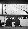 Royal Air Force Coastal Command, 1939-1945. CL1634.jpg 754 × 800; 57 KB
-
 Royal Air Force Coastal Command, 1939-1945. CL1635.jpg 800 × 640; 52 KB
-
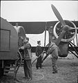 Royal Air Force Coastal Command, 1939-1945. CL1638.jpg 754 × 800; 66 KB


