Category:B1096 road (England)
Jump to navigation
Jump to search

road in England | |||||
| Upload media | |||||
| Instance of |
| ||||
|---|---|---|---|---|---|
| Location | England | ||||
| Transport network |
| ||||
| |||||
Media in category "B1096 road (England)"
The following 10 files are in this category, out of 10 total.
-

-
 High Street Benwick - geograph.org.uk - 813479.jpg 640 × 480; 100 KB
-
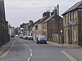 High Street, Ramsey - geograph.org.uk - 748505.jpg 640 × 480; 190 KB
-
 Ramsey Forty Foot - geograph.org.uk - 446817.jpg 640 × 480; 75 KB
-
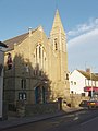 Ramsey Methodist Church - geograph.org.uk - 286945.jpg 480 × 640; 72 KB
-
 Wood Lane Cemetery, Ramsey - geograph.org.uk - 613790.jpg 640 × 427; 106 KB
-
 Fenholme bungalow on the B1096 - geograph.org.uk - 498372.jpg 640 × 425; 72 KB
-
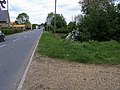
 Ibberson's Drove junction with B1096 - geograph.org.uk - 498360.jpg 640 × 425; 84 KB
-
 Roadside farm on the B1096 - geograph.org.uk - 498367.jpg 640 × 425; 66 KB
-
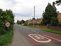
 Speed Sign - geograph.org.uk - 655965.jpg 640 × 480; 56 KB


