Category:B3098 road (England)
Jump to navigation
Jump to search
road in England | |||||
| Upload media | |||||
| Instance of |
| ||||
|---|---|---|---|---|---|
| Location | England | ||||
| Transport network |
| ||||
| |||||
Media in category "B3098 road (England)"
The following 35 files are in this category, out of 35 total.
-
 Alfred Street - geograph.org.uk - 128962.jpg 640 × 480; 95 KB
-
 B3098 at Edington - geograph.org.uk - 1770178.jpg 640 × 481; 101 KB
-
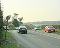
 B3098 at Flinty Knapp - geograph.org.uk - 1771330.jpg 640 × 464; 106 KB
-

-
 B3098 Cheverell Road - geograph.org.uk - 1236022.jpg 640 × 569; 167 KB
-
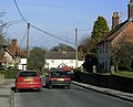
 B3098 heading west into Westbury - geograph.org.uk - 1726177.jpg 640 × 466; 53 KB
-
 B3098 heading west out of Erlestoke - geograph.org.uk - 1771507.jpg 640 × 494; 89 KB
-
 B3098 High Street, Erlestoke - geograph.org.uk - 1771475.jpg 640 × 518; 91 KB
-
 B3098 looking east at Flinty Knapp - geograph.org.uk - 1771357.jpg 640 × 521; 128 KB
-

-
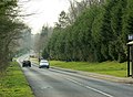
 B3098 near Bratton - geograph.org.uk - 1726170.jpg 640 × 491; 62 KB
-
 B3098 near Great Cheverell - geograph.org.uk - 1235913.jpg 640 × 512; 136 KB
-
 B3098 near Upper Baynton Farm - geograph.org.uk - 1771149.jpg 640 × 528; 146 KB
-
 B3098 near Upper Baynton Farm - geograph.org.uk - 1771167.jpg 640 × 494; 113 KB
-

-
 B3098 passing Dauntsey's School - geograph.org.uk - 1215158.jpg 640 × 518; 209 KB
-
 B3098 south of Great Cheverell - geograph.org.uk - 1235947.jpg 640 × 562; 177 KB
-
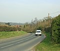
 B3098 west of Erlestoke - geograph.org.uk - 1235871.jpg 640 × 471; 153 KB
-
 B3098 west of Little Cheverell - geograph.org.uk - 1235959.jpg 640 × 507; 107 KB
-
 B3098 Westbury Road - geograph.org.uk - 1215152.jpg 640 × 542; 118 KB
-
 B3098 Westbury Road at Edington - geograph.org.uk - 1769801.jpg 640 × 486; 85 KB
-
 Birchanger Farm - geograph.org.uk - 102658.jpg 640 × 480; 78 KB
-
 Bratton Road, Westbury - geograph.org.uk - 667114.jpg 640 × 476; 97 KB
-
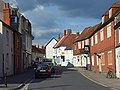
 Church Street, Market Lavington - geograph.org.uk - 846504.jpg 640 × 480; 130 KB
-
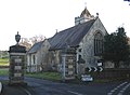 Erlestoke Parish Church - geograph.org.uk - 113552.jpg 640 × 470; 66 KB
-
 High Street, Market Lavington - geograph.org.uk - 846494.jpg 640 × 480; 141 KB
-
 Littleton Panell.JPG 2,272 × 1,704; 1.15 MB
-
 Melbourne Street, Bratton - geograph.org.uk - 314049.jpg 640 × 480; 100 KB
-
 North east from B3098 Westbury Road - geograph.org.uk - 1726147.jpg 640 × 459; 69 KB
-
 Old school house, Edington - geograph.org.uk - 1769823.jpg 640 × 449; 88 KB
-
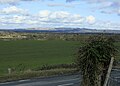
 Westbury cement works from B3098 - geograph.org.uk - 1726099.jpg 640 × 524; 51 KB
-
 Floral display on the Mead roundabout - geograph.org.uk - 54233.jpg 640 × 480; 68 KB
-
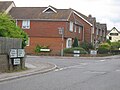
 Junction in Urchfont - geograph.org.uk - 424718.jpg 640 × 480; 85 KB
-
 The Duke, Bratton - geograph.org.uk - 314048.jpg 640 × 480; 99 KB
-
 Willoughby Hedge Services - geograph.org.uk - 199416.jpg 640 × 480; 69 KB


