Category:Bahnhof Weener
Jump to navigation
Jump to search
| Object location | | View all coordinates using: OpenStreetMap |
|---|
Nederlands: Station Weener is een halte langs de spoorlijn Nieuweschans-Leer, gelegen in de gelijknamige plaats.
Deutsch: Bahnhof (Haltepunkt) in Weener an der Bahnstrecke Leer–Groningen
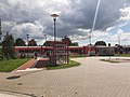
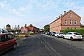
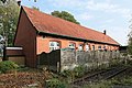
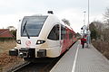
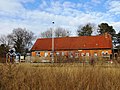
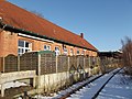
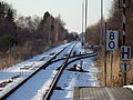
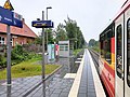
railway station in Weener, Germany    | |||||
| Upload media | |||||
| Instance of | |||||
|---|---|---|---|---|---|
| Location | Weener, Leer, Lower Saxony, Germany | ||||
| Street address |
| ||||
| Transport network | |||||
| Operator |
| ||||
| Date of official opening |
| ||||
| Connecting line | |||||
| Adjacent station | |||||
 | |||||
Subcategories
This category has only the following subcategory.
O
Media in category "Bahnhof Weener"
The following 54 files are in this category, out of 54 total.
-
 2013-05-03 Fotoflug Nordholz Papenburg HP 2413.JPG 5,760 × 3,840; 8.09 MB
-
 2013-05-03 Fotoflug Nordholz Papenburg HP 2414.JPG 5,760 × 3,840; 7.37 MB
-
 2013-05-03 Fotoflug Nordholz Papenburg HP 2415.JPG 5,760 × 3,840; 8.3 MB
-
 2013-05-03 Fotoflug Nordholz Papenburg HP 2416.JPG 5,760 × 3,840; 8.04 MB
-
 2013-05-03 Fotoflug Nordholz Papenburg HP 2417.JPG 5,760 × 3,840; 8.67 MB
-
 2013-05-03 Fotoflug Nordholz Papenburg HP 2418.JPG 5,760 × 3,840; 8.97 MB
-
 2013-05-03 Fotoflug Nordholz Papenburg HP 2419.JPG 5,760 × 3,840; 8.51 MB
-
 Ancien trainstation building Weener.jpg 1,024 × 768; 152 KB
-
 Bahnhof Weener 2021.jpg 4,032 × 3,024; 2.55 MB
-
 De trein van Weener naar Groningen (32736739996).jpg 1,536 × 1,024; 1.11 MB
-
 End of Iine (32654095301).jpg 1,536 × 1,024; 1.48 MB
-
 Stadler GTW von Arriva verläßt Bahnhof Weener - panoramio.jpg 2,592 × 1,456; 1.69 MB
-
 Weener - Am Bahnhof + 2 + Bahnhof 01 ies.jpg 5,616 × 3,743; 19.47 MB
-
 Weener - Am Bahnhof + Bahnhof 01 ies.jpg 5,616 × 3,744; 18.75 MB
-
 Weener - Am Bahnhof + Bahnhof 02 ies.jpg 5,616 × 3,744; 19.59 MB
-
 Weener - Am Bahnhof + Bahnhof 03 ies.jpg 5,616 × 3,744; 20.14 MB
-
 Weener - Am Bahnhof + Bahnhof 04 ies.jpg 5,616 × 3,745; 21.04 MB
-
 Weener - Am Bahnhof - Bahnhof 01 ies.jpg 5,616 × 3,745; 19.46 MB
-
 Weener - Am Bahnhof - Bahnhof 02 ies.jpg 5,616 × 3,744; 19.44 MB
-
 Weener - Am Bahnhof - Bahnhof 03 ies.jpg 5,616 × 3,744; 20.39 MB
-
 Weener - Am Bahnhof - Bahnhof 04 ies.jpg 5,616 × 3,744; 21.56 MB
-
 Weener - Am Bahnhof - Bahnhof 05 ies.jpg 3,744 × 5,616; 14.62 MB
-
 Weener - Am Bahnhof - Bahnhof 06 ies.jpg 5,616 × 3,744; 24.07 MB
-
 Weener - Am Bahnhof - Bahnhof 07 ies.jpg 5,616 × 3,744; 18.87 MB
-
 Weener - Am Bahnhof - Bahnhof 08 ies.jpg 5,616 × 3,744; 29.91 MB
-
 Weener - Am Bahnhof - Bahnhof 09 ies.jpg 3,744 × 5,616; 34.09 MB
-
 Weener - Am Bahnhof - Bahnhof 10 ies.jpg 3,744 × 5,616; 19.1 MB
-
 Weener - Am Bahnhof - Bahnhof 11 ies.jpg 3,745 × 5,616; 18.64 MB
-
 Weener - Am Bahnhof - Bahnhof 12 ies.jpg 5,616 × 3,744; 20.35 MB
-
 Weener - Am Bahnhof - Bahnhof 13 ies.jpg 5,616 × 3,744; 26.5 MB
-
 Weener - Am Bahnhof - Bahnhof 14 ies.jpg 5,616 × 3,744; 13.61 MB
-
 Weener - Am Bahnhof - Bahnhof 15 ies.jpg 5,616 × 3,744; 21.34 MB
-
 Weener - Bahnhofstraße - Bahnhof 01 ies.jpg 5,616 × 3,744; 34.05 MB
-
 Weener - Bahnhofstraße - Bahnhof 02 ies.jpg 5,616 × 3,744; 24.9 MB
-
 Weener - Gräfin-Theda-Weg - Bahnhof + Arriva 01 ies.jpg 5,616 × 3,744; 26.35 MB
-
 Weener - Gräfin-Theda-Weg - Bahnhof + Arriva 02 ies.jpg 5,616 × 3,744; 22.1 MB
-
 Weener - Gräfin-Theda-Weg - Bahnhof + Arriva 03 ies.jpg 5,616 × 3,744; 24.12 MB
-
 Weener - Gräfin-Theda-Weg - Bahnhof + Arriva 04 ies.jpg 5,616 × 3,744; 26.48 MB
-
 Weener - Gräfin-Theda-Weg - Bahnhof + Arriva 05 ies.jpg 5,616 × 3,743; 19.79 MB
-
 Weener - Gräfin-Theda-Weg - Bahnhof + Arriva 06 ies.jpg 5,616 × 3,744; 22.07 MB
-
 Weener Bahnhof.JPG 4,752 × 3,168; 5.19 MB
-
 Weener end of line (40324619291).jpg 1,536 × 1,024; 1.15 MB
-
 Weener railway station.JPG 4,000 × 3,000; 3.7 MB
-
 Weener station 2019.jpg 3,648 × 2,736; 4.48 MB
-
 Weener station gebouw.jpg 4,288 × 3,216; 3.66 MB
-
 Weener station in de sneeuw.jpg 4,288 × 3,216; 3.53 MB
-
 Weener station met Arriva Spurt I.jpg 4,288 × 3,216; 3.44 MB
-
 Weener station met Arriva Spurt II.jpg 4,288 × 3,216; 3.53 MB
-
 Weener station met Arriva Spurt III.jpg 4,288 × 3,216; 3.95 MB
-
 Weener station met Arriva Spurt IV.jpg 4,288 × 3,216; 3.68 MB
-
 Weener station met ticket machines.jpg 4,288 × 3,216; 3.57 MB
-
 Weener Station.jpg 1,024 × 768; 78 KB
-
 Weener train station in rain.jpg 4,485 × 3,365; 1.76 MB
-
 Weener train station.jpg 4,608 × 3,456; 2.74 MB


.jpg)
.jpg)


.jpg)


