Category:Bakkerstraat 18, Arnhem
Jump to navigation
Jump to search
| Object location | | View all coordinates using: OpenStreetMap |
|---|
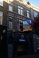
building in Arnhem, Netherlands  | |||||
| Upload media | |||||
| Instance of | |||||
|---|---|---|---|---|---|
| Location | Arnhem, Gelderland, Netherlands | ||||
| Street address |
| ||||
| Located on street | |||||
| Heritage designation |
| ||||
 | |||||
|
This is a category about rijksmonument number 516854
|
| Address |
|
Media in category "Bakkerstraat 18, Arnhem"
The following 5 files are in this category, out of 5 total.
-
 Arnhem - Bakkerstraat 18 deur.jpg 1,728 × 2,592; 1.06 MB
-
 Arnhem - Bakkerstraat 18-1.jpg 1,728 × 2,592; 1.17 MB
-
 Arnhem - Bakkerstraat 18-2.jpg 1,728 × 2,592; 1.41 MB
-
 Arnhem - Bakkerstraat 18.jpg 1,728 × 2,592; 1.31 MB
-
 Voorgevel - Arnhem - 20025214 - RCE.jpg 807 × 1,200; 186 KB


