Category:Bakkerstraat 19, Arnhem
Jump to navigation
Jump to search
| Object location | | View all coordinates using: OpenStreetMap |
|---|
building in Arnhem, Netherlands  | |||||
| Upload media | |||||
| Instance of | |||||
|---|---|---|---|---|---|
| Location | Arnhem, Gelderland, Netherlands | ||||
| Street address |
| ||||
| Located on street | |||||
| Heritage designation |
| ||||
 | |||||
|
This is a category about rijksmonument number 8298
|
| Address |
|
Media in category "Bakkerstraat 19, Arnhem"
The following 12 files are in this category, out of 12 total.
-
 Arnhem - Bakkerstraat 19.jpg 1,944 × 2,592; 1.35 MB
-
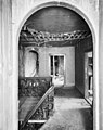
 Fragment hal met trap, 19 - Arnhem - 20025224 - RCE.jpg 953 × 1,200; 162 KB
-
 Fragment trapleuning - Arnhem - 20025221 - RCE.jpg 950 × 1,200; 217 KB
-
 Hal gezien naar voordeur, 19 - Arnhem - 20025223 - RCE.jpg 1,200 × 960; 167 KB
-
 Hal met trap - Arnhem - 20025222 - RCE.jpg 1,200 × 946; 220 KB
-
 Interieur - Arnhem - 20025217 - RCE.jpg 953 × 1,200; 225 KB
-
 Interieur - Arnhem - 20025218 - RCE.jpg 1,200 × 982; 227 KB
-
 Interieur - Arnhem - 20025219 - RCE.jpg 1,200 × 956; 314 KB
-
 Interieur - Arnhem - 20025220 - RCE.jpg 1,200 × 968; 307 KB
-
 M straat overzicht - Arnhem - 20025202 - RCE.jpg 963 × 1,200; 193 KB
-
 Voorgevel - Arnhem - 20025215 - RCE.jpg 945 × 1,200; 217 KB
-
 Voorgevel - Arnhem - 20025216 - RCE.jpg 963 × 1,200; 246 KB


