Category:Barsham, Suffolk
Jump to navigation
Jump to search
English: Barsham is a village and civil parish in the Waveney district of Suffolk, England. It is about two miles (3km) west of Beccles in the district of Waveney, and is on the edge of The Broads. It is dispersed along the B1062 Beccles to Bungay road, 1 mile, (1½ km) north-west of Ringsfield.
Français : Barsham est un village de (2001) dans le district du Waveney dans le comté du Suffolk, Angleterre. La ville est légérement à l'ouest de Beccles et à la limite de « The Broads ».
village and civil parish in Suffolk, UK  | |||||
| Upload media | |||||
| Instance of | |||||
|---|---|---|---|---|---|
| Location | Waveney, Suffolk, East of England, England | ||||
 | |||||
Subcategories
This category has the following 4 subcategories, out of 4 total.
H
- Barsham Hall (2 F)
T
Media in category "Barsham, Suffolk"
The following 200 files are in this category, out of 287 total.
(previous page) (next page)-
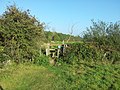 A double-stepped stile on Angles Way - geograph.org.uk - 2622558.jpg 3,264 × 2,448; 2.86 MB
-
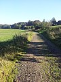
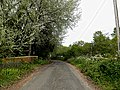
 A tree-lined byway in Beccles - geograph.org.uk - 3218457.jpg 3,264 × 2,448; 2.2 MB
-
 American WW2 aircraft crash memorial - geograph.org.uk - 6159725.jpg 2,408 × 1,484; 1.19 MB
-
 Angles Way - geograph.org.uk - 4166084.jpg 1,024 × 768; 222 KB
-
 Angles Way from Beccles to Shipmeadow - geograph.org.uk - 3338300.jpg 640 × 480; 169 KB
-
 Angles Way just outside Beccles - geograph.org.uk - 2624725.jpg 2,448 × 3,264; 2.58 MB
-
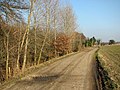 Angles Way north of Barsham - geograph.org.uk - 3338393.jpg 640 × 480; 226 KB
-

-
 Angles Way through Barsham Marshes - geograph.org.uk - 3338365.jpg 640 × 480; 190 KB
-

-

-
 B1062 Beccles Road ^ footpath - geograph.org.uk - 3941679.jpg 3,072 × 2,304; 1.25 MB
-
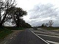
 B1062 Bungay Road - geograph.org.uk - 3465222.jpg 3,072 × 2,304; 1.25 MB
-
 B1062 Bungay Road at Barsham Bridge - geograph.org.uk - 3948861.jpg 3,072 × 2,304; 2.05 MB
-
 B1062 Bungay Road ^ footpath - geograph.org.uk - 3941725.jpg 3,072 × 2,304; 1.58 MB
-
 B1062 Bungay Road, Barsham - geograph.org.uk - 3465683.jpg 3,072 × 2,304; 1.28 MB
-
 B1062 Bungay Road, Barsham - geograph.org.uk - 3465700.jpg 3,072 × 2,304; 1.25 MB
-
 B1062 Bungay Road, Barsham - geograph.org.uk - 3466163.jpg 3,072 × 2,304; 1.29 MB
-
 B1062 Bungay Road, Barsham - geograph.org.uk - 3466184.jpg 3,072 × 2,304; 1.21 MB
-
 B1062 Bungay Road, Barsham - geograph.org.uk - 3466206.jpg 3,072 × 2,304; 1.24 MB
-
 B1062 Bungay Road, Barsham - geograph.org.uk - 3466217.jpg 3,068 × 1,927; 981 KB
-
 B1062 Bungay Road, Barsham - geograph.org.uk - 3466326.jpg 3,072 × 2,304; 1.2 MB
-
 B1062 Bungay Road, Barsham - geograph.org.uk - 3466357.jpg 3,072 × 2,304; 1.26 MB
-
 B1062 Bungay Road, Barsham - geograph.org.uk - 3466373.jpg 2,914 × 2,189; 978 KB
-
 B1062 Bungay Road, Barsham - geograph.org.uk - 3466467.jpg 3,072 × 2,304; 1.3 MB
-
 B1062 Bungay Road, Barsham - geograph.org.uk - 3466488.jpg 3,072 × 2,304; 1.28 MB
-
 B1062 Bungay Road, Barsham - geograph.org.uk - 3941740.jpg 3,072 × 2,304; 1.02 MB
-
 B1062 Bungay Road, Barsham - geograph.org.uk - 3944690.jpg 3,072 × 2,304; 948 KB
-
 B1062 Bungay Road, Barsham - geograph.org.uk - 3948628.jpg 3,072 × 2,304; 1.15 MB
-
 B1062 Bungay Road, Barsham - geograph.org.uk - 3948863.jpg 3,072 × 2,304; 1.69 MB
-
 B1062 Bungay Road, Barsham - geograph.org.uk - 3949076.jpg 3,072 × 2,304; 1.8 MB
-
 B1062 towards Bungay - geograph.org.uk - 5165289.jpg 640 × 480; 57 KB
-
 B1062, Barsham - geograph.org.uk - 5165287.jpg 640 × 480; 75 KB
-
 Barn owl hunting in Barsham Marshes - geograph.org.uk - 3338413.jpg 640 × 600; 266 KB
-
 Barn owl in Barsham Marshes - geograph.org.uk - 3338415.jpg 603 × 640; 193 KB
-
 Barsham and Shipmeadow WW1 war memorial - geograph.org.uk - 6159728.jpg 2,792 × 1,484; 1.54 MB
-
 Barsham Bridge on the B1062 Bungay Road - geograph.org.uk - 3944633.jpg 3,072 × 2,304; 2.03 MB
-
 Barsham Church sign - geograph.org.uk - 3466215.jpg 2,279 × 3,042; 1.06 MB
-
 Barsham City - geograph.org.uk - 2017210.jpg 640 × 480; 82 KB
-
 Barsham City - geograph.org.uk - 3466785.jpg 3,072 × 2,304; 1.26 MB
-
 Barsham City sign on Church Road - geograph.org.uk - 3466777.jpg 2,803 × 2,105; 1.39 MB
-
 Barsham Marshes - geograph.org.uk - 978151.jpg 640 × 477; 113 KB
-
 Barsham Marshes in February - geograph.org.uk - 3338368.jpg 640 × 480; 206 KB
-
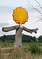
 Barsham Sculpture - geograph.org.uk - 3466529.jpg 2,304 × 3,072; 1.28 MB
-
 Barsham Sculpture - geograph.org.uk - 3466531.jpg 3,072 × 2,304; 1.2 MB
-
 Barsham Village Name sign - geograph.org.uk - 3941668.jpg 3,072 × 2,304; 1.58 MB
-
 Barsham Village Name sign - geograph.org.uk - 3944625.jpg 3,030 × 2,276; 2.04 MB
-
 Barsham Village Sign (Back) (geograph 5060862).jpg 2,506 × 3,508; 2.14 MB
-
 Barsham Village Sign (Front) (geograph 5060858).jpg 2,096 × 2,934; 1.79 MB
-
 Barsham water extraction headworks - geograph.org.uk - 2017143.jpg 640 × 480; 91 KB
-
 Barsham Water Works - geograph.org.uk - 3948841.jpg 3,072 × 2,304; 2.08 MB
-
 Barsham Water Works - geograph.org.uk - 3948843.jpg 3,072 × 2,304; 2.06 MB
-
 Barsham Water Works - geograph.org.uk - 3948869.jpg 2,304 × 3,072; 1.25 MB
-
 Barsham Water Works - geograph.org.uk - 3948870.jpg 2,279 × 3,042; 1.31 MB
-
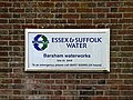 Barsham Water Works sign - geograph.org.uk - 3948874.jpg 2,983 × 2,241; 932 KB
-
 Barsham Waterworks - geograph.org.uk - 3944649.jpg 3,072 × 2,304; 1.05 MB
-
 Barsham Waterworks - geograph.org.uk - 3944650.jpg 3,072 × 2,304; 1.27 MB
-
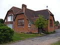
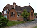 Barsham ^ Shipmeadow Village Hall - geograph.org.uk - 3465984.jpg 2,965 × 2,227; 1.35 MB
-
 Barsham ^ Shipmeadow Village Hall - geograph.org.uk - 3466041.jpg 3,072 × 2,304; 1.38 MB
-
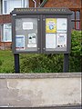 Barsham ^ Shipmeadow Village Notice Board - geograph.org.uk - 3465982.jpg 2,233 × 2,980; 1.41 MB
-
 Beccles tower from Barsham church tower (geograph 1856692).jpg 640 × 480; 48 KB
-
 Birch plantation - geograph.org.uk - 978111.jpg 640 × 477; 87 KB
-
 Boats moored on the River Waveney - geograph.org.uk - 3233923.jpg 640 × 480; 239 KB
-
 Brick shed at Gables Farm - geograph.org.uk - 3834327.jpg 640 × 480; 172 KB
-
 Bridleway to Church Road - geograph.org.uk - 3861752.jpg 3,072 × 2,304; 1.67 MB
-
 Bridleway to Church Road - geograph.org.uk - 3861779.jpg 2,304 × 3,072; 1.8 MB
-
 Bridleway to Lodge Farm Lane - geograph.org.uk - 3467319.jpg 3,072 × 2,304; 1.43 MB
-
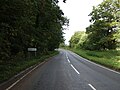
 Bungay Road (B1062) - geograph.org.uk - 5165280.jpg 640 × 480; 94 KB
-
 Bungay Road (B1062), Beccles - geograph.org.uk - 3323933.jpg 640 × 445; 155 KB
-
 Cattle grid in Barsham Marshes - geograph.org.uk - 3338367.jpg 640 × 480; 199 KB
-
 Chicken and Lamb - geograph.org.uk - 2017221.jpg 640 × 480; 90 KB
-
 Church Road at Barsham City junction - geograph.org.uk - 3466601.jpg 3,072 × 2,304; 1.28 MB
-
 Church Road near the footpath to Lodge Farm Lane - geograph.org.uk - 3466592.jpg 3,072 × 2,304; 1.53 MB
-
 Church Road ^ footpath to Lodge Farm Lane - geograph.org.uk - 3466577.jpg 3,072 × 2,304; 1.48 MB
-
 Church Road, Barsham - geograph.org.uk - 3466590.jpg 3,072 × 2,304; 1.38 MB
-
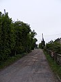
 Clarke's Lane - geograph.org.uk - 3465153.jpg 3,072 × 2,304; 1.37 MB
-
 Clarke's Lane - geograph.org.uk - 3465190.jpg 3,072 × 2,304; 1.27 MB
-
 Clarke's Lane ^ the footpaths - geograph.org.uk - 3465146.jpg 3,072 × 2,304; 1.66 MB
-
 Clarke's Lane, Barsham - geograph.org.uk - 3465986.jpg 3,072 × 2,304; 1.24 MB
-
 Clarke's Lane, Shipmeadow - geograph.org.uk - 3465111.jpg 3,072 × 2,304; 1.38 MB
-
 Clarkes Lane sign - geograph.org.uk - 3465195.jpg 3,072 × 2,304; 1.45 MB
-
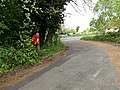
 Close up, Elizabeth II postbox on the B1062, Barsham - geograph.org.uk - 5167121.jpg 1,313 × 2,457; 656 KB
-
 Clover Fabrications sign - geograph.org.uk - 4960532.jpg 2,304 × 3,072; 2.64 MB
-
 Clover Fabrications, Barsham - geograph.org.uk - 4960526.jpg 2,992 × 2,302; 2.77 MB
-
 Craft stalls at Barsham Faire - geograph.org.uk - 2238889.jpg 640 × 415; 48 KB
-

-

-
 Cultivated fields in Barsham Marshes - geograph.org.uk - 3338330.jpg 622 × 640; 232 KB
-
 Cultivated fields, Barsham - geograph.org.uk - 3323772.jpg 640 × 480; 190 KB
-
 Danger - Keep Out - geograph.org.uk - 3338381.jpg 640 × 480; 266 KB
-
 Drainage channel in Barsham Marshes - geograph.org.uk - 3338344.jpg 640 × 480; 232 KB
-

-

-

-

-
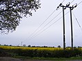 Electricity Poles ^ Wires - geograph.org.uk - 3465080.jpg 3,072 × 2,304; 1.3 MB
-
 Electricity pylons by the River Waveney - geograph.org.uk - 3237953.jpg 640 × 480; 208 KB
-
 Electricity pylons in Barsham Marshes - geograph.org.uk - 3233903.jpg 640 × 480; 185 KB
-
 Electricity transformer, Barsham Marshes - geograph.org.uk - 3338412.jpg 480 × 640; 145 KB
-
 Electricity wires over a crop on Barsham Marshes - geograph.org.uk - 2624737.jpg 3,264 × 2,448; 2.39 MB
-

-
 Elizabeth II postbox and phonebox on the B1062, Barsham - geograph.org.uk - 5167120.jpg 2,108 × 1,946; 866 KB
-
 Entering Barsham - geograph.org.uk - 5165279.jpg 640 × 480; 86 KB
-
 Entering Barsham on the B1062 Bungay Road - geograph.org.uk - 3944620.jpg 3,072 × 2,304; 1.82 MB
-
 Entrance of Holly Trinity Church - geograph.org.uk - 3466277.jpg 3,072 × 2,304; 1.3 MB
-
 Entrance of Holy Trinity Church - geograph.org.uk - 3466297.jpg 3,072 × 2,075; 1.22 MB
-
 Entrance to Barsham Hall - geograph.org.uk - 3466056.jpg 2,304 × 3,072; 1.28 MB
-
 Entrance to Barsham Village Hall - geograph.org.uk - 3470869.jpg 2,304 × 3,072; 1.29 MB
-
 Entrance to Furze Cottage - geograph.org.uk - 4960782.jpg 3,072 × 2,304; 1.91 MB
-
 Extra flower bed - geograph.org.uk - 978161.jpg 640 × 477; 104 KB
-
 Farm track in Barsham Marshes - geograph.org.uk - 3338392.jpg 640 × 480; 282 KB
-

-
 Field beside Hall Road - geograph.org.uk - 3834298.jpg 640 × 480; 204 KB
-
 Field beside Hall Road - geograph.org.uk - 3834299.jpg 640 × 480; 205 KB
-
 Field entrance off the B1062 Bungay Road - geograph.org.uk - 3941731.jpg 3,072 × 2,304; 1.09 MB
-
 Field entrance, Telephone Box ^ The Old School Postbox - geograph.org.uk - 3466201.jpg 3,072 × 2,304; 1.47 MB
-
 Field west of Roos Hall, Beccles - geograph.org.uk - 3338307.jpg 640 × 480; 191 KB
-
 Field, Barsham Hill - geograph.org.uk - 5165282.jpg 640 × 480; 59 KB
-

-
 Fields by Little Common - geograph.org.uk - 3834266.jpg 640 × 480; 183 KB
-
 Fields by Ringsfield Hall - geograph.org.uk - 3834294.jpg 640 × 480; 151 KB
-
 Fields in Barsham Marshes - geograph.org.uk - 3338374.jpg 640 × 480; 219 KB
-
 Fields north of the B1062 road, Beccles - geograph.org.uk - 3323939.jpg 640 × 480; 154 KB
-
 Fields on the edge of Barsham Marshes - geograph.org.uk - 3338303.jpg 640 × 480; 172 KB
-

-
 Fields west of Beccles - geograph.org.uk - 3338294.jpg 640 × 480; 182 KB
-
 Fire eater at Barsham Faire - geograph.org.uk - 2238888.jpg 640 × 481; 64 KB
-
 Flush bracket on Barsham Bridge - geograph.org.uk - 2070308.jpg 640 × 480; 86 KB
-
 Footbridge - geograph.org.uk - 4309430.jpg 768 × 1,024; 324 KB
-
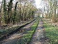
 Footpath - geograph.org.uk - 4309436.jpg 768 × 1,024; 317 KB
-
 Footpath - geograph.org.uk - 4309491.jpg 1,024 × 768; 282 KB
-

-
 Footpath off the B1062 Bungay Road - geograph.org.uk - 3941723.jpg 3,072 × 2,304; 1.88 MB
-
 Footpath parallel to Ringsfield Road - geograph.org.uk - 6178865.jpg 2,268 × 4,032; 2.56 MB
-
 Footpath past The Close, Barsham - geograph.org.uk - 3323788.jpg 640 × 412; 175 KB
-
 Footpath through Trees, near Clarke's Lane, Barsham - geograph.org.uk - 5550006.jpg 2,736 × 2,736; 5.1 MB
-
 Footpath to Barsham - geograph.org.uk - 3834331.jpg 640 × 480; 211 KB
-
 Footpath to Barsham Bridge - geograph.org.uk - 3323777.jpg 640 × 480; 204 KB
-
 Footpath to Barsham Bridge - geograph.org.uk - 3323793.jpg 640 × 480; 164 KB
-
 Footpath to Barsham City - geograph.org.uk - 3834315.jpg 640 × 480; 210 KB
-
 Footpath to Blacksmith's Corner - geograph.org.uk - 3834303.jpg 640 × 480; 229 KB
-
 Footpath to Bungay Road - geograph.org.uk - 3861751.jpg 3,008 × 2,254; 2.25 MB
-
 Footpath to Bungay Road - geograph.org.uk - 3861765.jpg 2,304 × 3,072; 2.22 MB
-
 Footpath to Clarke's Lane - geograph.org.uk - 4960696.jpg 3,072 × 2,304; 1.89 MB
-
 Footpath to Hall Road - geograph.org.uk - 3465180.jpg 2,304 × 3,072; 1.68 MB
-
 Footpath to Hall Road - geograph.org.uk - 3465182.jpg 2,304 × 3,072; 1.69 MB
-
 Footpath to Hall Road - geograph.org.uk - 3466783.jpg 2,304 × 3,072; 1.34 MB
-
 Footpath to Holy Trinity Church, Barsham - geograph.org.uk - 3323784.jpg 640 × 433; 181 KB
-
 Footpath to Laurels Farm - geograph.org.uk - 3465169.jpg 2,304 × 3,072; 1.67 MB
-
 Footpath to Laurels Farm - geograph.org.uk - 3465171.jpg 3,072 × 2,304; 1.32 MB
-
 Footpath to Lodge Farm Lane - geograph.org.uk - 3466581.jpg 2,304 × 3,072; 1.5 MB
-
 Footpath to Lodge Farm Lane - geograph.org.uk - 3466583.jpg 2,304 × 3,072; 1.51 MB
-
 Footpath to Lodge Farm Lane - geograph.org.uk - 3948884.jpg 3,072 × 2,304; 1.85 MB
-
 Footpath to the B1062 road, Barsham - geograph.org.uk - 3323782.jpg 640 × 480; 259 KB
-
 Footpath ^ Farmland near Barsham - geograph.org.uk - 2899755.jpg 3,264 × 2,448; 2.18 MB
-
 Gables Farm, Barsham - geograph.org.uk - 3834330.jpg 640 × 493; 163 KB
-

-
 Gated track in Barsham Marshes - geograph.org.uk - 3338385.jpg 640 × 480; 249 KB
-
 Glimpse across the River Waveney - geograph.org.uk - 3233889.jpg 640 × 480; 278 KB
-

-
 GR postbox on an ex-telegraph pole - geograph.org.uk - 2070303.jpg 640 × 480; 88 KB
-
 Hall Road - geograph.org.uk - 3466557.jpg 3,072 × 2,304; 1.48 MB
-
 Hall Road by Furze Common - geograph.org.uk - 3834306.jpg 640 × 480; 210 KB
-
 Hall Road junction - geograph.org.uk - 3466549.jpg 3,072 × 2,304; 1.36 MB
-
 Hall Road on Furze Common - geograph.org.uk - 4960752.jpg 3,072 × 1,971; 3.54 MB
-
 Hall Road past Gables Farm - geograph.org.uk - 3834323.jpg 640 × 480; 147 KB
-
 Hall Road past Orchard Place - geograph.org.uk - 3834311.jpg 640 × 480; 135 KB
-
 Hall Road ^ footpath - geograph.org.uk - 4960689.jpg 3,072 × 2,026; 3.07 MB
-
 Hall Road, Barsham - geograph.org.uk - 3466351.jpg 3,072 × 2,304; 1.39 MB
-
 Hall Road, Barsham - geograph.org.uk - 4960634.jpg 3,072 × 2,304; 4.42 MB
-
 Hall Road, Barsham - geograph.org.uk - 4960642.jpg 3,072 × 2,304; 1.88 MB
-
 Hall Road, Barsham - geograph.org.uk - 4960656.jpg 3,072 × 2,212; 4.08 MB
-
 Hall Road, Barsham - geograph.org.uk - 4960758.jpg 3,072 × 2,087; 4.12 MB
-
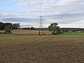
 High pylons in Barsham Marshes - geograph.org.uk - 3338328.jpg 619 × 640; 205 KB
-
 Horse-trading at Barsham Faire - geograph.org.uk - 2238891.jpg 640 × 480; 51 KB
-
 Ink Factory Cottages, Barsham - geograph.org.uk - 2017136.jpg 640 × 480; 75 KB
-

-

-
 Layby off the B1062 Bungay Road - geograph.org.uk - 3466332.jpg 3,072 × 2,304; 1.33 MB
-
 Lodge Farm Lane - geograph.org.uk - 4310077.jpg 768 × 1,024; 309 KB
-
 Lodge Farm Lane footpath - geograph.org.uk - 3948671.jpg 2,888 × 2,169; 1.26 MB
-
 Lodge Farm Lane footpath ^ entrance to Lodge Farm - geograph.org.uk - 3948668.jpg 3,072 × 2,304; 1.71 MB
-
 Lodge Farm Lane sign - geograph.org.uk - 3466367.jpg 3,072 × 2,304; 1.45 MB
-
 Lodge Farm Lane sign - geograph.org.uk - 3948639.jpg 3,072 × 2,304; 2.47 MB
-
 Lodge Farm Lane sign - geograph.org.uk - 3948855.jpg 3,049 × 2,290; 1.48 MB
-
 Lodge Farm Lane ^ Barsham Old Bridge - geograph.org.uk - 3948680.jpg 3,072 × 2,304; 2.07 MB
-
 Lodge Farm Lane ^ footpath - geograph.org.uk - 3948664.jpg 3,072 × 2,304; 2.11 MB
-
 Lodge Farm Lane ^ The Bridge George V Postbox - geograph.org.uk - 3948688.jpg 3,072 × 2,304; 1.68 MB
-
 Lodge Farm Lane ^ The Bridge George V Postbox - geograph.org.uk - 3948851.jpg 3,072 × 2,304; 1.94 MB
-
 Lodge Farm Lane, Barsham - geograph.org.uk - 3948630.jpg 3,072 × 2,157; 1.47 MB
-
 Lodge Farm Lane, Barsham - geograph.org.uk - 3948651.jpg 3,072 × 2,304; 1.49 MB
-
 Lodge Farm Lane, Barsham - geograph.org.uk - 3948652.jpg 3,072 × 2,304; 1.9 MB
-
 Lodge Farm Lane, Barsham - geograph.org.uk - 3948683.jpg 3,072 × 2,304; 1.67 MB
-
 Lodge Farm Lane, Barsham - geograph.org.uk - 3948819.jpg 3,072 × 2,304; 1.48 MB
-
 Lodge Farm Lane, Barsham - geograph.org.uk - 3948888.jpg 3,072 × 2,304; 1.84 MB
-
 Looking East - geograph.org.uk - 4310059.jpg 1,024 × 768; 181 KB
-
 Looking to Pylon in Arable Field, Barsham - geograph.org.uk - 5550002.jpg 3,648 × 2,736; 2.58 MB
-
 Muddy path skirting field - geograph.org.uk - 3834305.jpg 640 × 434; 203 KB
-
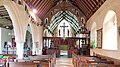 Nave of Most Holy Trinity church, Barsham - geograph.org.uk - 5931102.jpg 4,032 × 2,268; 1.92 MB
-
 Newly ploughed field near High Common - geograph.org.uk - 3621987.jpg 3,264 × 2,448; 2.5 MB


_(geograph_5060862).jpg)
_(geograph_5060858).jpg)


.jpg)


_-_geograph.org.uk_-_5165280.jpg)
,_Beccles_-_geograph.org.uk_-_3323933.jpg)


.jpg)


