Category:Bayerisch Gmain
Vai alla navigazione
Vai alla ricerca
municipality of Germany    | |||||
| Carica un file multimediale | |||||
| Istanza di |
| ||||
|---|---|---|---|---|---|
| Parte di |
| ||||
| Luogo | |||||
| Capo del governo |
| ||||
| Popolazione |
| ||||
| Superficie |
| ||||
| Altezza sul mare |
| ||||
| sito web ufficiale | |||||
 | |||||
Sottocategorie
Questa categoria contiene le 5 sottocategorie indicate di seguito, su un totale di 5.
Pagine nella categoria "Bayerisch Gmain"
Questa categoria contiene un'unica pagina, indicata di seguito.
File nella categoria "Bayerisch Gmain"
Questa categoria contiene 20 file, indicati di seguito, su un totale di 20.
-
 Wappen Bayerisch Gmain.jpg 219 × 247; 44 KB
-
 Wappen von Bayerisch Gmain.svg 696 × 789; 11 KB
-
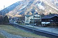
 Bahnhof Bayerisch Gmain.jpg 2 048 × 1 352; 568 KB
-
 Bayerisch Gmain in BGL.png 293 × 419; 8 KB
-
 Bayrgmain01.jpg 1 707 × 1 221; 2,05 MB
-
 BGmain Bahnhof 01.jpg 1 200 × 803; 241 KB
-
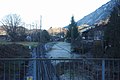 BGmain Bahnhof 02.jpg 1 200 × 803; 178 KB
-
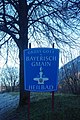 BGmain Schild Grüss Gott.jpg 803 × 1 200; 314 KB
-
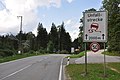
 BGmain Streitbichl.jpg 1 200 × 803; 150 KB
-
 Grossgmain Gmainer Tal.jpg 1 600 × 1 200; 1 023 KB
-
 Hallburg (Bad Reichenhall).PNG 606 × 396; 510 KB
-
 Hallthurmer Berg-Unfallstrecke.JPG 1 400 × 930; 199 KB
-
 Hochplatte-Bayerisch-Gmain.JPG 3 216 × 2 136; 3,19 MB
-
 Kirchholz Orthofoto.jpg 819 × 783; 835 KB
-
 Landschaftsschutzgebiet Ortelbach.JPG 1 400 × 930; 252 KB
-
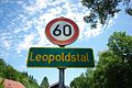 Leopoldstal.jpg 1 200 × 803; 231 KB
-
 REI Beethovenstr.jpg 1 024 × 685; 127 KB
-
 REI Schild Langenfeldstr.jpg 1 024 × 685; 128 KB
-
-
 Werkfoto BBC E 70 21.tif 2 016 × 1 450; 8,4 MB


.PNG)


_-_geograph.org.uk_-_8030.jpg)