Category:Beckley, Oxfordshire
Jump to navigation
Jump to search
village in Oxfordshire, UK  | |||||
| Upload media | |||||
| Instance of | |||||
|---|---|---|---|---|---|
| Location | Beckley and Stowood, South Oxfordshire, Oxfordshire, South East England, England | ||||
 | |||||
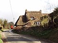
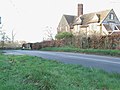
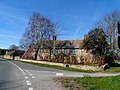
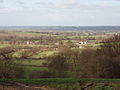
English: Beckley is a village in the civil parish of Beckley and Stowood, overlooking Otmoor to the north. The village is about northeast of the centre of Oxford. It is noted for its towering TV relay mast.
Subcategories
This category has the following 2 subcategories, out of 2 total.
B
- Beckley Park (12 F)
Media in category "Beckley, Oxfordshire"
The following 46 files are in this category, out of 46 total.
-
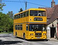 20180505 Walters Coaches F845ENV (cropped).jpg 3,291 × 2,579; 3.65 MB
-
 20180505 Walters Coaches F845ENV.jpg 5,184 × 3,456; 7.93 MB
-
 Beckley and Stowood - 1, Church Street - 20230924183729.jpg 4,000 × 3,000; 5.13 MB
-
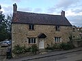
 Beckley HighRoad RoseCottage.JPG 2,600 × 1,950; 1.67 MB
-
 Beckley village.jpg 640 × 480; 117 KB
-
 Bridleway by pumping house - geograph.org.uk - 1172798.jpg 640 × 480; 83 KB
-
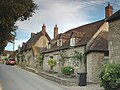
 Church Street, Beckley - geograph.org.uk - 353098.jpg 640 × 479; 126 KB
-
 Cottage and muck spreader - geograph.org.uk - 353071.jpg 640 × 480; 210 KB
-
 High Street in Beckley - geograph.org.uk - 3334078.jpg 1,500 × 1,000; 193 KB
-
 High Street, Beckley - geograph.org.uk - 1911553.jpg 640 × 478; 87 KB
-
 House by road junction - geograph.org.uk - 334519.jpg 640 × 480; 103 KB
-
 New Inn Farmhouse, Beckley - geograph.org.uk - 4408236.jpg 4,320 × 3,240; 5.4 MB
-
 Noke farms from Beckley - geograph.org.uk - 353085.jpg 640 × 480; 197 KB
-
 Ot Moor military range - geograph.org.uk - 1172860.jpg 640 × 480; 104 KB
-
 Oxfordshire Way footpath - geograph.org.uk - 353104.jpg 640 × 480; 157 KB
-

-
 Royal Oak Farmhouse near Beckley 01.jpg 4,000 × 3,000; 1.29 MB
-
 Royal Oak Farmhouse near Beckley 02.jpg 4,000 × 3,000; 6.29 MB
-
 Seventeenth century cottages, Church Street, Beckley - geograph.org.uk - 4406723.jpg 4,320 × 3,240; 2.91 MB
-
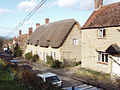
 Snow covered thatched cottage on High Street - geograph.org.uk - 3331750.jpg 1,500 × 1,000; 276 KB
-
 The Abingdon Arms in Beckley - geograph.org.uk - 1917589.jpg 640 × 480; 67 KB
-
 The Abingdon Arms on High Street - geograph.org.uk - 3331747.jpg 1,500 × 1,000; 174 KB
-
 The Abingdon Arms, Beckley - geograph.org.uk - 2768065.jpg 3,648 × 2,736; 1.76 MB
-
 The Abingdon Arms, Beckley - geograph.org.uk - 4406689.jpg 4,320 × 3,240; 4.05 MB
-
 Upper Park Farm, Beckley - geograph.org.uk - 353100.jpg 640 × 480; 97 KB
-
 Walters F845ENV - Flickr - megabus13601.jpg 3,264 × 2,448; 3.58 MB
-
 Across the fields to Beckley Church - geograph.org.uk - 1172775.jpg 640 × 480; 80 KB
-
 Churned up field, view towards Noke - geograph.org.uk - 353076.jpg 640 × 480; 237 KB
-
 Discreet silo - geograph.org.uk - 327346.jpg 640 × 480; 135 KB
-
 Field with Folly Farm beyond - geograph.org.uk - 353067.jpg 640 × 480; 89 KB
-
 Footpath by hedge and wheatfield - geograph.org.uk - 338769.jpg 640 × 480; 233 KB
-
 Hazel catkins - geograph.org.uk - 338773.jpg 640 × 480; 360 KB
-
 Hedge by wheatfield - geograph.org.uk - 338771.jpg 640 × 480; 267 KB
-
 Horses in field, flooded Otmoor beyond - geograph.org.uk - 351043.jpg 640 × 479; 190 KB
-
 Houses by field in Barton - geograph.org.uk - 338765.jpg 640 × 302; 58 KB
-
 Maize stubble - geograph.org.uk - 337562.jpg 640 × 480; 236 KB
-
 Metal detecting in ploughed field - geograph.org.uk - 339164.jpg 640 × 425; 170 KB
-
 Otmoor flooded,from Common Road, Beckley - geograph.org.uk - 353064.jpg 640 × 480; 196 KB
-
 Pasture and houses by Woodperry - geograph.org.uk - 352929.jpg 640 × 480; 212 KB
-
 Pasture and Noke Wood - geograph.org.uk - 351027.jpg 640 × 480; 102 KB
-
 Power line on poles - geograph.org.uk - 337574.jpg 640 × 480; 54 KB
-
 Television masts - geograph.org.uk - 327348.jpg 480 × 640; 78 KB
-
 That was a tree that was - geograph.org.uk - 351947.jpg 640 × 480; 199 KB
-
 The drive to Upper Wood's Farm - geograph.org.uk - 334534.jpg 640 × 480; 132 KB
-
 The Old Chapel, Beckley - geograph.org.uk - 353117.jpg 640 × 480; 114 KB
-

.jpg)


