Category:Beeckestijn
Jump to navigation
Jump to search
| Object location | | View all coordinates using: OpenStreetMap |
|---|
estate in Velsen .jpg) | |||||
| Upload media | |||||
| Instance of | |||||
|---|---|---|---|---|---|
| Location | Velsen, North Holland, Netherlands | ||||
| Owned by |
| ||||
| Has part(s) | |||||
| Heritage designation |
| ||||
| Inception |
| ||||
 | |||||
|
This is a category about rijksmonumentcomplex number 506979
|
| Address |
|
Subcategories
This category has the following 6 subcategories, out of 6 total.
B
- Beeckestijnpop (4 F)
- Bouwhuizen, Beeckestijn (6 F)
C
- Carriage houses (Beeckestijn) (41 F)
M
- Main building (Beeckestijn) (51 F)
S
- Slangenmuur, Beeckestijn (19 F)
T
- Tuinmanswoning, Beeckestijn (13 F)
Media in category "Beeckestijn"
The following 200 files are in this category, out of 238 total.
(previous page) (next page)-
 Aanzicht - Velsen - 20240564 - RCE.jpg 1,195 × 1,200; 486 KB
-
 Aanzicht - Velsen - 20240566 - RCE.jpg 1,186 × 1,200; 448 KB
-
 Aanzicht, reproductie uit gezichten om Haarlem - Velsen - 20240528 - RCE.jpg 1,200 × 873; 261 KB
-
 Achtergevel - Velsen - 20240548 - RCE.jpg 1,200 × 788; 182 KB
-
 Achterhal - Velsen - 20240493 - RCE.jpg 1,200 × 949; 141 KB
-
 Achterhal begane grond rechter trapopgang - Velsen - 20240426 - RCE.jpg 1,018 × 1,200; 391 KB
-
 Achterkamer 1e verdieping - Velsen - 20240497 - RCE.jpg 1,200 × 963; 199 KB
-
 Achterkamer 1e verdieping - Velsen - 20240498 - RCE.jpg 1,200 × 955; 207 KB
-
 Achterkamer begane grond - Velsen - 20240508 - RCE.jpg 1,200 × 953; 172 KB
-

-

-
 Atlas Schoemaker-WESTFRIESLAND-DEEL1-082-Noord-Holland, Bekesteyn.jpeg 1,031 × 1,680; 379 KB
-
 Balklaag plafond achterhal hoofdgebouw - Velsen - 20240424 - RCE.jpg 1,200 × 959; 326 KB
-
 Beeckestijn hekpijlers nabij rozentuin.jpg 2,172 × 1,448; 1.44 MB
-
 Beeckestijn Tuinmuur met speelhuisje.JPG 3,552 × 2,604; 3.04 MB
-
 Beeckestijn-02 (xndr).jpg 1,296 × 972; 386 KB
-
 Beeckestijn-03 (xndr).jpg 1,296 × 972; 370 KB
-

-

-
 Bekenstyn, Inventarisnummer NL-HlmNHA 53004486.JPG 2,379 × 1,908; 890 KB
-
 Bekroning en dak boven voorgevel - Velsen - 20240488 - RCE.jpg 1,195 × 1,200; 360 KB
-
 Bekroning voorgevel - Velsen - 20240489 - RCE.jpg 1,186 × 1,200; 341 KB
-
 Dessus de porte, linker middenvertrek - Velsen - 20240352 - RCE.jpg 1,184 × 1,200; 320 KB
-
 Detail binnenmuur - Velsen - 20240467 - RCE.jpg 960 × 1,200; 336 KB
-
 Detail binnenmuur - Velsen - 20240468 - RCE.jpg 916 × 1,200; 304 KB
-
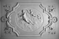
 Detail in stucwerk - Velsen - 20240470 - RCE.jpg 1,200 × 1,197; 213 KB
-
 Detail in stucwerk - Velsen - 20240471 - RCE.jpg 1,178 × 1,200; 264 KB
-
 Detail in stucwerk - Velsen - 20240472 - RCE.jpg 1,200 × 1,199; 213 KB
-
 Detailgevel zuid-zijde - Velsen - 20240487 - RCE.jpg 1,184 × 1,200; 311 KB
-
 Details - Velsen - 20240356 - RCE.jpg 1,200 × 1,188; 450 KB
-
 Details - Velsen - 20240357 - RCE.jpg 1,200 × 1,185; 366 KB
-
 Details - Velsen - 20240358 - RCE.jpg 1,200 × 1,179; 294 KB
-
 Details - Velsen - 20240359 - RCE.jpg 1,200 × 1,181; 380 KB
-
 Details - Velsen - 20240360 - RCE.jpg 1,200 × 1,191; 366 KB
-
 Details - Velsen - 20240361 - RCE.jpg 1,200 × 1,182; 317 KB
-
 Details - Velsen - 20240362 - RCE.jpg 1,200 × 1,178; 373 KB
-
 Details - Velsen - 20240363 - RCE.jpg 1,200 × 1,185; 309 KB
-
 Details - Velsen - 20240364 - RCE.jpg 1,200 × 1,175; 313 KB
-
 Details - Velsen - 20240365 - RCE.jpg 1,200 × 1,189; 331 KB
-
 Details - Velsen - 20240366 - RCE.jpg 1,200 × 1,192; 313 KB
-
 Details - Velsen - 20240367 - RCE.jpg 1,200 × 1,191; 316 KB
-
 Details - Velsen - 20240368 - RCE.jpg 1,200 × 1,175; 324 KB
-
 Details - Velsen - 20240369 - RCE.jpg 1,200 × 1,181; 367 KB
-
 Details - Velsen - 20240370 - RCE.jpg 1,200 × 1,188; 418 KB
-
 Details - Velsen - 20240391 - RCE.jpg 1,200 × 1,178; 363 KB
-
 Details - Velsen - 20240392 - RCE.jpg 1,200 × 1,191; 295 KB
-
 Details - Velsen - 20240393 - RCE.jpg 1,200 × 1,188; 387 KB
-
 Details - Velsen - 20240394 - RCE.jpg 1,200 × 1,185; 387 KB
-
 Details - Velsen - 20240395 - RCE.jpg 1,200 × 1,179; 346 KB
-
 Details - Velsen - 20240396 - RCE.jpg 1,174 × 1,200; 363 KB
-
 Details - Velsen - 20240397 - RCE.jpg 1,200 × 1,189; 335 KB
-
 Details - Velsen - 20240398 - RCE.jpg 1,200 × 1,175; 333 KB
-
 Details - Velsen - 20240399 - RCE.jpg 1,200 × 1,183; 407 KB
-
 Details - Velsen - 20240400 - RCE.jpg 1,200 × 954; 314 KB
-
 Details - Velsen - 20240401 - RCE.jpg 1,200 × 947; 254 KB
-
 Details - Velsen - 20240402 - RCE.jpg 949 × 1,200; 241 KB
-
 Details - Velsen - 20240403 - RCE.jpg 1,200 × 940; 289 KB
-
 Details - Velsen - 20240404 - RCE.jpg 1,200 × 954; 259 KB
-
 Details - Velsen - 20240405 - RCE.jpg 955 × 1,200; 320 KB
-
-

-
 Exterieur - Velsen - 20240326 - RCE.jpg 960 × 1,200; 336 KB
-
 Exterieur - Velsen - 20240453 - RCE.jpg 1,200 × 965; 337 KB
-
 Exterieur - Velsen - 20240454 - RCE.jpg 1,200 × 956; 298 KB
-
 Exterieur - Velsen - 20240455 - RCE.jpg 1,200 × 968; 277 KB
-
 Exterieur - Velsen - 20240456 - RCE.jpg 1,200 × 965; 288 KB
-
 Exterieur - Velsen - 20240457 - RCE.jpg 1,200 × 968; 302 KB
-
 Exterieur - Velsen - 20240458 - RCE.jpg 1,200 × 963; 310 KB
-
 Exterieur - Velsen - 20240529 - RCE.jpg 963 × 1,200; 301 KB
-
 Exterieur - Velsen - 20240530 - RCE.jpg 971 × 1,200; 268 KB
-
 Exterieur - Velsen - 20240531 - RCE.jpg 961 × 1,200; 330 KB
-
 Exterieur - Velsen - 20240532 - RCE.jpg 1,200 × 976; 275 KB
-
 Exterieur - Velsen - 20240533 - RCE.jpg 1,200 × 963; 286 KB
-
 Exterieur - Velsen - 20240534 - RCE.jpg 1,200 × 966; 292 KB
-
 Exterieur - Velsen - 20240535 - RCE.jpg 960 × 1,200; 281 KB
-
 Exterieur - Velsen - 20240536 - RCE.jpg 975 × 1,200; 269 KB
-
 Exterieur - Velsen - 20240537 - RCE.jpg 1,200 × 964; 269 KB
-
 Exterieur - Velsen - 20240538 - RCE.jpg 969 × 1,200; 280 KB
-
 Exterieur OVERZICHT ACHTERGEVEL - Velsen-Zuid - 20309417 - RCE.jpg 1,200 × 1,192; 332 KB
-
 Exterieur OVERZICHT ACHTERGEVEL - Velsen-Zuid - 20309418 - RCE.jpg 1,187 × 1,200; 346 KB
-
 Exterieur OVERZICHT DWARSAS NAAR HET NOORDEN - Velsen-Zuid - 20309428 - RCE.jpg 1,185 × 1,200; 480 KB
-
 Exterieur OVERZICHT DWARSAS NAAR HET ZUIDEN - Velsen-Zuid - 20309427 - RCE.jpg 1,181 × 1,200; 492 KB
-
 Exterieur OVERZICHT NAAR HET NOORDEN - Velsen-Zuid - 20309415 - RCE.jpg 1,181 × 1,200; 475 KB
-
 Exterieur OVERZICHT NAAR HET WESTEN - Velsen-Zuid - 20309421 - RCE.jpg 1,195 × 1,200; 328 KB
-
 Exterieur OVERZICHT NAAR HET WESTEN - Velsen-Zuid - 20309425 - RCE.jpg 1,192 × 1,200; 485 KB
-

-
 Exterieur OVERZICHT VANAF VIJVER NAAR BEUKENLAAN - Velsen-Zuid - 20309426 - RCE.jpg 1,197 × 1,200; 476 KB
-

-

-
 Exterieur VIJVER, OVERZICHT NAAR HET NOORDEN - Velsen-Zuid - 20309424 - RCE.jpg 1,197 × 1,200; 510 KB
-
 Exterieur VIJVER, OVERZICHT NAAR HET WESTEN - Velsen-Zuid - 20309422 - RCE.jpg 1,200 × 1,192; 395 KB
-
 Fullsizeoutput 282f.jpg 1,732 × 1,299; 1.46 MB
-
 Fundering tegen het westen - Velsen - 20240475 - RCE.jpg 960 × 1,200; 326 KB
-
 Fundering tegen het westen - Velsen - 20240477 - RCE.jpg 958 × 1,200; 314 KB
-
 Fundering ten noorden van huis - Velsen - 20240476 - RCE.jpg 1,200 × 967; 369 KB
-
 Gezicht in de buitenplaats Beesckestijn, Inventarisnummer NL-HlmNHA 53026057.JPG 4,044 × 3,078; 3.16 MB
-

-
 Gootklossen - Velsen - 20240436 - RCE.jpg 1,200 × 1,191; 258 KB
-
 Hal - Velsen - 20240346 - RCE.jpg 956 × 1,200; 212 KB
-
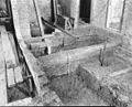
 Hal opgraving kelders - Velsen - 20240427 - RCE.jpg 960 × 1,200; 394 KB
-
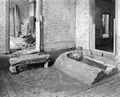
 Hal, fragment - Velsen - 20240491 - RCE.jpg 1,200 × 943; 195 KB
-
 Hal, fragment - Velsen - 20240494 - RCE.jpg 1,200 × 647; 123 KB
-

-
 Huis Beckenstein - Velsen - 20240413 - RCE.jpg 1,200 × 950; 358 KB
-
 Huis Beckenstein - Velsen - 20240414 - RCE.jpg 1,200 × 964; 350 KB
-
 Huis Beeckestijn.jpg 3,600 × 2,624; 770 KB
-
 IJskelder Beekestijn.JPG 2,304 × 3,072; 1.74 MB
-
 Interieur - Velsen - 20240345 - RCE.jpg 1,200 × 960; 253 KB
-
 Interieur - Velsen - 20240347 - RCE.jpg 1,200 × 947; 224 KB
-
-
 Interieur tussenkamer 1e verdieping - Velsen - 20240512 - RCE.jpg 1,200 × 963; 166 KB
-
 Interieur vestibule - Velsen - 20240351 - RCE.jpg 884 × 1,200; 123 KB
-

-

-

-

-
-
 INTERIEUR, KAMER, SCHOUW (REPRODUCTIE) - Velsen - 20289778 - RCE.jpg 1,200 × 807; 234 KB
-
 Kap middengedeelte naar het noorden - Velsen - 20240434 - RCE.jpg 1,200 × 1,193; 267 KB
-
 Kap voorzijde - Velsen - 20240430 - RCE.jpg 1,200 × 1,191; 296 KB
-
 Kapconstructie - Velsen - 20240459 - RCE.jpg 1,200 × 800; 163 KB
-
 Kapconstructie - Velsen - 20240460 - RCE.jpg 1,200 × 787; 177 KB
-
 Kapconstructie - Velsen - 20240461 - RCE.jpg 802 × 1,200; 188 KB
-
 Kapconstructie - Velsen - 20240462 - RCE.jpg 1,200 × 802; 169 KB
-
 Kapconstructie - Velsen - 20240463 - RCE.jpg 1,200 × 810; 166 KB
-
 Kapconstructie - Velsen - 20240464 - RCE.jpg 798 × 1,200; 171 KB
-
 Kapconstructie - Velsen - 20240465 - RCE.jpg 1,200 × 793; 185 KB
-
 Kapconstructie - Velsen - 20240466 - RCE.jpg 802 × 1,200; 165 KB
-
 Kapdetail - Velsen - 20240501 - RCE.jpg 1,200 × 959; 196 KB
-
 Kapdetail - Velsen - 20240502 - RCE.jpg 1,200 × 956; 178 KB
-

-
 Kleine kamer - Velsen - 20240506 - RCE.jpg 1,200 × 944; 224 KB
-
 Kleine voorkamer 1e verdieping - Velsen - 20240499 - RCE.jpg 1,200 × 958; 155 KB
-
 Kleine voorkamer 1e verdieping - Velsen - 20240500 - RCE.jpg 1,200 × 957; 122 KB
-
-
 Landgoed Beeckestijn CDA wethouder C.Visser op de oprijlaan, NL-HlmNHA 54050089.JPG 2,477 × 1,612; 730 KB
-
-
-

-

-

-

-
 Linker voorkamer begane grond - Velsen - 20240503 - RCE.jpg 1,200 × 942; 197 KB
-
 Middenkamer begane grond - Velsen - 20240505 - RCE.jpg 1,200 × 961; 185 KB
-
 Opgraving - Velsen - 20240450 - RCE.jpg 1,200 × 960; 278 KB
-
 Opgraving achterportaal - Velsen - 20240437 - RCE.jpg 958 × 1,200; 227 KB
-
 Opgraving achterportaal - Velsen - 20240438 - RCE.jpg 1,200 × 961; 272 KB
-
 Opgraving achterportaal - Velsen - 20240439 - RCE.jpg 1,200 × 956; 225 KB
-
 Opgraving achterportaal - Velsen - 20240440 - RCE.jpg 1,200 × 958; 233 KB
-
 Opgraving achterportaal - Velsen - 20240441 - RCE.jpg 1,200 × 969; 274 KB
-
 Opgraving achterportaal west-zijde - Velsen - 20240442 - RCE.jpg 960 × 1,200; 262 KB
-
 Opgraving gang - Velsen - 20240447 - RCE.jpg 961 × 1,200; 309 KB
-
 Opgraving hal noord-west hoek - Velsen - 20240445 - RCE.jpg 1,200 × 953; 255 KB
-
 Opgraving hal zuid-oost hoek - Velsen - 20240448 - RCE.jpg 1,200 × 959; 313 KB
-
 Opgraving hal zuid-west hoek - Velsen - 20240444 - RCE.jpg 1,200 × 958; 309 KB
-
 Opgraving voormalige waterput onder de gang - Velsen - 20240446 - RCE.jpg 961 × 1,200; 181 KB
-
 Opgraving zuid-oost hoek van de hal - Velsen - 20240443 - RCE.jpg 1,200 × 966; 256 KB
-

-
 Rechter trapopgang dakmoet - Velsen - 20240417 - RCE.jpg 966 × 1,200; 474 KB
-
 Rechter voorkamer begane grond - Velsen - 20240420 - RCE.jpg 1,200 × 953; 343 KB
-
 Rechter voorkamer begane grond - Velsen - 20240504 - RCE.jpg 1,200 × 952; 214 KB
-
 Rechter zij aanbouw - Velsen - 20240408 - RCE.jpg 961 × 1,200; 353 KB
-
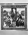 Schilderij aanbidding van Maria met kind - Velsen - 20377692 - RCE.jpg 965 × 1,200; 306 KB
-
 Schoorsteen noord-oost zijde - Velsen - 20240485 - RCE.jpg 1,200 × 1,198; 302 KB
-
 Schoorsteen zuid-oost zijde - Velsen - 20240486 - RCE.jpg 1,200 × 1,192; 262 KB
-
 Slechte toestand stalgebouw - Velsen - 20240343 - RCE.jpg 1,200 × 964; 345 KB
-
 Slechte toestand stalgebouw - Velsen - 20240344 - RCE.jpg 1,200 × 961; 344 KB
-
 Strijklicht-Beeckestijn.jpg 3,024 × 4,032; 1.77 MB
-
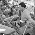
 Stucadoor in actie - Velsen - 20240473 - RCE.jpg 1,200 × 1,188; 222 KB
-
 Stucadoor in actie - Velsen - 20240474 - RCE.jpg 1,200 × 1,198; 232 KB
-
 Stucadoorswerkzaamheden - Velsen - 20240469 - RCE.jpg 1,197 × 1,200; 230 KB
-
 Stucwerk - Velsen - 20058929 - RCE.jpg 1,200 × 1,107; 191 KB
-
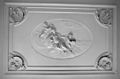
 Stucwerk - Velsen - 20240371 - RCE.jpg 1,200 × 1,185; 357 KB
-
 Stucwerk - Velsen - 20240372 - RCE.jpg 1,200 × 870; 291 KB
-
 Stucwerk - Velsen - 20240373 - RCE.jpg 1,200 × 832; 262 KB
-
 Stucwerk - Velsen - 20240374 - RCE.jpg 879 × 1,200; 273 KB
-
 Stucwerk - Velsen - 20240375 - RCE.jpg 710 × 1,200; 211 KB
-
 Stucwerk - Velsen - 20240376 - RCE.jpg 751 × 1,200; 252 KB
-
 Stucwerk - Velsen - 20240377 - RCE.jpg 756 × 1,200; 239 KB
-
 Stucwerk - Velsen - 20240378 - RCE.jpg 616 × 1,200; 185 KB
-
 Stucwerk - Velsen - 20240379 - RCE.jpg 1,200 × 867; 216 KB
-
 Stucwerk - Velsen - 20240380 - RCE.jpg 895 × 1,200; 259 KB
-
 Stucwerk - Velsen - 20240381 - RCE.jpg 894 × 1,200; 239 KB
-
 Stucwerk - Velsen - 20240382 - RCE.jpg 879 × 1,200; 342 KB
-
 Stucwerk - Velsen - 20240383 - RCE.jpg 1,200 × 888; 271 KB
-
 Stucwerk - Velsen - 20240384 - RCE.jpg 1,200 × 1,187; 415 KB
-
 Stucwerk - Velsen - 20240385 - RCE.jpg 1,200 × 1,190; 421 KB
-
 Stucwerk - Velsen - 20240386 - RCE.jpg 1,198 × 1,200; 338 KB
-
 Stucwerk - Velsen - 20240387 - RCE.jpg 1,200 × 1,198; 386 KB
-
 Stucwerk - Velsen - 20240388 - RCE.jpg 1,198 × 1,200; 323 KB
-
 Stucwerk - Velsen - 20240389 - RCE.jpg 1,171 × 1,200; 386 KB
-
 Stucwerk - Velsen - 20240390 - RCE.jpg 1,195 × 1,200; 383 KB
-
 Stucwerk - Velsen - 20240478 - RCE.jpg 1,194 × 1,200; 206 KB
-
 Stucwerk - Velsen - 20240479 - RCE.jpg 1,200 × 1,151; 195 KB
-
 Stucwerk - Velsen - 20240481 - RCE.jpg 1,200 × 1,194; 210 KB
-
 Stucwerk - Velsen - 20240482 - RCE.jpg 1,200 × 1,199; 192 KB
-
 Stucwerk - Velsen - 20240483 - RCE.jpg 1,197 × 1,200; 179 KB
-
 Stucwerk - Velsen - 20240484 - RCE.jpg 1,195 × 1,200; 182 KB
-
 Toegangshek - Velsen - 20292562 - RCE.jpg 1,188 × 1,200; 315 KB
-
 Toegangshek Beeckestijn nabij tuinmanswoning.jpg 3,072 × 2,048; 3.19 MB


.jpg)
.jpg)


_-_Velsen_-_20289778_-_RCE.jpg)


