Category:Bekesbourne-with-Patrixbourne
Jump to navigation
Jump to search
English: Bekesbourne-with-Patrixbourne is a civil parish in the Canterbury district, in the county of Kent, England.
civil parish in Kent, UK  | |||||
| Upload media | |||||
| Instance of | |||||
|---|---|---|---|---|---|
| Named after | |||||
| Location | Canterbury, Kent, South East England, England | ||||
 | |||||
Subcategories
This category has the following 3 subcategories, out of 3 total.
Media in category "Bekesbourne-with-Patrixbourne"
The following 200 files are in this category, out of 360 total.
(previous page) (next page)-
 2, The Street - geograph.org.uk - 3694020.jpg 800 × 1,077; 154 KB
-
 A rape field - geograph.org.uk - 2893297.jpg 640 × 430; 68 KB
-
 A2 Bridge over Patrixbourne Rd - geograph.org.uk - 2871760.jpg 640 × 430; 39 KB
-
 Adisham Rd - geograph.org.uk - 2860260.jpg 640 × 430; 51 KB
-
 Adisham Rd - geograph.org.uk - 2860262.jpg 640 × 430; 52 KB
-
 Adisham Road, Bekesbourne - geograph.org.uk - 4525354.jpg 2,272 × 1,704; 743 KB
-
 Adisham Road, near Bekesbourne - geograph.org.uk - 4525358.jpg 2,272 × 1,704; 747 KB
-
 Aerodrome Rd - geograph.org.uk - 2860258.jpg 640 × 430; 64 KB
-
 Aerodrome Road sign - geograph.org.uk - 1246442.jpg 640 × 479; 127 KB
-
 Aerodrome Road, Bekesbourne - geograph.org.uk - 4510227.jpg 640 × 480; 149 KB
-
 Aerodrome Road, Bekesbourne - geograph.org.uk - 4525341.jpg 2,272 × 1,704; 817 KB
-
 Aerodrome Road, Bekesbourne - geograph.org.uk - 4525346.jpg 2,272 × 1,704; 762 KB
-
 Aerodrome Road, Bekesbourne - geograph.org.uk - 4525348.jpg 2,272 × 1,704; 843 KB
-
 Aerodrome Road, Bekesbourne - geograph.org.uk - 4525352.jpg 2,272 × 1,704; 738 KB
-
 Alongside Bramling Road - geograph.org.uk - 4565973.jpg 4,000 × 3,000; 4.1 MB
-
-
 Arable landscape - geograph.org.uk - 4938059.jpg 640 × 426; 47 KB
-
 Avenue , Howletts Mansion - geograph.org.uk - 5899722.jpg 4,000 × 3,000; 6.83 MB
-
 Barham Downs - geograph.org.uk - 4895544.jpg 640 × 426; 78 KB
-
 Barham Downs - geograph.org.uk - 4895585.jpg 640 × 426; 66 KB
-
 Barham Downs - geograph.org.uk - 4895617.jpg 640 × 426; 69 KB
-
 Barham Downs - geograph.org.uk - 4895634.jpg 640 × 426; 60 KB
-
 Barn, Chalk Pit Farm - geograph.org.uk - 2862931.jpg 640 × 430; 43 KB
-
 Beer garden, The Unicorn - geograph.org.uk - 2887779.jpg 640 × 430; 73 KB
-
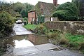
 Bekesbourne Ford - geograph.org.uk - 3741578.jpg 3,872 × 2,592; 4.85 MB
-
 Bekesbourne Hill - geograph.org.uk - 2887790.jpg 640 × 430; 72 KB
-
 Bekesbourne Hill - geograph.org.uk - 2887795.jpg 640 × 430; 49 KB
-
 Bekesbourne Hill - geograph.org.uk - 2890123.jpg 640 × 430; 57 KB
-
 Bekesbourne Hill - geograph.org.uk - 2890164.jpg 640 × 430; 77 KB
-
 Bekesbourne Hill, Bekesbourne - geograph.org.uk - 4499354.jpg 2,272 × 1,704; 854 KB
-
 Bekesbourne Lane - geograph.org.uk - 2893288.jpg 640 × 430; 113 KB
-
 Bekesbourne Lane, Bekesbourne - geograph.org.uk - 4499364.jpg 2,272 × 1,704; 909 KB
-
 Bekesbourne Lane, Kent - geograph.org.uk - 4713260.jpg 3,264 × 2,448; 3.42 MB
-
 Bekesbourne village sign - geograph.org.uk - 4499376.jpg 1,704 × 2,272; 1.12 MB
-
 Bifrons Cottage - geograph.org.uk - 2884165.jpg 640 × 430; 78 KB
-
 Bifrons Hill - geograph.org.uk - 2884169.jpg 640 × 430; 70 KB
-
 Bifrons Road, Patrixbourne - geograph.org.uk - 4499387.jpg 2,272 × 1,704; 817 KB
-

-
 Bramling And Adisham Downs crossroads. - geograph.org.uk - 2055618.jpg 3,072 × 2,304; 1.9 MB
-
 Bramling Road - geograph.org.uk - 2055611.jpg 3,072 × 2,304; 2.03 MB
-
 Bramling Road - geograph.org.uk - 4565969.jpg 4,000 × 3,000; 4.28 MB
-
 Bramling Road - geograph.org.uk - 6197143.jpg 1,024 × 768; 321 KB
-
 Bramling Road Bridge over the railway - geograph.org.uk - 2053984.jpg 3,072 × 2,304; 2.14 MB
-
 Bramling Road, near Bekesbourne - geograph.org.uk - 4525363.jpg 2,272 × 1,704; 694 KB
-
 Bramling Road, near Bekesbourne - geograph.org.uk - 4525371.jpg 2,272 × 1,704; 562 KB
-
 Bridge over the Nailbourne - geograph.org.uk - 2862997.jpg 640 × 430; 130 KB
-
 Bridge over the railway line - geograph.org.uk - 2890193.jpg 640 × 430; 89 KB
-
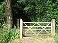
 Bridle gate on the bridleway to Highland Court Farm - geograph.org.uk - 2059414.jpg 3,072 × 2,304; 3.17 MB
-
 Bridleway junction near Keepers Hill Wood - geograph.org.uk - 2058689.jpg 3,072 × 2,304; 2.67 MB
-

-

-

-
 Bridleway near Highland Court Farm - geograph.org.uk - 4415517.jpg 4,000 × 3,000; 4.47 MB
-
 Bridleway past Keeper's Hill Wood - geograph.org.uk - 2059471.jpg 3,072 × 2,304; 1.78 MB
-
 Bridleway to Bramling Road - geograph.org.uk - 2058726.jpg 3,072 × 2,304; 2.66 MB
-
 Bridleway to Bramling Road - geograph.org.uk - 2059467.jpg 3,072 × 2,304; 1.94 MB
-
 Bridleway to Highland Court Farm - geograph.org.uk - 2058699.jpg 3,072 × 2,304; 2.84 MB
-
 Bridleway to Highland Court Farm - geograph.org.uk - 2058722.jpg 3,072 × 2,304; 1.94 MB
-
 Bridleway towards Highland Court Farm and Bramling Road - geograph.org.uk - 2058706.jpg 3,072 × 2,304; 1.63 MB
-
 Carter Road, Bekesbourne - geograph.org.uk - 4525337.jpg 2,272 × 1,704; 696 KB
-
 Cereal stubble - geograph.org.uk - 4895458.jpg 640 × 426; 75 KB
-
 Chalk Pit Farm - geograph.org.uk - 2860267.jpg 640 × 430; 53 KB
-
 Chalk Pit Farm - geograph.org.uk - 2862933.jpg 640 × 430; 74 KB
-
 Chalk Pit Hill - geograph.org.uk - 2862950.jpg 640 × 430; 99 KB
-
 Chalkpit Hill, Bekesbourne - geograph.org.uk - 4525324.jpg 2,272 × 1,704; 754 KB
-
 Clouded Leopard - geograph.org.uk - 2033723.jpg 3,072 × 2,304; 2.95 MB
-
 Cobham Court - geograph.org.uk - 2862990.jpg 640 × 430; 92 KB
-
 Cobham Court - geograph.org.uk - 2862994.jpg 640 × 430; 54 KB
-
 Coldharbour Lane - geograph.org.uk - 4895467.jpg 640 × 426; 98 KB
-
 Coldharbour Lane - geograph.org.uk - 4895471.jpg 640 × 426; 92 KB
-

-
 Coldharbour Lane, near Bridge - geograph.org.uk - 4499480.jpg 2,272 × 1,704; 830 KB
-
 Coppicing, Firdown Wood - geograph.org.uk - 2893311.jpg 640 × 430; 127 KB
-
 Coppicing, Palmsted Wood - geograph.org.uk - 2890190.jpg 640 × 430; 129 KB
-
 Cottages, Chalk Pit Farm - geograph.org.uk - 2862928.jpg 640 × 430; 65 KB
-
 Cottages, Keeper's Hill - geograph.org.uk - 2868727.jpg 640 × 430; 79 KB
-
 Cottages, Old Palace Rd - geograph.org.uk - 2868716.jpg 640 × 397; 46 KB
-
 Cottages, The Street - geograph.org.uk - 2884161.jpg 640 × 430; 78 KB
-
 Court Cottage - geograph.org.uk - 2868720.jpg 640 × 430; 69 KB
-
 Court Cottage - geograph.org.uk - 2868733.jpg 640 × 430; 82 KB
-
 Court Cottage - geograph.org.uk - 2871816.jpg 640 × 430; 48 KB
-
 Cowhouse Cottage - geograph.org.uk - 2893286.jpg 640 × 430; 114 KB
-
 Crest Cottage - geograph.org.uk - 2871772.jpg 640 × 430; 56 KB
-
 Crest Cottage - geograph.org.uk - 2871776.jpg 640 × 430; 64 KB
-
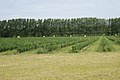
 Crop Field along Bramling Road - geograph.org.uk - 1932354.jpg 1,024 × 768; 243 KB
-
 Downside, a row of 8 semi-detached house - geograph.org.uk - 1765077.jpg 640 × 480; 134 KB
-
 Drive to Howletts Mansion - geograph.org.uk - 5899718.jpg 4,000 × 3,000; 4.62 MB
-
 Dry bed of the Nailbourne - geograph.org.uk - 2871773.jpg 640 × 430; 124 KB
-
 Dry ford, Old Palace Rd - geograph.org.uk - 2868703.jpg 640 × 430; 86 KB
-
 Dry river bed - geograph.org.uk - 2868701.jpg 640 × 430; 136 KB
-

-
 Elham Valley Way - geograph.org.uk - 2871758.jpg 640 × 430; 59 KB
-
 Elham Valley Way - geograph.org.uk - 2871765.jpg 640 × 430; 71 KB
-
 Entrance to Cold Harbour House - geograph.org.uk - 577605.jpg 640 × 480; 223 KB
-

-
 Entrance to Springfield Nurseries, Bekesbourne Lane - geograph.org.uk - 4487198.jpg 3,264 × 2,448; 3.92 MB
-
 Farm building - geograph.org.uk - 4895555.jpg 640 × 397; 90 KB
-
 Farm gateway off Adisham Rd - geograph.org.uk - 2860264.jpg 640 × 430; 34 KB
-
 Farm track (and bridleway) junction in Highland Court Farm - geograph.org.uk - 2058719.jpg 3,072 × 2,304; 2.53 MB
-
 Farm track in Highland Court Farm - geograph.org.uk - 2058711.jpg 3,072 × 2,304; 1.75 MB
-
 Farm track near Howletts Farm Orchard - geograph.org.uk - 2053929.jpg 3,072 × 2,304; 2.26 MB
-
 Farmland - geograph.org.uk - 4895461.jpg 640 × 426; 68 KB
-
 Farmland by Bekesbourne Hill - geograph.org.uk - 2890137.jpg 640 × 430; 54 KB
-
 Farmland by Patrixbourne Rd - geograph.org.uk - 2871761.jpg 640 × 430; 56 KB
-
 Field by Bekesbourne Hill - geograph.org.uk - 2890129.jpg 640 × 393; 45 KB
-
 Fields of flowers and peas - geograph.org.uk - 6196853.jpg 1,024 × 768; 440 KB
-
 Fingerpost near Bekesbourne - geograph.org.uk - 4525370.jpg 2,272 × 1,704; 803 KB
-
 Firdown Wood - geograph.org.uk - 2893312.jpg 640 × 430; 121 KB
-
 Firdown Wood - geograph.org.uk - 2893314.jpg 640 × 430; 125 KB
-
 Footpath follows the fence - geograph.org.uk - 2893291.jpg 640 × 430; 77 KB
-
 Footpath in Firdown Wood - geograph.org.uk - 2033889.jpg 2,304 × 3,072; 3.17 MB
-
 Footpath in Howlett's Farm Orchard - geograph.org.uk - 2053924.jpg 3,072 × 2,304; 1.46 MB
-
 Footpath into Palmsted Wood - geograph.org.uk - 2890185.jpg 640 × 430; 93 KB
-
 Footpath off Bekesbourne Hill - geograph.org.uk - 2890167.jpg 640 × 430; 80 KB
-
 Footpath off Keeper's Hill - geograph.org.uk - 2868736.jpg 640 × 430; 97 KB
-
 Footpath off Station Rd - geograph.org.uk - 2887738.jpg 640 × 430; 119 KB
-
 Footpath off The Street - geograph.org.uk - 2884110.jpg 640 × 430; 93 KB
-
 Footpath through the woods - geograph.org.uk - 4416462.jpg 4,000 × 3,000; 4.08 MB
-
 Footpath to Bekesbourne Hill - geograph.org.uk - 2887777.jpg 640 × 430; 85 KB
-
 Footpath to Bekesbourne Lane - geograph.org.uk - 2053835.jpg 2,304 × 3,072; 1.88 MB
-
 Footpath to Bekesbourne Station - geograph.org.uk - 2887753.jpg 640 × 430; 97 KB
-
 Footpath to Bekesbourne Station - geograph.org.uk - 2887759.jpg 640 × 430; 95 KB
-
 Footpath to Patrixbourne Rd - geograph.org.uk - 2868738.jpg 640 × 430; 54 KB
-
 Footpath to School Lane - geograph.org.uk - 2059478.jpg 3,072 × 2,304; 1.62 MB
-
 Footpath to the church - geograph.org.uk - 2862952.jpg 640 × 430; 110 KB
-
 Footpath to The Hoath Farm - geograph.org.uk - 2893316.jpg 640 × 430; 51 KB
-
 Footpath to Woolton Farm - geograph.org.uk - 2890127.jpg 640 × 430; 71 KB
-
 Footpath towards Bekesbourne - geograph.org.uk - 2033694.jpg 3,072 × 2,304; 1.68 MB
-
 Footpath towards Conduit Wood - geograph.org.uk - 2053819.jpg 3,072 × 2,304; 2.29 MB
-
 Footpath, Firdown Wood - geograph.org.uk - 2893309.jpg 640 × 430; 102 KB
-
 Footpath, Firdown Wood - geograph.org.uk - 2893313.jpg 640 × 430; 124 KB
-
 Ford at foot of Keeper's Hill, Patrixbourne - geograph.org.uk - 6196939.jpg 1,024 × 768; 452 KB
-
 Ford at Patrixbourne - geograph.org.uk - 3741552.jpg 3,872 × 2,592; 4.81 MB
-
 Ford in the Nailbourne - geograph.org.uk - 2089207.jpg 640 × 480; 207 KB
-
 Ford on the Nail Bourne at Patrixbourne - geograph.org.uk - 3741502.jpg 3,872 × 2,592; 4.8 MB
-
 Ford through the Nail Bourne at Patrixbourne - geograph.org.uk - 4419631.jpg 4,000 × 3,000; 4.05 MB
-
 Ford through the Nail Bourne at Patrixbourne - geograph.org.uk - 4419635.jpg 4,000 × 3,000; 4.15 MB
-
 Fruit bushes, Chalk Pit Hill - geograph.org.uk - 2862941.jpg 640 × 430; 42 KB
-
 Fruit Field near Cold Harbour Farm - geograph.org.uk - 1970295.jpg 1,024 × 683; 248 KB
-
 Gate and footpath junction near Firdown Wood - geograph.org.uk - 2033872.jpg 3,072 × 2,304; 2.8 MB
-
 Godden House Cottages - geograph.org.uk - 2884163.jpg 640 × 430; 80 KB
-
 Harvest time - geograph.org.uk - 2771831.jpg 1,024 × 768; 171 KB
-
 Harvesting flowers by Shepherds Close Road - geograph.org.uk - 6195767.jpg 1,024 × 768; 367 KB
-
 Higham Park - geograph.org.uk - 2058619.jpg 3,072 × 2,304; 1.65 MB
-
 Higham Park access bridge - geograph.org.uk - 2058623.jpg 3,072 × 2,304; 2.44 MB
-
 Highfield Care Home - geograph.org.uk - 2890175.jpg 640 × 430; 82 KB
-
 Highfield Care Home - geograph.org.uk - 2890178.jpg 640 × 430; 67 KB
-
 Highland Court Farm. - geograph.org.uk - 323119.jpg 640 × 480; 158 KB
-

-
 Horses grazing by Old Palace Rd - geograph.org.uk - 2868699.jpg 640 × 430; 38 KB
-
 House by the Railway Station - geograph.org.uk - 2887775.jpg 640 × 430; 77 KB
-
 House on Bekesbourne Hill - geograph.org.uk - 2890161.jpg 640 × 430; 54 KB
-
 Houses on Adisham Road, Bekesbourne - geograph.org.uk - 6196953.jpg 1,024 × 684; 348 KB
-
 Houses, Keepers Hill - geograph.org.uk - 3691456.jpg 1,077 × 807; 215 KB
-
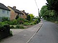
 Houses, The Street - geograph.org.uk - 3691497.jpg 1,077 × 807; 244 KB
-
 Houses, The Street - geograph.org.uk - 3691541.jpg 1,077 × 807; 217 KB
-
 Howletts Gate 2 - geograph.org.uk - 2033702.jpg 3,072 × 2,304; 2.49 MB
-
 Howletts Mansion - geograph.org.uk - 3297197.jpg 1,476 × 2,071; 1.11 MB
-
 Howletts Oast - geograph.org.uk - 2780871.jpg 640 × 342; 63 KB
-
 Howletts Oast on Bekesbourne Lane - geograph.org.uk - 1351810.jpg 640 × 480; 115 KB
-
 Informal path between the roads - geograph.org.uk - 2860261.jpg 640 × 430; 53 KB
-
 Information Plaque on One Howletts Farm House - geograph.org.uk - 2053921.jpg 3,072 × 2,304; 2.01 MB
-

-

-
 Keeper's Hill - geograph.org.uk - 1932352.jpg 1,024 × 768; 189 KB
-
 Keeper's Hill - geograph.org.uk - 2868734.jpg 640 × 430; 106 KB
-
 Keeper's Hill Wood - geograph.org.uk - 2868739.jpg 640 × 430; 54 KB
-
 Keeper's Hill Wood - geograph.org.uk - 2868741.jpg 640 × 430; 52 KB
-
 Keepers Hill, Patrixbourne - geograph.org.uk - 4499410.jpg 2,272 × 1,704; 1.16 MB
-
 Lackenden Cottages on Bekesbourne Lane - geograph.org.uk - 1351768.jpg 640 × 480; 118 KB
-
 Land at Highland Court Farm, Coldharbour Lane - geograph.org.uk - 5992263.jpg 3,264 × 2,388; 2.26 MB
-
 Lane crossing the North Downs Way - geograph.org.uk - 4895654.jpg 640 × 426; 102 KB
-
 Lane near Cold Harbour Farm - geograph.org.uk - 4416492.jpg 4,000 × 3,000; 4.15 MB
-
 Lane to the A2 - geograph.org.uk - 4895659.jpg 640 × 426; 86 KB
-
 Lane towards Bekesbourne - geograph.org.uk - 6196833.jpg 1,024 × 768; 279 KB
-
 Lane towards Cold Harbour Farm - geograph.org.uk - 4416474.jpg 4,000 × 3,000; 4.1 MB
-
 Large field of rape - geograph.org.uk - 2890173.jpg 640 × 430; 68 KB
-

-
 Lions Cottage - geograph.org.uk - 2884119.jpg 640 × 430; 51 KB
-
 Lions Cottage - geograph.org.uk - 2884159.jpg 640 × 430; 61 KB
-
 Looking across the Nail Bourne in Patrixbourne - geograph.org.uk - 4419677.jpg 4,000 × 3,000; 4.2 MB
-
 Looking N along Brambling Road. - geograph.org.uk - 323068.jpg 640 × 480; 231 KB
-

-
 Looking SW along Bekesbourne Lane - geograph.org.uk - 1351775.jpg 640 × 480; 150 KB
-
 Marlborough Rd - geograph.org.uk - 2860259.jpg 640 × 430; 68 KB
-
 Mobile Phone Towers beside Bramling Road - geograph.org.uk - 2058552.jpg 3,072 × 2,304; 2.15 MB
-
 Mulberry Cottage, The Street - geograph.org.uk - 4494015.jpg 3,264 × 2,448; 2.17 MB
-
 Nail Bourne Stream Ford, Keepers Hill, Patrixbourne - geograph.org.uk - 4499401.jpg 2,272 × 1,704; 1.15 MB
-
 New houses, Patrixbourne - geograph.org.uk - 2884106.jpg 640 × 430; 52 KB
-
 Norman south doorway at St Mary's Church, Patrixbourne - geograph.org.uk - 4419655.jpg 3,000 × 4,000; 4.01 MB
-
 North Downs Way - geograph.org.uk - 4895439.jpg 640 × 426; 98 KB
-
 North Downs Way - geograph.org.uk - 4895440.jpg 640 × 426; 82 KB
-
 North Downs Way - geograph.org.uk - 4895447.jpg 640 × 426; 117 KB
-
 North Downs Way - geograph.org.uk - 4895453.jpg 640 × 426; 124 KB
-
 North Downs Way - geograph.org.uk - 4895457.jpg 640 × 426; 121 KB
-
 North Downs Way - geograph.org.uk - 4895463.jpg 640 × 426; 142 KB
-
 North Downs Way - geograph.org.uk - 4895541.jpg 640 × 426; 89 KB
-
 North Downs Way - geograph.org.uk - 4895548.jpg 640 × 426; 74 KB
-
 North Downs Way - geograph.org.uk - 4895553.jpg 640 × 426; 73 KB
-
 North Downs Way - geograph.org.uk - 4895581.jpg 640 × 426; 71 KB


_junction_in_Highland_Court_Farm_-_geograph.org.uk_-_2058719.jpg)


