Category:Belmont, County Durham
Jump to navigation
Jump to search
English: Belmont is a formerly separate village in County Durham, England that is now incorporated into, and a suburb of, Durham City. It was initially a coal mining village and is situated to the north-east of the city centre, just east of the A1(M) motorway. The village forms the nucleus of the Belmont parish.
village and civil parish in County Durham, England  | |||||
| Upload media | |||||
| Instance of | |||||
|---|---|---|---|---|---|
| Location | County Durham, North East England, England | ||||
| Population |
| ||||
 | |||||
Subcategories
This category has the following 4 subcategories, out of 4 total.
Media in category "Belmont, County Durham"
The following 153 files are in this category, out of 153 total.
-
 A1(M) at the Carrville Interchange - geograph.org.uk - 6457179.jpg 800 × 533; 226 KB
-
 A1(M) Durham - geograph.org.uk - 3219117.jpg 1,920 × 1,080; 760 KB
-
 A1(M) heading north near Sherburn Grange - geograph.org.uk - 4064710.jpg 1,500 × 906; 1.07 MB
-
 A1(M) Island - geograph.org.uk - 4137439.jpg 800 × 511; 70 KB
-
 A1(M) near Durham - geograph.org.uk - 3850048.jpg 640 × 465; 210 KB
-
 A1(M) north of Durham - geograph.org.uk - 6457181.jpg 800 × 533; 285 KB
-
 A1(M) northbound - geograph.org.uk - 6673970.jpg 640 × 480; 51 KB
-
 A1(M) northbound - geograph.org.uk - 6673975.jpg 640 × 450; 50 KB
-
 A1(M) northbound - geograph.org.uk - 6673979.jpg 640 × 403; 54 KB
-
 A1(M) northbound - geograph.org.uk - 6673982.jpg 640 × 450; 54 KB
-
 A1(M) northbound - geograph.org.uk - 6673988.jpg 640 × 441; 52 KB
-
 A1(M) northbound - geograph.org.uk - 6673993.jpg 640 × 446; 48 KB
-
 A1(M) northbound - geograph.org.uk - 6673997.jpg 640 × 420; 47 KB
-
 A181 Front Street - geograph.org.uk - 4739613.jpg 640 × 481; 33 KB
-
 A690 View - geograph.org.uk - 4133694.jpg 800 × 570; 91 KB
-
 Access platforms, Durham - geograph.org.uk - 3850055.jpg 640 × 432; 216 KB
-
 Bainbridge Street, Carrville - geograph.org.uk - 4502055.jpg 640 × 480; 64 KB
-

-
 Belmont , A1(M) - geograph.org.uk - 6640855.jpg 6,000 × 4,000; 7.6 MB
-
 Belmont , A1(M) - geograph.org.uk - 6640857.jpg 6,000 × 4,000; 7.27 MB
-
 Belmont , A1(M) - geograph.org.uk - 6640860.jpg 6,000 × 4,000; 7.4 MB
-
 Belmont , A1(M) - geograph.org.uk - 6640865.jpg 6,000 × 4,000; 7.83 MB
-
 Belmont , A1(M) Junction 62 - geograph.org.uk - 6640858.jpg 5,847 × 3,899; 5.64 MB
-
 Belmont , Grassy Field - geograph.org.uk - 6640863.jpg 6,000 × 4,000; 5.83 MB
-
 Belmont , Nationwide Platforms - geograph.org.uk - 6640853.jpg 6,000 × 4,000; 6.46 MB
-
 Belmont Library - geograph.org.uk - 780982.jpg 640 × 480; 88 KB
-

-
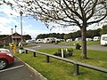
 Belmont Park-Ride - geograph.org.uk - 5846628.jpg 1,600 × 1,200; 438 KB
-
 Belmont Skateboard Park - geograph.org.uk - 317582.jpg 640 × 480; 72 KB
-
 Belmont Surgery - geograph.org.uk - 781046.jpg 640 × 480; 109 KB
-
 Bingo Hall on Front Street, Durham - geograph.org.uk - 2703805.jpg 640 × 480; 66 KB
-
 Broomside Lane - geograph.org.uk - 4502024.jpg 640 × 480; 79 KB
-
 Broomside Lane - geograph.org.uk - 4502057.jpg 640 × 480; 73 KB
-
 Broomside Lane Bridge - geograph.org.uk - 3237280.jpg 1,364 × 1,080; 518 KB
-

-
 Broomside Lane Bridge, A1(M) - geograph.org.uk - 2578340.jpg 640 × 368; 48 KB
-
 Broomside Lane, Durham - geograph.org.uk - 1925020.jpg 1,024 × 694; 284 KB
-

-
 Brownfield site at Gilesgate - geograph.org.uk - 3880089.jpg 1,500 × 1,125; 1.66 MB
-
 Bus on Carrville High Street - geograph.org.uk - 5945644.jpg 4,282 × 3,211; 2.39 MB
-
 Bus stop and shelter, Gilesagte Moor - geograph.org.uk - 4502006.jpg 640 × 480; 50 KB
-
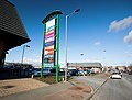
 B^Q extra at Durham City Retail Park - geograph.org.uk - 2523793.jpg 3,648 × 2,736; 2.13 MB
-
 B^Q extra, Durham - geograph.org.uk - 3656694.jpg 640 × 482; 76 KB
-
 Camp Site View - geograph.org.uk - 4132579.jpg 800 × 600; 137 KB
-
 Car showroom - geograph.org.uk - 5944536.jpg 4,459 × 3,345; 2.17 MB
-
 Cherry pickers - geograph.org.uk - 3706876.jpg 800 × 607; 477 KB
-
 Cheveley Park Medical Centre - geograph.org.uk - 781014.jpg 640 × 487; 110 KB
-
 Children's Play Area - geograph.org.uk - 780988.jpg 640 × 480; 73 KB
-
 Damson Way, Durham - geograph.org.uk - 3850854.jpg 446 × 640; 197 KB
-
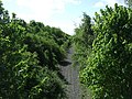 Dismantled railway, Broomside Cutting - geograph.org.uk - 4498806.jpg 640 × 480; 123 KB
-
 Dragon Lane, Durham - geograph.org.uk - 3850895.jpg 640 × 484; 218 KB
-
 Durham City AFC ground - geograph.org.uk - 4358633.jpg 1,600 × 1,246; 244 KB
-
 Durham City Retail Park - geograph.org.uk - 3386401.jpg 1,500 × 843; 1.05 MB
-
 Durham City Retail Park - geograph.org.uk - 3903964.jpg 640 × 480; 47 KB
-
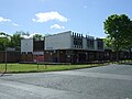
 Durham Diagnostic and Treatment Centre - geograph.org.uk - 5944532.jpg 4,608 × 3,456; 2.51 MB
-
 Durham Grange Caravan Club Site Meadow Lane - geograph.org.uk - 3777891.jpg 2,088 × 1,415; 1.03 MB
-
 Entrance and exit road for Belmont Park and Ride Station - geograph.org.uk - 2415144.jpg 3,648 × 2,736; 2.03 MB
-

-
 Extension at Durham Belmont Park and Ride Station - geograph.org.uk - 2816161.jpg 3,648 × 2,736; 2.03 MB
-
 Footbridge in Kepier wood - geograph.org.uk - 5093762.jpg 5,312 × 2,988; 6.42 MB
-
 Footpath by River Wear in Kepier wood - geograph.org.uk - 5093777.jpg 5,312 × 2,988; 7.23 MB
-
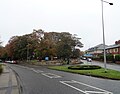
 Front Street (A181) heading west - geograph.org.uk - 2703808.jpg 640 × 480; 49 KB
-
 Gateway to playing fields - geograph.org.uk - 5944544.jpg 4,368 × 3,275; 4.62 MB
-
 Grange Caravan Club Site - geograph.org.uk - 2071398.jpg 2,762 × 1,797; 1,005 KB
-
 Grange Caravan Club Site - geograph.org.uk - 2086832.jpg 640 × 480; 64 KB
-
 High Street in Carrville - geograph.org.uk - 2505897.jpg 3,648 × 2,736; 1.99 MB
-

-
 Hotel Bannatyne, Eden Terrace - geograph.org.uk - 460109.jpg 640 × 480; 90 KB
-
 Houses on Bainbridge Street - geograph.org.uk - 4498802.jpg 640 × 480; 83 KB
-
 Houses on Dragon Lane - geograph.org.uk - 6373452.jpg 2,000 × 1,500; 3.33 MB
-

-
 Kepier Hospital - geograph.org.uk - 4249443.jpg 640 × 366; 57 KB
-
 Kepier Hospital - geograph.org.uk - 4249451.jpg 640 × 366; 67 KB
-
 Kepier Hospital gatehouse - geograph.org.uk - 5421435.jpg 1,500 × 1,027; 1.87 MB
-
 Layby on the B1283 at West Sherburn - geograph.org.uk - 2503927.jpg 3,648 × 2,736; 2.86 MB
-
 Looking down Dragon Lane - geograph.org.uk - 5947873.jpg 4,608 × 3,456; 3.42 MB
-
 Meadow Lane View - geograph.org.uk - 4137421.jpg 800 × 600; 88 KB
-
 Mini roundabout, Broomside Lane - geograph.org.uk - 781072.jpg 640 × 503; 77 KB
-
 Moor End, Belmont - geograph.org.uk - 5947762.jpg 4,608 × 3,456; 5.78 MB
-
 New Durham Workmen's Club - geograph.org.uk - 3601306.jpg 800 × 534; 254 KB
-
 No entry to Dragonville - geograph.org.uk - 3706887.jpg 640 × 476; 350 KB
-
 Old schoolhouse on Broomside Lane - geograph.org.uk - 4502013.jpg 640 × 480; 89 KB
-
 Overbridge, Junction 62, A1(M) - geograph.org.uk - 2578348.jpg 640 × 430; 43 KB
-
 Overbridges, Junction 62, A1(M) - geograph.org.uk - 2578346.jpg 640 × 430; 46 KB
-
 Path towards subway under the A1(M) - geograph.org.uk - 4831119.jpg 640 × 427; 147 KB
-
 Planted beds at Belmont Park and Ride - geograph.org.uk - 5420028.jpg 1,500 × 1,125; 1.86 MB
-
 Poplar Road, Carrville - geograph.org.uk - 2827555.jpg 640 × 480; 59 KB
-
 Premier Inn - Durham East Hotel - geograph.org.uk - 4358643.jpg 1,600 × 1,048; 306 KB
-
 Railway bridge over the A690 at Carrville - geograph.org.uk - 2415151.jpg 3,648 × 2,736; 2.81 MB
-
 Ramside Gardens - geograph.org.uk - 3899937.jpg 800 × 600; 115 KB
-
 Ramside Golf Club - geograph.org.uk - 3899946.jpg 800 × 600; 65 KB
-
 Ramside Hall - geograph.org.uk - 3899921.jpg 800 × 600; 55 KB
-
 Ramside Hall Hotel, Carrville - geograph.org.uk - 2640299.jpg 640 × 480; 115 KB
-
 Retail Park at Gilesgate Moor - geograph.org.uk - 5947778.jpg 4,327 × 3,245; 2.17 MB
-
 Road from Maureen Terrace - geograph.org.uk - 2086827.jpg 640 × 480; 114 KB
-
 Road junction at Broomside Lane - geograph.org.uk - 5945650.jpg 3,958 × 3,116; 2.02 MB
-
 Road junction at Gilesgate Moor - geograph.org.uk - 5947809.jpg 4,221 × 3,165; 2.26 MB
-
 Saturday morning junior football - geograph.org.uk - 4358617.jpg 1,600 × 1,228; 306 KB
-
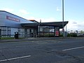
 Service station, Gilesgate Moor - geograph.org.uk - 4502003.jpg 640 × 480; 51 KB
-
 Shops on The Links - geograph.org.uk - 4502028.jpg 640 × 480; 59 KB
-
 Sign for the Belmont, Moor End - geograph.org.uk - 4498799.jpg 486 × 640; 70 KB
-
 Sign for the Gilesgate Moor - geograph.org.uk - 4498792.jpg 562 × 640; 55 KB
-
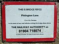 Sign on railway bridge FEP-32 - geograph.org.uk - 4502071.jpg 640 × 485; 135 KB
-
 Soccarena Durham City - geograph.org.uk - 4358523.jpg 1,600 × 1,200; 283 KB
-
 Sportsmans Arms in Carrville - geograph.org.uk - 2505907.jpg 3,648 × 2,736; 1.93 MB
-
 St Mary's Road - geograph.org.uk - 4502020.jpg 640 × 480; 66 KB
-
 Suburban sunrise - geograph.org.uk - 4831115.jpg 640 × 427; 59 KB
-
 Tall umbellifers near River Wear - geograph.org.uk - 5420207.jpg 1,499 × 938; 1.48 MB
-
 Tanks on Damson Way, Durham - geograph.org.uk - 3850472.jpg 558 × 640; 179 KB
-
 Terraced houses on Dragon Lane - geograph.org.uk - 5947886.jpg 4,608 × 3,456; 3.06 MB
-
 Terraced housing on Broomside Lane - geograph.org.uk - 4502062.jpg 640 × 480; 86 KB
-
 Tesco Car Park - geograph.org.uk - 2741324.jpg 427 × 640; 234 KB
-
 Tesco extra Durham - geograph.org.uk - 1586900.jpg 640 × 341; 51 KB
-
 Tesco Extra store, Durham - geograph.org.uk - 3656688.jpg 640 × 482; 62 KB
-
 The A1(M) northbound - geograph.org.uk - 4502010.jpg 640 × 480; 72 KB
-
 The A1M north - geograph.org.uk - 5945633.jpg 4,608 × 3,456; 3.32 MB
-

-
 The Belmont, Moor End - geograph.org.uk - 4498798.jpg 640 × 480; 56 KB
-
 The cold road south - geograph.org.uk - 4831113.jpg 640 × 427; 61 KB
-
 The Old Cinema Launderette - geograph.org.uk - 4501996.jpg 640 × 480; 66 KB
-
 The Old School House, Belmont - geograph.org.uk - 5947005.jpg 4,608 × 3,456; 3.13 MB
-
 The Travellers Rest - geograph.org.uk - 4502048.jpg 640 × 480; 54 KB
-
 The Travellers Rest - geograph.org.uk - 5947927.jpg 4,391 × 3,293; 2.18 MB
-
 The Travellers Rest, Gilesgate Moor - geograph.org.uk - 4498790.jpg 640 × 480; 52 KB
-
 TK Maxx Durham - geograph.org.uk - 4137402.jpg 800 × 567; 64 KB
-
 Track and fields south of Belmont - geograph.org.uk - 4831124.jpg 640 × 427; 101 KB
-
 Track to Sherburn Grange - geograph.org.uk - 3850730.jpg 475 × 640; 197 KB
-
 Traffic Lights, Broomside Lane - geograph.org.uk - 781064.jpg 640 × 480; 79 KB
-
 View across the river from the path below Frankland Farm - geograph.org.uk - 3833341.jpg 4,608 × 3,456; 4.88 MB
-
 View along Sunderland Road at Gilesgate Moor - geograph.org.uk - 5947860.jpg 4,111 × 3,224; 2.05 MB
-
 View south from the riverside path - geograph.org.uk - 3833347.jpg 4,608 × 3,456; 4.61 MB
-
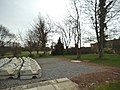
 War memorial, Belmont - geograph.org.uk - 5086415.jpg 1,500 × 995; 1.62 MB
-
 Wedding VW - geograph.org.uk - 3899969.jpg 800 × 600; 98 KB
-
 Wooden fence alongside wooded gorge - geograph.org.uk - 5609183.jpg 1,500 × 1,125; 2.32 MB
-
 Wooden fence bounding public footpath - geograph.org.uk - 5420433.jpg 1,500 × 1,125; 1.57 MB
-

-
 Belmont Business Park, Durham - geograph.org.uk - 373382.jpg 640 × 480; 57 KB
-
 Belmont Cemetery - geograph.org.uk - 460096.jpg 640 × 480; 146 KB
-

-
 Belmont Industrial Estate, Durham - geograph.org.uk - 373388.jpg 640 × 480; 54 KB
-
 Belmont Industrial Estate, Durham - geograph.org.uk - 373389.jpg 640 × 480; 56 KB
-
 Belmont Park-and-Ride, Durham - geograph.org.uk - 373392.jpg 640 × 480; 75 KB
-
 Belmont Primary School - geograph.org.uk - 781022.jpg 640 × 438; 55 KB
-
 Belmont School Sports Hall - geograph.org.uk - 781020.jpg 640 × 480; 55 KB
-
 Bishop's Close Housing Development - geograph.org.uk - 780999.jpg 640 × 451; 86 KB
-
 Bishop's Close under construction - geograph.org.uk - 781010.jpg 640 × 451; 80 KB
-
 Blue House Shops, Carville High Street - geograph.org.uk - 460085.jpg 640 × 480; 127 KB
-
 Cambridgeshire Drive, Cheveley Park - geograph.org.uk - 465286.jpg 640 × 372; 90 KB
-

-

-

-
 Moor Park, Belmont - geograph.org.uk - 317573.jpg 640 × 480; 91 KB
-
 Shropshire Drive, Cheveley Park - geograph.org.uk - 464374.jpg 640 × 461; 89 KB
_at_the_Carrville_Interchange_-_geograph.org.uk_-_6457179.jpg)
_Durham_-_geograph.org.uk_-_3219117.jpg)
_heading_north_near_Sherburn_Grange_-_geograph.org.uk_-_4064710.jpg)
_Island_-_geograph.org.uk_-_4137439.jpg)
_near_Durham_-_geograph.org.uk_-_3850048.jpg)
_north_of_Durham_-_geograph.org.uk_-_6457181.jpg)
_northbound_-_geograph.org.uk_-_6673970.jpg)
_northbound_-_geograph.org.uk_-_6673975.jpg)
_northbound_-_geograph.org.uk_-_6673979.jpg)
_northbound_-_geograph.org.uk_-_6673982.jpg)
_northbound_-_geograph.org.uk_-_6673988.jpg)
_northbound_-_geograph.org.uk_-_6673993.jpg)
_northbound_-_geograph.org.uk_-_6673997.jpg)


_-_geograph.org.uk_-_6640855.jpg)
_-_geograph.org.uk_-_6640857.jpg)
_-_geograph.org.uk_-_6640860.jpg)
_-_geograph.org.uk_-_6640865.jpg)
_Junction_62_-_geograph.org.uk_-_6640858.jpg)


_near_Durham_-_geograph.org.uk_-_6457176.jpg)
_-_geograph.org.uk_-_2578340.jpg)


_heading_west_-_geograph.org.uk_-_2703808.jpg)


_-_geograph.org.uk_-_2578348.jpg)
_-_geograph.org.uk_-_2578346.jpg)
_-_geograph.org.uk_-_4831119.jpg)


_northbound_-_geograph.org.uk_-_4502010.jpg)


.jpg)


