Category:Besford
Vai alla navigazione
Vai alla ricerca
village in the United Kingdom Aug2005.jpg) | |||||
| Carica un file multimediale | |||||
| Istanza di | |||||
|---|---|---|---|---|---|
| Luogo | Wychavon, Worcestershire, Midlands Occidentali, Inghilterra | ||||
| Popolazione |
| ||||
| Superficie |
| ||||
 | |||||
Sottocategorie
Questa categoria contiene le 2 sottocategorie indicate di seguito, su un totale di 2.
B
- Besford Court (5 F)
P
File nella categoria "Besford"
Questa categoria contiene 125 file, indicati di seguito, su un totale di 125.
-
 Approaching the crossroads - geograph.org.uk - 2645919.jpg 640 × 480; 60 KB
-
 Arable land at Besford - geograph.org.uk - 2156181.jpg 1 024 × 768; 193 KB
-
 Arable land near Besford - geograph.org.uk - 5167329.jpg 800 × 450; 89 KB
-
 Besford MMB 01.jpg 4 023 × 2 055; 2,04 MB
-
 Besford MMB 02.jpg 3 843 × 2 556; 3,85 MB
-
 Besford MMB 03.jpg 3 962 × 2 442; 3,67 MB
-
 Besford MMB 04.jpg 4 074 × 2 376; 3,22 MB
-
 Besford MMB 05.jpg 3 993 × 2 292; 2,66 MB
-

-
 Birmingham and Gloucester main line - geograph.org.uk - 937706.jpg 480 × 640; 92 KB
-
 Bow Brook valley - geograph.org.uk - 2059516.jpg 640 × 480; 54 KB
-
 Church Farm, Besford - geograph.org.uk - 4886987.jpg 640 × 480; 62 KB
-
 Coat of arms on tomb - geograph.org.uk - 5318189.jpg 600 × 800; 81 KB
-
 Coat of arms on tomb - geograph.org.uk - 5318192.jpg 768 × 1 024; 184 KB
-
 Cotswold Venturer near Croome Park - geograph.org.uk - 6396058.jpg 640 × 420; 86 KB
-
 Crabbe Lane junction - geograph.org.uk - 2645918.jpg 640 × 480; 70 KB
-
 Croome Perry Wood - geograph.org.uk - 3032146.jpg 1 200 × 811; 1,21 MB
-
 Croome Perry Wood - geograph.org.uk - 986059.jpg 480 × 640; 148 KB
-
 Croome River in evening sun - geograph.org.uk - 449454.jpg 640 × 426; 77 KB
-
 Crossroads near Wadborough - geograph.org.uk - 3256542.jpg 1 600 × 915; 257 KB
-
 Defford Airfield - geograph.org.uk - 756641.jpg 640 × 426; 89 KB
-
 Defford Airfield from 2500 feet - geograph.org.uk - 523857.jpg 640 × 480; 95 KB
-
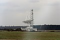
 Defford radio telescope - geograph.org.uk - 2986511.jpg 640 × 356; 34 KB
-
 Defford Road near the Granary - geograph.org.uk - 798980.jpg 640 × 426; 80 KB
-

-
 Dunstall Farm - geograph.org.uk - 738084.jpg 640 × 426; 92 KB
-
 Entrance to Besford Court Estate - geograph.org.uk - 5230630.jpg 1 600 × 1 200; 842 KB
-
 Evening sun on Croome River - geograph.org.uk - 449448.jpg 640 × 426; 119 KB
-
 Flying Scotsman bound for Worcester - geograph.org.uk - 6190828.jpg 1 024 × 680; 247 KB
-
 Footpath leaves Salters Lane - geograph.org.uk - 2646001.jpg 640 × 480; 66 KB
-
 Footpath off Ladywood Road - geograph.org.uk - 4004880.jpg 1 600 × 1 064; 648 KB
-
 Footpath options leave Harewell lane - geograph.org.uk - 2645941.jpg 640 × 480; 84 KB
-
 Footpath Sign - geograph.org.uk - 41251.jpg 640 × 426; 141 KB
-
 Footpath sign at Besford - geograph.org.uk - 4628806.jpg 800 × 531; 114 KB
-
 Grazing near Lincoln's Farm - geograph.org.uk - 4376578.jpg 800 × 487; 62 KB
-

-
 Harewell Lane - geograph.org.uk - 2156183.jpg 1 024 × 768; 241 KB
-
 Harewell Lane, Besford - geograph.org.uk - 2645923.jpg 640 × 480; 44 KB
-
 Houses near Besford Court - geograph.org.uk - 6383377.jpg 1 024 × 768; 271 KB
-
 Houses on Harewell Lane, Besford - geograph.org.uk - 2645942.jpg 640 × 480; 80 KB
-
 Ladywood Road enters Besford parish - geograph.org.uk - 2645921.jpg 640 × 480; 49 KB
-
 Listening in - geograph.org.uk - 937693.jpg 640 × 480; 93 KB
-

-
 Network Rail radio mast near Besford - geograph.org.uk - 1748770.jpg 1 500 × 988; 177 KB
-
-
 Ploughed field at Besford - geograph.org.uk - 2156193.jpg 1 024 × 768; 235 KB
-
 Poplar trees - geograph.org.uk - 6645580.jpg 768 × 1 024; 225 KB
-
 Post box in Harewell Lane - geograph.org.uk - 4887008.jpg 640 × 480; 61 KB
-
 Potato crop, pre-harvest - geograph.org.uk - 3714045.jpg 800 × 450; 252 KB
-
 Public footpath off Harewell Lane - geograph.org.uk - 4004888.jpg 1 600 × 1 064; 578 KB
-
 Public telephone box, Besford - geograph.org.uk - 2645945.jpg 640 × 480; 64 KB
-
 Radio dish at Besford - geograph.org.uk - 2645939.jpg 640 × 480; 49 KB
-
 Radio telescope at Defford - geograph.org.uk - 1834890.jpg 640 × 480; 150 KB
-

-
 Railway near Croome Park - geograph.org.uk - 6396051.jpg 640 × 427; 88 KB
-
 Ramsden crossroads - geograph.org.uk - 2645911.jpg 640 × 480; 59 KB
-
 Rebecca Road - geograph.org.uk - 6322632.jpg 1 024 × 768; 285 KB
-
 Rebecca Road and Croome Perry Wood - geograph.org.uk - 3511432.jpg 1 024 × 768; 110 KB
-
 Rebecca Road at Ladywood Road - geograph.org.uk - 4004863.jpg 1 600 × 1 064; 695 KB
-
 Rebecca Road Bridge - geograph.org.uk - 1748774.jpg 1 500 × 963; 228 KB
-
 Rebecca Road leading to Ladywood Road - geograph.org.uk - 4004848.jpg 1 600 × 1 064; 929 KB
-
 Recent housing development, Besford - geograph.org.uk - 799002.jpg 640 × 426; 119 KB
-
 Rural track bridge by Coombe Perry Wood - geograph.org.uk - 1748775.jpg 1 500 × 984; 246 KB
-
 Rush hour in Besford - geograph.org.uk - 4886978.jpg 640 × 480; 65 KB
-
 Salters Lane - geograph.org.uk - 2645998.jpg 640 × 480; 61 KB
-
 Salters Lane - geograph.org.uk - 3714049.jpg 800 × 450; 227 KB
-
 Salters Lane - geograph.org.uk - 3714116.jpg 800 × 450; 213 KB
-
 Salters Lane, looking north - geograph.org.uk - 2645954.jpg 640 × 480; 55 KB
-
 Salters Lane, looking south - geograph.org.uk - 2645955.jpg 640 × 480; 50 KB
-
 Section of The Millennium Way LDF - geograph.org.uk - 3714109.jpg 800 × 450; 274 KB
-
 Sight-lines for traffic from Besford Court estate - geograph.org.uk - 5230633.jpg 1 600 × 1 200; 853 KB
-
 SO 9245. Tiddesley Wood, Besford, Worcs. GB. 1 seen - Flickr - gailhampshire (2).jpg 1 236 × 1 086; 238 KB
-
 St Peter, Besford, churchyard - geograph.org.uk - 4886990.jpg 640 × 480; 65 KB
-
 St Peter, Besford, cwgc grave - geograph.org.uk - 4887002.jpg 454 × 640; 92 KB
-
 St Peter, Besford, notice board - geograph.org.uk - 4887006.jpg 640 × 480; 112 KB
-
 St Peter, Besford, path - geograph.org.uk - 4887003.jpg 640 × 480; 84 KB
-
 St. Peter's Lane, Besford - geograph.org.uk - 2645946.jpg 640 × 480; 74 KB
-
 Straw bales at Besford - geograph.org.uk - 965870.jpg 640 × 426; 106 KB
-
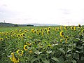 Sunflowers near Defford - geograph.org.uk - 50255.jpg 640 × 480; 90 KB
-
 Telephone box outside Besford church - geograph.org.uk - 4628800.jpg 800 × 531; 134 KB
-
 The Birmingham to Bristol line - geograph.org.uk - 986056.jpg 640 × 480; 135 KB
-

-
 The Croome River - geograph.org.uk - 629737.jpg 640 × 389; 51 KB
-

-
 The Granary - geograph.org.uk - 22495.jpg 640 × 479; 105 KB
-
 There is a footpath here - geograph.org.uk - 3714123.jpg 800 × 450; 202 KB
-
 Timber-framed barn, Bus Farm (geograph 6938983).jpg 1 600 × 1 200; 554 KB
-
 Timber-framed cottage (geograph 6938980).jpg 1 600 × 1 200; 487 KB
-
 Track over a railway bridge - geograph.org.uk - 986068.jpg 640 × 480; 189 KB
-
 Train passing straw field at Besford - geograph.org.uk - 965878.jpg 640 × 426; 91 KB
-
 Tree in a field of winter cereal - geograph.org.uk - 6351458.jpg 1 024 × 683; 167 KB
-
 View from Salters Lane - geograph.org.uk - 3714066.jpg 800 × 450; 229 KB
-
 View from the summit west of Ramsden - geograph.org.uk - 2645916.jpg 640 × 480; 47 KB
-
 Wheat field near Besford - geograph.org.uk - 992496.jpg 640 × 426; 92 KB
-
 Winding lane west of Besford Bridge - geograph.org.uk - 2645906.jpg 640 × 480; 52 KB
-

-
 Woodland near The Granary and Lincoln's Farm - geograph.org.uk - 3511452.jpg 1 024 × 768; 106 KB
-
 Woodland west of Ramsden - geograph.org.uk - 3510366.jpg 1 024 × 512; 73 KB
-
 Worcester to Cheltenham Railway - geograph.org.uk - 798995.jpg 426 × 640; 101 KB
-
 Worcester to Cheltenham railway line - geograph.org.uk - 798990.jpg 426 × 640; 119 KB
-
 WWI grave in Besford churchyard - geograph.org.uk - 4628797.jpg 531 × 800; 105 KB
-

-
 Ant hills and ridge and furrow - geograph.org.uk - 1119374.jpg 426 × 640; 131 KB
-
 Bakers Hill - geograph.org.uk - 50900.jpg 640 × 374; 54 KB
-
 Bridleway to Croome Perry Wood - geograph.org.uk - 341638.jpg 426 × 640; 170 KB
-
 Broad Hill Reservoir - geograph.org.uk - 284217.jpg 640 × 449; 287 KB
-
 Bull rushes and Croome Court - geograph.org.uk - 1421434.jpg 640 × 426; 108 KB
-
 Country road at Besford - geograph.org.uk - 763268.jpg 640 × 426; 66 KB
-
 Countrywide distribution warehouses - geograph.org.uk - 335106.jpg 640 × 426; 63 KB
-
 Croome Court - geograph.org.uk - 298730.jpg 640 × 426; 102 KB
-

-
 Defford Satellite Dish - geograph.org.uk - 50262.jpg 417 × 640; 77 KB
-
 Evening sunlight on Croome Court - geograph.org.uk - 446595.jpg 640 × 426; 98 KB
-

-
 Footpath to Croome church - geograph.org.uk - 1421481.jpg 640 × 426; 86 KB
-
 Giant Golf Balls - geograph.org.uk - 50258.jpg 640 × 480; 81 KB
-
 Golf Balls at Defford - geograph.org.uk - 756635.jpg 426 × 640; 104 KB
-
 New Farm, Besford - geograph.org.uk - 50265.jpg 640 × 480; 89 KB
-
 Old Access road to Defford airfield - geograph.org.uk - 22498.jpg 640 × 479; 155 KB
-
 Pond in Croome Landscape Park - geograph.org.uk - 470651.jpg 640 × 426; 122 KB
-
 Porter's Ashbed - geograph.org.uk - 50259.jpg 640 × 480; 110 KB
-

-

-
 Trees and Croome River - geograph.org.uk - 449445.jpg 426 × 640; 98 KB
-


.jpg)


.jpg)
.jpg)


