Category:Binderslebener Landstraße (Erfurt)
Jump to navigation
Jump to search
| Object location | | View all coordinates using: OpenStreetMap |
|---|
street in Erfurt, Thuringia, Germany | |||||
| Upload media | |||||
| Instance of | |||||
|---|---|---|---|---|---|
| Named after | |||||
| Location | Erfurt, Thuringia, Germany | ||||
 | |||||
Subcategories
This category has the following 2 subcategories, out of 2 total.
E
H
Media in category "Binderslebener Landstraße (Erfurt)"
The following 2 files are in this category, out of 2 total.
-
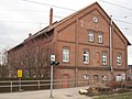 Gebäude W. Döppleb, Erfurt.jpg 3,072 × 2,304; 3.57 MB
-
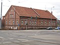 W. Döppleb, Erfurt.jpg 3,072 × 2,304; 2.7 MB

