Category:Black and white photographs of Cornwall
Jump to navigation
Jump to search
Ceremonial counties of England: Bedfordshire · Berkshire · Buckinghamshire · Cambridgeshire · Cheshire · Cornwall · Cumbria · Derbyshire · Devon · Dorset · Durham · East Riding of Yorkshire · East Sussex · Essex · Gloucestershire · Greater London · Greater Manchester · Hampshire · Herefordshire · Hertfordshire · Isle of Wight · Kent · Lancashire · Leicestershire · Lincolnshire · Merseyside · Norfolk · North Yorkshire · Northamptonshire · Northumberland · Nottinghamshire · Oxfordshire · Rutland · Shropshire · Somerset · South Yorkshire · Staffordshire · Suffolk · Surrey · Tyne and Wear · Warwickshire · West Midlands · West Sussex · West Yorkshire · Wiltshire · Worcestershire
City-counties: Bristol ·
Former historic counties:
Other former counties:
City-counties: Bristol ·
Former historic counties:
Other former counties:

Subcategories
This category has only the following subcategory.
P
Media in category "Black and white photographs of Cornwall"
The following 127 files are in this category, out of 127 total.
-
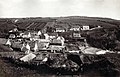 19th-century view of Cadgwith, Cornwall, England.jpg 1,567 × 1,012; 1.23 MB
-
 A Day In St Ives Cornwall United Kingdom (73165579).jpeg 667 × 1,000; 266 KB
-
 A Hand Shot Study of Lines on a Harsh Summer Day4096 x 6144.jpg 4,096 × 6,144; 8.03 MB
-
 Across from Fowey - geograph.org.uk - 803747.jpg 603 × 396; 66 KB
-
 Adolf Vinnen - StateLibQld 70 133022.jpg 683 × 957; 288 KB
-
 StateLibQld 1 133021 Adolf Vinn(en) (ship).jpg 685 × 1,000; 80 KB
-
 All alone at Kenneggy Cove - geograph.org.uk - 498915.jpg 640 × 426; 120 KB
-
 StateLibQld 1 133209 Andola (ship).jpg 1,000 × 649; 61 KB
-
 Barbara Hepworth Studio (3983441739).jpg 1,370 × 2,056; 1.5 MB
-
 Beach fish catch at St Ives, Cornwall, England 1906.jpg 1,084 × 680; 584 KB
-
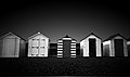 Beach Huts III - Flickr - Darren Shilson.jpg 2,832 × 1,665; 1.59 MB
-
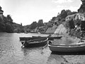 Boats on Helford Creek - geograph.org.uk - 581567.jpg 640 × 487; 109 KB
-
 Boats on the River Tamar in Cornwall, England 01.jpg 800 × 614; 72 KB
-
 Boats on the River Tamar in Cornwall, England 02.jpg 800 × 611; 78 KB
-
 Bochym Manor, Cornwall - geograph.org.uk - 720552.jpg 640 × 548; 93 KB
-
 Bodmin General railway station.jpg 640 × 369; 105 KB
-
 Bodmin North railway station.jpg 640 × 349; 109 KB
-
 Bodmin Road railway station.jpg 640 × 439; 115 KB
-
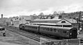
 Bodmin Road station geograph-2545373-by-Ben-Brooksbank.jpg 2,097 × 1,449; 506 KB
-
 Boscastle Harbour - geograph.org.uk - 884997.jpg 640 × 390; 38 KB
-

-
 Bude railway station 1935556 bb2fe589.jpg 409 × 640; 147 KB
-
 Bugle 1 railway station 1935574 45ddcf29.jpg 640 × 403; 121 KB
-
 Bugle 2 railway station 1935566 237a5eff.jpg 640 × 394; 119 KB
-
 Burngullow Station site of 1940091 636f9d3b.jpg 640 × 340; 96 KB
-
 Buses in Helston, Cornwall - geograph.org.uk - 631850.jpg 640 × 522; 84 KB
-
 Camborne Centenary Wesleyan Chapel - tramcar 1.jpg 1,024 × 559; 245 KB
-
 Camping at Mawgan Porth in 1935 - geograph.org.uk - 1725294.jpg 1,290 × 909; 286 KB
-
 Canoeing on the Bude Canal - geograph.org.uk - 878939.jpg 640 × 408; 60 KB
-
 Cape Cornwall - geograph.org.uk - 1030805.jpg 640 × 487; 122 KB
-
 Carn Leh, St. Mary's, Scilly Isles - geograph.org.uk - 621845.jpg 640 × 497; 79 KB
-
 Chapel on The Island, St. Ives - geograph.org.uk - 1593199.jpg 640 × 555; 82 KB
-
 Cherry Tree Coaches, Ruan Minor - geograph.org.uk - 631259.jpg 640 × 547; 85 KB
-
 Cherry Tree Coaches, Ruan Minor - geograph.org.uk - 631289.jpg 640 × 521; 74 KB
-
-
 Church Street, Helston (4942353213).jpg 1,653 × 2,479; 2.38 MB
-

-
 Clock Tower (4996832014).jpg 1,030 × 2,147; 963 KB
-
 Cottages at Helford - geograph.org.uk - 1590982.jpg 640 × 508; 91 KB
-
 Cromdale (ship, 1891) - SLV H99.220-1170.jpg 1,437 × 2,209; 2.27 MB
-
 Cromdale (ship, 1891) - SLV H99.220-4076.jpg 3,200 × 1,968; 5.52 MB
-
 Cromdale (ship, 1891) - SLV H99.220-608.jpg 1,328 × 1,982; 1.96 MB
-
 Ding Dong Mine (50218752721).jpg 1,228 × 1,818; 1.11 MB
-

-

-
 StateLibQld 1 142327 Hansy (ship).jpg 1,000 × 679; 125 KB
-
 Helford, Cornwall - geograph.org.uk - 581011.jpg 640 × 532; 133 KB
-
 StateLibQld 1 146295 Highland Fling (ship).jpg 1,000 × 738; 81 KB
-
 StateLibQld 1 147999 Duncan (ship).jpg 1,000 × 621; 137 KB
-
 StateLibQld 1 146139 Khyber (ship).jpg 1,000 × 609; 79 KB
-
 Kindly Light - Flickr - Cornish Cactus.jpg 3,577 × 2,592; 3.03 MB
-
 London Evacuees To Devon and Cornwall, England, 1941 D2223.jpg 800 × 578; 62 KB
-
 Monochrome Mist.jpg 2,949 × 3,010; 2.86 MB
-
 Mousehole harbour (1) - geograph.org.uk - 610538.jpg 640 × 547; 86 KB
-
 Mousehole Harbour (2) - geograph.org.uk - 610540.jpg 640 × 521; 76 KB
-
 Mousehole Harbour (3) - geograph.org.uk - 610543.jpg 640 × 558; 99 KB
-
 Mousehole Harbour (4) - geograph.org.uk - 610544.jpg 640 × 549; 98 KB
-
 Mousehole harbour in 1943 - geograph.org.uk - 3076997.jpg 883 × 614; 104 KB
-
 Mousehole, Cornwall - geograph.org.uk - 605022.jpg 640 × 528; 66 KB
-
 Mousehole, Cornwall - geograph.org.uk - 610545.jpg 640 × 559; 80 KB
-
 Mullion village, Cornwall - geograph.org.uk - 675682.jpg 640 × 523; 62 KB
-
 Neck-procession.jpg 454 × 350; 22 KB
-
 Newlyn Harbour in 1943 - geograph.org.uk - 3077005.jpg 862 × 593; 117 KB
-
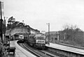
 North End of Penzance Station, 1985 - geograph.org.uk - 2617509.jpg 640 × 431; 49 KB
-
 Old lifeboat house and slipway, Lizard - geograph.org.uk - 720571.jpg 640 × 517; 119 KB
-
 One woman and her dog - geograph.org.uk - 383973.jpg 640 × 632; 67 KB
-
 Open-top bus at Land's End - geograph.org.uk - 1589390.jpg 640 × 542; 50 KB
-
 Parish Church, Mullion, Cornwall - geograph.org.uk - 675718.jpg 640 × 542; 86 KB
-
 Pastureland at Trevassack, Cornwall - geograph.org.uk - 631901.jpg 640 × 539; 72 KB
-
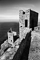
 Pendennis Castle (1).jpg 960 × 696; 368 KB
-
 Pendennis Castle keep 2.jpg 3,048 × 1,920; 656 KB
-
 Penzance Quayside - geograph.org.uk - 621825.jpg 640 × 517; 56 KB
-
 Pindos (ship, 1890) - SLV H99.220-892.jpg 2,441 × 1,352; 2.02 MB
-
 StateLibQld 1 140395 Pindos (ship).jpg 1,000 × 655; 90 KB
-
 StateLibQld 1 149459 Pindos (ship).jpg 1,000 × 665; 88 KB
-
 Pindos (ship, 1890) - SLV H99.220-4010.jpg 3,200 × 1,871; 3.32 MB
-
 Poldhu radio station.jpg 600 × 383; 38 KB
-
 RAF 224 Squadron Liberator crew RAF St Eval 1944 IWM CH 13725.jpg 800 × 628; 89 KB
-
 RAF Liberator pigeons WWII IWM CH 12364.jpg 800 × 546; 53 KB
-
 RAF St Eval aerial photograph WWII IWM HU 92963.jpg 800 × 664; 113 KB
-
 Redruth Station (Olympus OM-10) EXPLORE - Flickr - Mr B's Photography.jpg 3,201 × 2,134; 4.94 MB
-
 StateLibQld 1 170599 River Lune (ship).jpg 1,000 × 629; 65 KB
-
 Riverside view in Truro - geograph.org.uk - 605499.jpg 640 × 501; 47 KB
-
 StateLibQld 1 173651 Rosalia (ship).jpg 1,000 × 619; 105 KB
-
 StateLibQld 1 172899 Rosedale (ship).jpg 1,000 × 639; 61 KB
-
 StateLibQld 1 173571 Saintonge (ship).jpg 1,000 × 634; 68 KB
-
 StateLibQld 1 168967 Saluto (ship).jpg 1,000 × 532; 38 KB
-
 StateLibQld 1 172803 Saluto (ship).jpg 1,000 × 640; 49 KB
-
 StateLibQld 1 173663 Scheldt (ship).jpg 1,000 × 629; 67 KB
-
 StateLibQld 1 171335 Serica (ship).jpg 1,000 × 622; 80 KB
-
 Ships at anchor - geograph.org.uk - 1597844.jpg 640 × 450; 46 KB
-
 Ships at anchor on the River Fal - geograph.org.uk - 1597842.jpg 640 × 464; 56 KB
-
 Socoa (ship, 1901) - SLV H99.220-3410.jpg 2,129 × 1,412; 2.08 MB
-
 Socoa (ship, 1901) - SLV H99.220-4430.jpg 3,200 × 1,850; 3.17 MB
-
 St Ives - Back Lane - geograph.org.uk - 3835883.jpg 1,024 × 671; 651 KB
-
 St Ives Harbour, 1960 - geograph.org.uk - 4575703.jpg 2,129 × 1,323; 1.17 MB
-
 St. Ives Harbour - geograph.org.uk - 2784546.jpg 2,126 × 1,413; 402 KB
-
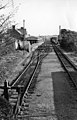
 St. Ives station - geograph.org.uk - 605014.jpg 640 × 537; 75 KB
-
 St. Just, Cornwall - geograph.org.uk - 631890.jpg 640 × 500; 67 KB
-
 St. Michael's Mount - geograph.org.uk - 1606525.jpg 640 × 499; 54 KB
-
 St. Michael's Mount, Cornwall - geograph.org.uk - 632119.jpg 640 × 504; 56 KB
-
 StateLibQld 1 133217 Andromeda (ship).jpg 1,000 × 630; 52 KB
-
 StateLibQld 1 150283 Coverack (ship).jpg 1,000 × 643; 107 KB
-
 Stream with swans in Truro - geograph.org.uk - 605504.jpg 640 × 583; 111 KB
-
 StateLibQld 1 171247 Susan Elizabeth (ship).jpg 1,000 × 618; 65 KB
-
 StateLibQld 1 46583 Sussex (ship).jpg 1,000 × 612; 64 KB
-
 Taking a break on the A390 in Tresillian, Cornwall.jpg 3,606 × 3,606; 6 MB
-
-
 The Moor, Falmouth, Cornwall - geograph.org.uk - 605219.jpg 640 × 552; 72 KB
-
 The Old Ale House (Olympus OM2n, Ilford XP2)EXPLORE - Flickr - Mr B's Photography.jpg 5,137 × 3,712; 2.35 MB
-
 The old oak tree (49913844047).jpg 3,570 × 2,873; 4.39 MB
-
 Tour bus on St. Mary's - geograph.org.uk - 1593205.jpg 640 × 555; 59 KB
-
 StateLibQld 1 169527 Transporter (ship).jpg 620 × 1,000; 63 KB
-
 StateLibQld 1 169507 Tripolitania (ship).jpg 1,000 × 610; 60 KB
-
 StateLibQld 1 173291 Umbre (ship).jpg 1,000 × 663; 57 KB
-

-

-
-
-

-
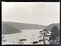
 View over Falmouth - geograph.org.uk - 580874.jpg 640 × 498; 124 KB
-
 Waterside buildings, Truro River - geograph.org.uk - 605263.jpg 640 × 477; 65 KB
-

-

-

-

-
 StateLibQld 1 201143 Wimborne (ship).jpg 1,000 × 629; 66 KB

.jpeg)


_(ship).jpg)

.jpg)
.jpg)


.jpg)

.jpg)

_-_SLV_H99.220-1170.jpg)
_-_SLV_H99.220-4076.jpg)
_-_SLV_H99.220-608.jpg)
.jpg)

_EXPLORE_-_Flickr_-_Mr_B%27s_Photography.jpg)
.jpg)

.jpg)
.jpg)
.jpg)


_-_geograph.org.uk_-_610538.jpg)
_-_geograph.org.uk_-_610540.jpg)
_-_geograph.org.uk_-_610543.jpg)
_-_geograph.org.uk_-_610544.jpg)


.jpg)


_-_SLV_H99.220-892.jpg)
.jpg)
.jpg)
_-_SLV_H99.220-4010.jpg)


_EXPLORE_-_Flickr_-_Mr_B%27s_Photography.jpg)
.jpg)

.jpg)
.jpg)
.jpg)
.jpg)
.jpg)
.jpg)
.jpg)


_-_SLV_H99.220-3410.jpg)
_-_SLV_H99.220-4430.jpg)


.jpg)
.jpg)

.jpg)
.jpg)


EXPLORE_-_Flickr_-_Mr_B%27s_Photography.jpg)
.jpg)

.jpg)
.jpg)


.jpg)
.jpg)
.jpg)
.jpg)