Category:Black and white photographs of the Isle of Man
Jump to navigation
Jump to search
Constituent countries of the United Kingdom: England · Northern Ireland · Scotland · Wales – British Crown dependencies: Isle of Man · Jersey
British overseas territories: Anguilla · Bermuda · British Antarctic Territory · British Virgin Islands · Cayman Islands · Falkland Islands · Gibraltar · South Georgia and the South Sandwich Islands · Turks and Caicos Islands
British overseas territories: Anguilla · Bermuda · British Antarctic Territory · British Virgin Islands · Cayman Islands · Falkland Islands · Gibraltar · South Georgia and the South Sandwich Islands · Turks and Caicos Islands
Subcategories
This category has only the following subcategory.
Media in category "Black and white photographs of the Isle of Man"
The following 102 files are in this category, out of 102 total.
-
-
 'Polar Bear' at Groudle Glen - geograph.org.uk - 717623.jpg 640 × 510; 114 KB
-
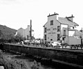
 A busy quayside at Peel, Isle of Man - geograph.org.uk - 1413133.jpg 640 × 602; 95 KB
-
 A full load for Ramsey - geograph.org.uk - 1546320.jpg 640 × 533; 69 KB
-
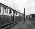
 An interior view - geograph.org.uk - 1348101.jpg 640 × 618; 80 KB
-
 Ancient crosses - geograph.org.uk - 1528868.jpg 495 × 640; 144 KB
-
 Anticline, Dhoon Beach, Isle of Man - geograph.org.uk - 377593.jpg 640 × 493; 98 KB
-
 At the bottom of the mountain - geograph.org.uk - 1634296.jpg 640 × 512; 99 KB
-
 Ballaglass Glen, Isle of Man - geograph.org.uk - 347145.jpg 640 × 503; 145 KB
-
 Ballaglass Glen, Isle of Man - geograph.org.uk - 636733.jpg 640 × 602; 135 KB
-
 Between the crossings - geograph.org.uk - 1350232.jpg 640 × 474; 52 KB
-
 Bungalow, SMR - geograph.org.uk - 1349766.jpg 640 × 495; 52 KB
-
 Cafe on Queens Pier, Ramsey - geograph.org.uk - 1551130.jpg 640 × 521; 62 KB
-
 Climbing towards the Bungalow - geograph.org.uk - 1523151.jpg 640 × 533; 80 KB
-
 Coming into service - geograph.org.uk - 1350157.jpg 640 × 517; 79 KB
-
 Cooil Roi.jpg 2,961 × 1,780; 1.23 MB
-
 Cottages on Shore Road, Laxey - geograph.org.uk - 1351567.jpg 640 × 535; 69 KB
-

-

-
 Diesel railcars at Port Erin - geograph.org.uk - 1522407.jpg 640 × 529; 82 KB
-
 Footbridge in Glen Mooar, Laxey - geograph.org.uk - 1430332.jpg 640 × 532; 117 KB
-

-
 Groudle Glen waterwheel - geograph.org.uk - 1606733.jpg 640 × 624; 101 KB
-
 High above Bulgham Bay - geograph.org.uk - 1524036.jpg 640 × 430; 91 KB
-
 In Ballaglass Glen - geograph.org.uk - 1351611.jpg 640 × 514; 84 KB
-
 In Ballaglass Glen - geograph.org.uk - 1630426.jpg 640 × 551; 130 KB
-
 In Ballaglass Glen - geograph.org.uk - 1630428.jpg 640 × 512; 145 KB
-
 In Ballaglass Glen - geograph.org.uk - 1630430.jpg 640 × 624; 143 KB
-
 In Ballaglass Glen - geograph.org.uk - 1630433.jpg 640 × 607; 152 KB
-
 In Ballaglass Glen, Isle of Man - geograph.org.uk - 562573.jpg 635 × 640; 214 KB
-
 In Glen Auldyn - geograph.org.uk - 562716.jpg 640 × 640; 215 KB
-
 Laxey - geograph.org.uk - 1409270.jpg 640 × 479; 69 KB
-
 Laxey Glen Gardens - geograph.org.uk - 1523669.jpg 640 × 498; 57 KB
-
 Laxey Glen Gardens - geograph.org.uk - 1523684.jpg 502 × 640; 59 KB
-
 Laxey Glen Gardens, Isle of Man - geograph.org.uk - 562735.jpg 640 × 514; 124 KB
-
 Laxey Harbour - geograph.org.uk - 1410695.jpg 640 × 508; 50 KB
-
 Laxey Harbour - geograph.org.uk - 1410698.jpg 640 × 496; 71 KB
-
 Laxey, Dumbell's Row - geograph.org.uk - 1633768.jpg 640 × 547; 75 KB
-
 Laxey, Isle of Man - geograph.org.uk - 1413337.jpg 640 × 480; 62 KB
-
 Lewaigue, Manx Electric Railway - geograph.org.uk - 1349823.jpg 640 × 488; 48 KB
-
 Looking north from the Gooseneck - geograph.org.uk - 562606.jpg 640 × 533; 100 KB
-

-
 Manx Electric cars on Laxey Head - geograph.org.uk - 1523089.jpg 640 × 509; 89 KB
-
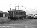
 Manx Electric Railway, Belle Vue - geograph.org.uk - 1552939.jpg 640 × 502; 65 KB
-
 Manx Electric Railway, Laxey - geograph.org.uk - 1633784.jpg 640 × 493; 113 KB
-
 Maughold Brooghs, Isle of Man - geograph.org.uk - 1410767.jpg 640 × 462; 62 KB
-
 Maughold Head from Port Mooar - geograph.org.uk - 1412521.jpg 640 × 473; 100 KB
-

-
 Near the Bungalow - geograph.org.uk - 1349749.jpg 640 × 511; 46 KB
-

-
 Off to Ramsey - geograph.org.uk - 1550808.jpg 640 × 491; 67 KB
-
 On Snaefell Mountain - geograph.org.uk - 1409324.jpg 640 × 465; 55 KB
-
-
 Peel Harbour at low tide - geograph.org.uk - 1523713.jpg 640 × 571; 96 KB
-
 Peel harbour, Isle of Man - geograph.org.uk - 1413096.jpg 640 × 498; 78 KB
-
 Peel, Isle of Man - geograph.org.uk - 1413108.jpg 640 × 493; 65 KB
-
 Peel, Isle of Man - geograph.org.uk - 1413312.jpg 640 × 502; 62 KB
-
 Peel, Isle of Man - geograph.org.uk - 1413317.jpg 640 × 499; 61 KB
-
 Port e Vullen - geograph.org.uk - 563012.jpg 640 × 492; 95 KB
-
 Port Erin - geograph.org.uk - 1409261.jpg 640 × 489; 52 KB
-
 Port Erin - geograph.org.uk - 1630124.jpg 640 × 533; 60 KB
-
 Port Erin station - geograph.org.uk - 1549946.jpg 640 × 538; 67 KB
-
 Port Lewaigue, Isle of Man - geograph.org.uk - 1409285.jpg 640 × 470; 74 KB
-
 Port Lewaigue, Isle of Man - geograph.org.uk - 562996.jpg 640 × 500; 99 KB
-
 Port St. Mary station - geograph.org.uk - 562676.jpg 640 × 537; 127 KB
-
 Port-e-Vullen, Isle of Man - geograph.org.uk - 562568.jpg 640 × 529; 124 KB
-
 Putting Green, Laxey, Isle of Man - geograph.org.uk - 1412510.jpg 640 × 466; 56 KB
-
 Queens Pier, Ramsey - geograph.org.uk - 1409161.jpg 640 × 502; 55 KB
-
 Queens Pier, Ramsey - geograph.org.uk - 1412490.jpg 640 × 492; 62 KB
-
 Queens Pier, Ramsey - geograph.org.uk - 1630402.jpg 640 × 572; 54 KB
-
 Queens Pier, Ramsey - geograph.org.uk - 562660.jpg 640 × 533; 121 KB
-
-
 Ramsey, from Guthrie's - geograph.org.uk - 1523166.jpg 640 × 467; 67 KB
-
 Ramsey, from Maughold Head - geograph.org.uk - 1523133.jpg 640 × 523; 72 KB
-
 Road near Groudle Glen - geograph.org.uk - 513492.jpg 640 × 490; 102 KB
-

-

-
 Stopping at South Cape - geograph.org.uk - 1348051.jpg 640 × 524; 69 KB
-
 Technical discussion at the Bungalow - geograph.org.uk - 1349785.jpg 640 × 484; 48 KB
-

-
 The 'Shore' Hotel, Laxey, Isle of Man - geograph.org.uk - 717241.jpg 640 × 529; 64 KB
-
 The Albert Tower, Ramsey, Isle of Man - geograph.org.uk - 513883.jpg 640 × 507; 100 KB
-
 The Beach Float, Laxey - geograph.org.uk - 1413420.jpg 640 × 471; 59 KB
-
 The Falcon Cliff Lift, Douglas - geograph.org.uk - 1552951.jpg 568 × 640; 116 KB
-
 The Falcon Cliff Lift, Douglas - geograph.org.uk - 1552954.jpg 541 × 640; 117 KB
-
 The Groudle Glen Hotel - geograph.org.uk - 1409354.jpg 640 × 519; 71 KB
-
 The Merseysippi Jazz Band - geograph.org.uk - 717634.jpg 640 × 545; 89 KB
-
 The Open Wagon - geograph.org.uk - 1348261.jpg 640 × 487; 63 KB
-
 Towards South Cape - geograph.org.uk - 1348035.jpg 640 × 458; 51 KB
-
 Train across the field - geograph.org.uk - 1550818.jpg 640 × 417; 41 KB
-

-
 View down Glen Mooar - geograph.org.uk - 717940.jpg 640 × 576; 55 KB
-
 View in Ballaglass Glen - geograph.org.uk - 513612.jpg 640 × 610; 219 KB
-

-
 View of Port Erin, Isle of Man - geograph.org.uk - 514082.jpg 640 × 500; 79 KB
-
 View of Ramsey from the Albert Tower - geograph.org.uk - 514056.jpg 640 × 553; 126 KB
-

-
 View over Laxey Head from South Cape - geograph.org.uk - 1356843.jpg 640 × 485; 66 KB
-
 View over Peel, Isle of Man - geograph.org.uk - 1413321.jpg 640 × 516; 80 KB
-

-

-
 Waterfall in Ballaglass Glen - geograph.org.uk - 1351590.jpg 640 × 494; 55 KB


_-_geograph.org.uk_-_1523141.jpg)


