Category:Blackfriars, London
Zur Navigation springen
Zur Suche springen
English: Blackfriars, London
Stadtteil von London  | |||||
| Medium hochladen | |||||
| Ist ein(e) | |||||
|---|---|---|---|---|---|
| Ort | City of London, London, England | ||||
| Liegt am oder im Gewässer | |||||
| Datum der Gründung, Erstellung, Entstehung, Erbauung |
| ||||
 | |||||
Unterkategorien
Es werden 9 von insgesamt 9 Unterkategorien in dieser Kategorie angezeigt:
In Klammern die Anzahl der enthaltenen Kategorien (K), Seiten (S), Dateien (D)
B
- Blackfriars Crown Court (2 D)
- Blackfriars Millennium Pier (25 D)
F
- Fatal Vespers (3 D)
Medien in der Kategorie „Blackfriars, London“
Folgende 49 Dateien sind in dieser Kategorie, von 49 insgesamt.
-
 ONL (1887) 1.199 - Falling-in of the Chapel at Blackfriars.jpg 2.848 × 1.924; 2,6 MB
-
 A lunchtime stroll in Old Bailey - geograph.org.uk - 1808591.jpg 640 × 480; 103 KB
-

-

-

-
 Bank in Giltspur Street - geograph.org.uk - 1808450.jpg 640 × 470; 66 KB
-

-
 Blackfriars c1965 - geograph.org.uk - 124153.jpg 640 × 403; 86 KB
-
 Blackfriars EC4 - 29801040694.jpg 3.072 × 2.304; 1,3 MB
-
 Blackfriars EC4.jpg 3.072 × 2.304; 1,37 MB
-
 Blackfriars from Southwark, London, by Daniel Turner GAG 1096.jpg 1.000 × 549; 89 KB
-
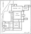 Blackfriars Monastery, London - ground plan.png 458 × 500; 9 KB
-
 Blackfriars theatre conjectural reconstruction 1921.png 3.490 × 3.834; 9,77 MB
-
 Blackfriars, London - geograph.org.uk - 908832.jpg 640 × 480; 48 KB
-
 Blue plaque in Old Bailey - geograph.org.uk - 1808601.jpg 640 × 480; 90 KB
-

-

-
 College of Arms - Coat of Arms - geograph.org.uk - 3566820.jpg 1.478 × 1.109; 419 KB
-
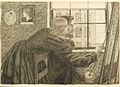 Dante Gabriel Rossetti - Fanny Cornforth and George Price Boyce.jpg 600 × 433; 374 KB
-
 Davy's Wine Bar in Creed Lane - geograph.org.uk - 1811962.jpg 480 × 640; 87 KB
-
 Detail above a property in Ludgate Hill - geograph.org.uk - 1811961.jpg 480 × 640; 105 KB
-
 Entrance to the Old Bailey - geograph.org.uk - 1808491.jpg 480 × 640; 91 KB
-

-

-

-
 Inside St Martin, Ludgate Hill (1) - geograph.org.uk - 1808670.jpg 480 × 640; 37 KB
-
 Inside St Martin, Ludgate Hill (2) - geograph.org.uk - 1808706.jpg 640 × 480; 86 KB
-

-
 Londres, Támesis (2007) 13.jpg 1.069 × 704; 852 KB
-
 Looking east along Fleet Street - geograph.org.uk - 3619115.jpg 3.456 × 4.608; 5,01 MB
-

-
 Looking towards Blackfriars Station.jpg 662 × 1.043; 141 KB
-
 Mediaeval Arches, Ireland Yard, Blackfriars, 1900 by Philip Norman.jpg 1.024 × 685; 112 KB
-

-
 Old and New London, vol. 1 - p 199.png 3.404 × 2.266; 5,43 MB
-

-
 Reconstruction of the plan of Priory of Blackfriars. Wellcome L0001718.jpg 1.118 × 1.726; 754 KB
-
 Restaurant in Old Bailey - geograph.org.uk - 1808597.jpg 480 × 640; 96 KB
-
 Sandwich bar on St Andrew's Hill - geograph.org.uk - 1811964.jpg 480 × 640; 68 KB
-
 Sculpture of four mother goddesses, 3rd century, Museum of London.jpg 3.888 × 2.592; 3,05 MB
-
 Southern abutment to former West Blackfriars and St Pauls Rail Bridge.jpg 3.000 × 4.000; 3,08 MB
-

-

-

-
 The places you could go to from Blackfriars - geograph.org.uk - 3627997.jpg 4.000 × 3.000; 4,01 MB
-
 The Shard, 32 London Bridge Street - geograph.org.uk - 3570457.jpg 804 × 1.200; 651 KB
-
 Travel agents in Old Bailey - geograph.org.uk - 1808551.jpg 640 × 480; 96 KB
-

-
 Ward boundary sign in Old Bailey - geograph.org.uk - 1808619.jpg 480 × 640; 82 KB
_1.199_-_Falling-in_of_the_Chapel_at_Blackfriars.jpg)

.jpg)


_-_geograph.org.uk_-_1808670.jpg)
_-_geograph.org.uk_-_1808706.jpg)

_13.jpg)


_-_geograph.org.uk_-_1808684.jpg)


