Category:Blackwater and Hawley
Jump to navigation
Jump to search
English: Blackwater and Hawley is a civil parish in the Hart district of Hampshire, England, on the county boundary with Surrey. The parish includes Minley, Blackwater and Hawley, both of which are parts of the Aldershot Urban Area. It was once part of the parish of Yateley.

civil parish in Hampshire, United Kingdom | |||||
| Upload media | |||||
| Instance of | |||||
|---|---|---|---|---|---|
| Location | Hart, Hampshire, South East England, England | ||||
 | |||||
Subcategories
This category has the following 3 subcategories, out of 3 total.
Media in category "Blackwater and Hawley"
The following 200 files are in this category, out of 226 total.
(previous page) (next page)-

-
 A327 heading north - geograph.org.uk - 6235831.jpg 1,024 × 684; 350 KB
-
 Access point to Hawley Common - geograph.org.uk - 4702901.jpg 2,000 × 1,333; 3.91 MB
-
 Access road, Hawley Common - geograph.org.uk - 4702990.jpg 2,000 × 1,333; 3.59 MB
-
 Access road, Hawley Common - geograph.org.uk - 4703356.jpg 1,999 × 1,333; 3.73 MB
-
 Access to Watchmoor Park - geograph.org.uk - 2561596.jpg 640 × 393; 41 KB
-
 Access track off Hawley Road - geograph.org.uk - 4515468.jpg 1,522 × 1,115; 1.04 MB
-
 Across the tracks - geograph.org.uk - 3830420.jpg 2,048 × 1,536; 1.3 MB
-
 Across the tracks - geograph.org.uk - 3850759.jpg 2,048 × 1,536; 1.99 MB
-

-
 Army depot, Hawley Lake - geograph.org.uk - 4703353.jpg 2,000 × 1,333; 2.45 MB
-
 B3272 Reading Road, Yateley - geograph.org.uk - 2856126.jpg 1,600 × 1,200; 516 KB
-
 Bare ground, Hawley Hill - geograph.org.uk - 4287339.jpg 2,048 × 1,536; 2.73 MB
-
 Bare ground, Hawley Hill - geograph.org.uk - 4288608.jpg 2,048 × 1,536; 2.83 MB
-
 Beech avenue, Hawley Common - geograph.org.uk - 4702909.jpg 2,000 × 1,333; 3.63 MB
-
 Beech woodland - geograph.org.uk - 1954335.jpg 2,272 × 1,704; 2.52 MB
-
 Bend on Hawley Road - geograph.org.uk - 3002374.jpg 600 × 800; 108 KB
-
 Bend on path parallel with Minley Road - geograph.org.uk - 4187944.jpg 800 × 600; 229 KB
-
 Blackwater Lodge on Yately Common - geograph.org.uk - 4188826.jpg 800 × 600; 219 KB
-
 Blackwater railway station, Hampshire - geograph.org.uk - 4339920.jpg 1,600 × 1,200; 459 KB
-
 Blackwater River bridge - geograph.org.uk - 3830938.jpg 2,048 × 1,536; 1.49 MB
-
 Blackwater Station - geograph.org.uk - 4199281.jpg 640 × 427; 92 KB
-
 Blackwater Station - geograph.org.uk - 5710025.jpg 3,264 × 2,448; 2.2 MB
-
 Blackwater Valley Path - geograph.org.uk - 3632174.jpg 2,048 × 1,536; 1.6 MB
-
 Blackwater Valley Path - geograph.org.uk - 3634001.jpg 1,963 × 1,472; 1.13 MB
-
 Blackwater Valley Path - geograph.org.uk - 3830394.jpg 2,048 × 1,536; 1.49 MB
-
 Blackwater Valley Path - geograph.org.uk - 3830409.jpg 2,048 × 1,536; 1.63 MB
-
 Blackwater Valley Path - geograph.org.uk - 3830943.jpg 2,048 × 1,536; 1.2 MB
-
 Blackwater Valley Road - geograph.org.uk - 5647648.jpg 640 × 426; 43 KB
-
 Bridge over gully, Hornley Common - geograph.org.uk - 4288617.jpg 2,048 × 1,536; 3.61 MB
-
 Bridge over the Blackwater River - geograph.org.uk - 3830407.jpg 2,048 × 1,536; 1.33 MB
-

-

-
-

-
 Bridleway reaches roundabout on the A30 - geograph.org.uk - 4189956.jpg 800 × 600; 182 KB
-
 Bridleway under the power lines - geograph.org.uk - 1954348.jpg 2,272 × 1,704; 1.99 MB
-
 Car park, Minley Cricket Club - geograph.org.uk - 3582666.jpg 640 × 480; 85 KB
-
 Clarendon Court - geograph.org.uk - 3852537.jpg 640 × 480; 71 KB
-
 Cleared track in Hawley Wood - geograph.org.uk - 4182263.jpg 1,553 × 1,081; 1.02 MB
-
 Cleared track in Hawley Wood - geograph.org.uk - 4182265.jpg 1,024 × 739; 241 KB
-
 Corner of Hawley Park Farm - geograph.org.uk - 4182279.jpg 1,024 × 741; 261 KB
-
 Country stile - geograph.org.uk - 3632136.jpg 2,048 × 1,536; 1.75 MB
-
 Cove Brook - geograph.org.uk - 3850679.jpg 2,048 × 1,536; 1.62 MB
-
 Cricket Hill Lane exit from the A30 - geograph.org.uk - 2856106.jpg 1,600 × 1,200; 475 KB
-
 Crossing on the A30, Yateley - geograph.org.uk - 4632962.jpg 2,560 × 1,920; 2 MB
-
 Crossing the River Blackwater - geograph.org.uk - 4531908.jpg 1,470 × 1,036; 562 KB
-
 Crossing the River Blackwater - geograph.org.uk - 4531909.jpg 1,525 × 1,112; 816 KB
-
 Crown ^ Cushion inn sign - geograph.org.uk - 3874880.jpg 480 × 640; 193 KB
-
 Detached shops on London Road, Blackwater - geograph.org.uk - 4632966.jpg 2,560 × 1,920; 1.95 MB
-
 Drag hunt jump, Hawlwy Hill - geograph.org.uk - 4287344.jpg 2,048 × 1,536; 3.61 MB
-
 Drag hunt jumps, Yateley Common - geograph.org.uk - 4290920.jpg 2,048 × 1,536; 3.19 MB
-
 Drain cover, Hawley Meadows - geograph.org.uk - 3850670.jpg 1,968 × 1,475; 910 KB
-
 Drain outflow, York Town - geograph.org.uk - 3830398.jpg 2,048 × 1,536; 1.37 MB
-
 Early gorse - geograph.org.uk - 3850351.jpg 2,048 × 1,536; 1.57 MB
-
 Eastbound M3 near Fleet - geograph.org.uk - 4158704.jpg 640 × 480; 272 KB
-
 Electricity pylon, Yateley Common - geograph.org.uk - 4287333.jpg 2,048 × 1,536; 3.21 MB
-
 Fernhill Road - geograph.org.uk - 3852490.jpg 640 × 480; 114 KB
-

-
 Floods, Hawley Meadows - geograph.org.uk - 3850212.jpg 2,048 × 1,536; 1.82 MB
-
 Footbridge ramp - geograph.org.uk - 4531907.jpg 1,528 × 1,106; 775 KB
-
 Footbridge, River Blackwater - geograph.org.uk - 3850218.jpg 2,048 × 1,536; 1.43 MB
-
 Garden shed - geograph.org.uk - 3830432.jpg 2,048 × 1,536; 1.58 MB
-
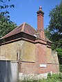
 Gate house for Hawley Park - geograph.org.uk - 5368819.jpg 640 × 480; 131 KB
-
 Gates and footbridge - geograph.org.uk - 3632133.jpg 2,048 × 1,536; 1.6 MB
-
 Gates, Hawley Meadows - geograph.org.uk - 3850337.jpg 2,048 × 1,536; 1.41 MB
-
 Girder bridge, York Town - geograph.org.uk - 3830403.jpg 1,965 × 1,474; 999 KB
-
 Grazing field - Hawley Park - geograph.org.uk - 4515451.jpg 1,520 × 1,117; 693 KB
-
 Grazing field - Hawley Park - geograph.org.uk - 4515456.jpg 1,520 × 1,128; 654 KB
-
 Hawley Common - geograph.org.uk - 4702179.jpg 2,000 × 1,333; 3.52 MB
-
 Hawley Grove - geograph.org.uk - 3852488.jpg 640 × 480; 115 KB
-
 Hawley Hill - geograph.org.uk - 4287336.jpg 2,048 × 1,536; 2.82 MB
-
 Hawley Hill MOD training area - geograph.org.uk - 4287349.jpg 2,048 × 1,536; 3.12 MB
-
 Hawley Lake - geograph.org.uk - 3823838.jpg 640 × 480; 81 KB
-
 Hawley Lake - geograph.org.uk - 4059299.jpg 1,536 × 1,128; 828 KB
-
 Hawley Lake - geograph.org.uk - 4700789.jpg 2,000 × 1,333; 2.89 MB
-
 Hawley Lake - geograph.org.uk - 4701578.jpg 2,000 × 1,333; 3.28 MB
-
 Hawley Lake - geograph.org.uk - 4702177.jpg 2,000 × 1,333; 3.28 MB
-
 Hawley Lake - geograph.org.uk - 4702926.jpg 2,000 × 1,333; 2.3 MB
-
 Hawley Lake - geograph.org.uk - 4702996.jpg 2,000 × 1,333; 3.36 MB
-
 Hawley Lake - geograph.org.uk - 4703364.jpg 2,000 × 1,333; 2.58 MB
-
 Hawley Lake - geograph.org.uk - 5245427.jpg 640 × 480; 56 KB
-
 Hawley Lake access road - geograph.org.uk - 4703343.jpg 2,000 × 1,333; 3.04 MB
-
 Hawley Lake car park - geograph.org.uk - 4702186.jpg 2,000 × 1,333; 2.79 MB
-
 Hawley Lake outflow - geograph.org.uk - 4701568.jpg 1,999 × 1,333; 3.25 MB
-
 Hawley Lake outflow - geograph.org.uk - 4701581.jpg 2,000 × 1,333; 2.84 MB
-
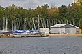 Hawley Lake, sailing dinghies - geograph.org.uk - 4703366.jpg 2,000 × 1,333; 2.71 MB
-
 Hawley Meadows - geograph.org.uk - 3830937.jpg 2,048 × 1,536; 1.02 MB
-
 Hawley Meadows - geograph.org.uk - 3830940.jpg 2,048 × 1,536; 1.4 MB
-
 Hawley Meadows - geograph.org.uk - 3830945.jpg 2,048 × 1,536; 1.77 MB
-
 Hawley Meadows - geograph.org.uk - 3850773.jpg 1,981 × 1,487; 1.03 MB
-
 Hawley Park - geograph.org.uk - 5368829.jpg 640 × 480; 142 KB
-
 Hawley Park Farm - geograph.org.uk - 4182278.jpg 1,567 × 1,137; 873 KB
-
 Hawley Place Gardens - geograph.org.uk - 4182284.jpg 1,200 × 1,600; 615 KB
-

-
 Hawley Road looking west - geograph.org.uk - 3002352.jpg 800 × 600; 121 KB
-
 Hornley Common - geograph.org.uk - 1954332.jpg 2,272 × 1,704; 1.76 MB
-
 Horse jump, Starve Acre - geograph.org.uk - 4287347.jpg 2,048 × 1,536; 3.23 MB
-
 Information board on Yately Common - geograph.org.uk - 4188815.jpg 800 × 600; 174 KB
-
 Island in Hawley Lake - geograph.org.uk - 4181049.jpg 1,526 × 1,149; 927 KB
-
 Island in Hawley Lake - geograph.org.uk - 4702183.jpg 2,000 × 1,333; 2.31 MB
-
 Island, Hawley Lake - geograph.org.uk - 4701592.jpg 2,000 × 1,333; 2.68 MB
-
 Jumps on the common - geograph.org.uk - 4189232.jpg 800 × 598; 140 KB
-
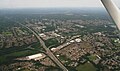
 Junction 4a (Smart motorway) - geograph.org.uk - 4746122.jpg 1,024 × 735; 121 KB
-

-
 Junction of tracks on Yately Common - geograph.org.uk - 4189225.jpg 800 × 600; 194 KB
-

-
 Line of beeches - geograph.org.uk - 1954355.jpg 1,704 × 2,272; 3.02 MB
-
 Lodge near Fleet - geograph.org.uk - 4217425.jpg 582 × 640; 324 KB
-
 London Road at the junction of Jays Nest Close - geograph.org.uk - 4632967.jpg 2,560 × 1,920; 2 MB
-
 London Road at the junction of Jays Nest Close - geograph.org.uk - 4632968.jpg 2,560 × 1,920; 1.71 MB
-
 London Road, Yateley - geograph.org.uk - 5122661.jpg 2,048 × 1,536; 1.42 MB
-
 London Road, Yateley - geograph.org.uk - 5122662.jpg 2,048 × 1,536; 1.48 MB
-
 Long straight path on Yately Common - geograph.org.uk - 4189212.jpg 600 × 800; 184 KB
-

-

-
 Looking northwards on Minley Road - geograph.org.uk - 4187939.jpg 800 × 600; 173 KB
-

-
 Looking northwards on Woodside - geograph.org.uk - 4189946.jpg 800 × 600; 175 KB
-
 Looking south on Minley Road - geograph.org.uk - 4187950.jpg 800 × 600; 149 KB
-
 Looking up Fernhill Road - geograph.org.uk - 4170158.jpg 640 × 459; 111 KB
-

-
-
 Lowland heath, Yateley Common - geograph.org.uk - 4288606.jpg 2,048 × 1,536; 3.07 MB
-
-
 M3 approaching junction 4a - geograph.org.uk - 2860812.jpg 640 × 383; 30 KB
-
 M3 eastbound - geograph.org.uk - 4427268.jpg 640 × 413; 40 KB
-
 M3 footbridge - geograph.org.uk - 3814881.jpg 1,825 × 1,215; 996 KB
-
 M3 junction 4a - geograph.org.uk - 2860833.jpg 640 × 392; 33 KB
-
 M3 north of Fleet - geograph.org.uk - 2808797.jpg 640 × 480; 50 KB
-
 Managed Access - geograph.org.uk - 6345763.jpg 800 × 450; 133 KB
-
 Managed Access Path - geograph.org.uk - 6345756.jpg 800 × 450; 149 KB
-
 Mast by bridleway on Yately Common - geograph.org.uk - 4188869.jpg 600 × 800; 253 KB
-
 Minley lodge - geograph.org.uk - 1954352.jpg 2,272 × 1,704; 2.6 MB
-
 Minley Road - geograph.org.uk - 6345746.jpg 800 × 450; 114 KB
-
 Minor track joins bridleway before bend - geograph.org.uk - 4189259.jpg 600 × 800; 173 KB
-

-
 MOD compound, Hawley Common - geograph.org.uk - 4702985.jpg 2,000 × 1,333; 3.04 MB
-
 MOD compound, Hawley Common - geograph.org.uk - 4702987.jpg 2,000 × 1,333; 2.77 MB
-
 Old Milestone - geograph.org.uk - 2676109.jpg 768 × 1,024; 322 KB
-
 Old Milestone - geograph.org.uk - 2676114.jpg 1,024 × 768; 329 KB
-
 Open heath, Hawley Common - geograph.org.uk - 4702181.jpg 2,000 × 1,333; 3.14 MB
-
 Overgrown horse jump - geograph.org.uk - 1954359.jpg 2,272 × 1,704; 2.73 MB
-
 Path and grassland - geograph.org.uk - 1954341.jpg 2,272 × 1,704; 1.66 MB
-
 Path going north to "The Ely" PH - geograph.org.uk - 4188799.jpg 800 × 600; 215 KB
-
 Path junction, Yateley Common - geograph.org.uk - 4285956.jpg 2,048 × 1,536; 2.87 MB
-
 Path on Yateley Common - geograph.org.uk - 5122657.jpg 2,048 × 1,536; 1.63 MB
-
 Path on Yateley Common - geograph.org.uk - 6345767.jpg 800 × 450; 113 KB
-
 Pine woods, Hawley Common - geograph.org.uk - 4702993.jpg 2,000 × 1,333; 3.34 MB
-
 Pine woods, Yateley Common - geograph.org.uk - 4290913.jpg 2,048 × 1,536; 3.19 MB
-
 Pine woods, Yateley Common - geograph.org.uk - 4290922.jpg 1,894 × 1,421; 3.3 MB
-
 Pipeline marker - geograph.org.uk - 3830426.jpg 2,048 × 1,536; 1.59 MB
-
 Pylon by old Hawley Road - geograph.org.uk - 4515461.jpg 1,531 × 1,100; 923 KB
-
 Pylon line, Hawley Hill - geograph.org.uk - 4288597.jpg 2,048 × 1,536; 3.2 MB
-
 Pylon ^ paddock - geograph.org.uk - 4515465.jpg 1,531 × 1,092; 821 KB
-
 River Blackwater - Hampshire - geograph.org.uk - 4531905.jpg 1,505 × 1,100; 855 KB
-
 River junction - geograph.org.uk - 3850663.jpg 2,048 × 1,536; 1.55 MB
-
 Road barrier, Hawley Hill - geograph.org.uk - 4288600.jpg 2,048 × 1,536; 2.9 MB
-
 Roadworks on the A30 - geograph.org.uk - 2561554.jpg 640 × 406; 55 KB
-
 Roundabout on the A30, Yateley - geograph.org.uk - 2856100.jpg 1,600 × 1,200; 469 KB
-
 Roundabout on the A30, Yateley - geograph.org.uk - 4395709.jpg 2,560 × 1,920; 2.09 MB
-
 Roundabout on the A327 - geograph.org.uk - 4188879.jpg 800 × 600; 148 KB
-

-
 Runners on bridleway approach barracks - geograph.org.uk - 4188835.jpg 800 × 600; 177 KB
-
 Sailing on Hawley Lake - geograph.org.uk - 5245425.jpg 640 × 480; 59 KB
-

-

-
 Shops on London Road, Blackwater - geograph.org.uk - 4395719.jpg 2,560 × 1,920; 2.18 MB
-
 Shops on London Road, Blackwater - geograph.org.uk - 4473079.jpg 2,472 × 1,796; 1.3 MB
-
 Shops on London Road, Blackwater - geograph.org.uk - 5128090.jpg 2,014 × 1,490; 813 KB
-

-
 Silver Birch, Yateley Common - geograph.org.uk - 4285953.jpg 2,015 × 1,512; 2.98 MB
-
 Small roundabout on Woodside - geograph.org.uk - 4189950.jpg 800 × 505; 104 KB
-
 Springcross Avenue - geograph.org.uk - 3002343.jpg 800 × 600; 111 KB
-
 Stile at junction of Fernhill Lane and Hawley Road - geograph.org.uk - 2157512.jpg 2,272 × 1,704; 2.99 MB
-
 Storm damage, Waldorf Heights - geograph.org.uk - 3852542.jpg 640 × 480; 115 KB
-
 The A30 on Yateley Common - geograph.org.uk - 2856117.jpg 1,600 × 1,200; 503 KB
-
 The A30 on Yateley Common - geograph.org.uk - 4632965.jpg 2,388 × 1,662; 823 KB
-
 The A30, Yateley - geograph.org.uk - 4632964.jpg 2,560 × 1,920; 2.01 MB
-
 The A327 arrives at Minley - geograph.org.uk - 4188890.jpg 800 × 600; 178 KB
-
 The Crown and Cushion, Camberley - geograph.org.uk - 3874891.jpg 640 × 480; 156 KB
-
 The Meadows Business Park - geograph.org.uk - 3830133.jpg 2,048 × 1,536; 1.03 MB
-
 The northern part of Woodside - geograph.org.uk - 4189955.jpg 800 × 600; 128 KB
-
 The River Blackwater - geograph.org.uk - 3850266.jpg 2,003 × 1,502; 520 KB
-
 The River Blackwater - geograph.org.uk - 3850648.jpg 2,048 × 1,536; 1.39 MB
-
 The River Blackwater - geograph.org.uk - 3850765.jpg 2,048 × 1,536; 1.44 MB
-
 This is number 25 - geograph.org.uk - 4189941.jpg 600 × 800; 149 KB
-
 Three counties - geograph.org.uk - 3830145.jpg 2,048 × 1,536; 1.6 MB
-
 Track - bridleway across Hawley Common - geograph.org.uk - 4182271.jpg 1,024 × 744; 258 KB
-
 Track - bridleway across Hawley Common - geograph.org.uk - 4182272.jpg 1,441 × 1,038; 935 KB
-
 Track arrives at Frogmore Park Drive - geograph.org.uk - 4189961.jpg 600 × 800; 207 KB
-
 Track from Hawley Lake - geograph.org.uk - 4182274.jpg 1,449 × 1,069; 980 KB
-
 Track from Hawley Lake - geograph.org.uk - 4182275.jpg 1,494 × 1,126; 985 KB
-

-
 Track in Hawley Wood - geograph.org.uk - 4182256.jpg 1,441 × 1,012; 887 KB
-
 Track in Hawley Wood - geograph.org.uk - 4182257.jpg 1,462 × 1,025; 919 KB
-
 Track in Hawley Wood - geograph.org.uk - 4182258.jpg 1,494 × 1,093; 1.04 MB
-
 Track in Hawley Wood - geograph.org.uk - 4182261.jpg 1,541 × 1,079; 1.03 MB
-
 Track in Hawley Wood - geograph.org.uk - 4182267.jpg 1,412 × 956; 869 KB
-
 Track in Hawley Wood - geograph.org.uk - 4182269.jpg 1,506 × 1,124; 1.06 MB


_-_geograph.org.uk_-_4746122.jpg)


