Category:Bocht 5, Enkhuizen
Jump to navigation
Jump to search
| Object location | | View all coordinates using: OpenStreetMap |
|---|
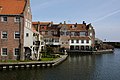
building in Enkhuizen, Netherlands  | |||||
| Upload media | |||||
| Instance of | |||||
|---|---|---|---|---|---|
| Location | Enkhuizen, North Holland, Netherlands | ||||
| Street address |
| ||||
| Heritage designation |
| ||||
 | |||||
|
This is a category about rijksmonument number 14973
|
| Address |
|
Media in category "Bocht 5, Enkhuizen"
The following 14 files are in this category, out of 14 total.
-
 Bocht naar Blauwpoortbrug - Enkhuizen - 20070077 - RCE.jpg 1,200 × 899; 257 KB
-
 Enkhuizen - panoramio (10).jpg 2,048 × 1,357; 541 KB
-
 Enkhuizen - panoramio (7).jpg 2,048 × 1,357; 477 KB
-
 Enkhuizen - panoramio (9).jpg 2,048 × 1,357; 531 KB
-
 Enkhuizen - rijksmonument 14973 - Bocht 5 20110924.jpg 577 × 800; 235 KB
-
 Enkhuizen, Netherlands - panoramio (123).jpg 2,048 × 1,148; 452 KB
-
 Enkhuizen, Netherlands - panoramio (157).jpg 2,048 × 1,148; 477 KB
-
 Enkhuizen, Netherlands - panoramio (40).jpg 2,048 × 1,375; 399 KB
-
 Enkhuizen, Netherlands - panoramio (87).jpg 2,048 × 1,375; 442 KB
-
 Huizen havenzijde - Enkhuizen - 20070593 - RCE.jpg 1,200 × 890; 180 KB
-

-

-
 Overzicht voorgevels gezien vanaf de weg - Enkhuizen - 20406757 - RCE.jpg 1,200 × 1,200; 331 KB
-
 Zuiderspui van uit de zee - Enkhuizen - 20070594 - RCE.jpg 1,200 × 946; 193 KB

.jpg)
.jpg)
.jpg)
.jpg)
.jpg)
.jpg)
.jpg)


