Category:Bolton-le-Sands
Jump to navigation
Jump to search
English: Bolton-le-Sands is a large village in the Lancaster district of Lancashire, England. The parish of Bolton-le-Sands had a population of 4,098 recorded in the 2001 census,
village in the United Kingdom  | |||||
| Upload media | |||||
| Instance of | |||||
|---|---|---|---|---|---|
| Location | Lancaster, Lancashire, North West England, England | ||||
| Population |
| ||||
 | |||||
Subcategories
This category has the following 2 subcategories, out of 2 total.
B
Media in category "Bolton-le-Sands"
The following 200 files are in this category, out of 360 total.
(previous page) (next page)-
 12 O'clock High - geograph.org.uk - 2044087.jpg 1,580 × 1,214; 212 KB
-

-
 A room with a view - geograph.org.uk - 1194407.jpg 640 × 480; 161 KB
-
 A Stile On The Coastal Way - geograph.org.uk - 6065294.jpg 640 × 464; 115 KB
-
 A train approaching the level crossing at Bolton-le-Sands - geograph.org.uk - 5403726.jpg 4,063 × 2,704; 5.45 MB
-
 A Wet Walk At Morecambe Bay - geograph.org.uk - 6065268.jpg 640 × 395; 92 KB
-
 A Windswept Coastal Way - geograph.org.uk - 6065290.jpg 640 × 399; 99 KB
-
 A6 entering Bolton-le-Sands - geograph.org.uk - 5683863.jpg 640 × 480; 51 KB
-

-
 A6 near Whin Grove, Bolton-le-Sands - geograph.org.uk - 5683875.jpg 640 × 480; 63 KB
-
 Archer's Cafe, Red Bank farm - geograph.org.uk - 5340235.jpg 5,202 × 3,465; 2.44 MB
-
 Ash again ^ - geograph.org.uk - 1863502.jpg 640 × 479; 42 KB
-
 Back Lodge at Hawkshead - geograph.org.uk - 2465552.jpg 640 × 480; 165 KB
-
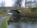
 Barker's Bridge (Bridge 126) - geograph.org.uk - 4071618.jpg 2,560 × 1,920; 2.95 MB
-
 Barker's Bridge - geograph.org.uk - 4877994.jpg 5,086 × 2,906; 1.52 MB
-
 Barker's Bridge No 126 - geograph.org.uk - 6105621.jpg 800 × 501; 96 KB
-
 Barker's Bridge, Bolton-le-Sands.jpg 640 × 480; 78 KB
-
 Barker's Bridge, Lancaster Canal - geograph.org.uk - 2035955.jpg 640 × 480; 149 KB
-
 Barker's Bridge, Lancaster Canal, near Carnforth - geograph.org.uk - 6293641.jpg 3,264 × 2,448; 2.61 MB
-
 Barkers Bridge on the Lancaster Canal - geograph.org.uk - 3089155.jpg 1,600 × 1,198; 428 KB
-
 Barn conversion by Old Mill - geograph.org.uk - 5340200.jpg 5,202 × 3,465; 3.07 MB
-
 Bay Search ^ Rescue - geograph.org.uk - 6065345.jpg 640 × 412; 106 KB
-
 Bay View garden centre - geograph.org.uk - 5340201.jpg 5,202 × 3,465; 2.87 MB
-
 Bay View Holiday Park, Morecambe Bay - geograph.org.uk - 3118375.jpg 640 × 480; 65 KB
-
 Bayview Garden Centre off Mill Lane - geograph.org.uk - 3131486.jpg 1,500 × 988; 105 KB
-
 Bench mark on Barker's Bridge (126) - geograph.org.uk - 2262260.jpg 480 × 640; 133 KB
-

-

-

-
 Bench mark, The Nook, Bolton-le-Sands - geograph.org.uk - 2269528.jpg 480 × 640; 132 KB
-
 Bleak outlook, Bolton-le-Sands - geograph.org.uk - 2269248.jpg 640 × 480; 78 KB
-
 Blue Anchor, Bolton-le-Sands - geograph.org.uk - 5341022.jpg 5,202 × 3,465; 2.63 MB
-
 Blue Anchor, Main Road, Bolton-le-Sands - geograph.org.uk - 835555.jpg 640 × 480; 100 KB
-
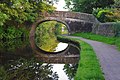
 Bolton Church Bridge No 122 - geograph.org.uk - 6105725.jpg 800 × 579; 151 KB
-
 Bolton Church Bridge, No 122 - geograph.org.uk - 5840794.jpg 1,024 × 768; 219 KB
-
 Bolton Cinder Ovens Bridge No 125 - geograph.org.uk - 6105694.jpg 800 × 631; 178 KB
-
 Bolton Cinder Ovens Bridge on the Lancaster Canal - geograph.org.uk - 3089120.jpg 1,600 × 1,198; 742 KB
-
 Bolton Holmes Farm - geograph.org.uk - 5340204.jpg 5,202 × 3,465; 3.84 MB
-
 Bolton Lane, Bolton-le-Sands - geograph.org.uk - 3022017.jpg 640 × 425; 170 KB
-
 Bolton le Sands village - geograph.org.uk - 28377.jpg 640 × 480; 106 KB
-

-
 Bolton Turnpike Bridge No 123 - geograph.org.uk - 6105715.jpg 800 × 559; 154 KB
-
 Bolton Turnpike Bridge No 123 - geograph.org.uk - 6105720.jpg 800 × 527; 124 KB
-
 Bolton-le-Sands Cricket Club - geograph.org.uk - 1949827.jpg 640 × 480; 85 KB
-
 Bolton-le-Sands fire station - geograph.org.uk - 1908445.jpg 640 × 427; 211 KB
-
 Bolton-le-Sands Fire Station - geograph.org.uk - 6065349.jpg 640 × 427; 88 KB
-
 Bolton-le-Sands Shoreline - geograph.org.uk - 6065282.jpg 640 × 448; 90 KB
-
 Bolton-le-Sands Station 1845546 0241dc21.jpg 640 × 350; 111 KB
-
 Bolton-le-Sands United Reformed church - geograph.org.uk - 5340242.jpg 5,202 × 3,465; 2.98 MB
-
 Bolton-le-Sands War Memorial - geograph.org.uk - 2898272.jpg 640 × 480; 153 KB
-
 Bolton-le-Sands, canal - geograph.org.uk - 2956941.jpg 1,024 × 768; 259 KB
-
 Bolton-le-Sands, Christchurch - geograph.org.uk - 2956923.jpg 1,024 × 768; 171 KB
-
 Bolton-le-Sands, churchyard - geograph.org.uk - 2956928.jpg 1,024 × 768; 294 KB
-
 Bolton-le-Sands, former school - geograph.org.uk - 2956934.jpg 1,024 × 757; 119 KB
-
 Bolton-le-Sands, Holy Trinity - geograph.org.uk - 2956931.jpg 1,024 × 746; 246 KB
-
 Bolton-le-Sands, Main Road - geograph.org.uk - 6099419.jpg 800 × 533; 609 KB
-
 Boulders on the beach below Red Bank - geograph.org.uk - 2269259.jpg 640 × 480; 78 KB
-
 Bridge 120, Lancaster Canal.jpg 4,608 × 3,456; 8.1 MB
-
 Bridge 121 - geograph.org.uk - 1007767.jpg 640 × 479; 141 KB
-
 Bridge 121, Lancaster Canal - geograph.org.uk - 1652328.jpg 640 × 480; 62 KB
-
 Bridge 122, Lancaster Canal - geograph.org.uk - 1652340.jpg 640 × 480; 77 KB
-
 Bridge 123, Lancaster Canal - geograph.org.uk - 1652356.jpg 640 × 480; 98 KB
-
 Bridge 123, Lancaster Canal - geograph.org.uk - 1853190.jpg 640 × 425; 128 KB
-
 Bridge 124, Lancaster Canal - geograph.org.uk - 1652359.jpg 640 × 480; 75 KB
-
 Bridge 125, Lancaster Canal - geograph.org.uk - 1652365.jpg 640 × 480; 96 KB
-
 Bridge 125, Lancaster Canal - geograph.org.uk - 2697664.jpg 640 × 425; 177 KB
-
 Bridge 126, Lancaster Canal - geograph.org.uk - 2696517.jpg 640 × 431; 177 KB
-
 Bridge carrying the A6 over the Lancaster Canal - geograph.org.uk - 2419339.jpg 2,592 × 1,944; 1.36 MB
-
 Bridge on the Lancaster Canal - geograph.org.uk - 4671019.jpg 1,024 × 768; 725 KB
-
 Building at Mount Pleasant - geograph.org.uk - 2465543.jpg 640 × 480; 196 KB
-

-
 Bye-Pass Road - geograph.org.uk - 6065340.jpg 640 × 437; 90 KB
-

-
 Canal-side farm, Bolton-le-Sands - geograph.org.uk - 2260986.jpg 640 × 480; 110 KB
-
 Canalside house, Bolton Town End - geograph.org.uk - 5840771.jpg 1,024 × 768; 239 KB
-
 Canalside houses on Greenwood Crescent - geograph.org.uk - 5840709.jpg 1,024 × 768; 203 KB
-
 Canoe school, Bolton-le-Sands - geograph.org.uk - 5840787.jpg 1,024 × 768; 151 KB
-
 Car park near Red Bank Farm - geograph.org.uk - 2046070.jpg 640 × 480; 83 KB
-
 Chorley's Bridge, Bolton-le-Sands.jpg 640 × 425; 303 KB
-

-
 Church Brow, Bolton-le-Sands - geograph.org.uk - 4689660.jpg 640 × 480; 67 KB
-

-
 Cinder Ovens Bridge, Bolton-le-Sands.jpg 2,560 × 1,920; 3.25 MB
-
 Coastal grazing, Bolton Town End - geograph.org.uk - 3815556.jpg 640 × 451; 35 KB
-

-
 Coastguard sign by Mill Lane - geograph.org.uk - 3137280.jpg 975 × 1,500; 191 KB
-
 Cockles and Caravans this way - geograph.org.uk - 1211272.jpg 640 × 427; 86 KB
-
 Corner of The Nook and Main Road, Bolton-le-Sands - geograph.org.uk - 5341029.jpg 4,830 × 3,290; 2.14 MB
-
 Crossing the Keer - geograph.org.uk - 1899218.jpg 640 × 480; 63 KB
-
 Cyclist on national cycle route 6 - geograph.org.uk - 5840817.jpg 1,024 × 768; 312 KB
-
 Date stone, Main Road, Bolton-le-Sands - geograph.org.uk - 2269521.jpg 640 × 480; 116 KB
-
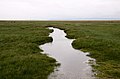 Drain in the marshland at Bolton-le-Sands - geograph.org.uk - 3137277.jpg 1,500 × 989; 131 KB
-
 Drainage channel off the foreshore near Bolton Holmes - geograph.org.uk - 3089030.jpg 1,600 × 1,198; 308 KB
-

-
 End of Pasture Lane - geograph.org.uk - 5340114.jpg 5,202 × 3,465; 2.75 MB
-
 Entering Bolton-le-Sands - geograph.org.uk - 4689644.jpg 640 × 480; 45 KB
-
 Entrance to the Bay View Holiday Park - geograph.org.uk - 3438368.jpg 2,048 × 1,536; 507 KB
-
 Eroded peat at Red Bank, Bolton le Sands - geograph.org.uk - 1754782.jpg 640 × 470; 141 KB
-
 Evening Sky - geograph.org.uk - 1817417.jpg 640 × 393; 34 KB
-
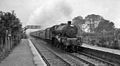
 Excursion train at Bolton-le-Sands - geograph.org.uk - 5870436.jpg 1,280 × 1,024; 457 KB
-
 Farm track off Lancaster Road (A6) - geograph.org.uk - 3815564.jpg 640 × 415; 42 KB
-
 Farmland near Hawksheads - geograph.org.uk - 6736871.jpg 1,280 × 720; 952 KB
-
 Farmland on the east bank of the Lancaster Canal - geograph.org.uk - 5840826.jpg 1,024 × 768; 305 KB
-
 Field overlooking Morecambe Bay - geograph.org.uk - 3131497.jpg 1,500 × 994; 172 KB
-
 Flooded field off Mill Lane - geograph.org.uk - 5340189.jpg 5,202 × 3,465; 3.85 MB
-
 Flooded field, Bolton-le-Sands - geograph.org.uk - 2712379.jpg 640 × 425; 119 KB
-

-

-

-
 Footpath to Red Bank Farm - geograph.org.uk - 3131501.jpg 1,500 × 1,000; 182 KB
-
 Footpath, Hest Bank to the coast - geograph.org.uk - 2269447.jpg 640 × 480; 95 KB
-
 Foreshore at Bolton-le-Sands - geograph.org.uk - 2716213.jpg 640 × 425; 173 KB
-
 Foreshore at Red Bank - geograph.org.uk - 2716242.jpg 640 × 425; 187 KB
-
 Foreshore near Morecambe Lodge - geograph.org.uk - 2716233.jpg 640 × 425; 188 KB
-
 Foreshore near Morecambe Lodge - geograph.org.uk - 2716237.jpg 640 × 443; 194 KB
-
 Foreshore near Morecambe Lodge - geograph.org.uk - 2716241.jpg 640 × 421; 214 KB
-
 Foreshore, Bolton-le-Sands - geograph.org.uk - 2712369.jpg 640 × 425; 165 KB
-
 Freight train, Bolton-le-Sands - geograph.org.uk - 6099771.jpg 1,280 × 720; 419 KB
-
 Frogs Galore - geograph.org.uk - 1814981.jpg 640 × 370; 91 KB
-
 Gardens edge the Lancaster Canal at Bolton Town End - geograph.org.uk - 3090164.jpg 1,600 × 1,198; 401 KB
-
 Gate near Bolton-le-Sands - geograph.org.uk - 3118360.jpg 640 × 480; 98 KB
-
 Gate near Red Bank farm car park - geograph.org.uk - 5340104.jpg 5,202 × 3,465; 3.27 MB
-
 Grange from over the sands - geograph.org.uk - 372893.jpg 640 × 384; 68 KB
-
 Grazing land, Bolton-le-Sands - geograph.org.uk - 5720761.jpg 1,280 × 850; 591 KB
-
 Grinding wheel outside the Old Mill, Mill Lane - geograph.org.uk - 5340193.jpg 5,202 × 3,465; 5.87 MB
-
 Hatlex Swing Bridge, Lancaster Canal - geograph.org.uk - 3438339.jpg 2,048 × 1,536; 761 KB
-
 Hatlex Swivel Bridge on the Lancaster Canal at Hest Bank - geograph.org.uk - 3090221.jpg 1,600 × 1,198; 645 KB
-
 Hatlex Swivel Bridge, Lancaster Canal - geograph.org.uk - 5182842.jpg 640 × 425; 213 KB
-
 Hatlex Swivel Bridge, Lancaster Canal - geograph.org.uk - 5720758.jpg 1,280 × 994; 763 KB
-
 Heading south on the A6 - geograph.org.uk - 4051957.jpg 640 × 480; 54 KB
-
 Hest Bank - geograph.org.uk - 4878889.jpg 5,184 × 3,133; 1.66 MB
-
 Hest Bank Swing Bridge - geograph.org.uk - 4071537.jpg 2,560 × 1,920; 3 MB
-
 Hest Bank Swing Bridge No 120 - geograph.org.uk - 6106761.jpg 800 × 498; 154 KB
-
 Hest Bank, Lancaster Canal - geograph.org.uk - 5732029.jpg 640 × 480; 560 KB
-
 Hest Bank, Slyne Road - geograph.org.uk - 5732090.jpg 640 × 384; 304 KB
-
 Highfield Lane - geograph.org.uk - 2465546.jpg 640 × 480; 149 KB
-
 Highfield Lane - geograph.org.uk - 2465551.jpg 640 × 480; 149 KB
-
 Highfield Lane at Tarn Cottages - geograph.org.uk - 2465544.jpg 640 × 480; 149 KB
-
 Holy Trinity churchyard, Bolton-le-Sands - geograph.org.uk - 5341018.jpg 5,202 × 3,465; 5.75 MB
-
 Houses on Grange View, Bolton Town End - geograph.org.uk - 5840752.jpg 1,024 × 768; 197 KB
-
 Houses on Slyne Road (A6) - geograph.org.uk - 4678359.jpg 640 × 480; 55 KB
-
 Houses on Slyne Road (A6) - geograph.org.uk - 4689648.jpg 640 × 480; 72 KB
-
 Houses on St Michaels Lane from The Shore - geograph.org.uk - 5340179.jpg 5,202 × 3,465; 2.61 MB
-
 Houses on Thwaite Brow Lane - geograph.org.uk - 5840833.jpg 1,024 × 768; 161 KB
-

-
 Houses, The Shore, Bolton-le-Sands - geograph.org.uk - 3208247.jpg 1,024 × 768; 178 KB
-
 In Thwaite Brow Woods - geograph.org.uk - 1652367.jpg 480 × 640; 129 KB
-
 Inglebrick in winter - geograph.org.uk - 5895794.jpg 1,280 × 854; 541 KB
-
 Inglebrick Summit - geograph.org.uk - 4129878.jpg 2,560 × 1,920; 2.21 MB
-
 Jack Scout - geograph.org.uk - 1088599.jpg 640 × 480; 83 KB
-
 Keer Channel out in Morecambe Bay - geograph.org.uk - 2311418.jpg 640 × 480; 70 KB
-

-

-

-
 Lancashire Coastal Way - geograph.org.uk - 5340184.jpg 5,202 × 3,465; 3.28 MB
-
 Lancashire Coastal Way after St Michael's Lane - geograph.org.uk - 5340183.jpg 5,202 × 3,465; 3.68 MB
-
 Lancashire Coastal Way alongside The Shore - geograph.org.uk - 5340177.jpg 5,202 × 3,465; 2.83 MB
-
 Lancashire Coastal Way looking South - geograph.org.uk - 5340213.jpg 5,202 × 3,465; 2.84 MB
-
 Lancashire Coastal Way, near Bolton-le-Sands - geograph.org.uk - 6293653.jpg 3,264 × 2,448; 2.55 MB
-
 Lancaster Bridge no. 122 - geograph.org.uk - 3172772.jpg 2,662 × 2,002; 3.17 MB
-
 Lancaster Canal - geograph.org.uk - 1652326.jpg 640 × 480; 85 KB
-
 Lancaster Canal - geograph.org.uk - 1652337.jpg 640 × 480; 103 KB
-
 Lancaster Canal - geograph.org.uk - 1652351.jpg 640 × 480; 61 KB
-
 Lancaster Canal - geograph.org.uk - 1652354.jpg 640 × 480; 86 KB
-
 Lancaster Canal - geograph.org.uk - 1652372.jpg 640 × 480; 85 KB
-
 Lancaster Canal - geograph.org.uk - 1654251.jpg 640 × 480; 112 KB
-
 Lancaster Canal - geograph.org.uk - 2890381.jpg 1,600 × 1,067; 509 KB
-
 Lancaster Canal - geograph.org.uk - 2890436.jpg 1,600 × 1,141; 622 KB
-
 Lancaster Canal at Bolton-le-Sands - geograph.org.uk - 4671014.jpg 1,024 × 787; 660 KB
-
 Lancaster Canal at Bolton-le-Sands - geograph.org.uk - 5340240.jpg 5,202 × 3,465; 3.33 MB
-
 Lancaster Canal at Bolton-le-Sands - geograph.org.uk - 6105701.jpg 800 × 577; 107 KB
-

-

-
 Lancaster Canal from Barker's Bridge - geograph.org.uk - 2037336.jpg 640 × 480; 139 KB
-
 Lancaster Canal from Barker's Bridge - geograph.org.uk - 2037350.jpg 640 × 480; 134 KB
-
 Lancaster Canal in Bolton-le-Sands - geograph.org.uk - 6105643.jpg 800 × 483; 107 KB
-
 Lancaster Canal in Bolton-le-Sands - geograph.org.uk - 6105721.jpg 800 × 455; 122 KB
-
 Lancaster Canal in Bolton-le-Sands - geograph.org.uk - 6105940.jpg 800 × 474; 92 KB
-
 Lancaster Canal near Carnforth - geograph.org.uk - 6105619.jpg 800 × 555; 122 KB
-

-
 Lancaster Canal south of Bolton Town End - geograph.org.uk - 3438343.jpg 2,048 × 1,536; 540 KB
-

-
 Lancaster Canal View - geograph.org.uk - 6065354.jpg 640 × 462; 95 KB
-
 Lancaster Canal, between bridges 123 and 124 - geograph.org.uk - 5840807.jpg 1,024 × 768; 271 KB
-
 Lancaster Canal, Bolton-le-Sands - geograph.org.uk - 1853182.jpg 640 × 425; 193 KB
-
 Lancaster Canal, Bolton-le-Sands - geograph.org.uk - 2443000.jpg 640 × 425; 309 KB
-
 Lancaster Canal, Bolton-le-Sands - geograph.org.uk - 2570620.jpg 640 × 425; 280 KB
-
 Lancaster Canal, Bolton-le-Sands - geograph.org.uk - 2570626.jpg 640 × 425; 315 KB
-
 Lancaster Canal, Bolton-le-Sands - geograph.org.uk - 2710860.jpg 640 × 425; 177 KB
-
 Lancaster Canal, Bolton-le-Sands - geograph.org.uk - 5732083.jpg 640 × 480; 514 KB
-
 Lancaster Canal, Bridge^121 - geograph.org.uk - 5732077.jpg 640 × 481; 538 KB
-
 Lancaster Canal, Crag Bank - geograph.org.uk - 1982069.jpg 640 × 480; 179 KB
-
 Lancaster Canal, Hest Bank - geograph.org.uk - 5732058.jpg 640 × 480; 477 KB
-
 Lancaster Road south of Carnforth - geograph.org.uk - 2037359.jpg 618 × 462; 154 KB
-
 Lancs Coastal Way after Bay View Holiday Park - geograph.org.uk - 5340208.jpg 5,202 × 3,465; 4.86 MB
-
 Lane near Bolton-le-Sands - geograph.org.uk - 3118364.jpg 640 × 480; 72 KB
-
 Leaper's Wood Quarry at Carnforth - geograph.org.uk - 3177140.jpg 3,264 × 2,448; 3.03 MB
-
 Level Crossing At Bolton-le-Sands - geograph.org.uk - 6065328.jpg 640 × 416; 90 KB
-
 Limestone Quarry - geograph.org.uk - 1057303.jpg 640 × 479; 57 KB
-
 LNWR boundary marker, Bolton-le-Sands - geograph.org.uk - 2107161.jpg 640 × 427; 233 KB


_-_geograph.org.uk_-_4071618.jpg)


_-_geograph.org.uk_-_2262260.jpg)


_-_geograph.org.uk_-_3815564.jpg)


_-_geograph.org.uk_-_4678359.jpg)
_-_geograph.org.uk_-_4689648.jpg)


