Category:Bothaplein 1, Arnhem
Jump to navigation
Jump to search
| Object location | | View all coordinates using: OpenStreetMap |
|---|
 | |||||
| Upload media | |||||
| Instance of | |||||
|---|---|---|---|---|---|
| Location | Arnhem, Gelderland, Netherlands | ||||
| Street address |
| ||||
| Located on street |
| ||||
| Heritage designation |
| ||||
 | |||||
|
This is a category about rijksmonument number 516922
|
| Address |
|
Media in category "Bothaplein 1, Arnhem"
The following 6 files are in this category, out of 6 total.
-
 Arnhem Rijksmonument 516922 Bothaplein 1, entree.JPG 3,648 × 2,736; 3.47 MB
-
 Arnhem Rijksmonument 516922 Bothaplein 1.JPG 3,648 × 2,736; 3.26 MB
-
 Monumental Bridge ornaments and lanternes at Transvaal distraict Arnhem - panoramio.jpg 4,336 × 2,891; 3.02 MB
-
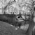 Overzicht - Arnhem - 20025271 - RCE.jpg 1,192 × 1,200; 500 KB
-
 Overzicht - Arnhem - 20025272 - RCE.jpg 1,190 × 1,200; 366 KB
-
 Voorgevel - Arnhem - 20025273 - RCE.jpg 1,188 × 1,200; 387 KB


