Category:Bowerchalke
Jump to navigation
Jump to search
village in Wiltshire, England, UK  | |||||
| Upload media | |||||
| Instance of | |||||
|---|---|---|---|---|---|
| Location | Bowerchalke, Wiltshire, South West England, England | ||||
 | |||||
English: Bowerchalke or Bower Chalke is a village and civil parish in Wiltshire, England, about twelve miles east of Shaftesbury, approximately one mile from both Hampshire and Dorset county boundaries. It is located within the 'Cranborne Chase and West Wiltshire Downs Area of Outstanding Natural Beauty' and is part of the Southern England Chalk Formation. The River Chalke, a classic chalk stream, rises in the village and joins the River Ebble at Broad Chalke, flowing into the Hampshire Avon south of Salisbury. The Bowerchalke Downs, also known as Woodminton Down, Marleycombe Down and Knowle Down, were defined as a 128.6 hectare Site of Special Scientific Interest in 1971.
Nederlands: Bower Chalke is een dorp (village) en civil parish in de unitary authority Wiltshire, in het Engelse graafschap Wiltshire. De civil parish telt
Subcategories
This category has only the following subcategory.
H
Media in category "Bowerchalke"
The following 200 files are in this category, out of 264 total.
(previous page) (next page)-
 A damp dip - geograph.org.uk - 5299820.jpg 640 × 480; 143 KB
-
 A former chapel at Bowerchalke - geograph.org.uk - 3580495.jpg 640 × 480; 101 KB
-
 Almost blocked footpath, Woodminton - geograph.org.uk - 4744702.jpg 1,920 × 2,560; 1.82 MB
-
 Autumn hedgerow, Bowerchalke - geograph.org.uk - 1014714.jpg 640 × 480; 150 KB
-
 Avenue of beech trees - geograph.org.uk - 5299774.jpg 640 × 480; 238 KB
-
 Baba black sheep, Bowerchalke - geograph.org.uk - 1014697.jpg 640 × 503; 131 KB
-
 Bare beeches - geograph.org.uk - 1052740.jpg 640 × 480; 168 KB
-
 Barley, Bowerchalke - geograph.org.uk - 4744848.jpg 1,920 × 1,191; 664 KB
-
 Barley, Bowerchalke - geograph.org.uk - 4744884.jpg 1,920 × 1,209; 574 KB
-
 Barley, Bowerchalke - geograph.org.uk - 4744918.jpg 1,920 × 1,312; 672 KB
-
 Barn on Marleycombe Hill - geograph.org.uk - 1366048.jpg 640 × 480; 262 KB
-
 Barn, Marleycombe Hill - geograph.org.uk - 1181791.jpg 640 × 481; 141 KB
-
 Beech trees near Middle Chase Farm - geograph.org.uk - 2879104.jpg 640 × 481; 99 KB
-
 Beeches, Stonedown Wood - geograph.org.uk - 4546143.jpg 2,112 × 2,816; 1.75 MB
-
 Bench Mark, Bowerchalke - geograph.org.uk - 2792418.jpg 640 × 480; 130 KB
-
 Bench under the tree, Bowerchalke - geograph.org.uk - 1863247.jpg 480 × 640; 225 KB
-
 Benchmark Knowle Farm - geograph.org.uk - 2792414.jpg 800 × 762; 258 KB
-
 Binghams Farmhouse and outbuildings, Bowerchalke (geograph 4745019).jpg 1,920 × 1,183; 477 KB
-
 Blue plaque, Ebble Thatch - geograph.org.uk - 2655118.jpg 480 × 640; 67 KB
-
 Bower Chalke, deer - geograph.org.uk - 1432102.jpg 640 × 480; 121 KB
-
 Bowerchalke - Cricket Pavilion - geograph.org.uk - 5261205.jpg 2,560 × 1,920; 2.1 MB
-
 Bowerchalke - geograph.org.uk - 5261201.jpg 2,560 × 1,920; 2.82 MB
-
 Bowerchalke - Holy Trinity Church - geograph.org.uk - 5260467.jpg 1,920 × 2,560; 2.57 MB
-
 Bowerchalke Church - geograph.org.uk - 5260475.jpg 2,560 × 1,920; 2.34 MB
-
 Bowerchalke, converted chapel - geograph.org.uk - 1031028.jpg 640 × 480; 78 KB
-
-
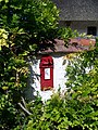
 Bowerchalke, postbox No. SP5 200 - geograph.org.uk - 1031024.jpg 640 × 480; 86 KB
-

-
 Bowerchalke, Wiltshire XPO (4068874101).jpg 3,047 × 2,286; 4.32 MB
-
 Bridge, Mead End - geograph.org.uk - 2864084.jpg 640 × 480; 81 KB
-
 Bridleway gate - geograph.org.uk - 1052733.jpg 640 × 480; 147 KB
-
 Buildings, East Chase Farm - geograph.org.uk - 2752287.jpg 480 × 640; 87 KB
-
 Buildings, East Chase Farm - geograph.org.uk - 2752295.jpg 480 × 640; 103 KB
-
 Byway to Ox Drove - geograph.org.uk - 5299776.jpg 640 × 480; 220 KB
-
 Catkins, Cow Down Hill - geograph.org.uk - 1181799.jpg 480 × 640; 214 KB
-
 Cattle at Misselfore - geograph.org.uk - 894579.jpg 640 × 480; 83 KB
-
 Church Road, Bowerchalke - geograph.org.uk - 795908.jpg 640 × 455; 93 KB
-
 Church Street, Bowerchalke (geograph 4745008).jpg 1,920 × 1,276; 521 KB
-

-

-
 Converted chapel in Bowerchalke - geograph.org.uk - 310691.jpg 640 × 480; 112 KB
-
 Cottage in Bowerchalke - geograph.org.uk - 1366110.jpg 640 × 480; 297 KB
-
 Country lane, Bowerchalke - geograph.org.uk - 906212.jpg 640 × 480; 122 KB
-
 Cow Down Hill - geograph.org.uk - 5260705.jpg 2,560 × 1,920; 2.69 MB
-
 Cricket pavilion, Bowerchalke - geograph.org.uk - 4744933.jpg 1,920 × 1,440; 743 KB
-
 Criss-cross lines - geograph.org.uk - 1366077.jpg 640 × 480; 293 KB
-
 Crossroads, Woodminton Down - geograph.org.uk - 4744657.jpg 1,920 × 1,319; 701 KB
-
 Dank Wood Corner - geograph.org.uk - 1221343.jpg 640 × 480; 233 KB
-
 Detail, Holy Trinity Church - geograph.org.uk - 2240628.jpg 480 × 640; 98 KB
-
 Earthworks on Marleycombe Hill - geograph.org.uk - 353259.jpg 640 × 430; 110 KB
-
 Ebble Thatch, Mead End - geograph.org.uk - 2655114.jpg 640 × 480; 71 KB
-

-
 Farm buildings, Woodminton - geograph.org.uk - 4744803.jpg 1,920 × 1,351; 686 KB
-
 Farm machinery, Middle Chase Farm - geograph.org.uk - 1221370.jpg 640 × 481; 167 KB
-
 Farmland near Middle Chase Farm - geograph.org.uk - 4744521.jpg 1,920 × 1,346; 740 KB
-
 Farmland near Middle Chase Farm - geograph.org.uk - 4744533.jpg 1,920 × 1,172; 539 KB
-
 Field Barn - geograph.org.uk - 5299822.jpg 640 × 480; 106 KB
-
 Field near Woodminton Down - geograph.org.uk - 4744632.jpg 1,920 × 1,440; 541 KB
-
 Footpath to the Ox Drove - geograph.org.uk - 1221355.jpg 640 × 481; 198 KB
-
 Footpath to Woodminton - geograph.org.uk - 4546199.jpg 2,112 × 2,816; 1.95 MB
-
 Footpath to Woodminton - geograph.org.uk - 4744695.jpg 1,920 × 1,440; 938 KB
-
 Footpath to Woodminton Down - geograph.org.uk - 4744643.jpg 1,920 × 1,440; 880 KB
-
 Footpath, Cow Down Hill - geograph.org.uk - 1181778.jpg 640 × 480; 178 KB
-
 Footpath, Woodminton - geograph.org.uk - 2305219.jpg 640 × 480; 67 KB
-
 Footpath, Woodminton - geograph.org.uk - 4744707.jpg 1,920 × 2,560; 2.05 MB
-
 Former chapel, Bowerchalke - geograph.org.uk - 2792394.jpg 640 × 480; 77 KB
-
 Fox Covert - geograph.org.uk - 5260709.jpg 2,560 × 1,920; 2.86 MB
-
 Game cover near Fifield Bavant - geograph.org.uk - 683092.jpg 640 × 489; 85 KB
-
 Gap in the hedge near Cutler's Corner - geograph.org.uk - 859765.jpg 640 × 480; 108 KB
-
 Grass field, Bowerchalke - geograph.org.uk - 2816260.jpg 640 × 481; 76 KB
-
 Green Man, Holy Trinity Church - geograph.org.uk - 2240664.jpg 640 × 480; 90 KB
-
 Headland, Cow Down Hill - geograph.org.uk - 1181802.jpg 640 × 482; 192 KB
-
 Hedgerow near Middle Chase Farm - geograph.org.uk - 2140305.jpg 640 × 480; 112 KB
-

-

-

-

-

-

-

-

-

-

-

-

-

-

-

-

-

-

-

-

-

-

-

-

-

-

-

-

-

-
 Horse jump near Bowerchalke - geograph.org.uk - 1014702.jpg 640 × 449; 111 KB
-
 Horse jump on Marleycombe Hill - geograph.org.uk - 1014477.jpg 640 × 475; 111 KB
-
 Horse jump, Marleycombe Hill - geograph.org.uk - 1181783.jpg 640 × 481; 143 KB
-

-

-

-
 Knowle Farm - geograph.org.uk - 2792402.jpg 800 × 600; 139 KB
-
 Lane above Woodminton - geograph.org.uk - 4744683.jpg 1,899 × 2,486; 1.12 MB
-
 Line of beeches - geograph.org.uk - 1052790.jpg 640 × 480; 138 KB
-
 Lonely Bluebell - geograph.org.uk - 1221359.jpg 480 × 640; 210 KB
-
 Lonely memorial - geograph.org.uk - 1366065.jpg 640 × 480; 232 KB
-
 Looking south across sunny fields - geograph.org.uk - 1916128.jpg 640 × 480; 148 KB
-
 Looking west - geograph.org.uk - 1052779.jpg 640 × 480; 77 KB
-
 Marleycombe Hill - Barn - geograph.org.uk - 5260700.jpg 2,560 × 1,920; 2.74 MB
-
 Marleycombe Hill - geograph.org.uk - 1366040.jpg 640 × 480; 228 KB
-
 Marleycombe Hill - geograph.org.uk - 4546672.jpg 1,920 × 1,232; 685 KB
-
 Marleycombe Hill - geograph.org.uk - 5260696.jpg 2,560 × 1,920; 2.75 MB
-
 Marleycombe Hill in evening sunshine - geograph.org.uk - 1359303.jpg 640 × 480; 241 KB
-
 Memorial atop Marleycombe Hill - geograph.org.uk - 353227.jpg 640 × 430; 121 KB
-
 Memorial on Marleycombe Hill - geograph.org.uk - 353251.jpg 430 × 640; 126 KB
-
 Misselflore - geograph.org.uk - 4744727.jpg 1,920 × 1,193; 439 KB
-
 My 90,000th image - geograph.org.uk - 3582627.jpg 640 × 480; 86 KB
-
 Not so reassuring sign - geograph.org.uk - 642894.jpg 640 × 430; 140 KB
-

-
 One in two-and-a-half - geograph.org.uk - 1366095.jpg 640 × 480; 238 KB
-
 Overgrown stile, Woodminton - geograph.org.uk - 4744711.jpg 1,920 × 2,560; 1.54 MB
-
 Ox Drove near Cow Down Hill - geograph.org.uk - 1222094.jpg 640 × 480; 197 KB
-
 Pasture near Bowerchalke - geograph.org.uk - 1014694.jpg 640 × 457; 111 KB
-
 Path past the cricket ground, Bowerchalke - geograph.org.uk - 4744935.jpg 1,920 × 1,440; 699 KB
-
 Path past the cricket ground, Bowerchalke - geograph.org.uk - 4744965.jpg 1,920 × 1,440; 738 KB
-
 Path to Ox Drove - geograph.org.uk - 4744529.jpg 1,920 × 1,440; 978 KB
-
 Path, Stonedown Wood - geograph.org.uk - 1191002.jpg 640 × 480; 226 KB
-
 Postbox, Woodminton - geograph.org.uk - 906214.jpg 480 × 640; 138 KB
-
 Pribdean Wood, footpath - geograph.org.uk - 2394923.jpg 768 × 1,024; 304 KB
-
 Private Road - Woodminton - geograph.org.uk - 642873.jpg 430 × 640; 127 KB
-
 Quidham Street, Bowerchalke - geograph.org.uk - 795906.jpg 640 × 480; 138 KB
-
 Ride, Stonedown Wood - geograph.org.uk - 1221347.jpg 480 × 640; 231 KB
-
 River Chalke at Mead End - geograph.org.uk - 4745101.jpg 1,920 × 2,560; 1.21 MB
-
 Rivet, Mead End - geograph.org.uk - 2864076.jpg 480 × 640; 107 KB
-
 Road junction, Bowerchalke - geograph.org.uk - 5299818.jpg 640 × 480; 141 KB
-
 Roe deer near Woodminton - geograph.org.uk - 1222020.jpg 640 × 483; 149 KB
-
 Roller, East Chase Farm - geograph.org.uk - 2752310.jpg 640 × 481; 94 KB
-
 Roses by the path, Bowerchalke - geograph.org.uk - 4744989.jpg 1,920 × 1,239; 744 KB
-
 Rush hour in Bowerchalke - geograph.org.uk - 3580492.jpg 640 × 480; 113 KB
-

-
 Sheep in the sunshine - geograph.org.uk - 1052802.jpg 640 × 480; 105 KB
-
 Sheppard's Cross - geograph.org.uk - 5261202.jpg 2,560 × 1,920; 3.07 MB
-
 Shermel Gate - geograph.org.uk - 4744438.jpg 1,920 × 1,440; 840 KB
-
 Sinuous curve in the lane - geograph.org.uk - 1053454.jpg 640 × 480; 64 KB
-
 Sinuous curves - geograph.org.uk - 1366119.jpg 640 × 480; 214 KB
-
 Site of ancient Field System (Woodminton) - geograph.org.uk - 642608.jpg 640 × 430; 100 KB
-
 Snow dusted fungi near Pribdean Wood - geograph.org.uk - 1621804.jpg 480 × 640; 221 KB
-
 Snow sprinkled downland, Bowerchalke - geograph.org.uk - 1621832.jpg 640 × 481; 169 KB
-
 South of Woodminton - geograph.org.uk - 4744680.jpg 1,920 × 1,396; 925 KB
-

-
 Standing deadwood, Cutlers Corner - geograph.org.uk - 2848729.jpg 480 × 640; 102 KB
-
 Start of nightmarish footpath, Woodminton - geograph.org.uk - 4744678.jpg 2,808 × 1,945; 1.6 MB
-
 Start of nightmarish footpath, Woodminton - geograph.org.uk - 4744715.jpg 1,920 × 2,560; 1.51 MB
-
 Steep descent to Woodminton - geograph.org.uk - 642614.jpg 430 × 640; 122 KB
-
 Steep slope above Woodminton - geograph.org.uk - 642620.jpg 640 × 430; 71 KB
-
 Stile for footpath to Bowerchalke - geograph.org.uk - 642615.jpg 430 × 640; 148 KB
-
 Stile near Woodminton - geograph.org.uk - 4744686.jpg 1,920 × 2,560; 1.37 MB
-
 Stonedown Wood - geograph.org.uk - 1052726.jpg 640 × 480; 150 KB
-
 Stonedown Wood - geograph.org.uk - 1190952.jpg 640 × 480; 236 KB
-
 Stonedown Wood - geograph.org.uk - 1190963.jpg 640 × 480; 201 KB
-
 Stonedown Wood - geograph.org.uk - 1221345.jpg 640 × 480; 224 KB
-
 Stonedown Wood - geograph.org.uk - 1221350.jpg 640 × 480; 225 KB
-
 Straw bales, East Chase Farm - geograph.org.uk - 1181807.jpg 640 × 481; 129 KB
-
 Thatching, Woodminton - geograph.org.uk - 1939404.jpg 640 × 480; 134 KB
-
 Thatching, Woodminton - geograph.org.uk - 1939412.jpg 480 × 640; 176 KB
-
 This is Cindy and Lotus - geograph.org.uk - 894589.jpg 480 × 640; 67 KB
-

-
 Track by Middle Chase Cottages - geograph.org.uk - 1052798.jpg 640 × 480; 148 KB
-
 Track junction, Stonedown Wood - geograph.org.uk - 1221351.jpg 640 × 480; 206 KB
-
 Track junction, Stonedown Wood - geograph.org.uk - 4744494.jpg 1,920 × 1,440; 1.22 MB
-
 Track to Ox Drove - geograph.org.uk - 4546172.jpg 1,920 × 1,440; 1.1 MB
-
 Track, Stonedown Wood - geograph.org.uk - 1190976.jpg 640 × 480; 223 KB
-
 Track, Stonedown Wood - geograph.org.uk - 1190986.jpg 479 × 640; 197 KB
-
 Track, Stonedown Wood - geograph.org.uk - 1191021.jpg 481 × 640; 213 KB
-
 Track, Stonedown Wood - geograph.org.uk - 4744505.jpg 1,920 × 1,440; 1,020 KB
-
 Track, Stonedown Wood - geograph.org.uk - 4744514.jpg 1,920 × 2,375; 1.81 MB
-
 Track, Wakesdean Wood - geograph.org.uk - 4744447.jpg 1,920 × 2,560; 1.96 MB
-
 Tracks join in Stonedown Wood - geograph.org.uk - 281176.jpg 640 × 480; 158 KB
-
 Tractor graveyard, Mead End - geograph.org.uk - 2655124.jpg 640 × 480; 102 KB
-
 Tractor graveyard, Mead End - geograph.org.uk - 2655128.jpg 640 × 481; 119 KB
-
 Tractor graveyard, Mead End - geograph.org.uk - 2655135.jpg 640 × 481; 123 KB
-
 Tramlines - geograph.org.uk - 1366057.jpg 640 × 480; 240 KB
-
 Tree Surgery, Bowerchalke - geograph.org.uk - 2816252.jpg 640 × 480; 86 KB
-
 Tree trunk, Marleycombe Hill - geograph.org.uk - 1014499.jpg 640 × 480; 131 KB
-
 Trees on Woodminton Down - geograph.org.uk - 4744673.jpg 2,538 × 1,450; 869 KB
-
 Up hill from Stowford Bridge - geograph.org.uk - 310473.jpg 480 × 640; 82 KB
-
 View from hill above Woodminton - geograph.org.uk - 642611.jpg 640 × 430; 73 KB
-
 View of Woodminton Farm - geograph.org.uk - 642618.jpg 640 × 430; 76 KB
-
 View to Knowle Hill - geograph.org.uk - 1366101.jpg 640 × 480; 205 KB
-
 Village Road in Bowerchalke - geograph.org.uk - 315016.jpg 480 × 640; 103 KB
-
 War Memorial, Bowerchalke - geograph.org.uk - 2240633.jpg 480 × 640; 83 KB
-
 Water trough for pheasants - geograph.org.uk - 310658.jpg 640 × 480; 150 KB
-
 West into Stonedown Wood - geograph.org.uk - 1052771.jpg 640 × 480; 184 KB


.jpg)


.jpg)


.jpg)
,_Cross_Bottom_-_geograph.org.uk_-_2470315.jpg)
,_Misselfore_-_geograph.org.uk_-_2470309.jpg)


_-_geograph.org.uk_-_3580579.jpg)
_-_geograph.org.uk_-_3580580.jpg)
_-_geograph.org.uk_-_3580581.jpg)
_-_geograph.org.uk_-_3580583.jpg)
_-_geograph.org.uk_-_3580585.jpg)
_-_geograph.org.uk_-_3580586.jpg)


_-_geograph.org.uk_-_3580572.jpg)
_-_geograph.org.uk_-_3580573.jpg)
_-_geograph.org.uk_-_3580577.jpg)


_-_geograph.org.uk_-_3580546.jpg)
_-_geograph.org.uk_-_3580548.jpg)
_-_geograph.org.uk_-_3580550.jpg)
_-_geograph.org.uk_-_3580552.jpg)
_-_geograph.org.uk_-_3580553.jpg)
_-_geograph.org.uk_-_3580555.jpg)
_-_geograph.org.uk_-_3580545.jpg)
_-_geograph.org.uk_-_3580544.jpg)


_-_geograph.org.uk_-_3580565.jpg)
_-_geograph.org.uk_-_3580566.jpg)
_-_geograph.org.uk_-_3580568.jpg)


_-_geograph.org.uk_-_642608.jpg)


