Category:Bradwell-on-Sea
Vai alla navigazione
Vai alla ricerca
village in Essex, England, UK  | |||||
| Carica un file multimediale | |||||
| Istanza di | |||||
|---|---|---|---|---|---|
| Luogo | Maldon, Essex, Est dell'Inghilterra, Inghilterra | ||||
| Considerato essere uguale a | Bradwell-on-Sea (pagina Wikimedia duplicata, parrocchia civile dell'Inghilterra) | ||||
 | |||||
Sottocategorie
Questa categoria contiene le 12 sottocategorie indicate di seguito, su un totale di 12.
B
- Bradwell nuclear power station (42 F)
D
K
L
- Bradwell Lodge, Essex (4 F)
O
- Othona (2 F)
P
R
- RAF Bradwell Bay Memorial (6 F)
T
File nella categoria "Bradwell-on-Sea"
Questa categoria contiene 200 file, indicati di seguito, su un totale di 283.
(pagina precedente) (pagina successiva)-
 2.05 MW Turbine - geograph.org.uk - 3897082.jpg 424 × 640; 40 KB
-
 A Damp Evening at Marsh House Pump - geograph.org.uk - 3971223.jpg 640 × 424; 48 KB
-
 A small wooded area - geograph.org.uk - 74620.jpg 640 × 480; 93 KB
-
 A.P.C - geograph.org.uk - 2296821.jpg 640 × 428; 67 KB
-
 Air Raid Shelter^ - geograph.org.uk - 2296766.jpg 428 × 640; 74 KB
-
 Antenna Aray - geograph.org.uk - 2296592.jpg 640 × 428; 59 KB
-
 Antennae array and saltmarsh - geograph.org.uk - 2697812.jpg 640 × 426; 57 KB
-

-

-
 Arable Fields ^ Ross Revenge - geograph.org.uk - 5179446.jpg 640 × 424; 52 KB
-
-
 Arable land behind the coastal defences, Bradwell - geograph.org.uk - 3677835.jpg 3 648 × 2 736; 2,89 MB
-
 Arable Land near Disused Airfield, Bradwell on Sea - geograph.org.uk - 6189564.jpg 3 648 × 2 736; 2,62 MB
-
 Barn near trees - geograph.org.uk - 2866352.jpg 3 648 × 2 736; 3,82 MB
-
 Beach near Sea Wall, Bradwell on Sea - geograph.org.uk - 6189581.jpg 3 648 × 2 255; 2,82 MB
-
 Blackwater Estuary, View of West Mersea - geograph.org.uk - 3476009.jpg 1 300 × 731; 94 KB
-
 Boats in Bradwell Creek - geograph.org.uk - 3677317.jpg 2 673 × 1 504; 920 KB
-
 Boats, Brent Geese ^ Bradwell Creek - geograph.org.uk - 3896934.jpg 640 × 424; 45 KB
-
 Borrow Dyke and Arable Land, Bradwell on Sea - geograph.org.uk - 6189584.jpg 3 648 × 2 736; 2,55 MB
-
 Boundary with Curry's Copse - geograph.org.uk - 2855652.jpg 3 648 × 2 736; 3,14 MB
-
 Bradwell "A" Sarcophagus - geograph.org.uk - 5246532.jpg 640 × 424; 37 KB
-
 Bradwell Barges - geograph.org.uk - 2296236.jpg 640 × 428; 78 KB
-
 Bradwell Bay War Memorial - geograph.org.uk - 3233811.jpg 4 608 × 3 072; 3,77 MB
-
 Bradwell Bay WW2 Airfield - geograph.org.uk - 3233782.jpg 4 608 × 3 072; 3,48 MB
-
 Bradwell Beach - geograph.org.uk - 5044161.jpg 1 600 × 1 067; 325 KB
-
 Bradwell Bird Observatory - geograph.org.uk - 2296305.jpg 640 × 428; 94 KB
-
 Bradwell Borrowdike - geograph.org.uk - 2296279.jpg 640 × 428; 63 KB
-
 Bradwell Brook - geograph.org.uk - 5204869.jpg 424 × 640; 66 KB
-
 Bradwell Cemetery - geograph.org.uk - 3897034.jpg 430 × 640; 84 KB
-
 Bradwell Community Shop and Post Office - geograph.org.uk - 2866427.jpg 3 617 × 2 235; 2,71 MB
-
 Bradwell Creek and Pewet Island - geograph.org.uk - 4993287.jpg 1 024 × 748; 119 KB
-
 Bradwell Creek at Bradwell Waterside - geograph.org.uk - 5093540.jpg 1 600 × 1 016; 301 KB
-
 Bradwell Creek Mudflats - geograph.org.uk - 3677325.jpg 3 618 × 2 713; 2,37 MB
-
 Bradwell Jetty - with Thames barge - geograph.org.uk - 5044156.jpg 1 600 × 1 067; 163 KB
-
 Bradwell Marina - geograph.org.uk - 3896875.jpg 640 × 424; 62 KB
-
 Bradwell Marina - geograph.org.uk - 5043936.jpg 1 600 × 1 067; 282 KB
-
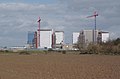
 Bradwell Nuclear Power Station - geograph.org.uk - 3596442.jpg 864 × 572; 88 KB
-
 Bradwell nuclear power station, 1963 - geograph.org.uk - 2717812.jpg 640 × 427; 78 KB
-
 Bradwell Nuclear Power Station, seen from the Beach - geograph.org.uk - 6189596.jpg 3 648 × 2 736; 3,85 MB
-
 Bradwell Old WW2 buildings - geograph.org.uk - 3234234.jpg 4 608 × 3 072; 3,53 MB
-
 Bradwell Power Station - geograph.org.uk - 5044159.jpg 1 600 × 1 067; 278 KB
-
 Bradwell Power Station and Waterside - geograph.org.uk - 2234958.jpg 4 000 × 3 000; 2,92 MB
-
 Bradwell Sailing Club building - geograph.org.uk - 2234959.jpg 4 000 × 3 000; 2,88 MB
-
 Bradwell Saltmarsh - geograph.org.uk - 2296511.jpg 640 × 435; 49 KB
-
 Bradwell Waterside slipway - geograph.org.uk - 2866324.jpg 3 648 × 2 736; 2,37 MB
-
 Bradwell Wind Farm - geograph.org.uk - 3897096.jpg 640 × 424; 69 KB
-

-
 Brian's Plaque - geograph.org.uk - 2296475.jpg 640 × 220; 38 KB
-
 Bridge Over Bradwell Brook - geograph.org.uk - 5204883.jpg 424 × 640; 111 KB
-
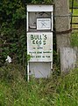 Bull's Eggs - geograph.org.uk - 4997555.jpg 760 × 1 024; 247 KB
-
 Cabin behind sea wall - geograph.org.uk - 5165427.jpg 640 × 480; 128 KB
-
 Cage Row, East End Road - geograph.org.uk - 3959895.jpg 1 011 × 758; 168 KB
-
 Car Park for St. Peter on the Wall - geograph.org.uk - 74492.jpg 640 × 480; 62 KB
-
 Caravan Park - geograph.org.uk - 75615.jpg 640 × 480; 132 KB
-
 Caravan Park, Bradwell, Essex - geograph.org.uk - 965275.jpg 640 × 296; 40 KB
-

-

-
 Church of St Thomas, Bradwell-on-Sea - geograph.org.uk - 5094082.jpg 1 213 × 1 600; 552 KB
-

-
 Coastal protection near Bradwell - geograph.org.uk - 1215283.jpg 640 × 352; 112 KB
-

-
 Concrete Shelter - geograph.org.uk - 2296749.jpg 428 × 640; 113 KB
-

-

-
 Control Centre - geograph.org.uk - 2296583.jpg 640 × 428; 46 KB
-
 Cottage on Maldon Rd - geograph.org.uk - 5204946.jpg 640 × 424; 122 KB
-
 Cottages in Bradwell - geograph.org.uk - 3897009.jpg 640 × 424; 67 KB
-
 Cottages, High St, Bradwell, Essex - geograph.org.uk - 4278592.jpg 1 024 × 768; 133 KB
-
 Crane on a Floating Pontoon - geograph.org.uk - 3896980.jpg 640 × 424; 43 KB
-
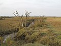 Dead trees in the salt marsh - geograph.org.uk - 3677363.jpg 3 648 × 2 736; 3,1 MB
-
 Decommissioning - geograph.org.uk - 3896963.jpg 640 × 424; 49 KB
-
 Defunct Defence - geograph.org.uk - 376897.jpg 640 × 426; 116 KB
-
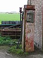 Derv pump - geograph.org.uk - 2866071.jpg 1 711 × 2 281; 1,19 MB
-
 Distant view of Bradwell Nuclear Power Station - geograph.org.uk - 5093554.jpg 1 600 × 1 067; 393 KB
-
-
 Dormer Cottage, Bradwell - geograph.org.uk - 5165167.jpg 640 × 428; 157 KB
-
 Double Rainbow Over Marsh House Pump - geograph.org.uk - 3971241.jpg 640 × 424; 55 KB
-
 Down Hall Sluice - geograph.org.uk - 3897001.jpg 640 × 424; 78 KB
-
 Duck Pond at Bradwell Hall - geograph.org.uk - 5205016.jpg 640 × 424; 110 KB
-
 East End - geograph.org.uk - 2697583.jpg 640 × 426; 50 KB
-
 East Hall Farm - geograph.org.uk - 2296835.jpg 428 × 640; 65 KB
-
 East Hall Farm, Bradwell - geograph.org.uk - 5165173.jpg 640 × 428; 158 KB
-
 Essex, Eastlands Farm, Bradwell-juxta-Mare - geograph.org.uk - 2334501.jpg 3 456 × 2 304; 5,27 MB
-
 Essex, Seat by the track to St. Peter's Chapel - geograph.org.uk - 2334569.jpg 3 456 × 2 304; 6,72 MB
-
 False Oxlip^ - geograph.org.uk - 3897043.jpg 424 × 640; 69 KB
-
 Farm track heading north - geograph.org.uk - 2866518.jpg 3 202 × 1 979; 1,78 MB
-
 Farm track near Weymarks Farm - geograph.org.uk - 5043965.jpg 1 600 × 1 067; 376 KB
-
 Farm track to Bay - geograph.org.uk - 2822358.jpg 3 648 × 2 736; 5,43 MB
-
 Farm Track, Bradwell Marshes, Bradwell on Sea - geograph.org.uk - 6032955.jpg 3 648 × 2 255; 2,13 MB
-
-
 Field and trees near Mill End, Bradwell - geograph.org.uk - 5165096.jpg 640 × 480; 184 KB
-
 Field boundary with conifer plantation - geograph.org.uk - 2866500.jpg 2 895 × 1 789; 1,84 MB
-
 Footbridge and gate - geograph.org.uk - 2866683.jpg 3 648 × 2 736; 5,4 MB
-
 Footbridge at exit from Curry's Copse - geograph.org.uk - 2855663.jpg 3 648 × 2 736; 3,8 MB
-
 Footbridge to Bradwell Rd - geograph.org.uk - 5205045.jpg 424 × 640; 94 KB
-
 Footpath From Curry's Farm - geograph.org.uk - 5204961.jpg 640 × 424; 76 KB
-
 Footpath joins Maldon Road - geograph.org.uk - 2698200.jpg 640 × 425; 139 KB
-
 Footpath over field - geograph.org.uk - 2866043.jpg 3 648 × 2 255; 2,6 MB
-
 Footpath through Arable Land, Bradwell on Sea - geograph.org.uk - 6189599.jpg 3 648 × 2 736; 3,18 MB
-
 Footpath through Curry's Copse - geograph.org.uk - 2855659.jpg 2 736 × 3 648; 4,59 MB
-
 Footpath to Bradwell - geograph.org.uk - 2698192.jpg 640 × 425; 81 KB
-
 Footpath to Bradwell entrance - geograph.org.uk - 2855645.jpg 3 648 × 2 736; 3,58 MB
-
 Footpath to Currys Farm - geograph.org.uk - 5204971.jpg 424 × 640; 107 KB
-
 Footpath to Maldon Rd - geograph.org.uk - 5204935.jpg 424 × 640; 67 KB
-
 Footpath to Peverells - geograph.org.uk - 3897106.jpg 640 × 424; 63 KB
-
 Footpath to Sandbeach Outfall - geograph.org.uk - 3971261.jpg 640 × 217; 34 KB
-
 Fordson Major - geograph.org.uk - 2296850.jpg 640 × 428; 59 KB
-
 Forge Cottages - geograph.org.uk - 2866392.jpg 3 235 × 1 999; 1,6 MB
-
 Former RAF Bradwell Bay from the air - geograph.org.uk - 4641725.jpg 640 × 480; 100 KB
-

-
 Glebe Farm - geograph.org.uk - 2698000.jpg 640 × 426; 74 KB
-
 Glebe Farm - geograph.org.uk - 5165530.jpg 640 × 480; 121 KB
-
 Glebe Farm, Bradwell-on-Sea - geograph.org.uk - 2417369.jpg 640 × 427; 86 KB
-
 GR Wall Post box in Bradwell on Sea (9198645597).jpg 2 448 × 3 264; 2,95 MB
-
 Grave markers - geograph.org.uk - 965255.jpg 640 × 426; 136 KB
-
 Gravel pits and lake - geograph.org.uk - 2854837.jpg 3 648 × 1 972; 1,86 MB
-
 Gravel Workings at Mill End - geograph.org.uk - 5205004.jpg 640 × 424; 51 KB
-
 Hedge and Pillbox - geograph.org.uk - 2697622.jpg 640 × 426; 62 KB
-
 HM Coastguard Station Bradwell Marina - geograph.org.uk - 3233667.jpg 4 608 × 3 072; 3,68 MB
-
 Hockley Lane (North) - geograph.org.uk - 2866516.jpg 3 648 × 2 255; 2,36 MB
-
 Hockley Lane (South) - geograph.org.uk - 2866686.jpg 3 400 × 2 101; 3,1 MB
-

-

-

-

-
 Kite Flying near River Blackwater, Bradwell on Sea - geograph.org.uk - 6189567.jpg 3 648 × 2 255; 2,47 MB
-
 Lake Near Curry's Farm - geograph.org.uk - 5204994.jpg 640 × 181; 26 KB
-
 Lighter Lightship - geograph.org.uk - 242176.jpg 640 × 426; 69 KB
-
 Linnets Cottage - geograph.org.uk - 2296464.jpg 640 × 428; 85 KB
-
 Looking East up Bradwell Creek - panoramio.jpg 7 712 × 4 352; 8,89 MB
-
 Looking east up Waterside Road (B1021) - geograph.org.uk - 3958807.jpg 1 077 × 807; 162 KB
-
 Looking eastward to the Estuary 1 - panoramio.jpg 7 712 × 4 352; 7,63 MB
-
 Looking eastward to the Estuary 2 - panoramio.jpg 7 712 × 4 352; 6,2 MB
-

-
-
 Looking north along the High Street - geograph.org.uk - 3959891.jpg 848 × 636; 181 KB
-

-
 Looking towards Tip Head - geograph.org.uk - 5241098.jpg 640 × 480; 44 KB
-
 Lych Gate - geograph.org.uk - 2866384.jpg 3 648 × 2 736; 4,02 MB
-
 Maldon Road - geograph.org.uk - 2866055.jpg 3 648 × 2 255; 2,29 MB
-
 Maldon Road, Bradwell - geograph.org.uk - 5165156.jpg 640 × 428; 172 KB
-
 Marshhouse Outfall - Seaward side - geograph.org.uk - 240785.jpg 640 × 480; 96 KB
-
 Mill End Cottage ^ Laburnum Cottage - geograph.org.uk - 2855634.jpg 3 232 × 1 998; 1,3 MB
-
 Monolith - origin and purpose unknown - geograph.org.uk - 5165345.jpg 640 × 480; 190 KB
-
 Mud flats near Tip Head - geograph.org.uk - 5927240.jpg 4 000 × 3 000; 4,75 MB
-
 Near Eastlands - geograph.org.uk - 2697612.jpg 640 × 426; 56 KB
-
 New Array - geograph.org.uk - 2296572.jpg 640 × 428; 41 KB
-
 New saltmarsh near Bradwell Creek - geograph.org.uk - 3677350.jpg 3 648 × 2 736; 2,74 MB
-
 New saltmarsh near Bradwell Creek - geograph.org.uk - 3677367.jpg 3 648 × 2 736; 2,03 MB
-
 Old Barn - geograph.org.uk - 2866067.jpg 2 794 × 1 727; 1,31 MB
-
 Old Barn on Glebe Farm - geograph.org.uk - 2296672.jpg 640 × 428; 66 KB
-
 Old sea defences - geograph.org.uk - 5044152.jpg 1 600 × 1 067; 365 KB
-
 Old Shelter - geograph.org.uk - 2296779.jpg 640 × 428; 87 KB
-
 Open the pod bay doors, Hal^ - geograph.org.uk - 5166297.jpg 640 × 480; 94 KB
-
 Ordnance Survey Sheet TM 00 (62 00) Tillingham, Published 1948.jpg 7 580 × 8 849; 13,17 MB
-
 Orplands farm buildings - geograph.org.uk - 2866682.jpg 3 223 × 1 742; 1,41 MB
-
 Outfall, Marsh House pumping station - geograph.org.uk - 5165494.jpg 640 × 480; 185 KB
-
 Path from church - geograph.org.uk - 965213.jpg 640 × 371; 75 KB
-
 Path Near Packard's Grove - geograph.org.uk - 5204891.jpg 424 × 640; 36 KB
-
 Path on Sea Wall to Othona, Bradwell on Sea - geograph.org.uk - 6189593.jpg 3 648 × 2 736; 2,64 MB
-
 Path Through Curry's Copse - geograph.org.uk - 5204906.jpg 424 × 640; 114 KB
-
 Path to Bradwell Hall - geograph.org.uk - 5205010.jpg 640 × 424; 81 KB
-
 Path to power station - geograph.org.uk - 2866345.jpg 3 648 × 2 255; 2,42 MB
-
 Path to St Peter-on-the-Wall, Bradwell-on-Sea - geograph.org.uk - 5926995.jpg 4 000 × 3 000; 4,93 MB
-
 Path to st. Peter's chapel - geograph.org.uk - 2373747.jpg 2 000 × 3 008; 1,32 MB
-
 Path towards St Peter's Chapel - geograph.org.uk - 3897317.jpg 800 × 475; 95 KB
-
 Path towards Tillingham Marshes - geograph.org.uk - 2697822.jpg 640 × 426; 53 KB
-
 Pewet Island and Bradwell Waterside - geograph.org.uk - 5366369.jpg 640 × 480; 194 KB
-
 Pine Walk - geograph.org.uk - 2866496.jpg 3 648 × 2 255; 4,21 MB
-
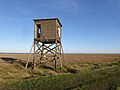
 RAF Bradwell Bay Observation Tower - geograph.org.uk - 3233433.jpg 4 608 × 3 072; 3,33 MB
-
 RAF war memorial, Bradwell-on-Sea - geograph.org.uk - 5092642.jpg 1 600 × 1 067; 425 KB
-
 Rainbow ^ Marsh House Pump - geograph.org.uk - 3971232.jpg 640 × 424; 51 KB
-
 Rainbow ^ St Peters Way - geograph.org.uk - 3971270.jpg 640 × 424; 49 KB
-
 Rear of the ATC - geograph.org.uk - 3897109.jpg 640 × 424; 69 KB
-

-
 Resting place on way from church - geograph.org.uk - 965212.jpg 640 × 325; 61 KB
-
 Return to Hockley Farm - geograph.org.uk - 2296718.jpg 640 × 428; 81 KB
-
 Right for St Peters Way - geograph.org.uk - 2296617.jpg 640 × 435; 50 KB
-
 Road from church - geograph.org.uk - 965218.jpg 640 × 340; 47 KB
-
 Roadside flowers and fields by Maldon Road - geograph.org.uk - 5044175.jpg 1 600 × 1 067; 562 KB
-
 Roadside Pond - geograph.org.uk - 2822365.jpg 3 648 × 2 736; 5,34 MB
-
 Ross Revenge - geograph.org.uk - 5172119.jpg 640 × 424; 38 KB
-
 Ross Revenge - geograph.org.uk - 5366360.jpg 640 × 480; 192 KB
-
 Row of cottages, Maldon Road - geograph.org.uk - 3959914.jpg 979 × 734; 187 KB
-
 Ruin in Curry's Copse - geograph.org.uk - 5204920.jpg 640 × 424; 121 KB
-
 Ruin ^ St Peters Way - geograph.org.uk - 2296545.jpg 640 × 428; 48 KB
-
 Ruined tower at Bradwell-on-Sea - geograph.org.uk - 5927204.jpg 3 555 × 2 666; 1,39 MB
-
 Ruined tower on the Essex coast at Bradwell-on-Sea - geograph.org.uk - 5927014.jpg 3 568 × 2 676; 1,45 MB
-
 Rural road junction - geograph.org.uk - 5165151.jpg 640 × 428; 124 KB
-
 Sales Point - geograph.org.uk - 2296259.jpg 428 × 640; 53 KB
-
 Sales Point, Bradwell-on-Sea - geograph.org.uk - 3897319.jpg 800 × 366; 64 KB
-
 Salt marsh by St Lawrence Creek - geograph.org.uk - 5044042.jpg 1 600 × 1 067; 382 KB
-
 Salt Marshes - geograph.org.uk - 74513.jpg 640 × 480; 79 KB
-
 Salt-marsh on the north of the Dengie Peninsula - geograph.org.uk - 5043922.jpg 1 600 × 1 067; 438 KB
-
 Saltmarsh ^ Defences - geograph.org.uk - 2296495.jpg 640 × 428; 62 KB
-
 Saltmarsh ^ Lighters - geograph.org.uk - 2296603.jpg 640 × 428; 45 KB
-
 Sandbeach Farm - geograph.org.uk - 3971281.jpg 640 × 424; 59 KB
-
 Sandbeach Road sluice - geograph.org.uk - 5165463.jpg 640 × 480; 185 KB
-
 Sandbeach ^ St Peters Way - geograph.org.uk - 2296640.jpg 640 × 428; 49 KB
-
 Sandbeach, Bradwell-on-Sea - geograph.org.uk - 2417378.jpg 640 × 440; 95 KB


_-_geograph.org.uk_-_5967501.jpg)


_-_geograph.org.uk_-_5967510.jpg)


.jpg)


_-_geograph.org.uk_-_2866516.jpg)
_-_geograph.org.uk_-_2866686.jpg)

_-_geograph.org.uk_-_5241095.jpg)
_-_geograph.org.uk_-_5241096.jpg)


_-_geograph.org.uk_-_3958807.jpg)


_Tillingham,_Published_1948.jpg)


