Category:Brailsford
Jump to navigation
Jump to search
village and civil parish in Derbyshire Dales, Derbyshire, England  | |||||
| Upload media | |||||
| Instance of | |||||
|---|---|---|---|---|---|
| Location | Derbyshire Dales, Derbyshire, East Midlands, England | ||||
 | |||||
Subcategories
This category has the following 3 subcategories, out of 3 total.
Media in category "Brailsford"
The following 200 files are in this category, out of 209 total.
(previous page) (next page)-
 A harvested field - geograph.org.uk - 3086091.jpg 4,000 × 3,000; 2.44 MB
-
 A lane by Fiddlers Folly - geograph.org.uk - 6138955.jpg 2,000 × 1,330; 2.53 MB
-
 A little shed - geograph.org.uk - 6139024.jpg 2,000 × 1,330; 3.03 MB
-
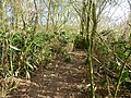
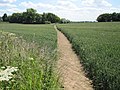
 A public footpath - geograph.org.uk - 6139033.jpg 2,000 × 1,330; 2.19 MB
-
 A rural post box - geograph.org.uk - 5672003.jpg 2,000 × 1,333; 1.85 MB
-
 A storm is threatened - geograph.org.uk - 5608100.jpg 2,000 × 1,333; 2.29 MB
-
 A52 crossing Brailsford Brook - geograph.org.uk - 2188204.jpg 3,264 × 2,448; 4.19 MB
-
 A52 Painter's Lane - geograph.org.uk - 3880374.jpg 3,088 × 2,056; 2.91 MB
-
 A52 towards Derby - geograph.org.uk - 4578985.jpg 640 × 480; 61 KB
-
 Access to stile - geograph.org.uk - 3086283.jpg 4,000 × 3,000; 2.61 MB
-
 Agricultural building - geograph.org.uk - 3086286.jpg 4,000 × 3,000; 2.52 MB
-
 An interesting wall - geograph.org.uk - 6138956.jpg 2,000 × 1,330; 2.3 MB
-
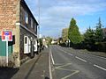
 Ashbourne Road - geograph.org.uk - 1837353.jpg 640 × 480; 50 KB
-
 Ashbourne Road in Brailsford - geograph.org.uk - 1837350.jpg 640 × 480; 61 KB
-
 Ashbourne Road in Brailsford - geograph.org.uk - 1837351.jpg 640 × 480; 74 KB
-
 Bamboo plantation - geograph.org.uk - 3321446.jpg 4,000 × 3,000; 4.98 MB
-
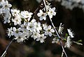 Blackthorn blossom - geograph.org.uk - 2349466.jpg 640 × 438; 71 KB
-

-
 Brailsford Barn - geograph.org.uk - 3039770.jpg 1,600 × 1,200; 397 KB
-
 Brailsford Common - geograph.org.uk - 3039900.jpg 4,320 × 3,240; 2.93 MB
-
 Brailsford Cricket Club - geograph.org.uk - 4579640.jpg 640 × 480; 41 KB
-
 Brailsford Cricket Club. - geograph.org.uk - 291238.jpg 640 × 480; 112 KB
-
 Brailsford Golf Centre - geograph.org.uk - 3321023.jpg 4,000 × 3,000; 4.72 MB
-
 Brailsford Golf Course - geograph.org.uk - 3501613.jpg 4,000 × 3,000; 2.58 MB
-
 Brailsford Gorse - geograph.org.uk - 289794.jpg 640 × 480; 124 KB
-
 Brailsford Gorse - geograph.org.uk - 3086123.jpg 4,000 × 3,000; 2.46 MB
-
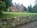
 Brailsford Hall - geograph.org.uk - 1568568.jpg 640 × 480; 123 KB
-
 Brailsford Hall and Gardens - geograph.org.uk - 3501655.jpg 4,000 × 3,000; 2.59 MB
-
 Brailsford Hall Ha-Ha - geograph.org.uk - 291245.jpg 640 × 480; 110 KB
-
 Brailsford Hall.jpg 640 × 480; 117 KB
-
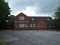 Brailsford Medical Centre - geograph.org.uk - 4535066.jpg 640 × 480; 56 KB
-
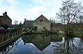 Brailsford Mill.jpg 1,024 × 677; 188 KB
-
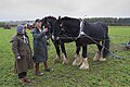 Brailsford Ploughing Match - geograph.org.uk - 5364034.jpg 2,000 × 1,333; 2.41 MB
-
 Brailsford village.jpg 640 × 480; 81 KB
-
 Brailsford Water Mill - geograph.org.uk - 2048694.jpg 3,488 × 2,616; 4.46 MB
-
 Brailsford, Derbyshire - geograph.org.uk - 1659904.jpg 640 × 480; 55 KB
-
 Brailsford, Derbyshire ... former post office with postbox DE6 251. (6772299329).jpg 4,340 × 3,260; 7.97 MB
-
 Brailsford, Derbyshire ... Post Office and stores with DE6 896. (6772609637).jpg 4,258 × 2,790; 5.82 MB
-
 Brailsford, lay-by - geograph.org.uk - 3172175.jpg 1,024 × 768; 191 KB
-
 Brailsford, village on the A52 - geograph.org.uk - 3086057.jpg 4,000 × 3,000; 2.6 MB
-
 BrailsfordBigHouse10.JPG 1,355 × 993; 774 KB
-
 Brunswood Lane - geograph.org.uk - 4238640.jpg 3,886 × 2,788; 2.08 MB
-
 Burrows Farm - geograph.org.uk - 3321128.jpg 4,000 × 3,000; 5.12 MB
-
 Burrows Farm - geograph.org.uk - 4535085.jpg 640 × 480; 51 KB
-
 Burrows Farm - geograph.org.uk - 4579655.jpg 640 × 480; 58 KB
-
 Burrows Lane - geograph.org.uk - 3880403.jpg 3,088 × 2,056; 3.01 MB
-
 Burrows Lane, Over Burrows - geograph.org.uk - 4579657.jpg 640 × 480; 62 KB
-
 Burrows Old Hall - geograph.org.uk - 3321145.jpg 4,000 × 3,000; 4.53 MB
-
 Burton Shutts Farm - geograph.org.uk - 3039816.jpg 1,600 × 1,200; 322 KB
-
 Bus stop on Painter's Lane (A52) - geograph.org.uk - 4578984.jpg 640 × 480; 97 KB
-
 Chapel House, Painter's Lane - geograph.org.uk - 3086118.jpg 4,000 × 3,000; 2.61 MB
-
 Church footpath - geograph.org.uk - 291236.jpg 640 × 480; 122 KB
-
 Church Lane - geograph.org.uk - 3086081.jpg 4,000 × 3,000; 2.48 MB
-
 Churchfields Farm Entrance. - geograph.org.uk - 291226.jpg 640 × 480; 116 KB
-
 Churchfields Farm with Dalmatian - geograph.org.uk - 3708244.jpg 800 × 451; 184 KB
-
 Country lane near Brailsford - geograph.org.uk - 2471022.jpg 640 × 480; 123 KB
-
 Countryside - geograph.org.uk - 3039874.jpg 4,320 × 3,240; 2.74 MB
-
 Crop Field between Shirley and Ednaston - geograph.org.uk - 3525130.jpg 4,000 × 3,000; 3.32 MB
-
 Crops in field - geograph.org.uk - 3039833.jpg 4,320 × 3,240; 2.92 MB
-
 Crows foraging in stubble field - geograph.org.uk - 3086133.jpg 4,000 × 3,000; 2.61 MB
-
 Culland Hall Entrance - geograph.org.uk - 289789.jpg 640 × 480; 123 KB
-
 Culland Manor Farm.jpg 3,914 × 2,882; 2.19 MB
-
 Cullandmanor Farm - geograph.org.uk - 3708236.jpg 800 × 451; 180 KB
-
 Cullandmoor Farm - geograph.org.uk - 289787.jpg 640 × 480; 129 KB
-
 Cuscas - geograph.org.uk - 3039788.jpg 1,600 × 1,200; 621 KB
-
 Derbyshire UK parish map highlighting Brailsford.svg 888 × 1,308; 2.34 MB
-
 Distant farm buildings - geograph.org.uk - 6139026.jpg 2,000 × 1,330; 1.62 MB
-
 Ednaston Hall drive - geograph.org.uk - 5672021.jpg 2,000 × 1,333; 3.25 MB
-
 End of the track. - geograph.org.uk - 291286.jpg 640 × 480; 121 KB
-
 Entering Brailsford - geograph.org.uk - 4578986.jpg 640 × 480; 51 KB
-
 Entrance to Churchfields Farm - geograph.org.uk - 3768188.jpg 2,256 × 1,504; 2.34 MB
-
 Entrance to North Farm - geograph.org.uk - 3881578.jpg 3,088 × 2,056; 3.9 MB
-
 Entrance to the Burrows Gardens - geograph.org.uk - 3321461.jpg 4,000 × 3,000; 5.21 MB
-
 Entrance to Wood Farm - geograph.org.uk - 3881541.jpg 3,088 × 2,056; 4.78 MB
-
 Farm cottages - geograph.org.uk - 289790.jpg 640 × 480; 123 KB
-
 Farm track - geograph.org.uk - 5608104.jpg 2,000 × 1,333; 2.82 MB
-
 Farmhouse, Burrows Farm - geograph.org.uk - 4579647.jpg 640 × 480; 75 KB
-
 Farmland beside Carr Wood - geograph.org.uk - 4579663.jpg 640 × 480; 59 KB
-
 Farmland in winter - geograph.org.uk - 3321033.jpg 4,000 × 3,000; 4.83 MB
-
 Farmland near Carr Wood - geograph.org.uk - 4579665.jpg 640 × 480; 52 KB
-
 Fiddlers Folly, Brailsford - geograph.org.uk - 3039867.jpg 1,600 × 1,200; 479 KB
-
 Field entrance near Burrows Farm - geograph.org.uk - 4579654.jpg 640 × 480; 89 KB
-
 Field entrance near Chuchfields Farm - geograph.org.uk - 4535073.jpg 640 × 480; 64 KB
-
 Field entrance near Over Burrows - geograph.org.uk - 4535089.jpg 640 × 480; 87 KB
-
 Field, grass growing back - geograph.org.uk - 3086292.jpg 4,000 × 3,000; 2.48 MB
-
 Fields and Woodland near North Farms - geograph.org.uk - 4238604.jpg 4,000 × 3,000; 3.22 MB
-
 Fields near King's Grove - geograph.org.uk - 4238596.jpg 4,000 × 3,000; 2.66 MB
-
 Fields near Over Burrows - geograph.org.uk - 3913199.jpg 4,000 × 3,000; 1.59 MB
-
 Fields to the South of Brailsford - geograph.org.uk - 4302874.jpg 4,000 × 3,000; 1.94 MB
-
 Footbridge over small stream - geograph.org.uk - 3321158.jpg 4,000 × 3,000; 5.24 MB
-
 Footpath - geograph.org.uk - 3039798.jpg 4,320 × 3,240; 2.97 MB
-
 Footpath and Maize Field near North Farm House - geograph.org.uk - 4238610.jpg 4,000 × 3,000; 2.65 MB
-
 Footpath to Commonside - geograph.org.uk - 3711429.jpg 800 × 451; 184 KB
-
 Footpath to Ednaston village - geograph.org.uk - 2469849.jpg 640 × 480; 119 KB
-
 Footpath to Ednaston, Derbyshire - geograph.org.uk - 2169222.jpg 2,640 × 1,980; 1.21 MB
-
 Footpath to Over Burrows - geograph.org.uk - 4535081.jpg 640 × 480; 80 KB
-
 Footpath, Cuscas - geograph.org.uk - 3039802.jpg 1,600 × 1,200; 724 KB
-
 Gate at Cuscas Farm - geograph.org.uk - 3039783.jpg 1,600 × 1,200; 508 KB
-
 Gate at Kingsgrove Farm - geograph.org.uk - 3039852.jpg 1,600 × 1,200; 447 KB
-
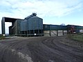 Grain storage at Burrows Farm - geograph.org.uk - 3321038.jpg 4,000 × 3,000; 4.24 MB
-
 Grassy fields - geograph.org.uk - 6139021.jpg 2,000 × 1,330; 2.92 MB
-
 Grazing near Pools Head - geograph.org.uk - 4579639.jpg 640 × 480; 59 KB
-
 Grazing sheep - geograph.org.uk - 5608110.jpg 2,000 × 1,333; 1.9 MB
-
 Hazelhurst - geograph.org.uk - 3039887.jpg 1,600 × 1,200; 423 KB
-
 Hazelhurst Clock - geograph.org.uk - 3039890.jpg 1,600 × 1,200; 419 KB
-
 Heading south towards Hollington - geograph.org.uk - 4578962.jpg 640 × 480; 53 KB
-
 House in farmland - geograph.org.uk - 3086268.jpg 4,000 × 3,000; 2.55 MB
-
 House in farmland west of Brailsford - geograph.org.uk - 3086102.jpg 4,000 × 3,000; 2.52 MB
-
 House on Yeldersley Lane - geograph.org.uk - 4534817.jpg 640 × 480; 62 KB
-
 House surrounded by fields - geograph.org.uk - 3086138.jpg 4,000 × 3,000; 2.42 MB
-
 Houses at Commonside - geograph.org.uk - 3526247.jpg 4,000 × 3,000; 2.31 MB
-
 Houses in Brailsford, Derbyshire - geograph.org.uk - 1659899.jpg 640 × 480; 50 KB
-
 Impossible stile - geograph.org.uk - 3710769.jpg 800 × 451; 197 KB
-
 Junction on the Ashbourne Road - geograph.org.uk - 1837348.jpg 640 × 480; 71 KB
-

-

-
 Kingsgrove Farm, Brailsford - geograph.org.uk - 3039862.jpg 1,600 × 1,200; 442 KB
-
 Knowle Farm. - geograph.org.uk - 289793.jpg 640 × 480; 121 KB
-
 Lake near Brailsford Hall - geograph.org.uk - 1568438.jpg 640 × 480; 134 KB
-
 Lane beside Carr Wood - geograph.org.uk - 4579668.jpg 640 × 480; 118 KB
-
 Lane by Burrows Farm - geograph.org.uk - 4579650.jpg 640 × 480; 73 KB
-
 Lane heading east by Pools Head - geograph.org.uk - 4579638.jpg 640 × 480; 72 KB
-
 Lane junction near Burrows Farm - geograph.org.uk - 1568549.jpg 640 × 480; 148 KB
-
 Lane Junction near Burrows Farm - geograph.org.uk - 2469808.jpg 640 × 480; 107 KB
-
 Lane near Burrows Farm - geograph.org.uk - 4579646.jpg 640 × 480; 105 KB
-
 Lane near Pools Head - geograph.org.uk - 4579637.jpg 640 × 480; 78 KB
-
 Lane towards Over Burows - geograph.org.uk - 4579643.jpg 640 × 480; 66 KB
-
 Lane towards Pools Head - geograph.org.uk - 4579635.jpg 640 × 480; 53 KB
-
 Lane with blackthorn blossom - geograph.org.uk - 2349459.jpg 427 × 640; 125 KB
-
 Large Farm Buildings at Birch House - geograph.org.uk - 3526205.jpg 3,786 × 2,688; 1.32 MB
-
 Looking across the fields - geograph.org.uk - 6139036.jpg 2,000 × 1,330; 1.61 MB
-
 Looking along the edge of a copse - geograph.org.uk - 5608098.jpg 2,000 × 1,333; 2.79 MB
-
 Looking towards Spinneyford Brook - geograph.org.uk - 6139011.jpg 2,000 × 1,330; 2.65 MB
-
 Looking towards St. Mary's Nursing home - geograph.org.uk - 5672026.jpg 2,000 × 1,333; 3.47 MB
-
 Main Road (A52), Brailsford - geograph.org.uk - 4579632.jpg 640 × 480; 46 KB
-
 Meadow Cranesbill - geograph.org.uk - 3086051.jpg 4,000 × 3,000; 2.52 MB
-
 Mercaston Green - geograph.org.uk - 6138959.jpg 2,000 × 1,330; 2.06 MB
-
 Minor road out of Over Burows - geograph.org.uk - 4579659.jpg 640 × 480; 58 KB
-
 Mixed Farmland near the Burrows - geograph.org.uk - 3501697.jpg 4,000 × 3,000; 3.23 MB
-
 National Grid Pylon - geograph.org.uk - 3039692.jpg 1,600 × 1,200; 270 KB
-
 National Grid Pylon, Brailsford Common - geograph.org.uk - 3039894.jpg 1,600 × 1,200; 404 KB
-
 Near Brailsford Green - geograph.org.uk - 5608105.jpg 2,000 × 1,333; 2.25 MB
-
 New growth in the field - geograph.org.uk - 5580792.jpg 2,000 × 1,333; 2.55 MB
-
 New plantation - geograph.org.uk - 3086272.jpg 4,000 × 3,000; 2.25 MB
-
 North Farm gateposts - geograph.org.uk - 3039705.jpg 4,320 × 3,240; 3.04 MB
-
 North Farm House - geograph.org.uk - 3039755.jpg 1,600 × 1,200; 442 KB
-
 North Farm Sign - geograph.org.uk - 3039716.jpg 4,320 × 3,240; 3.08 MB
-
 North Lane - geograph.org.uk - 2349468.jpg 640 × 470; 163 KB
-
 North Lane near Brailsford - geograph.org.uk - 2471026.jpg 640 × 480; 104 KB
-
 North Lane towards Ends Bridge - geograph.org.uk - 3880396.jpg 3,088 × 2,056; 5.31 MB
-
 Oilseed rape crop near Burrows Farm - geograph.org.uk - 4579644.jpg 640 × 480; 82 KB
-
 Park Farm - geograph.org.uk - 3039722.jpg 1,600 × 1,200; 418 KB
-
 Pasture at Pool's Head - geograph.org.uk - 3710765.jpg 800 × 451; 188 KB
-
 Path and Footbridge near Park Farm - geograph.org.uk - 4238615.jpg 4,000 × 3,000; 2.63 MB
-
 Path approaching Brailsford from the east - geograph.org.uk - 3086033.jpg 4,000 × 3,000; 2.51 MB
-
 Path Approaching Spinney Farm - geograph.org.uk - 4238617.jpg 3,806 × 2,714; 2.15 MB
-
 Path over the fields - geograph.org.uk - 3710774.jpg 800 × 451; 184 KB
-
 Ploughed fields - geograph.org.uk - 5672000.jpg 2,000 × 1,333; 2.71 MB
-
 Pond in Heritage Wood - geograph.org.uk - 1020358.jpg 640 × 480; 84 KB
-
 Pond near Burrows Farm - geograph.org.uk - 4579652.jpg 640 × 480; 124 KB
-
 Pool in grassland south of Brailsford - geograph.org.uk - 3321015.jpg 4,000 × 3,000; 4.85 MB
-
 Pools Head - geograph.org.uk - 3321028.jpg 4,000 × 3,000; 4.71 MB
-
 Pools Head - geograph.org.uk - 4535076.jpg 640 × 480; 86 KB
-
 Preston's wagon in Brailsford - geograph.org.uk - 3711440.jpg 800 × 452; 176 KB
-
 Pylons, Mansellpark - geograph.org.uk - 3039812.jpg 4,320 × 3,240; 3.12 MB
-
 Road across Brailsford Common - geograph.org.uk - 2471034.jpg 640 × 480; 104 KB
-
 Road Pedestrians near the Rose and Crown - geograph.org.uk - 3501594.jpg 3,878 × 2,830; 1.79 MB
-
 Road to the Church - geograph.org.uk - 3710783.jpg 800 × 451; 184 KB
-

-
 Russian Zone, Gordon Schaffer . Allen & Unwin, 1947 (3901586946).jpg 1,399 × 2,137; 626 KB
-
 Snapes Farm - geograph.org.uk - 3321468.jpg 4,000 × 3,000; 3.96 MB
-
 Stile and Footpath near Culland Hall - geograph.org.uk - 3880393.jpg 3,088 × 2,056; 5.61 MB
-
 Stile with vegetation - geograph.org.uk - 3086278.jpg 4,000 × 3,000; 2.55 MB
-
 Stoneworks - geograph.org.uk - 3039881.jpg 1,600 × 1,200; 430 KB
-
 Striped stubble field - geograph.org.uk - 3710757.jpg 800 × 600; 226 KB
-
 Stubble Field seen from the Centenary Way - geograph.org.uk - 4181278.jpg 4,000 × 3,000; 2.43 MB
-
 Telecomms mast, by Wood Lane - geograph.org.uk - 3085008.jpg 4,000 × 3,000; 2.29 MB
-
 The Burrows - geograph.org.uk - 289783.jpg 640 × 480; 120 KB
-
 The Burrows garden - geograph.org.uk - 375072.jpg 480 × 640; 99 KB
-
 The Burrows Garden - geograph.org.uk - 375076.jpg 640 × 420; 98 KB
-
 The Burrows Garden - geograph.org.uk - 375078.jpg 640 × 480; 89 KB
-
 The Centenary Way - geograph.org.uk - 4534771.jpg 640 × 480; 62 KB
-
 The edge of Ednaston - geograph.org.uk - 5672017.jpg 2,000 × 1,333; 2.15 MB
-

-

-
 The Market Garden - geograph.org.uk - 3039822.jpg 4,320 × 3,240; 3.03 MB
-
 The Market Garden, Slack Lane - geograph.org.uk - 3086128.jpg 4,000 × 3,000; 2.53 MB
-
 The Plain Brailsford - geograph.org.uk - 5608107.jpg 2,000 × 1,333; 2.19 MB
-
 The track to Bradley Oldpark South - geograph.org.uk - 6139032.jpg 2,000 × 1,330; 1.71 MB
-
 Track along a field edge - geograph.org.uk - 3880380.jpg 3,088 × 2,056; 4.01 MB
-
 Track and Communications Mast near Brailsford - geograph.org.uk - 4181275.jpg 3,794 × 2,813; 3.33 MB
-
 Track passing by Dam Farm - geograph.org.uk - 2469824.jpg 640 × 480; 104 KB
-
 Track to Churchfields Farm - geograph.org.uk - 4579634.jpg 640 × 480; 88 KB
-
 Track to Top Wild Park Farm - geograph.org.uk - 3321011.jpg 4,000 × 3,000; 4.95 MB
-
 Trailer, road, former property of British Rail - geograph.org.uk - 3321135.jpg 4,000 × 3,000; 4.41 MB
-
 Tree hit by lightning - geograph.org.uk - 291295.jpg 480 × 640; 118 KB
-
 Two trees, fields and bridleway - geograph.org.uk - 3321152.jpg 4,000 × 3,000; 5.18 MB
-
 Wet field - geograph.org.uk - 289785.jpg 640 × 480; 120 KB
-
 Winter wheat and Carr Wood - geograph.org.uk - 1568550.jpg 640 × 480; 89 KB
-
 Wood Lane - a track - geograph.org.uk - 3880413.jpg 3,088 × 2,056; 4.59 MB


.jpg)
.jpg)


_-_geograph.org.uk_-_4578984.jpg)


,_Brailsford_-_geograph.org.uk_-_4579632.jpg)


.jpg)


