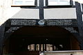
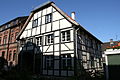
Category:Brandstraße 6 (Herten)
Jump to navigation
Jump to search
| Object location | | View all coordinates using: OpenStreetMap |
|---|
Media in category "Brandstraße 6 (Herten)"
The following 6 files are in this category, out of 6 total.
-
 Herten Westerholt - Brandstraße 07 ies.jpg 3,888 × 2,592; 1.3 MB
-
 Herten Westerholt - Brandstraße 08 ies.jpg 3,888 × 2,592; 1.41 MB
-
 Herten Westerholt - Brandstraße6 01 ies.jpg 5,616 × 3,744; 10.55 MB
-
 Herten Westerholt - Brandstraße6 02 ies.jpg 3,744 × 5,616; 10.49 MB
-
 Herten Westerholt - Brandstraße6 03 ies.jpg 5,616 × 3,744; 8 MB
-
 Herten Westerholt - Brandstraße6 04 ies.jpg 5,616 × 3,744; 9.96 MB


