Category:Bride, Isle of Man
Jump to navigation
Jump to search
parish in the Sheading of Ayre, Isle of Man  | |||||
| Upload media | |||||
| Instance of |
| ||||
|---|---|---|---|---|---|
| Location | Ayre, Isle of Man, Irish Sea | ||||
 | |||||
Bride (Manx: Skeerey Vreeshey), named after St. Brigid, is a parish in the Sheading of Ayre and lies in the extreme north of the Isle of Man, UK.
Media in category "Bride, Isle of Man"
The following 127 files are in this category, out of 127 total.
-
 "Winkie" and footpath sign - Point of Ayre - geograph.org.uk - 4871834.jpg 4,832 × 3,783; 4.38 MB
-
 'The Winkie', Point of Ayre - geograph.org.uk - 5569719.jpg 1,248 × 1,600; 277 KB
-
 A Kink In The Road to Cranstal - geograph.org.uk - 5347052.jpg 424 × 640; 65 KB
-
 A Little Glen Near Kionlough - geograph.org.uk - 5346845.jpg 640 × 424; 72 KB
-
 A view to the brine pumping plant remains - geograph.org.uk - 5569961.jpg 1,343 × 1,600; 729 KB
-
 A16 near Point of Ayre - geograph.org.uk - 5363517.jpg 1,280 × 851; 410 KB
-
 Abandoned Farm at Phurt - geograph.org.uk - 5346975.jpg 640 × 424; 74 KB
-
 Abandoned farmhouse at Phurt - geograph.org.uk - 4871861.jpg 5,184 × 3,888; 6.78 MB
-
 Almost Like Tundra - geograph.org.uk - 6121417.jpg 1,024 × 678; 197 KB
-
 Approaching Bride - geograph.org.uk - 5347056.jpg 424 × 640; 49 KB
-
 Approaching The Plantation - geograph.org.uk - 6121465.jpg 1,024 × 678; 159 KB
-
 At The Point of Ayre - geograph.org.uk - 4871842.jpg 4,769 × 3,563; 6.41 MB
-
 Ayres dunes, Isle of Man.jpg 2,627 × 3,964; 2.71 MB
-
 Ayres Nature Reserve Panorama - geograph.org.uk - 6121347.jpg 1,024 × 334; 110 KB
-
 Ayres viewing tower, Isle of Man 01.jpg 3,872 × 2,582; 1.25 MB
-
 Beach at Point of Ayre - geograph.org.uk - 5460572.jpg 800 × 600; 136 KB
-
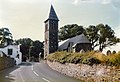 Bride Church - geograph.org.uk - 3452177.jpg 640 × 436; 449 KB
-
 Bride Church - geograph.org.uk - 4503270.jpg 4,608 × 3,456; 6.1 MB
-
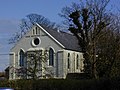 Bride Methodist Church - geograph.org.uk - 787298.jpg 640 × 480; 114 KB
-
 Bride Methodist Church, Lamb Hill, Bride - geograph.org.uk - 4871863.jpg 4,852 × 3,888; 3.73 MB
-
 Bride, Public toilets - geograph.org.uk - 4503030.jpg 4,608 × 3,456; 6.31 MB
-
 Brine pumping plant remains - geograph.org.uk - 5569949.jpg 1,600 × 1,113; 429 KB
-
 Brine pumping plant remains, alternative view - geograph.org.uk - 5569965.jpg 1,600 × 1,188; 434 KB
-
 Choughs at the Point of Ayre - geograph.org.uk - 5569733.jpg 1,600 × 1,292; 374 KB
-
 Cliff Erosion North of The Dog Mills - geograph.org.uk - 5346830.jpg 640 × 424; 96 KB
-
 Cranstal Cottage - geograph.org.uk - 5347038.jpg 640 × 424; 57 KB
-
 Derelict farmhouse - geograph.org.uk - 3616209.jpg 640 × 480; 101 KB
-
 Dogs Must Be On Leads - geograph.org.uk - 6121448.jpg 1,024 × 713; 154 KB
-
 Dunes Marram Grass and Ayres Beach - geograph.org.uk - 6121397.jpg 1,024 × 678; 131 KB
-
 Farmland Near Phurt - geograph.org.uk - 2389097.jpg 640 × 480; 159 KB
-

-

-
 Foghorn , Point of Ayre - geograph.org.uk - 4679914.jpg 4,608 × 3,072; 1.5 MB
-
 Foghorn at Point of Ayre - geograph.org.uk - 5390767.jpg 640 × 427; 39 KB
-
 Foghorn at The Point of Ayre - geograph.org.uk - 2389078.jpg 1,280 × 960; 559 KB
-
 Foghorn, Point of Ayre - geograph.org.uk - 5363613.jpg 851 × 1,280; 294 KB
-
 Foghorn, Point of Ayre - geograph.org.uk - 5569922.jpg 1,330 × 1,600; 163 KB
-
 Footpath to Ballaquark farm - geograph.org.uk - 5347030.jpg 640 × 424; 84 KB
-
 Former Cliff Top Fence - geograph.org.uk - 5346834.jpg 640 × 424; 74 KB
-
 Fungus on the footpath - geograph.org.uk - 5569780.jpg 1,600 × 1,204; 331 KB
-
 Gorse and The Point of Ayre Lighthouse - geograph.org.uk - 4871856.jpg 5,010 × 3,439; 4.64 MB
-
 Gravel Pit at Point of Ayre - geograph.org.uk - 3406116.jpg 640 × 424; 58 KB
-
 Gully and sandy cliffs - geograph.org.uk - 3620004.jpg 1,920 × 960; 500 KB
-
 Isle of Man Northern Plain - geograph.org.uk - 1986293.jpg 3,456 × 2,592; 3.26 MB
-
 Landslip near Shellag Point - geograph.org.uk - 3620024.jpg 1,920 × 1,276; 647 KB
-
 Lighthouse , Point of Ayre - geograph.org.uk - 4679911.jpg 4,608 × 3,072; 1.44 MB
-
 Lighthouse at Point of Ayre - geograph.org.uk - 2145557.jpg 1,024 × 768; 112 KB
-
 Lighthouse at Point of Ayre - geograph.org.uk - 5457962.jpg 800 × 600; 119 KB
-
 Lighthouse on shingle beach, Point of Ayre - geograph.org.uk - 2145548.jpg 1,024 × 768; 196 KB
-
 Lighthouses and fog horn at Point of Ayre - geograph.org.uk - 2145551.jpg 1,024 × 768; 120 KB
-
 Low Cliff North of Phurt - geograph.org.uk - 5346994.jpg 640 × 424; 85 KB
-
 Marram grass, The Ayres - geograph.org.uk - 5363648.jpg 1,280 × 851; 546 KB
-
 Marram Grass, The Ayres - geograph.org.uk - 5569751.jpg 1,249 × 1,600; 442 KB
-
 Mini Glen - geograph.org.uk - 5346850.jpg 424 × 640; 99 KB
-
 Motorcycle near Point of Ayre - geograph.org.uk - 5362332.jpg 1,280 × 851; 449 KB
-
 My Dog Doesn't Count^ - geograph.org.uk - 6121440.jpg 1,024 × 678; 176 KB
-
 Once in a blue moon - geograph.org.uk - 3620038.jpg 1,400 × 930; 112 KB
-
 Pasture South of Cranstal - geograph.org.uk - 5347045.jpg 640 × 424; 69 KB
-
 Path to the Light - geograph.org.uk - 3406098.jpg 424 × 640; 71 KB
-
 Point of Ayre - geograph.org.uk - 2389051.jpg 1,280 × 960; 763 KB
-
 Point of Ayre - geograph.org.uk - 2389073.jpg 1,280 × 960; 685 KB
-
 Point of Ayre - geograph.org.uk - 2389082.jpg 1,280 × 960; 696 KB
-
 Point of Ayre Beach - geograph.org.uk - 3406101.jpg 640 × 424; 90 KB
-
 Point of Ayre Beach - geograph.org.uk - 5363542.jpg 1,280 × 851; 487 KB
-
 Point of Ayre Foghorn Installation - geograph.org.uk - 4871850.jpg 4,759 × 3,501; 2.35 MB
-
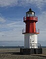
 Point of Ayre Lighthouse "Winkie" - geograph.org.uk - 2255070.jpg 800 × 496; 111 KB
-
 Point of Ayre lighthouse (35972447832).jpg 1,920 × 1,275; 1.36 MB
-
 Point of Ayre Lighthouse - geograph.org.uk - 2389044.jpg 960 × 1,280; 655 KB
-
 Point of Ayre Lighthouse - geograph.org.uk - 2389075.jpg 1,280 × 960; 486 KB
-
 Point of Ayre Lighthouse - geograph.org.uk - 3452160.jpg 640 × 438; 341 KB
-
 Point of Ayre Lighthouse - geograph.org.uk - 3616183.jpg 640 × 480; 60 KB
-
 Point of Ayre Lighthouse - geograph.org.uk - 4821954.jpg 640 × 480; 34 KB
-
 Point of Ayre Lighthouse - geograph.org.uk - 5363501.jpg 851 × 1,280; 444 KB
-
 Point of Ayre Lighthouse - geograph.org.uk - 5363522.jpg 1,280 × 851; 388 KB
-
 Point of Ayre lighthouse - geograph.org.uk - 5390751.jpg 640 × 427; 43 KB
-
 Point of Ayre Lighthouse - geograph.org.uk - 5569726.jpg 1,222 × 1,600; 236 KB
-
 Point of Ayre Lighthouse, "Winkie" - geograph.org.uk - 2389036.jpg 960 × 1,280; 632 KB
-
 Point of Ayre Lighthouses - geograph.org.uk - 2389067.jpg 1,280 × 960; 805 KB
-
 Point of Ayre on the Isle of Man - geograph.org.uk - 2109085.jpg 600 × 800; 102 KB
-
 Point of Ayre, End of the Road - geograph.org.uk - 2389088.jpg 1,280 × 960; 912 KB
-
 Public toilets at Bride - geograph.org.uk - 5783097.jpg 640 × 427; 81 KB
-
 Raad ny Foillan at The Ayres - geograph.org.uk - 6121494.jpg 1,024 × 678; 172 KB
-

-
 Rocks on the Raad ny Foillan - geograph.org.uk - 5346858.jpg 640 × 424; 88 KB
-

-

-
 Sand Dunes at the Point of Ayre - geograph.org.uk - 3406109.jpg 640 × 424; 42 KB
-
 Shore below Ballavarkish - geograph.org.uk - 762103.jpg 640 × 480; 84 KB
-
 Shoreline Crow - geograph.org.uk - 5569847.jpg 1,600 × 1,178; 413 KB
-

-
 Stone Wall at the Point of Ayre - geograph.org.uk - 3406104.jpg 640 × 424; 50 KB
-
 Thatched Cottage at Cranstal - geograph.org.uk - 3452149.jpg 640 × 436; 470 KB
-
 Thatched Cottage at Cranstal - geograph.org.uk - 3504786.jpg 438 × 640; 495 KB
-
 The 'Stena Mersey' off the Point of Ayre - geograph.org.uk - 5569802.jpg 1,600 × 1,103; 215 KB
-
 The Ayres - geograph.org.uk - 779139.jpg 640 × 480; 106 KB
-
 The Ayres - geograph.org.uk - 779146.jpg 640 × 475; 113 KB
-
 The Ayres - geograph.org.uk - 779149.jpg 640 × 478; 121 KB
-
 The Ayres - geograph.org.uk - 779154.jpg 640 × 480; 156 KB
-
 The Ayres - geograph.org.uk - 779160.jpg 640 × 480; 129 KB
-
 The Ayres Nature Reserve - geograph.org.uk - 5363622.jpg 1,280 × 851; 363 KB
-
 The Ayres Nature Reserve - geograph.org.uk - 5569747.jpg 1,600 × 1,141; 361 KB
-
 The Ayres Visitor Centre - geograph.org.uk - 6121376.jpg 1,024 × 678; 127 KB
-
 The Dog Mills, Raad ny Foillan - geograph.org.uk - 4618929.jpg 1,024 × 763; 190 KB
-
 The Dog Mills, steps - geograph.org.uk - 4618918.jpg 1,024 × 768; 232 KB
-
 The Edge of Land ^ Sea - geograph.org.uk - 3406107.jpg 640 × 424; 56 KB
-
 The Foghorn and the Winkie - geograph.org.uk - 5391765.jpg 640 × 480; 56 KB
-
 The foghorn at Point of Ayre - geograph.org.uk - 3617821.jpg 640 × 480; 51 KB
-
 The Isle of Man's north-eastern coast - geograph.org.uk - 5569772.jpg 1,600 × 1,120; 371 KB
-

-
 The Path to Ayres Point - geograph.org.uk - 6121414.jpg 1,024 × 678; 140 KB
-
 The Rectory at Bride - geograph.org.uk - 3617819.jpg 640 × 480; 112 KB
-
 The Road to the Ayres - geograph.org.uk - 6121363.jpg 1,024 × 678; 166 KB
-
 The Winkie at Point of Ayre - geograph.org.uk - 5390756.jpg 640 × 425; 42 KB
-
 Three in a row - geograph.org.uk - 4679931.jpg 4,608 × 3,072; 1.13 MB
-

-
 Track through The Ayres Nature Reserve - geograph.org.uk - 5553585.jpg 2,592 × 1,944; 1.44 MB
-
 Track through The Ayres Nature Reserve - geograph.org.uk - 5553588.jpg 2,592 × 1,944; 1.49 MB
-
 Trees round the car park - geograph.org.uk - 4679901.jpg 4,608 × 3,072; 1.75 MB
-
 View east from the view point - geograph.org.uk - 4679906.jpg 4,608 × 3,072; 1.51 MB
-
 View from Bride church - geograph.org.uk - 779100.jpg 640 × 480; 118 KB
-
 Wall By The A11 - geograph.org.uk - 5347025.jpg 424 × 640; 70 KB
-
 Welcome to Bride - geograph.org.uk - 787285.jpg 640 × 448; 171 KB
-
 Winkie light - geograph.org.uk - 4679927.jpg 3,072 × 4,608; 1.37 MB
-
 Winkie Light ^ The Borders - geograph.org.uk - 3406094.jpg 640 × 424; 42 KB
-
 Winkie Light, Point of Ayre - geograph.org.uk - 5363560.jpg 1,280 × 851; 433 KB
-
 Winkie Light, Point of Ayre - geograph.org.uk - 5363592.jpg 851 × 1,280; 292 KB
-
 Winkie Light, Point of Ayre - geograph.org.uk - 5363599.jpg 1,280 × 851; 280 KB


.jpg)


_-_geograph.org.uk_-_2109131.jpg)


_at_Point_of_Ayre_-_geograph.org.uk_-_3616194.jpg)


