Category:Bridges on the York to Beverley Line
Jump to navigation
Jump to search
Subcategories
This category has only the following subcategory.
Media in category "Bridges on the York to Beverley Line"
The following 24 files are in this category, out of 24 total.
-
 A bridge over the Hudson Way - geograph.org.uk - 826416.jpg 640 × 592; 360 KB
-
 A bridge over the Hudson Way - geograph.org.uk - 826449.jpg 640 × 433; 309 KB
-

-
 Bridge over the Hudson Way - geograph.org.uk - 683352.jpg 640 × 473; 175 KB
-
 Chalk Bridge - geograph.org.uk - 813851.jpg 640 × 478; 284 KB
-
 Chalk Bridge - geograph.org.uk - 825727.jpg 480 × 640; 241 KB
-
 Chalk Bridge, Etton Wold - geograph.org.uk - 739736.jpg 452 × 640; 109 KB
-
 Driffield Road crosses the Hudson Way - geograph.org.uk - 826482.jpg 640 × 480; 311 KB
-
 Goodmanham Dale, Kiplingcotes - geograph.org.uk - 739726.jpg 434 × 640; 96 KB
-
 Hudson Way footbridge - from below - geograph.org.uk - 683471.jpg 481 × 640; 178 KB
-
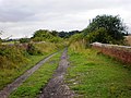
 Hudson Way near Beverley - geograph.org.uk - 59969.jpg 640 × 480; 164 KB
-
 Hudson Way near Cherry Burton - geograph.org.uk - 813981.jpg 478 × 640; 277 KB
-
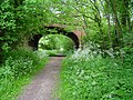
 Humpback Bridge over Disused Railway - geograph.org.uk - 1543240.jpg 640 × 480; 50 KB
-
 Kiplingcotes rail bridge - geograph.org.uk - 1388884.jpg 640 × 625; 226 KB
-
 Michael's Bridge - geograph.org.uk - 826259.jpg 480 × 640; 279 KB
-

-
 Michael's Bridge, Etton Wold - geograph.org.uk - 739740.jpg 461 × 640; 137 KB
-
 Millsike Beck - geograph.org.uk - 285148.jpg 640 × 479; 85 KB
-
 Mud Track - geograph.org.uk - 1730688.jpg 2,736 × 3,648; 5.07 MB
-
 Old Railway Bridge, Kiplingcotes - geograph.org.uk - 825674.jpg 640 × 425; 254 KB
-
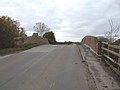
 Red Lane Bridge, Market Weighton - geograph.org.uk - 739655.jpg 640 × 516; 153 KB
-
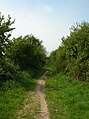
 The Hudson Way - geograph.org.uk - 19187.jpg 640 × 426; 124 KB
-
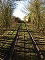
 The Hudson Way from Kiplingcotes - geograph.org.uk - 1436503.jpg 640 × 480; 86 KB
-
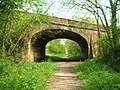 Under the A164 - geograph.org.uk - 813993.jpg 640 × 478; 359 KB


