Category:Brink 88, Deventer
Jump to navigation
Jump to search
| Object location | | View all coordinates using: OpenStreetMap |
|---|
house in Deventer, Netherlands  | |||||
| Upload media | |||||
| Instance of | |||||
|---|---|---|---|---|---|
| Location | Deventer, Overijssel, Netherlands | ||||
| Street address |
| ||||
| Heritage designation |
| ||||
 | |||||
|
This is a category about rijksmonument number 12532
|
| Address |
|
Media in category "Brink 88, Deventer"
The following 9 files are in this category, out of 9 total.
-
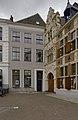
 Brink 88 Deventer.jpg 1,712 × 2,560; 983 KB
-
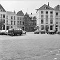
 Deventer, Netherlands - panoramio (9).jpg 2,048 × 1,375; 377 KB
-
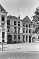
 Het Penninckshuis - Deventer - 20055736 - RCE.jpg 965 × 1,200; 289 KB
-

-
 Pleintje - Deventer - 20053969 - RCE.jpg 1,192 × 1,200; 290 KB
-
 Reproductie uit bibliotheek Monumenten Zorg - Deventer - 20055555 - RCE.jpg 1,200 × 931; 325 KB
-
-
 Voorgevels - Deventer - 20055733 - RCE.jpg 806 × 1,200; 195 KB
-
 Zo geheten Penninxhuis - Deventer - 20055737 - RCE.jpg 1,200 × 972; 249 KB
.jpg)


