Category:Bronwydd
Jump to navigation
Jump to search
village and community in Carmarthenshire   | |||||
| Upload media | |||||
| Pronunciation audio | |||||
|---|---|---|---|---|---|
| Instance of | |||||
| Location | Carmarthenshire, Wales | ||||
| Population |
| ||||
| Area |
| ||||
 | |||||
Cymraeg: Pentref a chymuned yn Sir Gaerfyrddin yw Bronwydd neu Bronwydd Arms. Saif tua thair milltir i'r gogledd o dref Caerfyrddin, ar y briffordd A484 rhwng Caerfyrddin a Chynwyl Elfed, yn nyffryn Afon Gwili. Mae Cymuned Bronwydd yn cynnwys y pentref ei hyn a phentrefi bychain Cwmdwyfran a Pentre Morgan. Cysegrwyd yr eglwys i Sant Celynin.
English: Bronwydd is a village in Carmarthenshire, South West Wales, United Kingdom, situated about three miles north of Carmarthen in the valley of the River Gwili.
Subcategories
This category has only the following subcategory.
B
- Bronwydd Arms railway station (24 F)
Media in category "Bronwydd"
The following 102 files are in this category, out of 102 total.
-
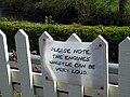 'Engine whistle can be very loud' - geograph.org.uk - 5369150.jpg 640 × 480; 176 KB
-

-
 A 'layover' at Llwyfan Cerrig - geograph.org.uk - 5367772.jpg 640 × 480; 260 KB
-
 A pair of tumuli - geograph.org.uk - 1506125.jpg 640 × 480; 102 KB
-
-
-
 A train standing at Danycoed Halt - geograph.org.uk - 5367735.jpg 640 × 480; 295 KB
-

-
 A484 junction at Bronwydd - geograph.org.uk - 3260690.jpg 2,130 × 957; 354 KB
-
 Afon Gwili (geograph 6400298).jpg 2,048 × 1,536; 1.42 MB
-
 Afon Gwili (geograph 6400312).jpg 3,690 × 2,764; 3.77 MB
-
 Afon Gwili, Bronwydd - geograph.org.uk - 2878262.jpg 690 × 518; 226 KB
-
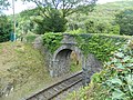 Bridge over Gwili Railway - geograph.org.uk - 4126473.jpg 4,320 × 3,240; 3.09 MB
-
 Bridge over Gwili Railway - geograph.org.uk - 4126474.jpg 4,320 × 3,240; 3.11 MB
-
 Bridge over the Afon Gwili - geograph.org.uk - 713791.jpg 640 × 471; 149 KB
-
 Bridle path at Clynmelyn - geograph.org.uk - 1240024.jpg 640 × 480; 165 KB
-
 Bronwydd Arms commemorative plaque - geograph.org.uk - 3260666.jpg 2,079 × 1,682; 601 KB
-
 Bronwydd Arms Station and level crossing - geograph.org.uk - 5809980.jpg 1,494 × 1,120; 620 KB
-
 Bronwydd Arms Station Signal Box - geograph.org.uk - 4148941.jpg 3,264 × 2,448; 2.7 MB
-
 Bronwydd bridge (geograph 6400308).jpg 2,048 × 1,536; 1.52 MB
-
-
 Criced Bronwydd Arms cricket (geograph 6377223).jpg 1,024 × 768; 226 KB
-
 Cricket ground (geograph 6400314).jpg 2,048 × 1,536; 1.31 MB
-
 Crossing Afon Gwili - geograph.org.uk - 5367792.jpg 4,896 × 3,672; 7.21 MB
-
 Cwmdwyfran - geograph.org.uk - 4117468.jpg 640 × 480; 74 KB
-
 Cwmdwyfran - geograph.org.uk - 6293373.jpg 1,024 × 768; 251 KB
-
 Cwmdwyfran Chapel - geograph.org.uk - 4126460.jpg 4,320 × 3,240; 4.77 MB
-
 Danycoed Halt - geograph.org.uk - 2654051.jpg 800 × 600; 175 KB
-
 Diwrnod Tomos Y Tanc - geograph.org.uk - 2413148.jpg 640 × 427; 94 KB
-
 Eglwys St Celynin (geograph 6400318).jpg 2,048 × 1,536; 1.77 MB
-
 Engines sit and wait for a train^ - geograph.org.uk - 301477.jpg 415 × 276; 30 KB
-
 Felinfach - geograph.org.uk - 1139052.jpg 640 × 416; 67 KB
-
 Felinfach - geograph.org.uk - 551552.jpg 640 × 484; 122 KB
-
 Friesian heifers - geograph.org.uk - 1506112.jpg 640 × 480; 77 KB
-
 Gwili Mill Farm - geograph.org.uk - 4403542.jpg 2,816 × 1,880; 1.96 MB
-
 Gwili Railway - geograph.org.uk - 3018765.jpg 3,264 × 2,448; 1.08 MB
-
 Gwili Railway - geograph.org.uk - 5809185.jpg 3,888 × 5,184; 4.75 MB
-
 Gwili Railway at Bronwydd Arms - geograph.org.uk - 5809187.jpg 5,184 × 3,888; 5.54 MB
-
 Gwili Railway just south of Bronwydd Arms Station - geograph.org.uk - 1899136.jpg 2,816 × 1,880; 1.79 MB
-
 Gwili Railway near Bronwydd Arms - geograph.org.uk - 4625785.jpg 2,250 × 3,000; 1.74 MB
-
 Gwili Railway near Bronwydd Arms - geograph.org.uk - 4625787.jpg 3,264 × 2,448; 2.09 MB
-
 Gwili Steam Railway - geograph.org.uk - 3260619.jpg 3,264 × 2,448; 4.5 MB
-
 Gwili View - geograph.org.uk - 518987.jpg 640 × 480; 53 KB
-
 Gwili View - geograph.org.uk - 537998.jpg 640 × 346; 40 KB
-
 Gwili Weir - geograph.org.uk - 2661748.jpg 800 × 600; 220 KB
-
 Heading for Bronwydd Arms - geograph.org.uk - 5367784.jpg 640 × 480; 258 KB
-

-
 Idle at Bronwydd Arms - geograph.org.uk - 5369146.jpg 640 × 480; 197 KB
-
 In the station yard, Bronwydd Arms - geograph.org.uk - 5369157.jpg 640 × 480; 200 KB
-
 In the yard at Llwyfan Cerrig Station - geograph.org.uk - 5369144.jpg 640 × 480; 220 KB
-
 Level crossing on the Gwili Railway - geograph.org.uk - 4126447.jpg 4,320 × 3,240; 3.04 MB
-
 Line-up at Bronwydd Arms - geograph.org.uk - 5809186.jpg 5,182 × 2,915; 3.71 MB
-
-
 Llwyfan Cerrig - geograph.org.uk - 2661632.jpg 800 × 600; 164 KB
-
 Llwyfan Cerrig Station, Gwili Steam Railway - geograph.org.uk - 4148946.jpg 3,264 × 2,448; 3.8 MB
-
 Locomotives at Bronwydd Arms - geograph.org.uk - 5809190.jpg 5,184 × 3,888; 6.01 MB
-
 Locomotives at Bronwydd Arms - geograph.org.uk - 5809191.jpg 5,184 × 3,888; 5.93 MB
-
 Mowable roof material - geograph.org.uk - 3260677.jpg 3,264 × 2,448; 4.42 MB
-
 Old Milestone by the A484, Cwmdwyfran - geograph.org.uk - 6099241.jpg 600 × 800; 179 KB
-

-

-
 Old Wagons - geograph.org.uk - 2661694.jpg 800 × 600; 193 KB
-
 On the road from Bronwydd to Peniel - geograph.org.uk - 5369937.jpg 640 × 480; 198 KB
-
 Open level crossing at Bronwydd - geograph.org.uk - 5367798.jpg 640 × 480; 264 KB
-
 Ordnance Survey Bolt - geograph.org.uk - 6309459.jpg 1,024 × 676; 260 KB
-
 Ordnance Survey Cut Mark - geograph.org.uk - 6303930.jpg 1,024 × 863; 343 KB
-
 Ordnance Survey Cut Mark - geograph.org.uk - 6303931.jpg 1,024 × 783; 297 KB
-
 Ordnance Survey Cut Mark - geograph.org.uk - 6303933.jpg 1,024 × 812; 194 KB
-
 Ordnance Survey Cut Mark - geograph.org.uk - 6303934.jpg 1,024 × 746; 202 KB
-
 Ordnance Survey Cut Mark - geograph.org.uk - 6304037.jpg 1,024 × 927; 316 KB
-
 Ordnance Survey Cut Mark - geograph.org.uk - 6309458.jpg 1,024 × 793; 267 KB
-
 Ordnance Survey Cut Mark - geograph.org.uk - 6309460.jpg 1,024 × 787; 263 KB
-
 Pannier tank at Bronwydd Arms - geograph.org.uk - 2467348.jpg 640 × 511; 96 KB
-
 Pasture and hill fort - geograph.org.uk - 1506095.jpg 640 × 480; 70 KB
-
 Pompren ym Mronwydd - Footbridge in Bronwydd - geograph.org.uk - 6293381.jpg 1,024 × 768; 304 KB
-
 Rhan o Bronwydd Arms Part of Bronwydd Arms - geograph.org.uk - 6377462.jpg 1,024 × 768; 221 KB
-
 River Bridge - geograph.org.uk - 2661735.jpg 600 × 800; 238 KB
-
 River View - geograph.org.uk - 2661718.jpg 800 × 600; 236 KB
-
 Riverside Track - geograph.org.uk - 2661666.jpg 800 × 600; 204 KB
-
 Road bridge across the Afon Gwili - geograph.org.uk - 4126432.jpg 4,320 × 3,240; 3.09 MB
-
 Road bridge over Gwili Railway - geograph.org.uk - 3260639.jpg 3,264 × 2,448; 4.37 MB
-
 Rural Scene at Bronwydd - geograph.org.uk - 792843.jpg 640 × 379; 51 KB
-
 Standing Stone and Pasture - geograph.org.uk - 707487.jpg 640 × 455; 73 KB
-
 Station View - geograph.org.uk - 2654040.jpg 800 × 600; 117 KB
-
-
 The A484 at Cwmdwyfran - geograph.org.uk - 4126463.jpg 4,320 × 3,240; 2.71 MB
-
 The Afon Gwili - geograph.org.uk - 4126436.jpg 4,320 × 3,240; 3.12 MB
-
 The Bronwydd Arms public house - geograph.org.uk - 3260657.jpg 3,264 × 2,448; 5.61 MB
-
 The Gwili Railway at Bronwydd Arms - geograph.org.uk - 2496042.jpg 1,024 × 768; 274 KB
-
 The Gwili Railway, bridge over the Afon Gwili - geograph.org.uk - 4126475.jpg 4,320 × 3,240; 3.02 MB
-
 The lane to Trefynys - geograph.org.uk - 5369914.jpg 480 × 640; 302 KB
-
 The line to Carmarthen - geograph.org.uk - 5367819.jpg 640 × 480; 232 KB
-
 The road to Bronwydd - geograph.org.uk - 5369919.jpg 640 × 480; 301 KB
-
 Traditional Welsh Farm - geograph.org.uk - 777537.jpg 640 × 453; 55 KB
-
 Uwchlaw - Above Pante - geograph.org.uk - 4115520.jpg 640 × 480; 124 KB
-
 Wales Carmarthenshire Community Bronwydd map.svg 512 × 399; 1.12 MB
-
 Watching 'Welsh Guardsman' run round - geograph.org.uk - 5367758.jpg 640 × 480; 318 KB
-
 Cottage with Tin Roof - geograph.org.uk - 713765.jpg 640 × 482; 136 KB
-
 Danrhiw Farm - geograph.org.uk - 713774.jpg 640 × 429; 84 KB
-
 Is This the End of the Line^ - geograph.org.uk - 777531.jpg 640 × 480; 139 KB
-
 Ponds near Pontarsais - geograph.org.uk - 686751.jpg 640 × 480; 61 KB
-
 Rhes o dai ger Caerfyrddin. - geograph.org.uk - 551557.jpg 640 × 452; 70 KB


.jpg)
.jpg)


.jpg)

.jpg)
.jpg)


.jpg)


