Category:Broughton and Old Dalby
Jump to navigation
Jump to search
civil parish in Leicestershire, United Kingdom | |||||
| Upload media | |||||
| Instance of | |||||
|---|---|---|---|---|---|
| Location | Melton, Leicestershire, East Midlands, England | ||||
 | |||||
English: Broughton and Old Dalby is a civil parish in the Melton district of Leicestershire, England. According to the 2001 census it had a population of 1,400. It includes Upper Broughton, Nether Broughton and Old Dalby. However, despite its LE14 postcode, the village of Upper Broughton lies entirely within Nottinghamshire.
Subcategories
This category has the following 2 subcategories, out of 2 total.
N
O
Media in category "Broughton and Old Dalby"
The following 200 files are in this category, out of 341 total.
(previous page) (next page)-
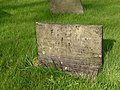
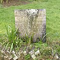 'Belvoir Angel' gravestone, Old Dalby - geograph.org.uk - 3872472.jpg 1,280 × 1,280; 664 KB
-
 A field of cattle near Grange Cottages - geograph.org.uk - 906786.jpg 640 × 484; 110 KB
-
 A46 bridge over the A6006 - geograph.org.uk - 3078831.jpg 640 × 480; 81 KB
-
 A46 bridge over the B676, Six Hills - geograph.org.uk - 3038665.jpg 640 × 480; 67 KB
-
 A46 Fosse Way at Six Hills - geograph.org.uk - 3642862.jpg 800 × 451; 176 KB
-
 A46 heading south - geograph.org.uk - 4581110.jpg 2,256 × 1,496; 865 KB
-
 A6006 Paddy's Lane looking east - geograph.org.uk - 3604283.jpg 640 × 480; 70 KB
-
 A6006 towards Rempstone - geograph.org.uk - 3078824.jpg 640 × 480; 85 KB
-
 A606 towards Melton Mowbray - geograph.org.uk - 5437083.jpg 640 × 514; 96 KB
-
 A606 towards Nottingham - geograph.org.uk - 5437084.jpg 640 × 391; 60 KB
-
 Alongside the railway - geograph.org.uk - 2847042.jpg 1,024 × 768; 201 KB
-
 B676 towards the A6006 - geograph.org.uk - 3078806.jpg 640 × 480; 89 KB
-

-

-

-
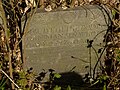
 Belvoir Angel headstone, Nether Broughton Churchyard - geograph.org.uk - 4430085.jpg 1,106 × 1,280; 327 KB
-

-
-

-

-

-

-

-

-
-

-
-

-

-

-

-
-

-
 Belvoir Angel headstone, Nether Broughton Churchyard - geograph.org.uk - 4430202.jpg 1,280 × 1,224; 401 KB
-

-

-
-

-

-
 Belvoir Angel headstone, Nether Broughton Churchyard - geograph.org.uk - 4430232.jpg 1,014 × 1,280; 302 KB
-

-

-

-

-
 Belvoir Brewery, Old Dalby - geograph.org.uk - 3634236.jpg 640 × 480; 93 KB
-
 Bench and power lines Clawson Lane - geograph.org.uk - 2230002.jpg 1,024 × 768; 123 KB
-
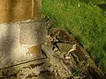
 Bench mark, Church End, Nether Broughton - geograph.org.uk - 4430053.jpg 960 × 1,280; 335 KB
-
 Bench mark, Moat Farm Nether Broughton - geograph.org.uk - 4430931.jpg 1,280 × 960; 502 KB
-
 Bench mark, St Mary's Church, Nether Broughton - geograph.org.uk - 4430255.jpg 1,280 × 960; 485 KB
-
 Bench mark, Station Road bridge, Old Dalby - geograph.org.uk - 3872487.jpg 1,280 × 960; 407 KB
-
 Bluebells and footpath - geograph.org.uk - 4454737.jpg 1,280 × 905; 632 KB
-

-
 Broughton Lane - geograph.org.uk - 4040335.jpg 640 × 480; 58 KB
-

-

-

-
 Cattle south of Gibson's Lane - geograph.org.uk - 5925066.jpg 640 × 439; 47 KB
-
 Chapel Lane, Nether Broughton - geograph.org.uk - 4430728.jpg 1,280 × 960; 275 KB
-
 Chapel Lane, Nether Broughton - geograph.org.uk - 5569655.jpg 640 × 427; 89 KB
-
 Charming lane to Saxelbye - geograph.org.uk - 5569650.jpg 640 × 427; 71 KB
-
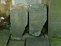
 Chest tomb, Nether Broughton Churchyard - geograph.org.uk - 4430252.jpg 1,280 × 960; 512 KB
-
 Church End, Nether Broughton - geograph.org.uk - 4430048.jpg 1,280 × 902; 276 KB
-
 Church Lane, Old Dalby - geograph.org.uk - 5569636.jpg 640 × 427; 85 KB
-
 Church of St Mary, Nether Broughton - geograph.org.uk - 4430056.jpg 1,280 × 827; 353 KB
-
 Church of St Mary, Nether Broughton - geograph.org.uk - 4430261.jpg 1,280 × 960; 333 KB
-
 Church of St Mary, Nether Broughton - geograph.org.uk - 4430943.jpg 1,280 × 1,280; 486 KB
-
 Clawson Lane - geograph.org.uk - 4040635.jpg 640 × 480; 101 KB
-
 Clawson Lane bend in the road - geograph.org.uk - 2230008.jpg 1,024 × 768; 118 KB
-

-
 Conservation area with pond - geograph.org.uk - 2307675.jpg 640 × 480; 127 KB
-
 Corner of field and wind turbines - geograph.org.uk - 5268706.jpg 640 × 520; 315 KB
-
 Cottage, Nether Broughton - geograph.org.uk - 4040332.jpg 640 × 480; 82 KB
-
 Country Road - geograph.org.uk - 1834381.jpg 640 × 427; 76 KB
-
 Cowslips on the Wolds - geograph.org.uk - 4454725.jpg 1,280 × 960; 583 KB
-
 Crop field north of Clawson Lane - geograph.org.uk - 4040336.jpg 640 × 480; 67 KB
-
 Crown Inn - geograph.org.uk - 3430966.jpg 1,024 × 768; 251 KB
-
 Dalby View - geograph.org.uk - 5268723.jpg 640 × 446; 225 KB
-
 Datestone on Heckadeck Cottage - geograph.org.uk - 4430668.jpg 1,280 × 960; 255 KB
-
 Datestone on The Old Bakehouse - geograph.org.uk - 4430655.jpg 1,280 × 960; 313 KB
-
 Debdale Farmhouse - geograph.org.uk - 3871914.jpg 1,280 × 941; 420 KB
-
 Debdale Hill House - geograph.org.uk - 3871956.jpg 1,280 × 861; 296 KB
-
 Debdale House - geograph.org.uk - 3871922.jpg 1,280 × 955; 357 KB
-
 Debdale House - geograph.org.uk - 3871928.jpg 1,280 × 948; 307 KB
-
 Derelict farm building - geograph.org.uk - 5268724.jpg 640 × 486; 392 KB
-
 Derelict field - geograph.org.uk - 2846989.jpg 1,024 × 768; 161 KB
-
 Descending Broughton Hill - geograph.org.uk - 6176897.jpg 3,648 × 2,432; 2.44 MB
-

-
 Ditch between fields - geograph.org.uk - 5268725.jpg 640 × 457; 304 KB
-
 Donkey Field, Nether Broughton - geograph.org.uk - 5569658.jpg 640 × 427; 115 KB
-
 Doorway at Heckadeck Cottage - geograph.org.uk - 4430938.jpg 960 × 1,280; 290 KB
-
 Dying oak tree - geograph.org.uk - 4454743.jpg 1,280 × 829; 249 KB
-

-
 Edge of field - geograph.org.uk - 5268707.jpg 640 × 474; 303 KB
-
 Entering Nether Broughton - geograph.org.uk - 4040331.jpg 640 × 480; 77 KB
-
 Entrance to field north of Gibson's Lane - geograph.org.uk - 5268715.jpg 640 × 482; 328 KB
-
-
 Entrance to Old Dalby reservoir - geograph.org.uk - 5015750.jpg 640 × 498; 101 KB
-
 Entrance to the former Red Lion - geograph.org.uk - 4430911.jpg 1,280 × 960; 351 KB
-
 Farm building off Six Hills Lane - geograph.org.uk - 3038655.jpg 640 × 480; 56 KB
-
 Farm buildings at Manor Farm - geograph.org.uk - 4430924.jpg 1,280 × 943; 281 KB
-

-

-
 Farm track, Vale View Farm - geograph.org.uk - 3608471.jpg 640 × 480; 83 KB
-
 Farmland near Nether Broughton - geograph.org.uk - 4040333.jpg 640 × 480; 56 KB
-
 Farmland off Nottingham Lane - geograph.org.uk - 3608462.jpg 640 × 480; 92 KB
-
 Farmland off the A6006 - geograph.org.uk - 3078828.jpg 640 × 480; 93 KB
-
 Farmland towards Hall Plantation - geograph.org.uk - 3608476.jpg 640 × 480; 76 KB
-
 Farmland towards Marriot's Spinney - geograph.org.uk - 3608538.jpg 640 × 480; 64 KB
-
 Farmland towards the A6006 - geograph.org.uk - 3078804.jpg 640 × 480; 62 KB
-
 Farmland, Dalby Wolds - geograph.org.uk - 3078815.jpg 640 × 480; 100 KB
-
 Farmland, The Lodge - geograph.org.uk - 3608505.jpg 640 × 538; 57 KB
-
 Farmland, Vale View Farm - geograph.org.uk - 3608469.jpg 640 × 480; 54 KB
-
 Farmland, Wavendon Grange - geograph.org.uk - 3608481.jpg 640 × 480; 66 KB
-
 Field alongside Gibson's Lane - geograph.org.uk - 5268716.jpg 640 × 426; 238 KB
-
 Field corner and derelict farm building - geograph.org.uk - 5268726.jpg 640 × 464; 298 KB
-
 Field corner with pond - geograph.org.uk - 5268727.jpg 640 × 423; 290 KB
-
 Field entrance off Nottingham Lane - geograph.org.uk - 3608456.jpg 640 × 480; 90 KB
-
 Field north of Gibson's Lane - geograph.org.uk - 5268717.jpg 640 × 446; 249 KB
-
 Field north of Gibsons Lane - geograph.org.uk - 2638752.jpg 640 × 469; 68 KB
-

-
 Fields towards south - geograph.org.uk - 5268708.jpg 640 × 447; 323 KB
-
 Fields towards wind turbines - geograph.org.uk - 5268709.jpg 640 × 415; 283 KB
-
 Fishermen's car park - geograph.org.uk - 3872475.jpg 1,280 × 960; 443 KB
-
 Flattened footpath sign - geograph.org.uk - 5268710.jpg 640 × 509; 602 KB
-
 Footbridge and stile - geograph.org.uk - 2847047.jpg 1,024 × 768; 272 KB
-
 Footpath alongside Station Road - geograph.org.uk - 2847056.jpg 1,024 × 768; 167 KB
-
 Footpath by Hill Top Farm - geograph.org.uk - 5268728.jpg 640 × 493; 485 KB
-
 Footpath crosses stream - geograph.org.uk - 5268711.jpg 640 × 480; 357 KB
-

-

-

-
 Footpath in the evening sun - geograph.org.uk - 4430945.jpg 1,280 × 960; 366 KB
-
 Footpath sign - geograph.org.uk - 5268729.jpg 640 × 446; 372 KB
-
 Footpath through Old Dalby - geograph.org.uk - 3872455.jpg 1,280 × 960; 489 KB
-
 Footpath to Long Clawson - geograph.org.uk - 2846182.jpg 1,024 × 768; 280 KB
-
 Footpath to Long Clawson - geograph.org.uk - 2846187.jpg 1,024 × 768; 226 KB
-
 Footpath to Longcliff Hill and Old Dalby - geograph.org.uk - 2638744.jpg 640 × 579; 180 KB
-
 Footpath to Upper Broughton - geograph.org.uk - 2847000.jpg 1,024 × 768; 276 KB
-
 Footpath towards Hill Top Farm - geograph.org.uk - 5268730.jpg 640 × 526; 540 KB
-
 Footpath towards Old Dalby - geograph.org.uk - 5268712.jpg 640 × 473; 377 KB
-
 Footpath towards Old Dalby - geograph.org.uk - 5268731.jpg 640 × 484; 350 KB
-
 Footpath towards Old Dalby - geograph.org.uk - 5268732.jpg 640 × 508; 292 KB
-
 Footpath towards Old Dalby - geograph.org.uk - 5268733.jpg 640 × 489; 388 KB
-
 Footpath towards the Fosse Way - geograph.org.uk - 5268734.jpg 640 × 466; 350 KB
-
 Footpath towards Vale View Equestrian - geograph.org.uk - 5268735.jpg 640 × 471; 276 KB
-
 Footpath towards Vale View Farm - geograph.org.uk - 5268736.jpg 640 × 391; 242 KB
-
 Gated Road - geograph.org.uk - 3871909.jpg 1,280 × 960; 394 KB
-

-
-
 Gateway on north side of Gibson's Lane - geograph.org.uk - 5268737.jpg 640 × 471; 311 KB
-
 Gateway on Nottingham Road - geograph.org.uk - 2638745.jpg 640 × 460; 88 KB
-
 Gateway to the road - geograph.org.uk - 5268738.jpg 640 × 524; 397 KB
-
 Gibson's Lane - geograph.org.uk - 5268739.jpg 640 × 483; 266 KB
-
 Gibson's Lane eastwards - geograph.org.uk - 5925067.jpg 640 × 460; 53 KB
-
-
 Gibson's Lane passes Lawn Farm - geograph.org.uk - 5268740.jpg 640 × 491; 296 KB
-
 Gibson's Lane towards crossroads - geograph.org.uk - 5268741.jpg 640 × 371; 209 KB
-
 Gibson's Lane towards Old Dalby - geograph.org.uk - 5268720.jpg 640 × 393; 206 KB
-
 Gibson's Lane towards Old Dalby - geograph.org.uk - 5925069.jpg 640 × 459; 65 KB
-
 Gibson's Lane westwards - geograph.org.uk - 5925070.jpg 640 × 446; 54 KB
-
 Gibson's Lane-Paddys Lane junction - geograph.org.uk - 5925068.jpg 640 × 462; 52 KB
-
 Gibsons Lane passes Grange Cottages - geograph.org.uk - 5268719.jpg 640 × 486; 329 KB
-
 Gibsons Lane towards Dalby Wolds - geograph.org.uk - 2638753.jpg 640 × 536; 92 KB
-
 Gibsons Lane towards Old Dalby - geograph.org.uk - 2638739.jpg 640 × 510; 117 KB
-
 Gibsons Lane towards Old Dalby - geograph.org.uk - 2638754.jpg 640 × 541; 101 KB
-

-

-
 Hatton Lodge - geograph.org.uk - 1651493.jpg 640 × 427; 80 KB
-
 Hatton Lodge - geograph.org.uk - 4430040.jpg 1,280 × 960; 263 KB
-
 Hawthorn Close - geograph.org.uk - 3871950.jpg 1,280 × 829; 215 KB
-
 Haylage at Vale View Farm - geograph.org.uk - 5268742.jpg 640 × 422; 226 KB
-
 Heckadeck Cottage, Nether Broughton - geograph.org.uk - 4430664.jpg 1,280 × 960; 286 KB
-
 Heckadeck Lane - geograph.org.uk - 4430697.jpg 1,280 × 960; 358 KB
-
 Hedgerow near Gorse Farm - geograph.org.uk - 3608535.jpg 640 × 480; 72 KB
-
 Home Lodge Farm - geograph.org.uk - 4390491.jpg 640 × 427; 83 KB
-
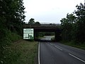
 Junction of A46 and A6006 near Old Dalby - geograph.org.uk - 5455191.jpg 1,706 × 1,137; 368 KB
-

-

-
 Lane on Green Hill - geograph.org.uk - 4043147.jpg 1,280 × 960; 425 KB
-
 Lawn Lane - geograph.org.uk - 3608477.jpg 640 × 480; 56 KB
-
 Lawn Lane - geograph.org.uk - 3608485.jpg 640 × 480; 61 KB
-
 Layby on Paddy's Lane, A6006 - geograph.org.uk - 5455207.jpg 640 × 427; 91 KB
-
-
-
 Lodge Farm - geograph.org.uk - 1067585.jpg 640 × 436; 93 KB
-
 Lodge Farm and Greenacres - geograph.org.uk - 1052174.jpg 640 × 480; 82 KB
-
 Lodge Farm sign - geograph.org.uk - 4430046.jpg 1,280 × 960; 281 KB
-
 Main Road (A606) - geograph.org.uk - 4040326.jpg 640 × 480; 76 KB
-
 Main Road, Old Dalby - geograph.org.uk - 3622304.jpg 640 × 480; 112 KB
-
 Making haylage - geograph.org.uk - 5268743.jpg 640 × 457; 312 KB
-
 Manor Farmhouse, Nether Broughton - geograph.org.uk - 4430918.jpg 1,280 × 919; 277 KB
-
 Manor House Farm - geograph.org.uk - 2846336.jpg 1,024 × 768; 151 KB
-
 Manor House Farmhouse, Nether Broughton - geograph.org.uk - 4430676.jpg 1,280 × 960; 241 KB
-
 Marsh Marigold (caltha palustris) - geograph.org.uk - 4454728.jpg 1,280 × 960; 414 KB
-
 Medieval strip fields, Nether Broughton - geograph.org.uk - 4430929.jpg 1,034 × 1,280; 435 KB
-
 Mill House, Main Street, Nether Broughton - geograph.org.uk - 4430701.jpg 1,280 × 960; 359 KB
-
 Moat Farm, Nether Broughton - geograph.org.uk - 4430928.jpg 1,280 × 960; 276 KB
-
 Moat Field - geograph.org.uk - 2846163.jpg 1,024 × 768; 161 KB
-
 Nether Broughton Main Street - geograph.org.uk - 5437560.jpg 1,024 × 731; 811 KB
-
 Nether Broughton Village Hall - geograph.org.uk - 4430720.jpg 1,280 × 960; 270 KB


_-_geograph.org.uk_-_4390538.jpg)


_and_the_road_to_Hoby_-_geograph.org.uk_-_4390015.jpg)


_-_geograph.org.uk_-_4040326.jpg)


_-_geograph.org.uk_-_4454728.jpg)


