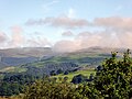
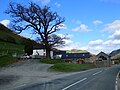
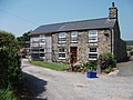
Category:Bryncrug
Jump to navigation
Jump to search
village and community in Gwynedd, Wales, UK  | |||||
| Upload media | |||||
| Instance of | |||||
|---|---|---|---|---|---|
| Location | Gwynedd, Wales | ||||
 | |||||
Cymraeg: Pentref a chymuned yn ne Gwynedd, yw Bryn-crug, weithiau Bryncrug. Saif y pentref i'r gogledd ddwyrain o dref Tywyn, ger cyffordd y briffordd A493 a'r B4405. Llifa Afon Dysynni ychydig i'r gorllewin.
Subcategories
This category has the following 9 subcategories, out of 9 total.
B
- Brynglas railway station (29 F)
C
- Cwm Cynfal quarry (11 F)
- Cynfal Halt railway station (2 F)
D
F
N
R
- Rhydyronen railway station (19 F)
T
Y
- Ynysymaengwyn Dovecote (6 F)
Media in category "Bryncrug"
The following 200 files are in this category, out of 256 total.
(previous page) (next page)-
 "Water feature" on Nant Braich-y-Rhiw - geograph.org.uk - 2057027.jpg 800 × 600; 191 KB
-
 1959 Election in Merioneth (cropped).jpg 197 × 317; 50 KB
-
 1959 Election in Merioneth.jpg 600 × 459; 117 KB
-
 2021-10-26 Cwm Cynfal 02.jpg 3,264 × 1,836; 1.83 MB
-
 2021-10-26 Cwm Cynfal 06.jpg 3,264 × 1,836; 1.77 MB
-
 2021-10-26 Cwm Cynfal 19.jpg 3,264 × 1,836; 2.19 MB
-
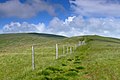
 A fence in the mist - geograph.org.uk - 2267772.jpg 1,306 × 979; 258 KB
-

-
 Above Nant Dol-goch - geograph.org.uk - 4876212.jpg 4,608 × 3,072; 3.18 MB
-
 Afon Fathew at Bryncrug - geograph.org.uk - 6107712.jpg 4,000 × 3,000; 2.86 MB
-
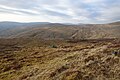
 Approaching Mynydd Tan Coed - geograph.org.uk - 4876180.jpg 4,608 × 3,072; 3.12 MB
-
 Avon Dysynni - geograph.org.uk - 2973276.jpg 1,600 × 1,200; 413 KB
-
 Avon Dysynni - geograph.org.uk - 2974502.jpg 1,600 × 1,200; 361 KB
-
 B4405 ger Bryncrug - B4405 near Bryncrug - geograph.org.uk - 4113263.jpg 3,600 × 2,400; 3.94 MB
-
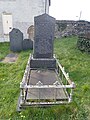
 Bedd Mary Jones ym mynwent capel Bethlehem, Bryncrug.jpg 3,096 × 4,128; 7.11 MB
-
 Bedd Mary Jones.jpg 3,096 × 4,128; 7.32 MB
-
 Bird rock from the south - geograph.org.uk - 2106739.jpg 640 × 480; 52 KB
-
 Bluebell woods, Dolgoch - geograph.org.uk - 1317279.jpg 640 × 480; 220 KB
-
 Bluebells ^ Whins in Nant Cynfal - geograph.org.uk - 1878894.jpg 800 × 536; 144 KB
-
 Bridge over a small burn - geograph.org.uk - 1881318.jpg 1,600 × 1,071; 708 KB
-
 Bridge over Afon Cwm Pandy at Brynglas - geograph.org.uk - 1926538.jpg 640 × 488; 134 KB
-
 Broad Water viewed from Tarren Hendre - geograph.org.uk - 4075808.jpg 640 × 480; 159 KB
-
 Bryncrug - 2009-02-27.jpg 2,592 × 1,944; 1.93 MB
-
 Bryncrug Church - geograph.org.uk - 148804.jpg 640 × 480; 102 KB
-
 Bryncrug Primary School - geograph.org.uk - 6108413.jpg 4,000 × 3,000; 2.66 MB
-
 Bryncrug sewage works - geograph.org.uk - 2974438.jpg 1,600 × 1,200; 425 KB
-
 Bryncrug Village - geograph.org.uk - 1013453.jpg 640 × 480; 85 KB
-
 Bryncrug Village Store - geograph.org.uk - 6107798.jpg 4,000 × 3,000; 2.67 MB
-
 Bwlch between Tarren and Pen - geograph.org.uk - 2267737.jpg 1,306 × 979; 305 KB
-
 Cadair Idris - geograph.org.uk - 4062183.jpg 3,600 × 2,400; 4.16 MB
-
 Cader Idris range from the South - geograph.org.uk - 2106771.jpg 640 × 480; 40 KB
-
 Cairn on Tarren Cwm-ffernol - geograph.org.uk - 4876767.jpg 4,608 × 3,072; 3.22 MB
-
 Cairn, Tarrenhendre - geograph.org.uk - 2532748.jpg 2,592 × 1,944; 1.39 MB
-
 Calm amongst the reed beds - geograph.org.uk - 2973253.jpg 1,600 × 1,200; 262 KB
-

-
 Capel Bethlehem, Bryncrug - geograph.org.uk - 6107803.jpg 4,000 × 3,000; 2.58 MB
-
 Capel Bethlehem, Bryncrug.jpg 3,096 × 4,128; 5.58 MB
-
 Cloud over Tarren Nantymynach - geograph.org.uk - 923287.jpg 640 × 480; 94 KB
-
 Coat of Arms at Ynysmaengwyn - geograph.org.uk - 6107666.jpg 4,000 × 3,000; 2.29 MB
-
 Collapsed cairn on Trum Gelli - geograph.org.uk - 2267789.jpg 1,306 × 979; 370 KB
-
 Confluence of Avon Dysynni and Pant Rhyd-yr-onen - geograph.org.uk - 2973316.jpg 1,600 × 1,200; 402 KB
-
 Confluence of stream and river, west of Dolgoch - geograph.org.uk - 5035640.jpg 1,024 × 614; 140 KB
-
 Croes Faen. - geograph.org.uk - 353480.jpg 480 × 640; 108 KB
-
 Cwm Dol-goch - geograph.org.uk - 4075825.jpg 640 × 480; 221 KB
-
 Cwm Nant- Braich-y-Rhiw - geograph.org.uk - 4063735.jpg 3,600 × 2,400; 4.14 MB
-
 Cwm of the Nant Braich-y-rhiw - geograph.org.uk - 1499698.jpg 640 × 489; 124 KB
-
 Dairy roadside churn stand - geograph.org.uk - 2974369.jpg 1,600 × 1,200; 542 KB
-
 Delayed at Dyfi J. - geograph.org.uk - 5452432.jpg 4,896 × 3,672; 7.37 MB
-
 Derelict boat house - geograph.org.uk - 2973232.jpg 1,600 × 1,200; 494 KB
-
 Derwenlas on the outskirts of Bryncrug - geograph.org.uk - 2974421.jpg 1,600 × 1,200; 426 KB
-
 Descending Tarrenhendre - geograph.org.uk - 4875515.jpg 4,451 × 2,967; 2.11 MB
-
 Disused fence heading downhill - geograph.org.uk - 2267778.jpg 1,306 × 979; 274 KB
-
 Dol-dehewydd - geograph.org.uk - 6108491.jpg 4,000 × 3,000; 2.52 MB
-
 Dolaugwyn - geograph.org.uk - 6108478.jpg 3,607 × 2,705; 2.54 MB
-
 Dolgoch Station, Talyllyn Railway - geograph.org.uk - 4152686.jpg 734 × 1,280; 819 KB
-
 Dolgoch Woods - geograph.org.uk - 2510094.jpg 2,816 × 2,112; 3.04 MB
-
 Downstream from Dolgoch Falls - geograph.org.uk - 2557975.jpg 640 × 427; 134 KB
-

-
 Drained lowland fields - geograph.org.uk - 2973218.jpg 1,600 × 1,200; 432 KB
-
-
 Entrance to Ynysmaengwyn Holiday Park - geograph.org.uk - 6107659.jpg 4,000 × 3,000; 2.53 MB
-
 Escarpment on Tarren Nantymynach - geograph.org.uk - 4075818.jpg 640 × 480; 264 KB
-
 Evening on Mynydd Esgairweddan - geograph.org.uk - 4876757.jpg 4,391 × 2,927; 1.05 MB
-
 Extension at Pen-y-sarn farmhouse - geograph.org.uk - 2974395.jpg 1,600 × 1,200; 473 KB
-
 Farm buildings at Briach-y-rhiw - geograph.org.uk - 1884970.jpg 640 × 428; 122 KB
-
 Farm buildings at Bryn-y-castell - geograph.org.uk - 1884965.jpg 640 × 428; 85 KB
-
 Farm buildings at Dolaugwyn - geograph.org.uk - 214291.jpg 640 × 480; 107 KB
-
 Farm Track - geograph.org.uk - 2106842.jpg 640 × 480; 128 KB
-
 Farm track - geograph.org.uk - 2106862.jpg 640 × 480; 60 KB
-
 Farm track and grazings - geograph.org.uk - 1878907.jpg 800 × 536; 145 KB
-
 Farm track to Rhyd-yr-onnen - geograph.org.uk - 1881262.jpg 1,600 × 1,071; 548 KB
-
 Farmhouse at Bryn-y-castell - geograph.org.uk - 1884973.jpg 640 × 428; 126 KB
-
 Farmland in the valley of Afon Fathew - geograph.org.uk - 5035613.jpg 1,024 × 614; 115 KB
-
 Farmland near Fach-goch - geograph.org.uk - 6262312.jpg 4,283 × 2,602; 1.17 MB
-

-
 Fathew Valley, viewed from Talyllyn Railway west of Dolgoch - geograph.org.uk - 2511146.jpg 2,816 × 2,112; 1.66 MB
-

-
 Fence junction at the summit of Pen Trum-gwr - geograph.org.uk - 2267711.jpg 1,306 × 979; 291 KB
-
 Fence junction near Dolau-gwyn - geograph.org.uk - 2267727.jpg 1,306 × 979; 415 KB
-
 Fence Line - geograph.org.uk - 6001235.jpg 640 × 480; 112 KB
-

-
 Fence line on Tarren Hendre - geograph.org.uk - 4075813.jpg 640 × 480; 311 KB
-
 Fence reaching skyward - geograph.org.uk - 1878953.jpg 1,024 × 685; 173 KB
-
 Fence-line on Tarren Hendre - geograph.org.uk - 4075828.jpg 640 × 480; 222 KB
-

-

-
 Ffridd Cocyn - geograph.org.uk - 3353757.jpg 1,600 × 1,200; 871 KB
-
 Fields by the Afon Fathew - geograph.org.uk - 3401796.jpg 1,152 × 768; 607 KB
-
 Fields in Dyffryn Dysynni - geograph.org.uk - 2090162.jpg 640 × 480; 149 KB
-
 Fields near Brynglas, Talyllyn Railway - geograph.org.uk - 2511133.jpg 2,816 × 2,112; 1.69 MB
-
 Fields near Cynfal Farm - geograph.org.uk - 6262314.jpg 4,920 × 2,678; 1.41 MB
-
 Fields near Cynfal Halt on Talyllyn Railway - geograph.org.uk - 2511131.jpg 2,816 × 2,112; 1.62 MB
-
 Foggily down towards Pen Trum-gwr - geograph.org.uk - 2267704.jpg 1,306 × 979; 230 KB
-
 Footpath to Bryncrug - geograph.org.uk - 6107674.jpg 4,000 × 3,000; 2.86 MB
-
 Footpath to Llanerch Goediog - geograph.org.uk - 6108487.jpg 4,000 × 3,000; 2.29 MB
-
 Forestry stand near the Nant Braich-y-rhiw - geograph.org.uk - 1499689.jpg 1,024 × 768; 1.26 MB
-
 From the path, Dolgoch - geograph.org.uk - 1517146.jpg 640 × 428; 84 KB
-

-
 Graig Fach Goch from the A493 - geograph.org.uk - 6107655.jpg 4,000 × 3,000; 2.93 MB
-
 Grazing land by Bryncrug - geograph.org.uk - 1735935.jpg 640 × 428; 139 KB
-
 Group of trees in pasture field, west of Pandy - geograph.org.uk - 5034804.jpg 1,024 × 768; 170 KB
-

-
 Hill Fort - geograph.org.uk - 1878885.jpg 800 × 536; 113 KB
-
 Hills to the south-east of Afon Fathew - geograph.org.uk - 6108484.jpg 4,000 × 3,000; 2.25 MB
-
 House for sale, Bryncrug - geograph.org.uk - 6107677.jpg 4,000 × 3,000; 2.31 MB
-
 Improved grazings inland of the sea wall - geograph.org.uk - 2974284.jpg 1,600 × 1,200; 377 KB
-
 In the Valley of the Afon Fathew, Gwynedd - geograph.org.uk - 2115070.jpg 3,872 × 2,592; 4.13 MB
-
 Junction of narrow roads, Dysynni Valley - geograph.org.uk - 2511313.jpg 2,816 × 2,112; 1.9 MB
-
 Lambing time near the Afon Fathew - geograph.org.uk - 3401788.jpg 1,152 × 768; 435 KB
-

-
 Lane to Tŷ-mawr and Bwlch-y-maen - geograph.org.uk - 2089984.jpg 640 × 480; 149 KB
-
 Leaning Yew near Bryncrug, Gwynedd - geograph.org.uk - 353393.jpg 640 × 480; 150 KB
-
 Llethrau Tarren Cwm-Ffernol - geograph.org.uk - 4062080.jpg 3,600 × 2,400; 4.23 MB
-
 Llweybr Arfordir Cymru ar y morglawdd - geograph.org.uk - 2974464.jpg 1,600 × 1,200; 701 KB
-
 Llwybr Arfordir Cymru - geograph.org.uk - 2974430.jpg 640 × 480; 120 KB
-
 Llwybr Arfordir Cymru ar Pont Dysynni - geograph.org.uk - 2967629.jpg 1,600 × 1,200; 672 KB
-
 Llwybr Arfordir Cymru ar y morglawdd - geograph.org.uk - 2974267.jpg 1,600 × 1,200; 397 KB
-
 Llwybr Arfordir Cymru ar Ynysymaengwyn - geograph.org.uk - 2967383.jpg 1,600 × 1,200; 388 KB
-
 Llwybr Arfordir Cymru ar Ynysymaengwyn - geograph.org.uk - 2973175.jpg 1,600 × 1,200; 346 KB
-
 Locomotives Prohibited. - geograph.org.uk - 477982.jpg 640 × 480; 121 KB
-
 Looking across Nant Sychnant - geograph.org.uk - 3366020.jpg 2,592 × 1,944; 1.11 MB
-
 Looking down Dolau-gwyn towards Tywyn - geograph.org.uk - 2267733.jpg 1,306 × 979; 326 KB
-
 Looking to the hills from Bryncrug - geograph.org.uk - 6108422.jpg 4,000 × 3,000; 2.22 MB
-
 Looking towards The Dyfi - geograph.org.uk - 4876761.jpg 4,590 × 3,060; 1.95 MB
-
 Looking up Nant y Bala - geograph.org.uk - 1880496.jpg 1,600 × 1,071; 523 KB
-
 Main drain heading towards the sea - geograph.org.uk - 2974475.jpg 1,600 × 1,200; 316 KB
-
 Main drainage ditch at Penowern - geograph.org.uk - 2967344.jpg 1,600 × 1,200; 518 KB
-
 Marshland drain - geograph.org.uk - 2973339.jpg 1,600 × 1,200; 387 KB
-
 St Matthews Bryncrug - geograph.org.uk - 691954.jpg 640 × 460; 115 KB
-
 Mile Marker 2.jpg 3,308 × 2,205; 1.96 MB
-
 Milepost - geograph.org.uk - 2152388.jpg 1,200 × 1,600; 592 KB
-
 Mynydd Esgairweddan - geograph.org.uk - 2532739.jpg 2,592 × 1,944; 1.64 MB
-
 Mynydd Esgairweddan - geograph.org.uk - 4062009.jpg 3,600 × 2,400; 4.03 MB
-
 Mynydd Tan Coed Summit - geograph.org.uk - 4876192.jpg 4,279 × 2,853; 1.61 MB
-
 Nant Braich-y-rhiw - geograph.org.uk - 1927691.jpg 2,842 × 2,104; 3.25 MB
-
 Nant Dol-gôch - geograph.org.uk - 1317312.jpg 640 × 480; 100 KB
-
 Nant Rhyd-yr-onen - geograph.org.uk - 2974309.jpg 1,600 × 1,200; 346 KB
-
 Nant Rhyd-yr-onen - geograph.org.uk - 2974447.jpg 1,600 × 1,200; 735 KB
-
 Nant y Mynach - geograph.org.uk - 5035645.jpg 1,024 × 614; 115 KB
-
 Nant-y-mynach - geograph.org.uk - 1415219.jpg 640 × 419; 66 KB
-
 Nant-y-mynach Farm - geograph.org.uk - 5837604.jpg 640 × 427; 95 KB
-
 Narrow road to Abertrinant - geograph.org.uk - 6108493.jpg 4,000 × 3,000; 2.88 MB
-
 NE up valley of Afon Fathew on B4405 near Dolgoch, 1962 - geograph.org.uk - 4742740.jpg 2,424 × 1,441; 4.43 MB
-
 Near Brynglas Station - geograph.org.uk - 6262373.jpg 5,327 × 2,843; 1.8 MB
-
 New Mown Hay - geograph.org.uk - 6262317.jpg 4,981 × 2,848; 1.65 MB
-
 Northern Cairn, Trum Gelli - geograph.org.uk - 2532694.jpg 2,592 × 1,944; 1.34 MB
-

-
-

-
 On Tarren Cwm-ffernol - geograph.org.uk - 4876764.jpg 4,608 × 3,072; 3.28 MB
-
 On Tarrenhendre - geograph.org.uk - 4875508.jpg 4,608 × 3,072; 3.24 MB
-
 Ordnance Survey Flush Bracket (S0341) - geograph.org.uk - 4590890.jpg 480 × 640; 110 KB
-

-
 Pasture beside the railway - geograph.org.uk - 5776464.jpg 1,024 × 768; 278 KB
-
 Pasture beside the railway - geograph.org.uk - 5895695.jpg 1,024 × 768; 446 KB
-

-
 Path to Pencraig - geograph.org.uk - 6236266.jpg 5,472 × 3,648; 4.19 MB
-
 Pen-y-sarn a Tyn-yr-eithin fferm - geograph.org.uk - 2974328.jpg 1,600 × 1,200; 369 KB
-
 Perfeddnant in the Dysynni Valley - geograph.org.uk - 2511307.jpg 2,816 × 2,112; 1.77 MB
-
 Pine trees - geograph.org.uk - 2106836.jpg 640 × 480; 121 KB
-
 Plas Goch - geograph.org.uk - 1881354.jpg 1,600 × 1,071; 468 KB
-
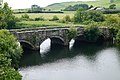 Pont Dysynni (partly in Bryn Crug community).jpg 4,000 × 2,672; 3.38 MB
-
 Pont Dysynni - geograph.org.uk - 5447258.jpg 1,600 × 1,200; 563 KB
-
 Pont Felindre - geograph.org.uk - 5540716.jpg 640 × 428; 80 KB
-
 Redundant Stile - geograph.org.uk - 923265.jpg 640 × 480; 214 KB
-
 Reed bed in Avon Dysynni - geograph.org.uk - 2973209.jpg 1,600 × 1,200; 422 KB
-
 Reed bed to marshland - geograph.org.uk - 2973295.jpg 1,600 × 1,200; 364 KB
-
 Replacement fence - geograph.org.uk - 2974434.jpg 1,600 × 1,200; 586 KB
-
 Rhydyronen railway station, Gwynedd - geograph.org.uk - 4661614.jpg 1,600 × 1,200; 519 KB
-
-
 Roadside cottages in Brynchrug - geograph.org.uk - 2974425.jpg 1,600 × 1,200; 415 KB
-
 Ruin on the skyline - geograph.org.uk - 2057055.jpg 800 × 600; 94 KB
-
 Scenery near Brynglas - geograph.org.uk - 6262377.jpg 5,472 × 3,648; 2.24 MB
-
 Sheep pasture, south of Nant y Mynach - geograph.org.uk - 5035652.jpg 1,024 × 768; 198 KB
-
 Sheep pastures on both sides of Afon Fethew - geograph.org.uk - 5035620.jpg 1,024 × 614; 116 KB
-
 Slate Fence near Rhyd - yr -onen - geograph.org.uk - 2808978.jpg 1,024 × 683; 610 KB
-
 Slate fence, Dolgoch Station, Talyllyn Railway - geograph.org.uk - 5035792.jpg 1,024 × 768; 182 KB
-
 Sluice at Ynysymaengwyn - geograph.org.uk - 2967321.jpg 1,600 × 1,200; 618 KB
-
 Small plantation in Nant Braich-y-rhiw - geograph.org.uk - 1881294.jpg 1,600 × 1,071; 683 KB
-
 Snowdonian barn - geograph.org.uk - 2057118.jpg 800 × 600; 172 KB
-
 Spring on Tarrenhendre - geograph.org.uk - 4876198.jpg 3,053 × 4,579; 3.95 MB
-
 Steep descent to Nant Braich-y-rhiw - geograph.org.uk - 1880480.jpg 1,600 × 1,071; 560 KB
-
 Stone heap from pasture "improvement" - geograph.org.uk - 1878926.jpg 800 × 536; 124 KB
-
 Summit of Pen Trum-gwr - geograph.org.uk - 2267716.jpg 1,306 × 979; 344 KB
-
 Tarren Cwm Ffernol - geograph.org.uk - 4062137.jpg 3,600 × 2,400; 3.81 MB
-
 Tarren Cwm-Ffernol - geograph.org.uk - 4063662.jpg 3,600 × 2,400; 4.21 MB
-
 Tarren Rhosfarch - geograph.org.uk - 4061998.jpg 3,600 × 2,400; 4.24 MB
-
 Tarrenhendre - geograph.org.uk - 4923278.jpg 640 × 480; 60 KB
-
 Tarrenhendre Summit - geograph.org.uk - 4875512.jpg 4,279 × 2,853; 3.4 MB
-
 Tent, Mynydd Esgairweddan - geograph.org.uk - 4876220.jpg 4,608 × 3,072; 3.31 MB
-
 Tent, Mynydd Esgairweddan - geograph.org.uk - 4876223.jpg 4,608 × 3,072; 3.22 MB
-
 The A 493 approaching Bryncrug - geograph.org.uk - 2974413.jpg 1,600 × 1,200; 343 KB
-

-
 The Afon Fathew valley under low cloud - geograph.org.uk - 5034813.jpg 1,024 × 615; 122 KB
-
 The B4405 approaching Dol-Deheuwydd - geograph.org.uk - 3401804.jpg 1,152 × 768; 520 KB
-
 The grave of Mary Jones - geograph.org.uk - 6107807.jpg 3,000 × 4,000; 2.6 MB
-
 The main road through Bryncrug - geograph.org.uk - 6107794.jpg 4,000 × 3,000; 2.38 MB
-
 The Motte of Castell Cynfal - geograph.org.uk - 5843771.jpg 768 × 1,024; 150 KB
-
 The new viewed from the old - geograph.org.uk - 2967652.jpg 1,600 × 1,200; 368 KB
-
 The road to Abergynolwyn from Bryncrug - geograph.org.uk - 6108425.jpg 4,000 × 3,000; 2.88 MB

.jpg)


,_Dolgoch,_Gwynedd_-_geograph.org.uk_-_3018254.jpg)


_-_geograph.org.uk_-_4590890.jpg)


.jpg)


