Category:Buckley Mountain (Utah)
Jump to navigation
Jump to search
mountain in Utah County, Utah, United States  | |||||
| Upload media | |||||
| Instance of | |||||
|---|---|---|---|---|---|
| Located in protected area | |||||
| Location | Utah County, Utah | ||||
| Mountain range | |||||
| Topographic prominence |
| ||||
 | |||||
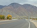
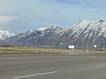
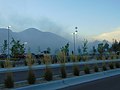
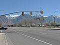
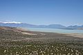
English: Media related to Buckley Mountain (Utah), a 9,511-foot (2,899 m) mountain in the Uinta-Wasatch-Cache National Forest in the southern Wasatch Range (southeast of Provo) in Utah County, Utah, United States.
Media in category "Buckley Mountain (Utah)"
The following 61 files are in this category, out of 61 total.
-
 BNSF Locomotives in the Provo UP yard, Dec 16.jpg 2,592 × 1,944; 2.15 MB
-
 Buckley Mountain (from Spanish Oaks Reservoir), May 17.jpg 2,592 × 1,944; 2.39 MB
-
 BYU Motion Picture Studio, ca. 1959.png 1,056 × 848; 962 KB
-
 Condominios.jpg 2,592 × 1,944; 749 KB
-
 East along Dry Creek from Main St, Spanish Fork, UT, Mar 17.jpg 2,592 × 1,944; 2.31 MB
-
 East at I-15 & SR-114 interchange, Provo, Utah, May 16.jpg 2,592 × 1,944; 2.33 MB
-
 East at N University Pkwy, N 550 W, & W 2230 N in Provo, Mar 15.jpg 2,816 × 2,112; 2.4 MB
-
 East at SR-75 & N 1100 W, Oct 16.jpg 2,592 × 1,944; 2.39 MB
-
 East on Lakeview Pkwy at 620 W, Oct 16.jpg 2,592 × 1,944; 2.35 MB
-
 East-southeast on SR-265 in Provo, Jul 16.jpg 2,592 × 1,944; 2.37 MB
-
 Flying J Travel Plaza, Springville, Utah, Oct 16.jpg 2,592 × 1,944; 2.38 MB
-
 Football field at Springville High School.JPG 2,816 × 2,112; 2.45 MB
-
 Front of public library in Springville, Utah, Jun 15.jpg 2,816 × 2,112; 2.59 MB
-
FrontRunner passing Provo Amtrak station, Feb 17.webm 1 min 10 s, 1,280 × 720; 48.95 MB
-
 FrontRunner train at Provo station, Feb 17.jpg 2,592 × 1,944; 2.38 MB
-
 Future sight of Spanish Fork Hospital, Mar 17.jpg 2,592 × 1,944; 2.37 MB
-
 Le Bus bus in Provo Utah, Apr 17.jpg 2,592 × 1,944; 2.46 MB
-
 Light tower at Spanish Fork-Springville Airport, Jun 16.jpg 1,944 × 2,592; 1.61 MB
-
 Looking north farther along Squaw Peak Road, Jun 04.jpg 1,280 × 960; 307 KB
-
 Macey's store in Provo, Utah.JPG 2,816 × 2,112; 2.46 MB
-
 Macey's store in Spanish Fork, Utah.JPG 2,816 × 2,112; 2.23 MB
-
 Mapleton, Utah cemetery.jpg 2,816 × 2,112; 2.33 MB
-
 North across Springville High School football field, Apr 17.jpg 2,592 × 1,944; 2.33 MB
-
 North along Dry Creek to its source, Mar 17.jpg 2,592 × 1,944; 2.06 MB
-
 North along US-89, from 2700 S, in Mapleton, Utah, May 16.jpg 2,592 × 1,944; 2.36 MB
-
 North at Big Hollow Park, Jun 15.jpg 2,816 × 2,112; 2.3 MB
-
 North at intersection of SR-51 & Expressway Ln, Apr 16.jpg 2,592 × 1,944; 2.43 MB
-
 North at Spanish Fork Pkwy & SR-51, Spanish Fork, Utah, Apr 16.jpg 2,592 × 1,944; 2.37 MB
-
 North at SR-51 & E 800 N Spanish Fork, Apr 16.jpg 2,592 × 1,944; 2.3 MB
-
 North at US-89 & SR-147 (W 1600 South) in Mapleton, Utah, Apr 16.jpg 2,592 × 1,944; 2.39 MB
-
 North at West 400 South (SR-77) railway overpass, Jan 09.jpg 2,816 × 2,112; 2.81 MB
-
 North on S Main St in Springville, Utah, Jun 16.jpg 2,592 × 1,944; 2.37 MB
-
 North on US-89, Springville-Mapleton, Jul 15.jpg 2,816 × 2,112; 2.64 MB
-
 North toward junction of US-89 and SR-75, Feb 16.jpg 2,816 × 2,112; 2.23 MB
-
 North US-189 (University Ave) with a Covered Shield - panoramio.jpg 1,600 × 1,200; 527 KB
-
 North US-189 With a Yet-to-be-Numbered Route Shield - panoramio.jpg 1,600 × 1,200; 668 KB
-
 North-northwest across Springville High School football field, Apr 17.jpg 2,592 × 1,944; 2.42 MB
-
 Northeast at West 400 South (SR-77) I-15 overpass (close up), Jan 09.jpg 2,816 × 2,112; 2.76 MB
-
 Northeast at West 400 South (SR-77) I-15 overpass, Jan 09.jpg 2,816 × 2,112; 2.7 MB
-
 Northeast on Dry Creek from S 1200 W, Mar 17.jpg 2,592 × 1,944; 2.25 MB
-
 Northeast on Dry Creek from S 950 W in Springville, Utah, March 2017.jpg 2,592 × 1,944; 2.19 MB
-
 Northeast on Dry Creek from W 1350 S, Springville, Utah, Mar 17.jpg 2,592 × 1,944; 1.94 MB
-
 Northeast on Dry Creek, Springville from Dry Creek Trial, UT, Mar 17.jpg 2,592 × 1,944; 2.11 MB
-
 Novell Building F in Provo 1994.jpg 1,179 × 789; 230 KB
-
 Provo East Mountains Panoramic View - 4 - South End - panoramio.jpg 3,264 × 2,448; 2.27 MB
-
 ProvoMntns.jpg 2,272 × 1,704; 1.37 MB
-
 Roundabout on BYU campus, east of Wilkinson Center 01.JPG 2,816 × 2,112; 2.3 MB
-
 Sizzler restaurant in south Provo, Utah, Aug 16.jpg 2,592 × 1,944; 2.41 MB
-
 Snowy Buckley Mountain, Utah County, Utah, Mar 17.jpg 2,592 × 1,944; 2.33 MB
-
 South on Lakeview Pkwy at 810 S, Oct 16.jpg 2,592 × 1,944; 2.32 MB
-
 South-southeast on SR-265 in Provo, Jul 16.jpg 2,592 × 1,944; 2.34 MB
-
 Southeast at East University Pkwy & University Place in Orem, Mar 15.jpg 2,816 × 2,112; 2.57 MB
-
 Southeast at the site of the former chimneys in Provo, Utah, Aug 16.jpg 2,592 × 1,944; 2.34 MB
-
 Southeast at University Pkwy & S Main Street in Orem, Mar 15.jpg 2,816 × 2,112; 2.24 MB
-
 Southeast on SR-265 in Provo, Jul 16.jpg 2,592 × 1,944; 2.4 MB
-
 Springville Utah Main Street with mountain background.JPG 4,912 × 3,264; 6.28 MB
-
 Stouffer Factory in North Springville - panoramio.jpg 1,280 × 960; 324 KB
-
 US 89, SR 147 (30275854297).jpg 4,032 × 3,024; 2.14 MB
-
 Utah Lake - panoramio.jpg 2,160 × 1,440; 597 KB
-
 Westside Elementary (39787994180).jpg 5,152 × 1,995; 2.11 MB
-
 Westside Elementary School (Utah) 01.JPG 2,816 × 2,112; 2.5 MB

,_May_17.jpg)


_in_Mapleton,_Utah,_Apr_16.jpg)
_railway_overpass,_Jan_09.jpg)


_with_a_Covered_Shield_-_panoramio.jpg)


_I-15_overpass_(close_up),_Jan_09.jpg)
_I-15_overpass,_Jan_09.jpg)


.jpg)

_01.JPG)
.jpg)