Category:Buildings in Leek
Jump to navigation
Jump to search
Wikimedia category | |||||
| Upload media | |||||
| Instance of | |||||
|---|---|---|---|---|---|
| Category combines topics |
| ||||
| |||||
Subcategories
This category has the following 17 subcategories, out of 17 total.
A
- All Saints' Church, Leek (4 F)
- Arch Lodge, Leek (6 F)
B
- Birchall Tunnel (1 F)
C
- Leek Clock Tower, Staffordshire (21 F)
D
- Dieulacres Abbey (12 F)
E
G
- Greystones, Leek (10 F)
J
- St John's Church, Leek (4 F)
L
- Leek railway station (2 F)
- St Luke's Church, Leek (3 F)
M
- St Mary's Church, Leek (5 F)
N
P
T
- Trinity Church, Leek (11 F)
Media in category "Buildings in Leek"
The following 188 files are in this category, out of 188 total.
-
 1 and 3 Stockwell Street, Leek.jpg 1,600 × 1,200; 585 KB
-
 1-6 Leonard Street - geograph.org.uk - 2541303.jpg 1,280 × 853; 151 KB
-
 10 & 12 Westwood Road - geograph.org.uk - 2542473.jpg 1,280 × 854; 241 KB
-
 10, Stockwell Street, Leek 01.jpg 3,000 × 4,000; 4.53 MB
-
 114-116 Portland Street North - geograph.org.uk - 2543792.jpg 1,280 × 835; 206 KB
-
 12 Haywood Street, Leek.jpg 1,065 × 1,600; 763 KB
-
 16 and 18, Stockwell Street, Leek.jpg 4,103 × 3,138; 2.09 MB
-
 19 St Edward Street, Leek.jpg 1,600 × 1,200; 635 KB
-
 19 St. Edwards Street, Leek, July 2019.jpg 4,032 × 3,024; 3.57 MB
-
 2, 2A & 4 Church Street - geograph.org.uk - 2543758.jpg 1,280 × 853; 205 KB
-
 2, 2A and 4 Church Street, Leek.jpg 1,600 × 1,200; 723 KB
-
 2, 3 and 4 Clerk Bank, Leek.jpg 1,280 × 853; 240 KB
-
 21 and 22 Market Place, Leek, June 2019.jpg 1,536 × 2,048; 1 MB
-
 23 and 25 Derby Street, Leek.jpg 1,600 × 1,200; 560 KB
-
 23 Market Place, Leek, June 2019.jpg 1,536 × 2,048; 1.02 MB
-
 23 Market Place, Leek.jpg 1,200 × 1,600; 558 KB
-
 24 Market Place, Leek, June 2019.jpg 1,536 × 2,048; 855 KB
-
 24, Market Place, Leek.jpg 3,000 × 4,000; 2.32 MB
-
 240, Abbey Green Road, Leek.jpg 4,000 × 3,000; 2.45 MB
-
 27-33 London Street, Leek.jpg 1,280 × 853; 226 KB
-
 28-34 Ashbourne Road - geograph.org.uk - 2463378.jpg 1,280 × 853; 212 KB
-
 35-41 London Street, Leek.jpg 1,280 × 853; 251 KB
-
 39 St Edwards Street, Leek.jpg 1,200 × 1,600; 634 KB
-
 39, St Edward Street, Leek.jpg 1,661 × 1,800; 1,000 KB
-
 43 and 45, St Edward Street, Leek.jpg 4,000 × 3,000; 4.73 MB
-
 5 and 7 Sheep Market, Leek.jpg 1,600 × 1,200; 607 KB
-
 54 St Edwards Street, Leek.jpg 1,600 × 1,200; 644 KB
-
 56 and 58 St Edwards Street, Leek.jpg 1,600 × 1,200; 676 KB
-
 56 and 58, St Edward Street, Leek.jpg 4,000 × 3,000; 2.44 MB
-
 62 St Edwards Street, Leek.jpg 1,600 × 1,200; 579 KB
-
 64 St Edward Street, Leek.jpg 1,600 × 1,200; 698 KB
-
 64, St Edward Street, Leek.jpg 1,800 × 1,474; 957 KB
-
 70 and 72 St Edwards Street, Leek.jpg 1,600 × 1,200; 644 KB
-
 8 10 and 12 Sheep Market, Leek.jpg 1,600 × 1,200; 515 KB
-
 9 and 10, Market Place, Leek.jpg 3,000 × 4,000; 4.57 MB
-
 9 to 12 Overton Bank, Leek.jpg 1,600 × 1,200; 764 KB
-
 A fine memorial - geograph.org.uk - 230489.jpg 480 × 640; 124 KB
-
 Abdul Spice - geograph.org.uk - 3251011.jpg 533 × 800; 76 KB
-

-
 Almshouses on Broad Street, Leek - geograph.org.uk - 4907957.jpg 1,200 × 772; 251 KB
-
 Almshouses, Broad Street, Leek.jpg 1,600 × 1,200; 564 KB
-
 Antiques and Interiors - geograph.org.uk - 3482970.jpg 2,736 × 3,648; 3.86 MB
-
 Archway into factory courtyard - geograph.org.uk - 2541340.jpg 853 × 1,280; 248 KB
-
 Ash Almshouses, Leek.jpg 4,000 × 3,000; 2.23 MB
-
 Back alley doorway - geograph.org.uk - 1710732.jpg 1,067 × 1,600; 410 KB
-
 Back alley in Leek - geograph.org.uk - 1710721.jpg 1,067 × 1,600; 399 KB
-
 Bank House, Leek.jpg 1,600 × 1,200; 610 KB
-
 Barnfields Canal Aqueduct.jpg 4,000 × 3,000; 4.76 MB
-
 Boots shop at 13 Derby Street, Leek.jpg 1,600 × 1,200; 558 KB
-
 Britannia Building Society HQ - geograph.org.uk - 516672.jpg 640 × 480; 132 KB
-
 Buildings on St Edwards Street, Leek - geograph.org.uk - 4891731.jpg 1,200 × 799; 282 KB
-
 Cemetery Chapels in Leek 01.jpg 4,000 × 3,000; 4.67 MB
-
 Cemetery Chapels in Leek 02.jpg 3,000 × 4,000; 4.92 MB
-
 Cemetery Chapels in Leek 03.jpg 3,000 × 4,000; 4.82 MB
-
 Chemical factory, Macclesfield Road - geograph.org.uk - 2542496.jpg 1,280 × 853; 173 KB
-
 Chemical factory, Macclesfield Road - geograph.org.uk - 2542500.jpg 1,280 × 853; 237 KB
-
 Closed corner shop - geograph.org.uk - 1710837.jpg 1,600 × 1,066; 303 KB
-
 College, New Street, Leek - geograph.org.uk - 3938669.jpg 1,600 × 1,200; 526 KB
-
 College, Union Street, Leek - geograph.org.uk - 3938683.jpg 1,200 × 1,600; 520 KB
-
 Leek - St Marys Church, Compton - geograph.org.uk - 1937226.jpg 1,200 × 1,600; 349 KB
-
 Condlyffe Almshouses - the northern end - geograph.org.uk - 1403000.jpg 640 × 480; 126 KB
-
 Condlyffe Almshouses, Leek.jpg 4,000 × 3,000; 4.67 MB
-
 Condlyffe Almshouses, Nos 1 and 2 - geograph.org.uk - 3483001.jpg 3,648 × 2,736; 3.56 MB
-
 Conservative Working Men's Club, Leek.jpg 1,600 × 1,200; 589 KB
-
 Corner of Compton and Brook Street - geograph.org.uk - 3483068.jpg 3,648 × 2,736; 3.52 MB
-
 Corner of St Edwards Street and High Street, Leek - geograph.org.uk - 3544817.jpg 1,600 × 1,200; 525 KB
-
 Court No. 10, Leek - geograph.org.uk - 3483350.jpg 3,648 × 2,736; 3.44 MB
-
 Dieu-La-Cres Abbey farmhouse and stables 01.jpg 4,000 × 3,000; 4.75 MB
-
 Dieu-La-Cres Abbey farmhouse and stables 02.jpg 4,000 × 3,000; 4.62 MB
-
 Disused building with sundial, Haregate Road, Leek - geograph.org.uk - 3554140.jpg 1,600 × 1,200; 612 KB
-
 Disused factory, Barngate Street, Leek - geograph.org.uk - 3585058.jpg 1,600 × 1,200; 570 KB
-
 Disused Terraced Houses - geograph.org.uk - 4364471.jpg 640 × 428; 91 KB
-
 Edward Street, Leek.jpg 2,304 × 1,728; 867 KB
-
 Entrance gate and flanking wall to Condlyffe Almshouses.jpg 3,070 × 4,052; 2.84 MB
-
 Ford House, Leek.jpg 4,000 × 3,000; 3.04 MB
-
 Ford House, Market Street, Leek.jpg 1,600 × 1,200; 534 KB
-
 Former Grammar School, Leek.jpg 1,280 × 837; 283 KB
-
 Former Slimma clothing factory - geograph.org.uk - 2541440.jpg 1,280 × 860; 264 KB
-
 Foxlowe Arts Centre - geograph.org.uk - 3251013.jpg 800 × 602; 123 KB
-
 Foxlowe, Leek.jpg 2,880 × 1,913; 4.21 MB
-
 Friends Meeting House, Leek.jpg 1,600 × 1,200; 905 KB
-
 Front entrance of Slimma factory, James Street, Leek - geograph.org.uk - 3586438.jpg 1,200 × 1,600; 808 KB
-
 George Massey's ginger beer factory - geograph.org.uk - 2541350.jpg 1,280 × 853; 239 KB
-
 Getliffes Yard - Leek - geograph.org.uk - 2595598.jpg 2,880 × 1,913; 5.23 MB
-
 Getliffes Yard - panoramio.jpg 1,944 × 2,592; 1.3 MB
-
 HarrisonPark.jpg 1,200 × 1,189; 119 KB
-
 House at Poolend - geograph.org.uk - 2377885.jpg 2,979 × 2,069; 2.58 MB
-
 Houses on Broad Street, Leek - geograph.org.uk - 4907967.jpg 1,020 × 1,200; 348 KB
-
 Houses on Haregate Road - geograph.org.uk - 2034243.jpg 3,732 × 2,494; 4.41 MB
-
 Houses on Queen Street - geograph.org.uk - 2463352.jpg 1,280 × 858; 232 KB
-
 Housey House, Broad St, Leek - geograph.org.uk - 4747873.jpg 640 × 428; 95 KB
-
 Industrial building, Cornhill Street, Leek - geograph.org.uk - 3482978.jpg 3,648 × 2,736; 3.99 MB
-
 Inside the Butter Market - geograph.org.uk - 949682.jpg 480 × 640; 111 KB
-

-
 Junction of Sheep Market and Dog Lane - Leek - geograph.org.uk - 2595608.jpg 2,880 × 1,913; 4.46 MB
-
 King Street, Leek.jpg 1,280 × 853; 273 KB
-
 Leek - Haywood Interiors - geograph.org.uk - 1937551.jpg 1,200 × 1,600; 490 KB
-
 Leek - King Street - geograph.org.uk - 1937236.jpg 1,600 × 1,200; 582 KB
-
 Leek - Leonard Street - geograph.org.uk - 1937221.jpg 1,600 × 1,200; 471 KB
-
 Leek - Slimma Factory - geograph.org.uk - 1937392.jpg 1,600 × 1,200; 408 KB
-
 Leek - Southbank Street - geograph.org.uk - 1937213.jpg 1,600 × 1,200; 486 KB
-
 Leek - Wesleyan Chapel - geograph.org.uk - 1937399.jpg 1,200 × 1,600; 410 KB
-
 Leek 2015 01.jpg 3,456 × 5,184; 4.74 MB
-
 Leek 2015 03.jpg 5,184 × 3,456; 4.57 MB
-
 Leek 2015 05.jpg 5,184 × 3,456; 4.77 MB
-
 Leek 2015 07.jpg 5,184 × 3,456; 3.37 MB
-
 Leek 2015 12.jpg 3,455 × 4,392; 3.93 MB
-
 Leek 2015 13.jpg 5,184 × 3,456; 3.37 MB
-
 Leek 2015 16.jpg 3,456 × 5,184; 4.75 MB
-
 Leek 2015 17.jpg 3,456 × 5,184; 6.05 MB
-
 Leek 2015 18.jpg 3,456 × 5,184; 5.11 MB
-
 Leek 3.JPG 1,280 × 960; 343 KB
-
 Leek 4.JPG 1,280 × 960; 319 KB
-
 Leek 7.JPG 1,280 × 960; 377 KB
-
 Leek Brook junction signal box.jpg 768 × 1,024; 645 KB
-
 Leek Cemetery - geograph.org.uk - 227912.jpg 640 × 500; 86 KB
-
 Leek Central Club - geograph.org.uk - 2358299.jpg 800 × 632; 164 KB
-
 Leek Central Club - geograph.org.uk - 3557678.jpg 1,200 × 1,600; 490 KB
-
 Leek Fire Station - geograph.org.uk - 2377875.jpg 2,644 × 1,747; 1.92 MB
-
 Leek fire station - geograph.org.uk - 607308.jpg 640 × 427; 210 KB
-
 Leek House dated 1723.jpg 2,304 × 1,728; 1.06 MB
-
 Leek Houses dated 1696.jpg 2,304 × 1,728; 748 KB
-
 Leek old fire station - geograph.org.uk - 2024513.jpg 640 × 427; 211 KB
-
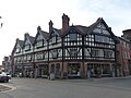
 Leek Tudor buildings, Staffs.JPG 2,304 × 1,728; 909 KB
-
 Leek Tunnel.JPG 2,519 × 1,987; 822 KB
-
 Leek, Butter Market - geograph.org.uk - 4687037.jpg 760 × 1,024; 159 KB
-
 Leek, House dated 1724.jpg 2,304 × 1,728; 1.02 MB
-
 Leek, House dated 1760.jpg 2,304 × 1,728; 1.03 MB
-
 Leek, The Home and Colonial Stores (closed).jpg 3,224 × 2,871; 1.16 MB
-
 Leek, This was the entrance to Mount Pleasant Church.jpg 2,304 × 1,728; 1.22 MB
-
 Leek, View 2.JPG 2,304 × 1,728; 919 KB
-
 Leek, View 4.JPG 2,304 × 1,728; 939 KB
-
 Leek, View 5.jpg 2,304 × 1,728; 795 KB
-
 Leek, Wilkes Head - geograph.org.uk - 4687011.jpg 1,024 × 758; 182 KB
-
 Library window - geograph.org.uk - 2358706.jpg 587 × 800; 190 KB
-
 Library window detail - geograph.org.uk - 2358763.jpg 800 × 594; 195 KB
-
 Listed footbridge over River Churnet, Leek.jpg 4,000 × 3,000; 4.91 MB
-
 London Street, Leek - geograph.org.uk - 4608622.jpg 1,600 × 1,200; 605 KB
-
 Manchester and Liverpool Banking Co, House.jpg 1,728 × 2,304; 750 KB
-
 Market Place, Leek.jpg 1,600 × 1,067; 345 KB
-
 Market Square, Leek.JPG 1,536 × 2,048; 629 KB
-
 Maude Institute, Leek.jpg 1,280 × 850; 201 KB
-
 Morrisons' store, Leek - geograph.org.uk - 1614121.jpg 640 × 480; 88 KB
-
 Nat West Bank- coat of arms - geograph.org.uk - 2358265.jpg 546 × 800; 108 KB
-
 Nat West Bank- front detail - geograph.org.uk - 2358255.jpg 645 × 800; 122 KB
-
 Nat West Bank- main entrance - geograph.org.uk - 2358231.jpg 520 × 800; 118 KB
-
 National Westminster Bank, Leek.jpg 4,000 × 3,000; 2.1 MB
-
 NatWest Bank, Leek.jpg 800 × 721; 128 KB
-
 Old building in Strangman Street, Leek - geograph.org.uk - 3544978.jpg 1,200 × 1,600; 565 KB
-
 Old building near Haregate Road, Leek - geograph.org.uk - 3548611.jpg 1,600 × 1,200; 568 KB
-
 Old building near Haregate Road, Leek - geograph.org.uk - 3548631.jpg 1,600 × 1,200; 468 KB
-
 Old building near Haregate Road, Leek - geograph.org.uk - 4792225.jpg 1,600 × 1,200; 656 KB
-
 Overton Bank House, Leek.jpg 1,600 × 1,200; 578 KB
-
 Parker Street - geograph.org.uk - 1709273.jpg 1,600 × 1,067; 305 KB
-
 Penny Bank House, part frontage - geograph.org.uk - 2541285.jpg 1,280 × 919; 294 KB
-
 Plaque on 54 St Edwards Street, Leek.jpg 1,600 × 1,200; 803 KB
-
 Plaque on 56 St Edwards Street, Leek.jpg 1,600 × 1,200; 614 KB
-
 Plaque over the door - geograph.org.uk - 2358677.jpg 577 × 800; 151 KB
-
 Premier Inn, Leek, staffordshire, UK.jpeg 4,320 × 2,432; 5.52 MB
-
 Public Conveniences, Mill Street, Leek.jpg 1,280 × 853; 274 KB
-
 Sanders Building - geograph.org.uk - 2541298.jpg 853 × 1,280; 155 KB
-
 Sanders Buildings, Leek.jpg 2,304 × 1,728; 875 KB
-
 Signal Box, Leek Brook Junction, Churnet Valley Railway - geograph.org.uk - 4939603.jpg 3,125 × 4,688; 2.97 MB
-

-
 Spout Hall, Leek.jpg 1,600 × 1,200; 622 KB
-
 St Edwards Vicarage, July 2019.jpg 4,032 × 3,024; 3.75 MB
-
 St Edwards Vicarage, Leek.jpg 1,600 × 1,200; 691 KB
-
 St. Edward Street, Leek - geograph.org.uk - 3483286.jpg 3,619 × 2,439; 3.35 MB
-
 Supersport on Macclesfield Road, Leek - geograph.org.uk - 4891713.jpg 1,200 × 832; 383 KB
-
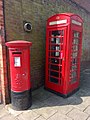 Telephone kiosk, Market Place, Leek, June 2019.jpg 1,536 × 2,048; 893 KB
-
 Terrace in Bath Street, Leek - geograph.org.uk - 2426682.jpg 640 × 480; 96 KB
-
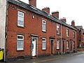
 Terraced houses on Ashbourne Road - geograph.org.uk - 1707722.jpg 1,600 × 1,067; 250 KB
-
 Terraced houses on Queen Street - geograph.org.uk - 2463339.jpg 1,280 × 959; 294 KB
-
 The Butter Market, Leek - geograph.org.uk - 271810.jpg 480 × 640; 70 KB
-
 The co-operative bank, leek, staffordshire, UK.jpeg 4,320 × 2,432; 4.58 MB
-
 The Maude Church Institute Building, Leek.jpg 2,098 × 1,602; 704 KB
-
 The Smithfield Centre, Leek - geograph.org.uk - 2976154.jpg 640 × 482; 43 KB
-
 To remind me where I was. - geograph.org.uk - 635648.jpg 640 × 427; 62 KB
-
 Victoria Buildings, Leek.jpg 4,000 × 3,000; 2.11 MB
-
 Westwood College - geograph.org.uk - 452893.jpg 640 × 519; 117 KB
-
 Westwood College - geograph.org.uk - 452898.jpg 640 × 480; 160 KB
-
 Woolworths, Leek - geograph.org.uk - 1283004.jpg 480 × 640; 70 KB
-
 Yorkshire Trading Company, Leek - geograph.org.uk - 1600428.jpg 640 × 480; 107 KB
-
 Church Street, Leek - geograph.org.uk - 271816.jpg 640 × 480; 68 KB
-
 Condlyffe Almshouses - the southern end - geograph.org.uk - 1403006.jpg 640 × 480; 120 KB
-
 Leek bowling club - geograph.org.uk - 446461.jpg 640 × 480; 74 KB
-
 Leek Tunnel - geograph.org.uk - 3934.jpg 600 × 418; 37 KB
-
 Railway Cottages - geograph.org.uk - 224641.jpg 640 × 480; 89 KB


_-_geograph.org.uk_-_4666888.jpg)


.jpg)


