Category:Buildings in the Metropolitan Borough of Wirral
Jump to navigation
Jump to search

Wikimedia category | |||||
| Upload media | |||||
| Instance of | |||||
|---|---|---|---|---|---|
| |||||
Subcategories
This category has the following 58 subcategories, out of 58 total.
*
A
B
- Brimstage old school house (3 F)
C
D
E
F
G
- Grange Borehole (3 F)
H
L
N
- Newton Borehole (6 F)
O
P
R
S
T
- Wirral in Tower Block Archive (19 F)
Media in category "Buildings in the Metropolitan Borough of Wirral"
The following 101 files are in this category, out of 101 total.
-
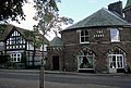
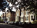 Alton Road, Oxton - DSC09387.JPG 3,648 × 2,736; 3.48 MB
-
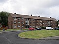
 Apartments in West Kirby - geograph.org.uk - 233238.jpg 640 × 480; 78 KB
-
 Beechwood, Birkenhead - DSC03598.JPG 3,648 × 2,736; 3.62 MB
-
 Beechwood, Birkenhead - DSC03600.JPG 3,648 × 2,736; 3.52 MB
-
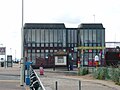 Benkid77 West Kirby sailing centre 200709.JPG 2,240 × 1,680; 851 KB
-
 Biofortuna, Bromborough.jpg 4,608 × 3,456; 3.58 MB
-
 Blundells Drive, Moreton - IMG 0393.JPG 4,320 × 3,240; 2.98 MB
-
 Bridge House, West Kirby.JPG 4,320 × 3,240; 2.81 MB
-
 Bromborough - DSC03487.JPG 3,648 × 2,736; 3.65 MB
-
 Building in Caldy (1).JPG 3,240 × 4,320; 4.05 MB
-
 Building in Caldy (2).JPG 3,240 × 4,320; 3.9 MB
-
 Building in Caldy (3).JPG 4,320 × 3,240; 3.24 MB
-
 Building in Caldy Village (1).JPG 3,240 × 4,320; 2.95 MB
-
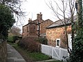
 Building, Devonshire Place, Oxton - DSC09378.JPG 3,648 × 2,736; 3.42 MB
-
 Building, Wirral - scan01.jpg 2,472 × 1,728; 2.95 MB
-
 Cafe at Meols Common-by-chris-croft.jpg 640 × 480; 73 KB
-
 Carr Hall, Meols - geograph.org.uk - 280208.jpg 640 × 480; 132 KB
-
 Coastguard station at Dove Point Meols-by-Raymond-Knapman.jpg 640 × 479; 50 KB
-
 Colour Contrast - geograph.org.uk - 690384.jpg 640 × 398; 107 KB
-
 Converted Barn near Warrens Nurseries - geograph.org.uk - 120610.jpg 640 × 480; 82 KB
-
 Corner House - geograph.org.uk - 689935.jpg 640 × 398; 93 KB
-
 De Grouchy Street - geograph.org.uk - 220666.jpg 640 × 480; 75 KB
-
 Dental laboratory, Woodchurch - IMG 0890.JPG 4,320 × 3,240; 3.79 MB
-
 Electrical substation on Bromsgrove Road, Greasby.JPG 4,000 × 3,000; 2.98 MB
-
 Electrical substation, Tabley Close, Oxton - IMG 0963.JPG 4,320 × 3,240; 3.98 MB
-
 Former Tranmere volunteer drill hall (geograph.org.uk 4096912).jpg 640 × 479; 81 KB
-
 Frankby Hamlet - geograph.org.uk - 689939.jpg 640 × 409; 81 KB
-
 G.J.'s Cafe, Thurstaston - geograph.org.uk - 1383392.jpg 640 × 480; 63 KB
-
 Greasby Health Centre - geograph.org.uk - 889659.jpg 640 × 480; 63 KB
-
 Health Centre - geograph.org.uk - 689952.jpg 640 × 427; 76 KB
-
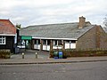
 Heritage Centre - geograph.org.uk - 154699.jpg 640 × 480; 91 KB
-
 Holm Hill, West Kirby.JPG 2,240 × 1,680; 909 KB
-
 Homes in Greasby - geograph.org.uk - 689954.jpg 640 × 448; 105 KB
-
 House in Caldy (3).JPG 4,320 × 3,240; 4.87 MB
-
 House in Caldy (4).JPG 4,320 × 3,240; 3.82 MB
-
 House in Caldy (5).JPG 4,320 × 3,240; 3.27 MB
-
 House in Caldy (7).JPG 4,320 × 3,240; 2.99 MB
-
 House, Montgomery Hill, Wirral - IMG 1121.JPG 4,320 × 3,240; 3.9 MB
-
 Houses, Landican Road - geograph.org.uk - 1412350.jpg 640 × 480; 75 KB
-
 Houses, Sandlea Park, West Kirby - DSC04625.JPG 3,648 × 2,736; 3.55 MB
-
 Houses, West Kirby promenade - IMG 1074.JPG 4,320 × 3,240; 2.35 MB
-
 Hudson Place, Wirral - IMG 0467.JPG 4,320 × 3,240; 3.85 MB
-
 Ice cream shop and first aid post, West Kirby - IMG 1087.JPG 4,320 × 3,240; 1.97 MB
-
 In The Woods - geograph.org.uk - 689933.jpg 640 × 398; 111 KB
-
 Irby Club (1).JPG 4,608 × 3,456; 3.51 MB
-
 Irby Club (2).JPG 4,608 × 3,456; 3.43 MB
-
 Irby Dental Practice - IMG 0883.JPG 4,320 × 3,240; 3.08 MB
-
 Irby telephone exchange (1).JPG 4,320 × 3,240; 3.04 MB
-
 Irby telephone exchange (2).JPG 4,320 × 3,240; 3.44 MB
-
 Irbyside Cottages - geograph.org.uk - 689922.jpg 640 × 425; 112 KB
-
 Lakeside Orthodontics, West Kirby - IMG 1090.JPG 3,240 × 4,320; 2.54 MB
-
 Landican Village - geograph.org.uk - 593028.jpg 640 × 480; 77 KB
-
 Landican Village - geograph.org.uk - 71288.jpg 640 × 480; 157 KB
-
 Liverpool Victoria Rowing Club - Wirral Rowing Centre - IMG 0340.JPG 4,320 × 3,240; 3.17 MB
-
 Meadowcroft, Spital Road, Bromborough.JPG 4,320 × 3,240; 3.04 MB
-
 New commercial units, Bidston Link Road, Wallasey.JPG 4,608 × 3,456; 3.41 MB
-
 Old building, Woodchurch, Wirral.jpg 5,152 × 3,864; 7.87 MB
-
 Old Pump Lane - geograph.org.uk - 689953.jpg 640 × 399; 96 KB
-
 Old sandstone building on Hilbre View, West Kirby (1).JPG 3,240 × 4,320; 4.17 MB
-
 Old sandstone building on Hilbre View, West Kirby (2).JPG 3,240 × 4,320; 3.91 MB
-
 Old sandstone building on Hilbre View, West Kirby (3).JPG 4,320 × 3,240; 3.75 MB
-
 On The Market - geograph.org.uk - 689937.jpg 640 × 408; 92 KB
-
 Opposite the cemetery - geograph.org.uk - 689936.jpg 640 × 389; 122 KB
-
 Pensby Wood adult day centre (1).JPG 4,320 × 3,240; 4.29 MB
-
 Pensby Wood adult day centre (2).JPG 4,320 × 3,240; 4.15 MB
-
 Poulton Victoria Sports & Social Club, Wallasey.JPG 3,648 × 2,736; 3.66 MB
-
 Quest International, Bromborough Pool - geograph.org.uk - 209741.jpg 640 × 480; 73 KB
-
 Raby Hall - geograph.org.uk - 131937.jpg 640 × 480; 60 KB
-
 Road and Building, Wirral - scan01.jpg 3,456 × 3,920; 9.53 MB
-
 Roklis Building, Bromborough - DSC04633.JPG 3,648 × 2,736; 3.49 MB
-
 Royden Road, Overchurch - IMG 0468.JPG 4,320 × 3,240; 2.58 MB
-
 Royden Road, Overchurch - IMG 0470.JPG 4,320 × 3,240; 2.88 MB
-
 School Lane Cottage - geograph.org.uk - 689778.jpg 640 × 453; 137 KB
-
 Sea front apartments-by-Steve--F.jpg 640 × 356; 52 KB
-
 Semi Ds - geograph.org.uk - 689928.jpg 640 × 398; 103 KB
-
 Shady View - geograph.org.uk - 667988.jpg 640 × 427; 55 KB
-
 Shelter at Hilbre View, West Kirby.jpg 5,152 × 3,864; 7.4 MB
-
 Shore Cottage, Thurstaston - geograph.org.uk - 167566.jpg 640 × 480; 59 KB
-
 Shore Cottage, Thurstaston - geograph.org.uk - 167569.jpg 640 × 480; 60 KB
-
 Small Housing Block. - geograph.org.uk - 637868.jpg 640 × 480; 63 KB
-
 Spring Cottage, Bromborough - geograph.org.uk - 105942.jpg 640 × 480; 60 KB
-
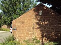
 Stone building, Newton.JPG 3,648 × 2,736; 3.53 MB
-
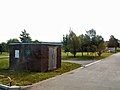
 Storage tank, Bromborough - modified.PNG 1,788 × 1,343; 2.44 MB
-
 Storage tank, Bromoborough.JPG 4,320 × 3,240; 2.85 MB
-
 Substation - geograph.org.uk - 46259.jpg 640 × 480; 108 KB
-
 Swimming baths building at The Oval, Wirral.jpg 800 × 600; 97 KB
-
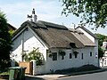 Thatched house, West Kirby.JPG 2,240 × 1,680; 903 KB
-

-
 The Nook - geograph.org.uk - 689938.jpg 640 × 401; 74 KB
-
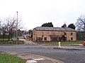
 The old dairy, Greasby.JPG 3,648 × 2,736; 3.57 MB
-
 The Old Village, West Kirby - geograph.org.uk - 39808.jpg 640 × 480; 61 KB
-
 The Smithy, Caldy (1).JPG 4,320 × 3,240; 3.03 MB
-
 The Smithy, Caldy (2).JPG 4,320 × 3,240; 2.86 MB
-
 Thimble Inn House, Meols - geograph.org.uk - 155015.jpg 640 × 480; 61 KB
-
 Thornton Hough - geograph.org.uk - 132181.jpg 640 × 480; 62 KB
-
 Thornton Hough - geograph.org.uk - 132182.jpg 640 × 480; 60 KB
-
 Thornton Hough - geograph.org.uk - 2497.jpg 640 × 431; 64 KB
-
 Thornton Hough Village Hall - geograph.org.uk - 1029157.jpg 640 × 480; 73 KB
-
 White Bungalow - geograph.org.uk - 689898.jpg 640 × 398; 82 KB
-
 White Terrace - geograph.org.uk - 689955.jpg 640 × 415; 81 KB
-
 Willow Cottage, West Kirby - geograph.org.uk - 684317.jpg 640 × 480; 105 KB


.JPG)
.JPG)
.JPG)
.JPG)


.jpg)


.JPG)
.JPG)
.JPG)
.JPG)


.JPG)
.JPG)

.JPG)
.JPG)


.JPG)
.JPG)
.JPG)


.JPG)
.JPG)


.JPG)
.JPG)


