Category:Burgruine Stollburg
Jump to navigation
Jump to search
This is the category of the Bavarian Baudenkmal (cultural heritage monument) with the ID Unknown
|
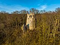
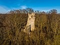
Deutsch: Ruine einer Höhenburg bei 442,9 Meter auf dem 476 Meter hohen Stollberg, Frankens höchster Weinlage, auf der Gemarkung Handthal, Ortsteil des Marktes Oberschwarzach im unterfränkischen Landkreis Schweinfurt, Bayern, Deutschland
castle ruin .JPG) | |||||
| Upload media | |||||
| Instance of | |||||
|---|---|---|---|---|---|
| Location | Oberschwarzach, Schweinfurt, Lower Franconia, Bavaria, Germany | ||||
| Heritage designation | |||||
 | |||||
Media in category "Burgruine Stollburg"
The following 6 files are in this category, out of 6 total.
-
 Burgruine Stollburg-20220213-RM-162018.jpg 5,272 × 3,948; 17.83 MB
-
 Burgruine Stollburg-20220213-RM-162035.jpg 5,272 × 3,948; 16.9 MB
-
 Burgruine Stollburg-20220213-RM-162108.jpg 5,272 × 3,948; 20.3 MB
-
 Stollberg.JPG 3,456 × 2,304; 385 KB
-
 Stollburg (1).JPG 2,304 × 3,456; 392 KB
-
 Stollburg (2).JPG 2,304 × 3,456; 388 KB


.JPG)