Category:Burntisland
Перейти к навигации
Перейти к поиску

town in Fife, Scotland, UK  | |||||
| Медиафайл | |||||
| Это частный случай понятия |
| ||||
|---|---|---|---|---|---|
| Местонахождение |
| ||||
| Численность населения |
| ||||
| Высота над уровнем моря |
| ||||
 | |||||
Подкатегории
В этой категории отображается 13 подкатегорий из имеющихся 13.
B
- The Binn (14 Ф)
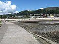
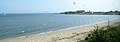
- Burntisland Beach (19 Ф)
- Burntisland Burgh Chambers (2 Ф)
- Burntisland cemetery (2 Ф)
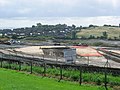
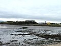
- Burntisland docks (32 Ф)
- Burntisland Links (5 Ф)
- Burntisland railway station (11 Ф)
- Burntisland viaduct (4 Ф)
E
- Erskine church, Burntisland (3 Ф)
P
- Burntisland parish church (28 Ф)
R
- Rossend Castle (10 Ф)
Файлы в категории «Burntisland»
Показаны 200 файлов из 323, находящихся в данной категории.
(Предыдущая страница) (Следующая страница)-
 'Harry McGill' - geograph.org.uk - 5732701.jpg 5620 × 3199; 2,31 Мб
-
 1 GL Bolt, Burntisland Town Hall - geograph.org.uk - 6121060.jpg 640 × 427; 64 Кб
-

-
-
 18thC doorway, Somerville Square - geograph.org.uk - 2371161.jpg 640 × 486; 55 Кб
-

-
-
 2016 - January Fife Walk (24280596025).jpg 4777 × 3184; 1009 Кб
-
-
 A View of Burntisland.jpg 450 × 289; 32 Кб
-

-
 A woodgatherer returns - geograph.org.uk - 1045576.jpg 640 × 486; 56 Кб
-
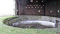
 Access tunnel - geograph.org.uk - 678940.jpg 640 × 541; 71 Кб
-
 Air shaft (2) - geograph.org.uk - 766089.jpg 640 × 426; 80 Кб
-
 Air shaft (3) - geograph.org.uk - 766090.jpg 640 × 426; 46 Кб
-
 Air shaft - geograph.org.uk - 765213.jpg 640 × 426; 100 Кб
-
 Aluminium works, Burntisland. - geograph.org.uk - 42617.jpg 640 × 480; 92 Кб
-
 Anti-glider poles, Burntisland - geograph.org.uk - 5226370.jpg 1024 × 683; 176 Кб
-
 Arthur's Seat - geograph.org.uk - 2701693.jpg 640 × 360; 158 Кб
-
 B923 - geograph.org.uk - 75065.jpg 640 × 480; 332 Кб
-
 Backwater beside the railway - geograph.org.uk - 3408418.jpg 1600 × 960; 139 Кб
-
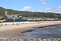
 Bay between Burntisland and Kinghorn - geograph.org.uk - 2508628.jpg 1024 × 768; 77 Кб
-
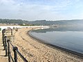
 Beach, Burntisland - geograph.org.uk - 5225650.jpg 1024 × 683; 204 Кб
-
 Beach, Burntisland - geograph.org.uk - 5225655.jpg 1024 × 683; 228 Кб
-
 Beacon Leisure Centre, Burntisland - geograph.org.uk - 4557319.jpg 4313 × 2136; 1,22 Мб
-

-
 Benchmark on gatepost, Dunearn - geograph.org.uk - 6121076.jpg 640 × 427; 100 Кб
-
 Black Rocks viewed from Burntisland - geograph.org.uk - 5543374.jpg 640 × 480; 89 Кб
-
 Black Rocks, Burntisland, from the air - geograph.org.uk - 6228594.jpg 1600 × 1069; 369 Кб
-
 Briggs Marine Ltd Yard, Burntisland - geograph.org.uk - 2487897.jpg 2736 × 3648; 2,82 Мб
-
 Building plots for sale - geograph.org.uk - 5721605.jpg 3264 × 2448; 3,46 Мб
-
 Sundials - geograph.org.uk - 453983.jpg 640 × 424; 59 Кб
-
 Burntisland - geograph.org.uk - 452691.jpg 640 × 424; 83 Кб
-
 Burntisland - geograph.org.uk - 453034.jpg 640 × 424; 84 Кб
-
 Burntisland - geograph.org.uk - 453940.jpg 640 × 424; 70 Кб
-
 Burntisland - geograph.org.uk - 454823.jpg 640 × 424; 57 Кб
-
 Burntisland - geograph.org.uk - 5226251.jpg 1024 × 683; 188 Кб
-
 Burntisland 1.jpg 640 × 480; 108 Кб
-
 Burntisland banner.JPG 2800 × 400; 334 Кб
-
 Burntisland beach - geograph.org.uk - 4993436.jpg 640 × 223; 54 Кб
-
 Burntisland beach - geograph.org.uk - 5226247.jpg 1024 × 683; 219 Кб
-
 Burntisland breakwater - geograph.org.uk - 3213736.jpg 640 × 480; 159 Кб
-
 Burntisland Docks - geograph.org.uk - 2371695.jpg 640 × 483; 36 Кб
-
 Burntisland Docks - geograph.org.uk - 2371705.jpg 640 × 480; 55 Кб
-
 Burntisland docks from the air (geograph 5835088).jpg 1024 × 768; 368 Кб
-
 Burntisland from Pettycur Bay - geograph.org.uk - 5182468.jpg 2560 × 1920; 953 Кб
-
 Burntisland from the air - geograph.org.uk - 2725518.jpg 640 × 304; 55 Кб
-
 Burntisland from the air - geograph.org.uk - 3467213.jpg 640 × 281; 66 Кб
-
 Burntisland from the air - geograph.org.uk - 3467230.jpg 640 × 480; 89 Кб
-
 Burntisland from the air - geograph.org.uk - 3907871.jpg 640 × 367; 108 Кб
-
 Burntisland from the air - geograph.org.uk - 4072045.jpg 480 × 640; 98 Кб
-
 Burntisland from the Binn - geograph.org.uk - 5182534.jpg 2560 × 1920; 1,26 Мб
-
 Burntisland from The Binn - geograph.org.uk - 5420174.jpg 640 × 425; 115 Кб
-
 Burntisland from the Firth of Forth - geograph.org.uk - 4668588.jpg 1024 × 682; 126 Кб
-
 Burntisland from the top of The Binn.jpg 640 × 480; 88 Кб
-
 Burntisland Golf Club - geograph.org.uk - 5721632.jpg 3264 × 2448; 5,28 Мб
-
 Burntisland Golf Club from The Binn - geograph.org.uk - 5420154.jpg 640 × 425; 107 Кб
-
 Burntisland harbour - geograph.org.uk - 422416.jpg 640 × 424; 30 Кб
-
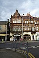
 Burntisland High Street - geograph.org.uk - 454802.jpg 640 × 449; 52 Кб
-
 Burntisland Pipe Band Hall - geograph.org.uk - 4250811.jpg 3264 × 2448; 3,54 Мб
-
 Burntisland Pipe Band Hall windows - geograph.org.uk - 4250827.jpg 3264 × 2448; 4,07 Мб
-
 Burntisland Promenade - geograph.org.uk - 3676042.jpg 1024 × 768; 174 Кб
-
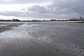
 Burntisland sands - geograph.org.uk - 5226384.jpg 1024 × 683; 211 Кб
-
 Burntisland sands - geograph.org.uk - 5226479.jpg 1024 × 683; 211 Кб
-
 Burntisland sands and Paragon MSS1 - geograph.org.uk - 5226258.jpg 1024 × 683; 223 Кб
-
 Burntisland The Co-operative (42064749324).jpg 3072 × 2304; 1,37 Мб
-
 Burntisland War Memorial - geograph.org.uk - 5419031.jpg 640 × 425; 91 Кб
-
 Burntisland, from over the Firth of Forth - geograph.org.uk - 2102759.jpg 2048 × 1536; 1,07 Мб
-
Burntisland.ogg 1,4 с; 27 Кб
-
 Caravan park. Pettycur - geograph.org.uk - 3331467.jpg 640 × 360; 53 Кб
-
 Carpark - Burntisland - geograph.org.uk - 3676051.jpg 1024 × 768; 138 Кб
-
 Carron Harbour - geograph.org.uk - 3409623.jpg 1600 × 984; 108 Кб
-
 Castle Stores - geograph.org.uk - 1288022.jpg 640 × 480; 85 Кб
-
 Caution, you may get wet - geograph.org.uk - 1982169.jpg 640 × 481; 105 Кб
-
 Church spire in the High Street - geograph.org.uk - 2371664.jpg 640 × 458; 53 Кб
-

-

-
 Coastal Fife , Starleyburn Harbour - geograph.org.uk - 3519295.jpg 1600 × 1200; 236 Кб
-

-
 Coastal Fife , West Dock, Burntisland - geograph.org.uk - 3519306.jpg 1600 × 1200; 315 Кб
-
 Coastal railway heading west - geograph.org.uk - 3609240.jpg 640 × 480; 66 Кб
-

-
 Converted to housing, Rossend - geograph.org.uk - 1457453.jpg 640 × 480; 108 Кб
-
 Craigkelly mast - geograph.org.uk - 5182556.jpg 1671 × 2436; 452 Кб
-
 Craigkelly Transmitter - geograph.org.uk - 2149858.jpg 640 × 427; 48 Кб
-
 Craigkelly Transmitter - geograph.org.uk - 5420163.jpg 640 × 425; 84 Кб
-

-

-
 Cromwell Road - geograph.org.uk - 1288040.jpg 640 × 480; 65 Кб
-
 Crown Tavern pub sign, Burntisland - geograph.org.uk - 2371640.jpg 640 × 480; 47 Кб
-
 Derelict Farm Buildings - geograph.org.uk - 5420277.jpg 640 × 425; 103 Кб
-
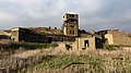
 Deserted village - geograph.org.uk - 356967.jpg 640 × 480; 89 Кб
-
 Distillery Ruins - geograph.org.uk - 5420289.jpg 640 × 425; 131 Кб
-
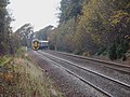 DMU to Edinburgh - geograph.org.uk - 1045616.jpg 640 × 480; 95 Кб
-
 Dockside path - geograph.org.uk - 5439514.jpg 2560 × 1920; 1,11 Мб
-
 Doocot , Newbigging. - geograph.org.uk - 42611.jpg 640 × 480; 68 Кб
-
 Doocot and television transmitter - geograph.org.uk - 422369.jpg 640 × 424; 36 Кб
-
 Dunearn - geograph.org.uk - 5721571.jpg 3264 × 2448; 3,74 Мб
-
 Dunearn - geograph.org.uk - 6152550.jpg 640 × 427; 87 Кб
-
 Dunearn House,Burntisland - geograph.org.uk - 2161936.jpg 640 × 427; 98 Кб
-
 East Port Buildings, Burntisland High Street - geograph.org.uk - 2496269.jpg 800 × 1200; 737 Кб
-
 East Stell - geograph.org.uk - 3323948.jpg 640 × 360; 79 Кб
-
 East Stell - geograph.org.uk - 4451114.jpg 2560 × 1920; 3,04 Мб
-
 Edinburgh from Burntisland - geograph.org.uk - 1974061.jpg 640 × 427; 51 Кб
-
 Edinburgh from Fife - geograph.org.uk - 901598.jpg 640 × 381; 85 Кб
-
 Edinburgh in the mist (23984999590).jpg 4928 × 3264; 1,13 Мб
-
 Edinburgh, seen from Inchkeith - geograph.org.uk - 3330397.jpg 640 × 360; 56 Кб
-
 Excursion at Burntisland - geograph.org.uk - 3029075.jpg 1200 × 810; 985 Кб
-
 F Group - geograph.org.uk - 3330401.jpg 640 × 360; 89 Кб
-
 F Group - geograph.org.uk - 3330403.jpg 640 × 360; 88 Кб
-
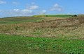
 Farmland at Craigkelly, Burntisland - geograph.org.uk - 2149969.jpg 640 × 427; 42 Кб
-
 Farmland, Newbigging - geograph.org.uk - 42607.jpg 640 × 415; 81 Кб
-
 Ferguson Place, Burntisland - geograph.org.uk - 2019719.jpg 640 × 480; 104 Кб
-
 Fife coast near Burntisland - geograph.org.uk - 3816490.jpg 640 × 480; 331 Кб
-
 Fife coastal path - geograph.org.uk - 1288009.jpg 640 × 480; 156 Кб
-
 Fife Coastal Path at Kirkton - geograph.org.uk - 6121080.jpg 427 × 640; 55 Кб
-
 Flooding the sands, Burntisland - geograph.org.uk - 5226482.jpg 1024 × 683; 221 Кб
-
 Flume, Beacon Centre - geograph.org.uk - 1288061.jpg 640 × 480; 72 Кб
-
 Footbridge by Starley Burn - geograph.org.uk - 3672898.jpg 1024 × 768; 344 Кб
-
 Footpath Crossroads - geograph.org.uk - 5419303.jpg 640 × 425; 140 Кб
-
 Footpath down The Binn - geograph.org.uk - 6121079.jpg 461 × 640; 133 Кб
-
 Former gateposts, Dunearn - geograph.org.uk - 6121078.jpg 640 × 427; 116 Кб
-
 Former Grange Quarry - geograph.org.uk - 5420263.jpg 640 × 425; 121 Кб
-
 Former Milk Bar - geograph.org.uk - 6092299.jpg 4965 × 2930; 3,6 Мб
-
 Fortifications, Inchkeith - geograph.org.uk - 2701668.jpg 640 × 360; 228 Кб
-
 Freight Train at Burntisland - geograph.org.uk - 3029093.jpg 1200 × 806; 1,09 Мб
-
 Fresh Water Supply^ - geograph.org.uk - 1707747.jpg 3072 × 2304; 2,5 Мб
-
 From the footbridge (geograph 2508611).jpg 2000 × 1500; 607 Кб
-
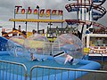
 Funfair - geograph.org.uk - 453461.jpg 640 × 424; 62 Кб
-
 Gale Slap Plantation - geograph.org.uk - 2149917.jpg 640 × 427; 61 Кб
-
 Gate posts at Grange Farm - geograph.org.uk - 5721585.jpg 3264 × 2448; 1,87 Мб
-
 Grass play area - geograph.org.uk - 3408425.jpg 1600 × 1051; 143 Кб
-
 Grazing at Glassliehead - geograph.org.uk - 2161953.jpg 640 × 427; 63 Кб
-
 Grotesque limb - geograph.org.uk - 1045592.jpg 640 × 480; 163 Кб
-
 Gun battery, Inchkeith - geograph.org.uk - 2701674.jpg 640 × 360; 215 Кб
-
 Hanselled Books, Burntisland - geograph.org.uk - 2371219.jpg 2560 × 1920; 1,72 Мб
-
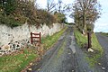
 Haugh Road - geograph.org.uk - 1288017.jpg 640 × 480; 85 Кб
-
 Hawk Craig from above Burntisland - geograph.org.uk - 3558398.jpg 3261 × 2256; 3,51 Мб
-
 Helter skelter, Burntisland fair - geograph.org.uk - 1982161.jpg 640 × 481; 106 Кб
-
 Herm and Safe Bristolia - geograph.org.uk - 3816656.jpg 640 × 484; 217 Кб
-
 High Street pend, Burntisland - geograph.org.uk - 2371657.jpg 480 × 640; 78 Кб
-
 High Street, Burntisland - geograph.org.uk - 2371323.jpg 640 × 480; 61 Кб
-
 Hillfort at Dunearn - geograph.org.uk - 5721441.jpg 3257 × 1901; 1,82 Мб
-
 Hills of Edinburgh - geograph.org.uk - 3330392.jpg 640 × 360; 36 Кб
-
 HMS-cattistock.jpg 2656 × 1996; 748 Кб
-
 House in East Leven Street - geograph.org.uk - 2371209.jpg 640 × 480; 70 Кб
-
 House, Inchkeith - geograph.org.uk - 3323959.jpg 640 × 360; 79 Кб
-

-
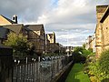
 Houses on Haugh Road - geograph.org.uk - 3609225.jpg 640 × 567; 71 Кб
-
 Inchkeith from Arthur's Seat - geograph.org.uk - 3123523.jpg 1390 × 946; 874 Кб
-
 Inchkeith from Burntisland sands - geograph.org.uk - 5226400.jpg 1024 × 683; 215 Кб
-
 Inchkeith from Edinburgh Castle - geograph.org.uk - 3118718.jpg 1620 × 1000; 1,3 Мб
-
 Inchkeith from Edinburgh Castle - geograph.org.uk - 3512172.jpg 1024 × 681; 90 Кб
-
 Inchkeith from Inchcolm - geograph.org.uk - 5359039.jpg 1024 × 682; 126 Кб
-
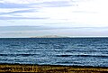
 Inchkeith from the air - geograph.org.uk - 3595863.jpg 640 × 512; 108 Кб
-
 Inchkeith from the air - geograph.org.uk - 4764849.jpg 523 × 640; 80 Кб
-
 Inchkeith from the air - geograph.org.uk - 5571658.jpg 640 × 390; 87 Кб
-
 Inchkeith in the Firth of Forth - geograph.org.uk - 3009947.jpg 3264 × 2448; 2,77 Мб
-
 Inchkeith in the Firth of Forth - geograph.org.uk - 5613780.jpg 3264 × 2448; 1,82 Мб
-
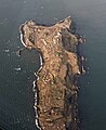
 Inchkeith Island - geograph.org.uk - 4815751.jpg 1555 × 1052; 687 Кб
-
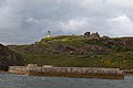 Inchkeith Lighthouse and breakwater - geograph.org.uk - 1962982.jpg 2784 × 1856; 968 Кб
-
 Inchkeith seen from the harbour - geograph.org.uk - 3314527.jpg 640 × 360; 81 Кб
-
 Inchkeith Summit - geograph.org.uk - 4452675.jpg 2516 × 1860; 2,15 Мб
-
 Intertidal zone, Burntisland - geograph.org.uk - 5226250.jpg 1024 × 683; 175 Кб
-
 Kilmundy Hill - geograph.org.uk - 5721552.jpg 3264 × 2448; 3,81 Мб
-
 Kilmundy Steadings - geograph.org.uk - 5721550.jpg 3264 × 2448; 2,4 Мб
-

-
 Kinghorn Road, Burntisland - geograph.org.uk - 1628476.jpg 640 × 480; 73 Кб
-
 Kinghorn Road, Burntisland, 2010.JPG 3888 × 2592; 4,94 Мб
-
 Kingswood Hotel - geograph.org.uk - 75062.jpg 640 × 480; 324 Кб
-
 Kirkton - geograph.org.uk - 3373348.jpg 1600 × 1200; 1,08 Мб
-
 Kirkton Churchyard - geograph.org.uk - 2675606.jpg 640 × 480; 105 Кб
-
 Kirkton Churchyard ruins - geograph.org.uk - 2675614.jpg 640 × 480; 115 Кб
-
 Kirkton, Burntisland - geograph.org.uk - 5420295.jpg 640 × 425; 97 Кб
-
 Lammerlaws - geograph.org.uk - 1458550.jpg 640 × 359; 82 Кб
-
 Lammerlaws Road - geograph.org.uk - 1458533.jpg 640 × 359; 77 Кб
-
 Lammerlaws Road - geograph.org.uk - 1458540.jpg 640 × 359; 76 Кб
-
 Lane - geograph.org.uk - 453956.jpg 640 × 424; 63 Кб
-
 Leisure centre - geograph.org.uk - 531328.jpg 640 × 424; 47 Кб
-
 Leisure Pool at Burntisland - geograph.org.uk - 3408387.jpg 1600 × 1054; 164 Кб
-
 Lifeguard station - geograph.org.uk - 530348.jpg 640 × 424; 53 Кб
-
 Links Place (Burntisland).JPG 3888 × 2592; 4,88 Мб
-
 Links Place, Burntisland - geograph.org.uk - 4250834.jpg 3264 × 2448; 4,17 Мб
-
 Lochies Road - geograph.org.uk - 1474574.jpg 640 × 480; 87 Кб
-
 Lochies Road - geograph.org.uk - 5419083.jpg 640 × 425; 97 Кб
-
 Lochies Road Bridge - geograph.org.uk - 5419106.jpg 640 × 425; 113 Кб
-
 Logs for Sale - geograph.org.uk - 6121906.jpg 640 × 427; 54 Кб
-
-
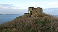
 Lookout tower, Inchkeith - geograph.org.uk - 2707737.jpg 360 × 640; 211 Кб
-
 Lost Industrial Landscapes - geograph.org.uk - 5420145.jpg 640 × 425; 96 Кб
-
 Masonic Lodge, Somerville Square - geograph.org.uk - 2371150.jpg 480 × 640; 54 Кб
-
 Men's Quarters and B Group - geograph.org.uk - 3331461.jpg 640 × 360; 93 Кб
-
 Military ruins, Inchkeith - geograph.org.uk - 3331472.jpg 640 × 360; 100 Кб
-
 Moss-covered waterfall - geograph.org.uk - 3373038.jpg 1600 × 1200; 1,51 Мб
-
 Museum of Communication, Burntisland.jpg 6000 × 4000; 3,84 Мб
-
 Nellfield, 24 East Leven Street, in 1979.jpg 4608 × 3072; 2,95 Мб
-
 New house, Burntisland - geograph.org.uk - 1457431.jpg 640 × 480; 103 Кб
-
 Non-compliant sign and gate, Starleyburn - geograph.org.uk - 1457424.jpg 640 × 480; 140 Кб
-
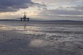
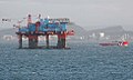
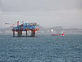 Oil rig Firth of Forth Burntisland - geograph.org.uk - 1014592.jpg 640 × 486; 63 Кб
-


.jpg)


_-_geograph.org.uk_-_766089.jpg)
_-_geograph.org.uk_-_766090.jpg)


.jpg)


.jpg)


.jpg)


.jpg)


.JPG)


