Category:Bury Park
Jump to navigation
Jump to search
Neighbourhood in Luton, England.  | |||||
| Upload media | |||||
| Instance of | |||||
|---|---|---|---|---|---|
| Location |
| ||||
 | |||||
English: Bury Park is an area in Luton in Bedfordshire, England. It is within the Biscot and Dallow wards of Luton. It also contains Kenilworth Road, the stadium of Luton Town Football Club.
Subcategories
This category has the following 2 subcategories, out of 2 total.
H
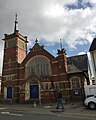
- Holy Ghost Church, Luton (4 F)
K
- Kenilworth Road Stadium (14 F)
Media in category "Bury Park"
The following 30 files are in this category, out of 30 total.
-
 A street in Bury Park.jpg 4,032 × 3,024; 4.86 MB
-
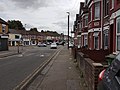
 Ash Road, Luton - geograph.org.uk - 3719707.jpg 640 × 439; 83 KB
-
 Beech Hill on Dunstable Road, Luton - geograph.org.uk - 5295151.jpg 640 × 472; 107 KB
-
 BrittaniaHouseLuton.jpg 640 × 480; 87 KB
-

-
-
 BuryPark.jpg 640 × 480; 90 KB
-

-
 Corner shop in Bury Park, Luton - geograph.org.uk - 3719736.jpg 640 × 427; 93 KB
-

-
 Dallow Road Primary School - geograph.org.uk - 5840424.jpg 3,264 × 2,448; 2.43 MB
-

-

-
 Executive boxes at Kenilworth Road - geograph.org.uk - 5300207.jpg 1,500 × 1,000; 164 KB
-

-

-
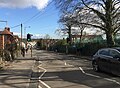
 Junction of Telford Way and Dunstable Road - geograph.org.uk - 2558378.jpg 1,600 × 1,200; 496 KB
-

-
 Luton, Beech Road - geograph.org.uk - 192300.jpg 640 × 480; 93 KB
-
 Luton, Brantwood Park - geograph.org.uk - 194092.jpg 640 × 480; 89 KB
-
 Luton, Conway Road - geograph.org.uk - 193074.jpg 640 × 480; 114 KB
-
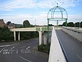 Luton, Footbridge over the ring road - geograph.org.uk - 191482.jpg 640 × 480; 75 KB
-
 Luton, Hampton Road - geograph.org.uk - 191320.jpg 640 × 480; 124 KB
-
 Luton, Runley Road - geograph.org.uk - 191344.jpg 640 × 480; 99 KB
-
 Mansfield Road, Luton - geograph.org.uk - 2226928.jpg 640 × 480; 82 KB
-

-
 Stratford Road, Luton - geograph.org.uk - 2226921.jpg 640 × 480; 81 KB
-

-
 The main stand at Kenilworth Road - geograph.org.uk - 5299416.jpg 1,500 × 1,000; 178 KB
-


