Category:CIA World Factbook maps of Cook Islands
Jump to navigation
Jump to search
Media in category "CIA World Factbook maps of Cook Islands"
The following 11 files are in this category, out of 11 total.
-
 Cook Islands (New Zealand) map.png 324 × 348; 15 KB
-
 Cook Islands Map.png 330 × 355; 5 KB
-
 Cook Islands-CIA WFB Map.png 325 × 350; 5 KB
-
 Cook-Islands-map.gif 325 × 350; 5 KB
-
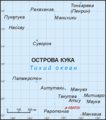
 Cook-lang-ru.png 789 × 896; 23 KB
-
 Cook-wiki.png 789 × 896; 14 KB
-
 Cw-map.png 330 × 355; 5 KB
-
 KukiAiraniCIA.png 330 × 355; 6 KB
-
 Map of Cook Islands.png 330 × 355; 11 KB
-
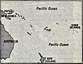 World Factbook (1982) Cook Islands.jpg 758 × 589; 95 KB
-
 World Factbook (1990) Cook Islands.jpg 524 × 561; 35 KB
_map.png)


_Cook_Islands.jpg)
_Cook_Islands.jpg)