Category:CIA World Factbook maps of Saint Vincent and the Grenadines
Jump to navigation
Jump to search
Media in category "CIA World Factbook maps of Saint Vincent and the Grenadines"
The following 5 files are in this category, out of 5 total.
-
 Saint Vincent and the Grenadines-CIA WFB Map (2004).png 330 × 355; 7 KB
-
 Saint Vincent and the Grenadines-CIA WFB Map.png 328 × 352; 10 KB
-
 SaintVincentGrenadinenKarte.png 330 × 355; 17 KB
-
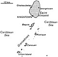
 World Factbook (1982) St. Vincent and the Grenadines.jpg 585 × 588; 88 KB
-
 World Factbook (1990) St. Vincent and the Grenadines.jpg 556 × 545; 50 KB
.png)


_St._Vincent_and_the_Grenadines.jpg)
_St._Vincent_and_the_Grenadines.jpg)