Category:Calder Vale
Jump to navigation
Jump to search
English: Calder Vale is an English village, located on the edge of the Forest of Bowland in Lancashire. It lies on the River Calder in a deep valley with only a single road providing access to it.
village in Barnacre-with-Bonds, Lancashire, England  | |||||
| Upload media | |||||
| Instance of | |||||
|---|---|---|---|---|---|
| Location | Barnacre-with-Bonds, Wyre, Lancashire, North West England, England | ||||
 | |||||
Subcategories
This category has only the following subcategory.
Media in category "Calder Vale"
The following 22 files are in this category, out of 22 total.
-
 2008-08 - Plum Island and Cowal Games 559.jpg 1,600 × 1,200; 996 KB
-
 Calder Vale Methodist chapel.jpg 1,600 × 1,200; 438 KB
-
 Calder Vale Primary School - geograph.org.uk - 1032504.jpg 640 × 426; 109 KB
-
 Footpath entrance to Delph Wood - geograph.org.uk - 1136069.jpg 504 × 335; 105 KB
-
 Lappet Mill, Calder Vale.jpg 640 × 480; 137 KB
-
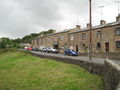
 Long Row, Calder Vale - geograph.org.uk - 110283.jpg 640 × 480; 145 KB
-
 Long Row, Calder Vale.jpg 640 × 426; 141 KB
-
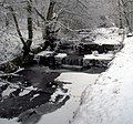
 Mill Pond Weir - geograph.org.uk - 1204686.jpg 640 × 410; 86 KB
-
-
 Old Cart Bridge - geograph.org.uk - 1122810.jpg 640 × 427; 130 KB
-
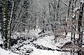
 Path through Delph Wood - geograph.org.uk - 1136068.jpg 504 × 335; 90 KB
-
 Permissive footpath to Tootle Hall - geograph.org.uk - 1136065.jpg 504 × 335; 95 KB
-
-
 Sheep Pens at Cobble Hey Farm - geograph.org.uk - 1174733.jpg 640 × 426; 121 KB
-
 Sluice Gate, Long Row, Calder Vale - geograph.org.uk - 1032422.jpg 640 × 426; 134 KB
-
 Small Pond on Rough Moor - geograph.org.uk - 1062257.jpg 640 × 426; 99 KB
-
 The Weir in St Johns Wood - geograph.org.uk - 1204777.jpg 640 × 384; 100 KB
-
 Three Men Not In A Boat - geograph.org.uk - 1032444.jpg 640 × 426; 140 KB
-
 Weir and Path Above Calder Vale - geograph.org.uk - 1032463.jpg 640 × 426; 190 KB
-

-
 Cottages at Calder Vale - geograph.org.uk - 110292.jpg 640 × 480; 117 KB
-
 Farmland near Oakenclough - geograph.org.uk - 72465.jpg 640 × 480; 70 KB


