Category:Car Colston
Jump to navigation
Jump to search
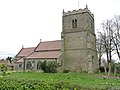
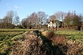
English: Car Colston is a village and civil parish in the Rushcliffe borough of Nottinghamshire. It is just off the A46 (the old Fosse Way) north of Bingham and west of East Bridgford.
village in United Kingdom | |||||
| Upload media | |||||
| Instance of | |||||
|---|---|---|---|---|---|
| Location | Rushcliffe, Nottinghamshire, East Midlands, England | ||||
 | |||||
Subcategories
This category has the following 2 subcategories, out of 2 total.
M
- St Mary's, Car Colston (13 F)
T
Media in category "Car Colston"
The following 89 files are in this category, out of 89 total.
-
 A living house number - geograph.org.uk - 3113861.jpg 640 × 480; 110 KB
-

-
-
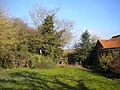
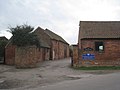 Barns at Car Colston Old Hall - geograph.org.uk - 2337857.jpg 1,024 × 768; 140 KB
-
 Beech Close, Car Colston.jpg 1,280 × 960; 499 KB
-
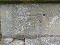 Bench mark with bolt, Car Colston Church - geograph.org.uk - 3922177.jpg 1,280 × 960; 465 KB
-
 Bench mark, St. Wilfrid's Church - geograph.org.uk - 3922409.jpg 1,280 × 960; 495 KB
-
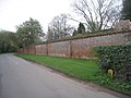 Boundary Wall of the Old Hall, Car Colston - geograph.org.uk - 2337875.jpg 1,024 × 768; 209 KB
-
 Brunsell Hall - geograph.org.uk - 1086704.jpg 640 × 427; 89 KB
-
 Car Colston - geograph.org.uk - 1086182.jpg 640 × 427; 76 KB
-
 Car Colston - geograph.org.uk - 1086186.jpg 640 × 427; 51 KB
-
 Car Colston - geograph.org.uk - 1086200.jpg 640 × 427; 54 KB
-
 Car Colston and Screveton Village Hall - geograph.org.uk - 2337477.jpg 1,024 × 768; 122 KB
-
 Car Dyke - geograph.org.uk - 1085366.jpg 640 × 427; 68 KB
-
 Car Dyke - geograph.org.uk - 3933292.jpg 1,280 × 960; 394 KB
-
 Car Dyke Bridge - geograph.org.uk - 2648680.jpg 3,648 × 2,736; 5.85 MB
-
 Car Dyke Bridge - geograph.org.uk - 3933288.jpg 1,280 × 960; 213 KB
-
 Car Lane - geograph.org.uk - 1085385.jpg 640 × 427; 72 KB
-
 Car Lane - geograph.org.uk - 5273428.jpg 3,696 × 2,448; 2.29 MB
-
 Car lane, Car Colston - geograph.org.uk - 1949488.jpg 640 × 480; 73 KB
-
 Car Lane, east of Car Colston - geograph.org.uk - 6104138.jpg 1,024 × 768; 196 KB
-
 Cattle grazing on Large Green, Car Colston - geograph.org.uk - 3933282.jpg 1,280 × 960; 231 KB
-
 Church of St Wilfrid, Screveton - geograph.org.uk - 3922431.jpg 1,280 × 960; 328 KB
-
 Cricket field, Car Colston - geograph.org.uk - 6104127.jpg 1,024 × 768; 141 KB
-
 Cross base - geograph.org.uk - 3737445.jpg 800 × 533; 261 KB
-
 Farm road south of Car Colston - geograph.org.uk - 6104136.jpg 1,024 × 768; 152 KB
-
 Farm track east of Car Colston (1) - geograph.org.uk - 6105861.jpg 1,024 × 768; 214 KB
-
 Farm track east of Car Colston (2) - geograph.org.uk - 6105878.jpg 1,024 × 768; 145 KB
-
 Farm track north of Bingham - geograph.org.uk - 6106853.jpg 1,024 × 768; 170 KB
-
 Farm track west of Car Colston - geograph.org.uk - 6104115.jpg 1,024 × 768; 243 KB
-
 Farmland off Car lane, Car Colston - geograph.org.uk - 1949491.jpg 640 × 480; 85 KB
-
 Farmland off Tenman Lane - geograph.org.uk - 1949481.jpg 640 × 480; 52 KB
-
 Field east of Car Colston - geograph.org.uk - 6104173.jpg 1,024 × 768; 149 KB
-
 Field north of Scarrington (1) - geograph.org.uk - 6105881.jpg 1,024 × 768; 194 KB
-
 Field north of Scarrington (2) - geograph.org.uk - 6105887.jpg 1,024 × 768; 172 KB
-
 Field west of Car Colston - geograph.org.uk - 6104120.jpg 1,024 × 768; 162 KB
-
 Fingerpost at Car Colston Large Green - geograph.org.uk - 3922173.jpg 1,280 × 960; 343 KB
-
 Flinders Cottage, Large Green, Car Colston - geograph.org.uk - 3922176.jpg 1,280 × 960; 220 KB
-

-

-
 Footpath across Little Green, Car Colston - geograph.org.uk - 2337837.jpg 1,024 × 768; 132 KB
-
 Footpath to Kneeton - geograph.org.uk - 2337845.jpg 1,024 × 768; 272 KB
-
 Former Methodist Chapel, Car Colston - geograph.org.uk - 2336593.jpg 1,024 × 768; 187 KB
-
 Garden Wall, Old Hall, Car Colston.jpg 1,280 × 960; 333 KB
-
 High Westing Farm - geograph.org.uk - 2648561.jpg 3,648 × 2,736; 5.41 MB
-
 Jubilee footbridge - geograph.org.uk - 1086662.jpg 640 × 427; 118 KB
-
 Lane north of Bingham - geograph.org.uk - 6104064.jpg 1,024 × 768; 238 KB
-
 Large Green - geograph.org.uk - 1086190.jpg 640 × 427; 76 KB
-
 Large Green - geograph.org.uk - 1086198.jpg 640 × 427; 67 KB
-
 Little Green - geograph.org.uk - 1086647.jpg 640 × 427; 95 KB
-
 Little Green - geograph.org.uk - 1086715.jpg 640 × 427; 91 KB
-
 Manor Cottages, Car Colston.jpg 1,280 × 960; 398 KB
-
 Martin's Cottage, Car Colston.jpg 1,280 × 960; 321 KB
-
 Minor road towards Screveton - geograph.org.uk - 1949486.jpg 640 × 480; 67 KB
-
 Old Hall, surrounded by brick wall - geograph.org.uk - 2648612.jpg 3,648 × 2,736; 5.11 MB
-
 Porch view - geograph.org.uk - 4924202.jpg 677 × 1,024; 203 KB
-
 Priest's House - geograph.org.uk - 1087053.jpg 640 × 427; 111 KB
-
 Prospect mound - geograph.org.uk - 1084591.jpg 640 × 427; 52 KB
-
 Public footpath along cricket field, Car Colston - geograph.org.uk - 6104132.jpg 1,024 × 768; 204 KB
-
 Public footpath north of Bingham (2) - geograph.org.uk - 6104087.jpg 1,024 × 768; 291 KB
-
 Public footpath north of Bingham (3) - geograph.org.uk - 6106838.jpg 1,024 × 768; 170 KB
-
 Public footpath north of Bingham (4) - geograph.org.uk - 6106843.jpg 1,024 × 768; 172 KB
-
 Public footpath south of Car Colston - geograph.org.uk - 6104134.jpg 1,024 × 768; 238 KB
-
 Public footpath to Car Colston (1) - geograph.org.uk - 6104109.jpg 1,024 × 768; 353 KB
-
 Repairs to roof and tower - geograph.org.uk - 2648603.jpg 3,648 × 2,736; 5.95 MB
-
 Road works, Car Lane - geograph.org.uk - 2648668.jpg 3,648 × 2,736; 5.68 MB
-
 Shackerdale Farm.jpg 1,280 × 960; 377 KB
-
 Spring Lane, Car Colston - geograph.org.uk - 2873133.jpg 640 × 480; 109 KB
-
 St.Wilfred's font - geograph.org.uk - 3736023.jpg 800 × 533; 92 KB
-
 Straight path through farmland - geograph.org.uk - 2648569.jpg 3,648 × 2,736; 4.74 MB
-
 The footpath to Scarrington - geograph.org.uk - 2336596.jpg 1,024 × 768; 135 KB
-
 The Green, road sign and old house, Car Colston - geograph.org.uk - 2648588.jpg 3,648 × 2,736; 5.63 MB
-
 The Hall at Car Colston - geograph.org.uk - 2648573.jpg 3,648 × 2,736; 5.14 MB
-
 The Hall, Car Colston.jpg 1,280 × 955; 514 KB
-
 The Old Hall, Car Colston - geograph.org.uk - 2337866.jpg 1,024 × 768; 266 KB
-
 The Old Hall, Car Colston.jpg 1,280 × 992; 334 KB
-
 The Royal Oak at Car Colston - geograph.org.uk - 5273344.jpg 4,928 × 3,264; 4.05 MB
-
 The Royal Oak, Car Colston - geograph.org.uk - 2873129.jpg 640 × 480; 84 KB
-
 Thoroton tablet - geograph.org.uk - 3737434.jpg 533 × 800; 204 KB
-
 Track to Car Colston Hall Stud Farm - geograph.org.uk - 1949479.jpg 640 × 480; 82 KB
-
 Tree on a mound - geograph.org.uk - 2337854.jpg 1,024 × 768; 102 KB
-
 View from Car Lane towards The Old Hall - geograph.org.uk - 3933286.jpg 1,280 × 960; 346 KB
-
 Village Hall - geograph.org.uk - 2648598.jpg 3,648 × 2,736; 5.32 MB
-
 Village stocks, Car Colston - geograph.org.uk - 2873147.jpg 480 × 640; 130 KB
-
 Whipping Post, Car Colston.jpg 1,280 × 960; 675 KB
-
 White Gates, Car Colston - geograph.org.uk - 3933276.jpg 1,280 × 960; 290 KB
-
 Bean Crop. - geograph.org.uk - 292533.jpg 640 × 480; 113 KB
-
 Somewhere UNDER the rainbow ^^ - geograph.org.uk - 295727.jpg 640 × 351; 24 KB
-
 Tenman Lane, Car Colston - geograph.org.uk - 46894.jpg 640 × 480; 95 KB

_-_geograph.org.uk_-_6104093.jpg)
_-_geograph.org.uk_-_6104096.jpg)


_-_geograph.org.uk_-_6105861.jpg)
_-_geograph.org.uk_-_6105878.jpg)


_-_geograph.org.uk_-_6105881.jpg)
_-_geograph.org.uk_-_6105887.jpg)


_-_geograph.org.uk_-_6104087.jpg)
_-_geograph.org.uk_-_6106838.jpg)
_-_geograph.org.uk_-_6106843.jpg)

_-_geograph.org.uk_-_6104109.jpg)


