Category:Cartography
Przejdź do nawigacji
Przejdź do wyszukiwania

tworzenie i wykorzystanie map  | |||||
| Prześlij plik multimedialny | |||||
| Jest to |
| ||||
|---|---|---|---|---|---|
| Podklasa dla | |||||
| Inne niż | |||||
| |||||
Podkategorie
Poniżej wyświetlono 19 spośród wszystkich 19 podkategorii tej kategorii.
Pliki w kategorii „Cartography”
Poniżej wyświetlono 68 spośród wszystkich 68 plików w tej kategorii.
-
 19-20 STOWARZYSZENIA KARTOGRAFÓW POLSKICH.pdf 1239 × 1754, 40 stron; 807 KB
-
 ADEN DISTRICS MAP-02-02.png 8000 × 4500; 429 KB
-
 Assinatura de Jacques Funck..png 548 × 206; 49 KB
-
 Bahsi Geçen Harita.jpg 3000 × 3390; 6,1 MB
-
-
 Carta topográfica da capitania do Rio de Janeiro.png 1600 × 860; 2,81 MB
-
 Carte du site de la Nécropole de Prissé-la-Charriere, Tumulus de Péré.jpg 1482 × 773; 1,16 MB
-
 Carte du site du Tumulus de la Motte des Justices, à Thouars.jpg 1487 × 774; 902 KB
-
 Carte esri world topographic map chirons bougon.jpg 1410 × 812; 531 KB
-
 Carte geoportail.gouv.fr chirons bougon.jpg 1485 × 774; 1,07 MB
-
 Cartographie du Maroc.jpg 658 × 749; 69 KB
-
 Cartographie optique.png 916 × 470; 127 KB
-
 Cartography 01.jpg 3024 × 4032; 1,28 MB
-
 Cartography 02.jpg 3024 × 4032; 1,85 MB
-
 Cartography 03.jpg 3024 × 4032; 2,35 MB
-
 Cartography 04.jpg 4032 × 3024; 3,31 MB
-
 Conmuisca.webp 389 × 389; 220 KB
-
 Cours riviere bougon.jpg 1207 × 835; 847 KB
-
 Di xing dui dong zhi wu de ying xiang (1956.9) (20357908574).jpg 1705 × 3221; 761 KB
-
 Districts of Aden.png 8000 × 4500; 383 KB
-

-

-
 Extract of Thomson’s map (1817) with borders of Tigray.jpg 520 × 563; 128 KB
-
 Fidelia Heard.png 250 × 288; 72 KB
-
 Granbahiadetampa.jpg 7956 × 5651; 6,97 MB
-
 Hangneigungsklassen nach KA5.png 858 × 439; 57 KB
-
-
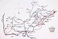
 Ingush (Kists) districts by J. Güldenstädt.jpg 1219 × 907; 382 KB
-
 Institut géographique et artistique Mullhaupt à Berne (Suisse).jpg 267 × 245; 15 KB
-
-
 Kampen Open StreetMap.png 1028 × 766; 867 KB
-
 Kéran.jpg 3104 × 2356; 4,58 MB
-
 La nova descrittione di tutta la patria del Friuli dilignetissimamente esposta.jpg 16 571 × 9820; 111,11 MB
-
 Lambertprojection.svg 276 × 188; 7 KB
-
 Lissen Lubinus 1618.jpg 448 × 492; 219 KB
-
 Lißowen (Lubinus, 1618).jpg 191 × 254; 56 KB
-
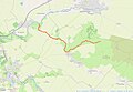
 Location of the border between Tigray and Amhara.jpg 1348 × 535; 85 KB
-
 Macarte-statistique.png 1280 × 720; 131 KB
-
 Macarte.png 1024 × 1024; 541 KB
-
-
 Map of the Subdistricts of the Hashemite Kingdom of Jordan.png 1302 × 1472; 102 KB
-
 Mapa 2024-1-1 94418.jpg 2934 × 1087; 2,18 MB
-
 Mapa cartográfico de Joaquín Revuelta 1810.jpg 664 × 550; 213 KB
-
 Mapa cartográfico de Joaquín Revuelta.jpg 1652 × 2276; 706 KB
-

-
 Mapa Geográfico do Continente do Rio Grande.png 1438 × 900; 2,64 MB
-

-
 Nicolas de Fer - L'Isle de la Martinique, 1704.png 1474 × 978; 2,53 MB
-
 Partie de l'Ecosse selon Gérard Mercator.jpg 2000 × 1534; 1,37 MB
-
 PiriReisMap Akcura 1935.pdf 1210 × 1754, 10 stron; 58,87 MB
-
 Plano topografico do continente do Rio Grande e da Ilha de Santa Catharina.png 1533 × 716; 2,55 MB
-
 Planta dos suburbios de Monte-Video e parte do Rincão do Cerro.png 798 × 600; 670 KB
-
 PPK 1968–2021 - finalna wersja internetowa - 2022-03-03.pdf 975 × 1387, 612 stron; 10,81 MB
-
 Primärkarta400del 1.jpg 1200 × 934; 524 KB
-
 Provincie Overijssel gemeente Kuinre 1867.jpg 3153 × 2380; 1,93 MB
-
 Ritaglio mappa OFM.png 823 × 565; 516 KB
-
 Six-plans-scenographiques-de-lyon 1.1.jpg 1518 × 1318; 2,27 MB
-
 Surveyor's wheel in use.jpg 295 × 313; 150 KB
-
 Tenochtitlan in a Michoacan map.jpg 4087 × 2357; 2,61 MB
-
 Termoli, incisione di Francesco Cassiano De Silva.jpg 2160 × 2160; 3,35 MB
-

-
 Updates in Lunar and Planetary Mission Cartography.pdf 1239 × 1754, 196 stron; 86,28 MB
-
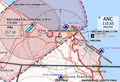
 US-Canadian border along the 49th parallel.png 2108 × 708; 64 KB
-
 Westendorp - Conrebberswegen (1823).jpg 983 × 662; 186 KB
-
 Zwarsluis OpenStreetMap.jpg 1506 × 810; 460 KB
-
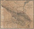 Карта Кавказского края 1842 года.jpg 21 635 × 18 381; 57,63 MB
-
 Фрагмент карты Кавказского края 1842 г. (Ингуши).png 1354 × 1109; 2,84 MB
-
 地圖繪圖器.jpg 3424 × 3424; 4,88 MB


.jpg)


_(20357908574).jpg)


_map_with_borders_of_Royaume_de_Tigre.jpg)
_with_borders_of_Tigray.jpg)


_districts_by_J._G%C3%BCldenst%C3%A4dt.jpg)
.jpg)


.jpg)


_representing_the_consensus_among_ethnographers_and_linguists_about_the_approximate_extent_of_the_Tigrinya_language.jpg)


.jpg)


.png)
