Category:Maps
Jump to navigation
Jump to search
visual representation of a concept space; symbolic depiction emphasizing relationships between elements of some space, such as objects, regions, or themes _ESA23162625.png)  | |||||
| Upload media | |||||
| Pronunciation audio | |||||
|---|---|---|---|---|---|
| Instance of | |||||
| Subclass of |
| ||||
| Part of |
| ||||
| Different from | |||||
| |||||
- (en) Map
- (an) Mapa
- (ar) خريطة
- (as) মানচিত্র
- (ast) Mapa
- (bg) Карта
- (bn) মানচিত্র
- (bs) Karta
- (ca) Plànol
- (cs) Mapa
- (cy) Map
- (da) Kort (geografi)
- (de) Karte (Kartografie)
- (eo) Mapo
- (es) Mapa
- (et) Kaart (kartograafia)
- (fa) نقشه
- (fi) Kartta
- (fr) Carte géographique
- (gan) 地圖
- (gl) Mapa
- (he) מפה
- (hi) मानचित्र
- (hr) Karta
- (hu) Térkép
- (id) Peta
- (is) Kort
- (it) Mappa
- (ja) 地図
- (ka) გეოგრაფიული რუკა
- (ko) 지도
- (la) Tabula geographica
- (lb) Landkaart
- (lt) Žemėlapis
- (ml) ഭൂപടം
- (ms) Peta
- (nl) Kaart (cartografie)
- (nn) Kart
- (no) Kart
- (oc) Mapa
- (pl) Mapa
- (pt) Mapa
- (ro) Hartă
- (ru) Географическая карта
- (sa) Хаарта
- (sco) Cairt
- (si) ple:Map
- (sk) Mapa
- (sl) Zemljevid
- (sq) Harta
- (sr) Карта (мапа)
- (su) Atlas
- (sv) Karta
- (sw) Ramani
- (ta) நிலப்படம்
- (tg) Харита
- (th) แผนที่
- (tl) Mapa
- (tr) Harita
- (uk) Географічна карта
- (vi) Bản đồ
- (yi) מאפע
- (zh) 地图
- (zh-classical) 地圖
- (zh-yue) 地圖
Before changing or adding maps, please read the brief guideline on the organizational schema About this Category developed during an eight month effort by a working group in 2007–2008.
- See also maps needing categories in Category:Unidentified maps
- See also these related categories: (These categories may contain more maps. Please categorize them in map categories.)
- Category:Cartography – for map symbols, projections, etc.
- Category:Demography
- Category:Geography
- Category:Aerial photographs
- Category:Satellite pictures
- Category:Astronomical maps – maps and star charts
- Category:Cartographic reliefs for models of landscape profiles
Resources:

Subcategories
This category has the following 28 subcategories, out of 28 total.
Pages in category "Maps"
The following 4 pages are in this category, out of 4 total.
Media in category "Maps"
The following 200 files are in this category, out of 1,294 total.
(previous page) (next page)-
 -JHSCDWFNcw.jpg 603 × 276; 27 KB
-
 .Morocco.png 585 × 487; 18 KB
-
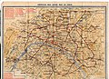
 0525 Maps.jpg 1,061 × 1,499; 588 KB
-
 1123chineland.png 220 × 261; 25 KB
-
 1766 карта Кусов.jpg 1,289 × 580; 310 KB
-
 1849-cu il kamerlakadan.png 5,644 × 5,106; 734 KB
-
 1863 Shelby's Raid Map.png 909 × 711; 128 KB
-
 1864 Verdelingskaart overlay met kleuren.jpg 661 × 692; 156 KB
-
 1889 USGS Topographic Map of Brooklyn NY.jpg 4,804 × 5,996; 3.52 MB
-
 1914 Екатеринославская губерния.jpg 1,571 × 1,181; 267 KB
-
 1936 AYH "Knapsack" magazine artwork drawn by Isabel Smith.jpg 2,793 × 3,763; 2.98 MB
-
 2 carte-route-encens-1b62a8bd.webp 995 × 614; 39 KB
-
 2024 AFC U-17 Women's Asian Cup map of teams.png 7,192 × 3,318; 1.46 MB
-
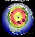 22 Aurora Viewing Location Map (2849896588).jpg 1,040 × 1,090; 489 KB
-
 4 colors.jpg 1,920 × 1,080; 460 KB
-

-
 8FdSvySqn part 100,000 map Popondetta 1974.jpg 2,870 × 1,787; 1.91 MB
-
 A Piece of Map Rangamati, Bangladesh.jpg 2,667 × 2,000; 5.27 MB
-
 A sketch map from the boulder survey.jpg 1,885 × 1,490; 282 KB
-
 Adoulis Carte du réseau hydrographique.jpg 1,120 × 882; 364 KB
-
 Africa-739 CE(Map).png 8,000 × 4,500; 1.76 MB
-
 Aguada Satelital.jpg 1,080 × 874; 324 KB
-
 Ahmar Laglalcha Map - 2021.jpg 1,471 × 1,054; 496 KB
-
 Aires Puros Satelital.jpg 1,080 × 864; 396 KB
-
 Akcje OP-11 na mapie obszaru działania..png 1,254 × 1,168; 1.45 MB
-
 Akcje OP-11 na mapie rejonu działania..png 1,254 × 1,168; 1.45 MB
-
 Akim abuakwa north map.png 650 × 338; 22 KB
-
 Alash1917-1920.png 1,400 × 1,200; 98 KB
-
 AlashAutonomyKK.png 1,400 × 1,108; 95 KB
-
 Algeria extradition treaties-ar.svg 2,754 × 1,398; 1.19 MB
-
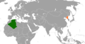 Algeria North Korea Locator.png 1,376 × 708; 51 KB
-
 Alternative.Map.Bryansk.Oblast.png 1,200 × 933; 206 KB
-
 American Red Cross Map of Paris (7433408968).jpg 3,504 × 2,544; 2.2 MB
-
 AmericanRevolutionaryWar.png 1,357 × 628; 35 KB
-
 Androctonus Kunti distribution map.png 4,592 × 3,196; 382 KB
-
 Android Places - Clustered view of items when zoomed out on the map.png 752 × 1,472; 455 KB
-
 Android Places - Items with thumbnails when zoomed in on the map.png 752 × 1,472; 653 KB
-
 Android Places - Map view and bottom sheet.png 752 × 1,472; 505 KB
-
 Android Places - Map view and overflow menu of the bottom sheet.png 752 × 1,472; 479 KB
-
 Anshan-Stadt.jpg 2,484 × 941; 439 KB
-
 Anti Nazi Leuge Map leauge.png 2,753 × 1,400; 89 KB
-
 Anzico.jpg 1,536 × 1,184; 283 KB
-
 APERA Conference Locations.png 360 × 223; 26 KB
-
 Approximate map of Comancheria (borders in flux).png 359 × 399; 37 KB
-
 Arabistan map1918.png 720 × 1,280; 1.41 MB
-
 Ares Vallis Karte.jpg 1,080 × 1,439; 1.25 MB
-
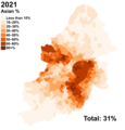 Asian Birmingham 2021 distribution.png 2,928 × 3,057; 1.09 MB
-
 Atlas Map Fictional.jpg 400 × 255; 29 KB
-
 ATS States Map September 23.png 2,431 × 1,695; 453 KB
-
 Auckland Council.jpg 2,124 × 2,360; 1.35 MB
-
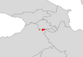
 Aukh (American map of the Caucasus 1910).jpg 916 × 719; 227 KB
-
 Aït Aidel carte corrigée.png 1,024 × 576; 146 KB
-

-
 Baloskion tetraphyllum range map.png 728 × 612; 67 KB
-
 Barangay San Miguel, Lobo Map.png 1,624 × 1,343; 461 KB
-
 Baranovka 1729 40V Strizhevskij Sukhachev.png 1,366 × 768; 1.27 MB
-
 Barca map took by me.png 1,024 × 853; 690 KB
-
 Barrios y Comunas de Buenos Aires.jpg 800 × 815; 126 KB
-
 Barriosanjorge.png 256 × 256; 27 KB
-
 BASALDE MAPA.jpg 1,989 × 3,771; 1.03 MB
-
 Base para preparar mapa - no publicar.png 766 × 732; 518 KB
-
 Bat mappa.gif 430 × 507; 40 KB
-
 Bella Vista Satelital.jpg 1,079 × 862; 344 KB
-
 Belvedere Satelital.jpg 1,080 × 852; 384 KB
-
 Bide berdearen mapa.png 1,022 × 633; 985 KB
-
 Big 12 Map.jpg 1,920 × 1,187; 149 KB
-
 Bimanese languages.jpg 589 × 804; 66 KB
-
 Binan Map.jpg 598 × 856; 80 KB
-
 Birobidzhan Agricultural-map.jpg 918 × 650; 121 KB
-
 Black Birmingham 2021 distribution.png 2,733 × 3,045; 917 KB
-
 Black Sea map lld.png 2,006 × 1,541; 748 KB
-
 Blank map of Austria October 1938 - March 1939.png 446 × 456; 83 KB
-
 Blank map of Lithuania 1929-1938.png 446 × 456; 83 KB
-
 BlankMap-HMAO.svg 1,440 × 900; 81 KB
-
 BlankMap-World 16 April 2024.svg 2,754 × 1,398; 1.1 MB
-
 BlankMap-World-v6pt6 small states.svg 512 × 260; 804 KB
-
 BlankMap-World-with-Circles 17 April 2024.svg 2,754 × 1,398; 1.1 MB
-
 Blondin Diop Map.png 11,200 × 6,800; 3.16 MB
-
 Blue Dot Network Map.png 7,192 × 3,318; 2.12 MB
-
 Blue Water Michigan Map.jpg 119 × 164; 30 KB
-
 Borghetto Battle Map 30May1796.JPG 720 × 586; 70 KB
-
 Boudikka1-c6f5e4de5f8e5e9cd8179cc5ec80750b.jpg 837 × 789; 67 KB
-
 Boudouaou - Alma - Crimée - carte ancienne.jpg 3,024 × 4,032; 4.27 MB
-
 Boudouaou carte ancienne.jpg 3,980 × 2,322; 6.92 MB
-
 Brabantse wouden kaart en legende-022.jpg 3,508 × 2,480; 613 KB
-
 Brain Maps.JPG 1,915 × 1,033; 340 KB
-
 Brent-Talli map.jpg 600 × 527; 52 KB
-
 Bristol 3rd District.svg 388 × 210; 59 KB
-
 Brooklyn census tracts by percent Black, 2020.svg 619 × 409; 480 KB
-
 Bulgaria 1994 CIA map Modifiziert Route.jpg 800 × 791; 1.2 MB
-
 Bunga Hayat Map.png 454 × 160; 7 KB
-
 Bản đồ huyện Xonbuly.png 480 × 300; 6 KB
-
 Cambodge Ratanakiri Geographic map (draft).svg 1,280 × 1,442; 13.66 MB
-
 Cambodge Ratanakiri Geographic map-fr-villages.svg 1,280 × 1,442; 6.33 MB
-
 CampoZanelliTassinariImolaRugby.jpg 807 × 521; 159 KB
-
 Cape Roberts Bohrprojekt Karte.png 579 × 582; 53 KB
-
 Cape Verdes on map.png 1,052 × 774; 263 KB
-
 CapillaDelSauce 123.jpg 400 × 255; 52 KB
-
 Captura de pantalla 2023-10-13 015607.png 1,150 × 778; 1.85 MB
-
 Capurro Satelital.jpg 1,080 × 870; 374 KB
-
 Carte 12 - L’Afrique d’Antalas.jpg 7,172 × 6,312; 3.53 MB
-
 Carte 18.png 962 × 682; 76 KB
-
 CARTE 2024 JP légendé.jpg 930 × 646; 714 KB
-
 CARTE ACE FINAL (Récupéré).png 6,520 × 7,087; 1.03 MB
-
 CARTE ACE FINAL.jpg 6,520 × 7,087; 875 KB
-
 CARTE ACE FINAL.png 6,520 × 7,087; 1.03 MB
-
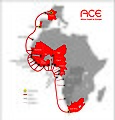 CARTE ACEvecto2.jpg 2,488 × 2,606; 574 KB
-
 Carte Barrage de la Renaissance.jpg 636 × 326; 43 KB
-
 Carte CAIRN noms.jpg 5,395 × 3,976; 8.8 MB
-
 Carte campus Laval UdeM.jpg 2,135 × 1,091; 1.33 MB
-
 Carte CCTiV Complète.png 7,990 × 4,587; 1.48 MB
-
 Carte Chasse impériales Ormesson.jpg 590 × 731; 200 KB
-
 Carte Cilicie.png 483 × 444; 57 KB
-
 Carte de Cassini, 1740 Remonter le temps IGN.jpg 1,579 × 849; 403 KB
-
 Carte de l'Algérie divisée par tribus - E. Carette, A. Warnier, 1846.jpg 1,351 × 1,054; 408 KB
-
 Carte de l'Algérie divisée par tribus.png 438 × 310; 274 KB
-
 Carte de l'Eurafrique de Jean Thiriart.png 18,750 × 9,308; 5.39 MB
-
 Carte de l'Europe des ethnies de Saint-Loup.png 2,576 × 2,576; 516 KB
-
 Carte de l'Europe du monde blanc de Jean Mabire.png 18,750 × 9,308; 5.25 MB
-
-
 Carte de la Chute de Petersburg.png 400 × 313; 125 KB
-
 Carte de la Commission internationale de l'état civil.png 7,192 × 3,318; 2.14 MB
-
 Carte de la Flandre en 1590.png 1,754 × 1,396; 6.74 MB
-
 Carte de la peine de mort dans le monde.jpg 1,761 × 926; 168 KB
-
 Carte de la Vendée actuelle.png 916 × 656; 477 KB
-
 Carte de la ville d'Islamabad Ouest.png 496 × 367; 125 KB
-
 Carte de Slovaquie Modifiziert Route.png 634 × 323; 54 KB
-
 Carte des 6 pays de DADLI.png 700 × 350; 176 KB
-
 Carte des communes françaises possédant des exclaves (2023).png 9,814 × 7,440; 33.6 MB
-
 Carte des départements touchés par l'exercice militaire Orion 23.png 770 × 433; 169 KB
-
 Carte Des Nouvelles Decouvertes Au Nord de la Mer de Sud 1750.jpg 2,564 × 1,900; 5.46 MB
-
 Carte des poles internationaux.png 477 × 480; 138 KB
-
 Carte des poles régionaux.png 2,014 × 2,099; 383 KB
-
 Carte des réseaux permanents distribués par Epos-France.png 2,150 × 1,716; 3.52 MB
-
 Carte des voies romaines de la Belgique.jpg 1,855 × 1,048; 232 KB
-
 Carte des zaouïas et tombeaux des saints - Soad Belekziz.jpg 700 × 949; 116 KB
-
 Carte du champ d'application du Droit de la vente en France.png 6,300 × 6,220; 3.07 MB
-
 Carte du monde CSI .png 1,517 × 935; 535 KB
-
 Carte du monde de The Man in the High Castle.png 1,204 × 681; 692 KB
-
 Carte du monde hellénistique (200-192).png 1,550 × 872; 1.05 MB
-
 Carte du monde implantation de Novelis.png 4,460 × 2,259; 616 KB
-
 Carte du Royaume de Maurétanie.jpg 1,125 × 611; 131 KB
-
 Carte du Sahel Guebli (Sennatus Consulte).jpg 5,827 × 4,278; 2.59 MB
-
 Carte du volume de la collecte des panneaux solaires photovoltaïques en France.png 15,057 × 10,326; 3.29 MB
-
 Carte dynastie zirides.png 1,040 × 713; 268 KB
-
 Carte ferroviaire du département de l'Orne.jpg 2,992 × 2,048; 617 KB
-
 CARTE FORET.png 645 × 891; 453 KB
-
 Carte France projets éoliens en mer - 2023.png 870 × 730; 339 KB
-
 Carte globale Fishing Planet.jpg 1,920 × 1,080; 690 KB
-
 Carte géologique simplifiée du Géoparc Beaujolais.pdf 5,102 × 7,158; 143.33 MB
-
 Carte ID 2018 paysage A4.png 4,875 × 3,383; 2.84 MB
-
 Carte JL.png 4,051 × 2,925; 345 KB
-
 Carte krima.jpg 922 × 652; 145 KB
-
 Carte localisation Île de Montréal - Dorval.png 1,920 × 1,227; 146 KB
-
 Carte localisation Île de Montréal - L'Ile-Dorval.png 1,920 × 1,227; 180 KB
-
 Carte Maroc.gif 424 × 411; 23 KB
-
 Carte maroc.png 650 × 761; 58 KB
-
 Carte monde Maya 800.jpg 3,072 × 2,287; 930 KB
-
 Carte Moscheles indice social Prague.jpg 2,480 × 1,748; 289 KB
-
 Carte nabatene ret 0.jpg 1,398 × 1,440; 201 KB
-
 Carte nombre salariés groupement d'employeurs 2014.png 693 × 554; 165 KB
-
 Carte paysagère.jpg 790 × 576; 83 KB
-
 Carte Paysagère.jpg 683 × 345; 95 KB
-
 Carte relief Lyssytchansk.png 1,548 × 958; 3.51 MB
-
 Carte réseau Buckmaster Jockey (44) et Tilleul (43).jpg 948 × 377; 65 KB
-
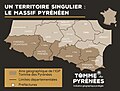 Carte Tomme des Pyrénées.jpg 2,000 × 1,512; 616 KB
-
 Carte union France—Royaume-Unis.jpg 7,000 × 4,192; 1.12 MB
-
 Carte village Fonakeukeu.png 725 × 682; 41 KB
-
 Carte viols et agression.pdf 1,239 × 1,752; 219 KB
-
 Carte wiki.png 1,040 × 698; 735 KB
-
 Carte établissements pénitentiaires et SPIP IDF .jpg 3,467 × 2,362; 604 KB
-
 Carte-de-franc=e.jpg 3,793 × 1,943; 1.07 MB
-
 Carte-EBRA-GROUPE.gif 2,329 × 2,350; 219 KB
-
 Carte-hauts-de-france-1024x684.png 1,024 × 684; 233 KB
-
 Carte-magasins-comptoirdelamer.jpg 2,126 × 2,953; 737 KB
-
 Carte-MTE-eolien.jpg 605 × 487; 56 KB
-
 Carte-REM gris FR low.jpg 995 × 645; 247 KB
-
 Carte-russie-PZ-90.11-IGS-DORIS.jpg 2,000 × 1,154; 173 KB
-
 CarteAdalUP.png 379 × 245; 17 KB
-
 Cartecirco6904.jpg 3,024 × 3,618; 2.56 MB
-
 Case coloniche della tenuta castello.png 419 × 357; 467 KB
-
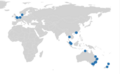
 Central American Bank for Economic Integration Map.png 7,192 × 3,318; 2.16 MB
-
 CF Regency Map E4.png 5,000 × 2,560; 3.35 MB
-
 ChanuForges.jpg 2,829 × 2,109; 1.29 MB
-
 Chicago Portage National Historic Site.png 2,134 × 2,159; 1.41 MB
-
 Chittoor District Revenue Divisions Map.png 1,400 × 866; 294 KB
-
 Chola empire map.jpg 1,033 × 778; 183 KB
-
 Chola Empire Map.png 1,039 × 746; 674 KB
-
 Cities and CDP's in Hillsborough county.png 2,360 × 1,640; 510 KB
-
 Cities and CDP's in Sarasota.png 2,360 × 1,640; 440 KB
-
 ClassiCube freebuild map.png 1,447 × 788; 1.14 MB
-
 Classification and Distribution Map of the Ngái Ethnic Group in Vietnam.jpg 1,280 × 720; 94 KB
-
 Cole's Map.png 1,633 × 821; 432 KB
-
 Colón Satelital.jpg 1,080 × 841; 311 KB
-
 Commonwealth of Nations Map.png 7,192 × 3,318; 1.07 MB
-
 Communauté de communes Provence Verdon.png 674 × 599; 83 KB
-
 Como province map.svg 744 × 1,052; 945 KB
-

-
 Conflicts in the world.png 2,754 × 1,398; 388 KB
-
 Convention for the Conservation of Antarctic Marine Living Resources Map.png 7,192 × 3,318; 2.14 MB


.jpg)


.png)


.jpg)


.png)


.jpg)


.svg)


.png)


Mission_scientifique_btv1b77591003.jpg)


.png)


.png)


.jpg)


_et_Tilleul_(43).jpg)