Category:Castlecove
Jump to navigation
Jump to search
town in Munster, Ireland  | |||||
| Upload media | |||||
| Instance of | |||||
|---|---|---|---|---|---|
| Location | County Kerry, Munster, Ireland | ||||
 | |||||
English: Castlecove is a village in County Kerry, Ireland, located on the Iveragh peninsula on the N70 road which forms part of the Ring of Kerry. It is situated on the southwestern side of the peninsula.
Media in category "Castlecove"
The following 17 files are in this category, out of 17 total.
-
 136 Gleesk - geograph.org.uk - 1022507.jpg 640 × 480; 73 KB
-
 An Siopa Dubh - geograph.org.uk - 575445.jpg 640 × 480; 77 KB
-
 Approaching Castlecove, N70 - geograph.org.uk - 5999072.jpg 1,024 × 441; 83 KB
-
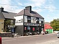 BlackShop.jpg 800 × 600; 80 KB
-
 Castlecove beach - 1 - geograph.org.uk - 1218874.jpg 640 × 420; 63 KB
-
 Castlecove beach - 2 - geograph.org.uk - 1218880.jpg 640 × 422; 59 KB
-

-

-

-
 Church at Castle Cove - geograph.org.uk - 5817286.jpg 1,024 × 768; 97 KB
-
 Coastline east of Castlecove - geograph.org.uk - 1218862.jpg 640 × 416; 88 KB
-
 Derelict cottage, Killeen - geograph.org.uk - 3309557.jpg 2,063 × 1,415; 950 KB
-
 House next to Birchgrove Farm, Behaghane - geograph.org.uk - 3309536.jpg 2,046 × 1,357; 1.01 MB
-
 Ring of Kerry, N70 - geograph.org.uk - 5999082.jpg 1,024 × 844; 225 KB
-
 Ring of Kerry, N70 - geograph.org.uk - 5999083.jpg 1,024 × 657; 151 KB
-

-
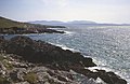
 The beautiful Kerry coast - geograph.org.uk - 575441.jpg 640 × 480; 78 KB


_-_geograph.org.uk_-_6497022.jpg)
_-_geograph.org.uk_-_6498598.jpg)
_-_geograph.org.uk_-_6498604.jpg)


