Category:Centenary Way, North Yorkshire
Jump to navigation
Jump to search
| Upload media | |||||
| Instance of |
| ||||
|---|---|---|---|---|---|
| Location | Yorkshire, England | ||||
| Length |
| ||||
| Terminus | |||||
| |||||
The Centenary Way is a hiking trail through England.
Media in category "Centenary Way, North Yorkshire"
The following 28 files are in this category, out of 28 total.
-
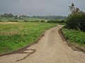 A Road To West Lilling - geograph.org.uk - 265965.jpg 640 × 480; 100 KB
-
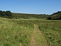 Camp Dale - geograph.org.uk - 202622.jpg 640 × 480; 83 KB
-
 Centenary Way at SE821665 - geograph.org.uk - 133116.jpg 640 × 480; 170 KB
-
-
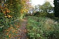
 Centenary Way Footpath heading east - geograph.org.uk - 1964282.jpg 640 × 480; 62 KB
-
 Centenary Way Hunmanby 1 (Nigel Coates).jpg 1,200 × 1,600; 660 KB
-
 Centenary Way towards Field House Farm (geograph 5936795).jpg 1,600 × 1,064; 884 KB
-
 Ebor ^ Centenary Ways and Foss Walk - geograph.org.uk - 5654774.jpg 1,600 × 1,064; 757 KB
-
 Ebor ^ Centenary Ways and Foss Walk - geograph.org.uk - 5658256.jpg 1,600 × 1,064; 1,014 KB
-
 Fingerpost on Towthorpe Road - geograph.org.uk - 5658267.jpg 1,600 × 1,064; 974 KB
-
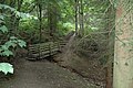
 Footbridge on Ebor ^ Centenary Ways and Foss Walk - geograph.org.uk - 5658261.jpg 1,600 × 1,064; 1.15 MB
-
 Footpath to the Jeffry Bog Plantation - geograph.org.uk - 1292238.jpg 640 × 427; 404 KB
-
 King of all he surveys (geograph 5526527).jpg 1,024 × 768; 198 KB
-
 Kirk Hill Settrington - geograph.org.uk - 245982.jpg 640 × 426; 259 KB
-
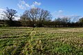
 Norton and Malton Golf Course - geograph.org.uk - 1270014.jpg 640 × 427; 379 KB
-
 Old railway at Wharram Percy - geograph.org.uk - 120164.jpg 640 × 480; 203 KB
-

-
 Over looking North Grimston June 2009 (Nigel Coates).jpg 3,264 × 2,448; 1.96 MB
-
 Over Looking Wintringham Close June 2009 (Nigel Coates).jpg 3,264 × 2,448; 1.96 MB
-
 River Derwent from the Centenary Way - geograph.org.uk - 1270098.jpg 640 × 427; 397 KB
-
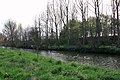
 Riverside footpath, near New Earswick - geograph.org.uk - 5070372.jpg 640 × 480; 574 KB
-
 The Centenary Way - geograph.org.uk - 1295077.jpg 640 × 427; 514 KB
-
 The Centenary Way - geograph.org.uk - 211181.jpg 640 × 480; 108 KB
-
 The Centenary Way and the River Derwent - geograph.org.uk - 1291700.jpg 640 × 418; 403 KB
-
 The riverside path near Earswick - geograph.org.uk - 3748477.jpg 1,024 × 681; 275 KB
-
 The riverside path towards Church Lane - geograph.org.uk - 3748176.jpg 1,024 × 681; 419 KB
-
 Wolds Way, Camp Dale - geograph.org.uk - 120277.jpg 640 × 480; 117 KB
-
 Wolds Way, Flixton Wold - geograph.org.uk - 120269.jpg 640 × 480; 119 KB


.jpg)
.jpg)


.jpg)


.jpg)
.jpg)


