Category:Chapel in Vesce (Tábor District)
Jump to navigation
Jump to search
| Object location | | View all coordinates using: OpenStreetMap |
|---|
,_chapel_01.jpg) | |||||
| Upload media | |||||
| Instance of | |||||
|---|---|---|---|---|---|
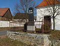
| Location | Vesce, Tábor District, South Bohemian Region, Czechia | ||||
 | |||||
Media in category "Chapel in Vesce (Tábor District)"
The following 5 files are in this category, out of 5 total.
-
 Kaple ve Vescích (Q80460471).jpg 1,200 × 899; 133 KB
-
 Vesce (Tábor District), chapel 01.jpg 2,736 × 3,648; 4.16 MB
-
 Vesce (Tábor District), chapel 02.jpg 3,088 × 3,746; 2.47 MB
-
 Vesce (Tábor District), chapel 03.jpg 2,736 × 3,648; 4.46 MB
-
 Vesce (Tábor District), memorial 01.jpg 3,582 × 2,736; 4.42 MB
.jpg)
,_chapel_02.jpg)
,_chapel_03.jpg)
,_memorial_01.jpg)