Category:Chapelle Saint-Mathias (Folkendange)
Jump to navigation
Jump to search
| Object location | | View all coordinates using: OpenStreetMap |
|---|
 | |||||
| Upload media | |||||
| Instance of | |||||
|---|---|---|---|---|---|
| Location |
| ||||
 | |||||
Media in category "Chapelle Saint-Mathias (Folkendange)"
The following 4 files are in this category, out of 4 total.
-
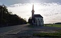 Folkendeng Chapel Bus Stop.jpg 4,000 × 2,500; 1.48 MB
-
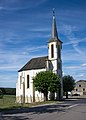
 Kapelle Folkendange 01.jpg 1,780 × 2,642; 2.45 MB
-
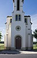
 Kapelle Folkendange 02.jpg 1,840 × 2,573; 2.85 MB
-
 Kapelle Folkendange 03.jpg 1,750 × 2,716; 2.86 MB


