Category:Charley, Leicestershire
Jump to navigation
Jump to search
village and civil parish in Leicestershire, United Kingdom | |||||
| Upload media | |||||
| Instance of | |||||
|---|---|---|---|---|---|
| Location | North West Leicestershire, Leicestershire, East Midlands, England | ||||
| Different from | |||||
 | |||||
English: Charley is a civil parish in the North West Leicestershire district of Leicestershire, England. According to the 2001 census it had a population of 203. It is set within the Charnwood Forest.

Subcategories
This category has the following 3 subcategories, out of 3 total.
C
M
Media in category "Charley, Leicestershire"
The following 200 files are in this category, out of 253 total.
(previous page) (next page)-
 A busy M1 heading north - geograph.org.uk - 2853727.jpg 640 × 480; 60 KB
-
 A view northwards across Charnwood - geograph.org.uk - 2105687.jpg 2,978 × 2,214; 2.22 MB
-
 A wet M1, southbound - geograph.org.uk - 4682468.jpg 640 × 408; 21 KB
-
 A wet M1, southbound - geograph.org.uk - 4682470.jpg 640 × 426; 20 KB
-
 Abbey Lodge along Abbey Road - geograph.org.uk - 5243366.jpg 775 × 800; 177 KB
-
 Abbey Road - geograph.org.uk - 5890666.jpg 4,000 × 3,000; 2.69 MB
-
 Abbey Road at Oaks in Charnwood - geograph.org.uk - 3521699.jpg 4,000 × 3,000; 3.43 MB
-
 Abbey Road towards Shepshed - geograph.org.uk - 3068411.jpg 640 × 480; 92 KB
-
 Abbey Road towards Shepshed - geograph.org.uk - 3068417.jpg 640 × 480; 87 KB
-
 B591 heading north towards Charley Crossroads - geograph.org.uk - 3515664.jpg 4,000 × 3,000; 3.44 MB
-
 B591 towards Copt Oak - geograph.org.uk - 3037083.jpg 640 × 480; 108 KB
-
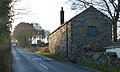
 Bawdon Lodge Farm at Charley Crossroads - geograph.org.uk - 3515675.jpg 2,790 × 2,050; 1.91 MB
-
 Beacon Energy - geograph.org.uk - 1904447.jpg 2,465 × 1,398; 1.55 MB
-
 Beacon Road near Bess Bagley Junction - geograph.org.uk - 3515382.jpg 3,321 × 2,343; 2.22 MB
-
 Bess Bagley Farm - geograph.org.uk - 3515575.jpg 3,108 × 2,425; 2.62 MB
-
 Bess Bagley Farm in Charnwood Forest - geograph.org.uk - 4055577.jpg 1,600 × 1,182; 513 KB
-
 Black Brook valley in Charnwood Forest - geograph.org.uk - 3521700.jpg 4,000 × 3,000; 4.64 MB
-
 Blackbrook Reservoir - geograph.org.uk - 5972498.jpg 3,850 × 2,887; 2.61 MB
-
 Blackbrook Reservoir dam - geograph.org.uk - 2103881.jpg 3,123 × 1,799; 2.51 MB
-
 Blackbrook valley in Charnwood Forest - geograph.org.uk - 3521703.jpg 4,000 × 3,000; 4.5 MB
-
 Bluebells in Burrow Wood - geograph.org.uk - 3518536.jpg 4,000 × 3,000; 6.97 MB
-
 Bluebells in Burrow Wood - geograph.org.uk - 3518537.jpg 1,024 × 768; 402 KB
-
 Bluebells in Cat Hill Wood - geograph.org.uk - 3517226.jpg 4,000 × 3,000; 4.76 MB
-
 Bluebells in Cat Hill Wood - geograph.org.uk - 3517239.jpg 3,459 × 2,799; 3.4 MB
-
 Bluebells in Cat Hill Wood - geograph.org.uk - 3518451.jpg 3,440 × 2,616; 4.64 MB
-
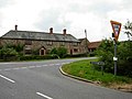
 Brickyard Cottages along the B591 - geograph.org.uk - 3515374.jpg 3,057 × 2,180; 1.99 MB
-
 Bridleway to Burrow Wood - geograph.org.uk - 5531503.jpg 4,000 × 3,000; 3.44 MB
-
 Building work at High Tor Farm - geograph.org.uk - 3521667.jpg 3,283 × 2,266; 2.17 MB
-
 Buildings at the Mount St Bernard Abbey - geograph.org.uk - 5243403.jpg 800 × 615; 133 KB
-
 Burrow Wood - geograph.org.uk - 350279.jpg 640 × 427; 151 KB
-
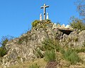 Calvary at Mount St Bernard Abbey - geograph.org.uk - 5243414.jpg 800 × 650; 154 KB
-
 Calvary in the Rock Garden - geograph.org.uk - 6155142.jpg 1,936 × 2,592; 2.79 MB
-
 Cattle in the Black Brook Valley - geograph.org.uk - 5244104.jpg 800 × 564; 125 KB
-
 Charley Chapel - geograph.org.uk - 2086567.jpg 3,072 × 2,304; 2.48 MB
-
 Charley Crossroads - geograph.org.uk - 188392.jpg 640 × 480; 70 KB
-
 Charley Crossroads in Charnwood Forest - geograph.org.uk - 3515672.jpg 2,843 × 2,117; 1.91 MB
-
 Charley Mill and pond - geograph.org.uk - 3520119.jpg 2,814 × 2,314; 1.97 MB
-
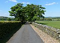
 Charley Road - geograph.org.uk - 5832568.jpg 4,000 × 3,000; 3.27 MB
-
 Charley Road - geograph.org.uk - 5832586.jpg 4,000 × 3,000; 3.2 MB
-
 Charnwood Andesite - geograph.org.uk - 2958168.jpg 640 × 424; 315 KB
-
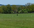
 Charnwood Forest farmland - geograph.org.uk - 3515654.jpg 2,737 × 2,104; 1.62 MB
-
 Charnwood Forest sheep - geograph.org.uk - 3515633.jpg 3,727 × 2,669; 2.97 MB
-
 Church of St. James the Greater - geograph.org.uk - 5244106.jpg 708 × 800; 185 KB
-

-
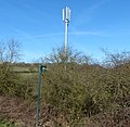 Communications mast next to the M1 motorway - geograph.org.uk - 4343335.jpg 1,600 × 1,565; 678 KB
-
 Country road climbing Whittle Hill - geograph.org.uk - 1904453.jpg 1,590 × 1,237; 877 KB
-
 Country Road descending Whittle Hill - geograph.org.uk - 1904457.jpg 1,712 × 1,075; 680 KB
-
 Countryside near Blackbrook Reservoir - geograph.org.uk - 2103984.jpg 3,264 × 2,448; 3.3 MB
-
 Cows near Mount St Bernard Abbey - geograph.org.uk - 2105646.jpg 2,728 × 1,675; 1.91 MB
-

-
 Derelict farm buildings near Mount St Bernard Abbey - geograph.org.uk - 2105700.jpg 1,737 × 1,565; 1.08 MB
-
 Descending along Ingleberry Road - geograph.org.uk - 3511797.jpg 4,000 × 3,000; 3.44 MB
-
 Door at Mount St Bernard Abbey - geograph.org.uk - 5243430.jpg 800 × 534; 135 KB
-
 Driveway and gates to Charley Mill - geograph.org.uk - 3518597.jpg 4,000 × 3,000; 5.65 MB
-
 Dry stone wall along Nanpantan Road - geograph.org.uk - 1904527.jpg 2,448 × 3,264; 2.65 MB
-
 Dry stone wall along Oaks Road - geograph.org.uk - 2105663.jpg 2,436 × 1,677; 1.88 MB
-
 Dry stone wall along the road to Charley Mill - geograph.org.uk - 3520218.jpg 4,000 × 2,835; 3.32 MB
-
 Dry stone wall at Charley Mill Farm - geograph.org.uk - 348690.jpg 640 × 427; 131 KB
-
 Dry stone wall at Roe's Plantation - geograph.org.uk - 1904523.jpg 3,197 × 2,360; 3.36 MB
-
 Dry stone wall near Rock Farm - geograph.org.uk - 3515728.jpg 3,736 × 2,938; 3.28 MB
-
 Drybrook Lodge Farm - geograph.org.uk - 2105694.jpg 2,778 × 2,211; 2.51 MB
-
 Entrance to Charley Knoll Farm - geograph.org.uk - 3515686.jpg 2,065 × 1,749; 1.09 MB
-
 Entrance to Charley Woods - geograph.org.uk - 348683.jpg 640 × 427; 134 KB
-
 Entrance to Charley Woods Nature Reserve - geograph.org.uk - 3518563.jpg 4,000 × 3,000; 3.36 MB
-
 Entrance to Louella Stud - geograph.org.uk - 3515592.jpg 3,475 × 2,435; 2.7 MB
-
 Entrance to the Scania Training Centre - geograph.org.uk - 3515711.jpg 2,922 × 2,050; 1.76 MB
-
 Entrance to Tudor Cottage - geograph.org.uk - 3511807.jpg 4,000 × 3,000; 3.33 MB
-
 Fallen tree at Charley Woods - geograph.org.uk - 350255.jpg 640 × 427; 125 KB
-
 Fallen tree in Kitehill Plantation - geograph.org.uk - 2103932.jpg 2,956 × 2,052; 2.42 MB
-
 Fallen tree near Blackbrook Reservoir - geograph.org.uk - 5243595.jpg 800 × 600; 178 KB
-
 Farm building at Mount St Bernard Abbey - geograph.org.uk - 5243400.jpg 800 × 602; 165 KB
-
 Farmland by Roe's Plantation - geograph.org.uk - 3037049.jpg 640 × 480; 56 KB
-
 Farmland near Blackbrook Reservoir - geograph.org.uk - 2258962.jpg 3,248 × 1,886; 2.64 MB
-
 Farmland near Charley Mill - geograph.org.uk - 3520113.jpg 3,514 × 2,740; 2.63 MB
-
 Farmland off Abbey Road - geograph.org.uk - 3068413.jpg 640 × 480; 60 KB
-
 Farmland towards the M1 - geograph.org.uk - 3037082.jpg 640 × 480; 66 KB
-
 Farmland, High Tor Farm - geograph.org.uk - 3068407.jpg 640 × 480; 69 KB
-
 Farmland, Oaks in Charnwood - geograph.org.uk - 3068427.jpg 640 × 480; 89 KB
-
 Farmland, Whittle Hill - geograph.org.uk - 3037050.jpg 640 × 480; 97 KB
-
 Fields west of Mount St Bernard Abbey - geograph.org.uk - 2105706.jpg 2,905 × 2,356; 2.89 MB
-
 Footpath across the fields - geograph.org.uk - 2105722.jpg 2,278 × 2,557; 2.56 MB
-
 Footpath and dry stone wall at Cat Hill Wood - geograph.org.uk - 3517249.jpg 3,673 × 2,692; 3.39 MB
-
 Footpath enters Burrow Wood - geograph.org.uk - 3518478.jpg 2,516 × 1,990; 1.59 MB
-
 Footpath from Benscliffe Road to Charley Road - geograph.org.uk - 5832553.jpg 4,000 × 3,000; 2.87 MB
-
 Footpath south from Mount St Bernard Abbey - geograph.org.uk - 5890665.jpg 4,000 × 3,000; 3.17 MB
-
 Footpath to Blackbrook Reservoir - geograph.org.uk - 2103906.jpg 3,173 × 2,110; 2.45 MB
-
 Footpath to Blackbrook Reservoir - geograph.org.uk - 2103986.jpg 2,991 × 2,362; 2.97 MB
-
 Footpath to Blackbrook Reservoir - geograph.org.uk - 5972493.jpg 4,000 × 3,000; 1.93 MB
-
 Footpath to Mount St Bernard Abbey - geograph.org.uk - 2103809.jpg 2,848 × 2,125; 2.4 MB
-
 Footpath to Oaks Road - geograph.org.uk - 2105730.jpg 2,808 × 2,049; 2.46 MB
-
 Footpath to Whitwick - geograph.org.uk - 2105711.jpg 2,331 × 3,154; 3.21 MB
-
 Footpaths in The Field at Charley Woods - geograph.org.uk - 3516874.jpg 3,494 × 2,590; 2.68 MB
-
 Former RAF Coalville (signals) building - geograph.org.uk - 4454285.jpg 4,320 × 3,240; 4.33 MB
-
 Foxgloves at Blackbrook Reservoir - geograph.org.uk - 2103868.jpg 2,290 × 3,003; 2.89 MB
-
 Gate and dry stone wall along Abbey Road - geograph.org.uk - 3521692.jpg 4,000 × 3,000; 4.84 MB
-
 Gate and farmland south of Beacon Road - geograph.org.uk - 3515340.jpg 4,000 × 3,000; 3.62 MB
-
 Gate and wall at Mount St Bernard Abbey - geograph.org.uk - 5243420.jpg 800 × 665; 232 KB
-
 Gate on Oaks Road - geograph.org.uk - 2105724.jpg 2,459 × 1,897; 1.96 MB
-
 Gate on to farmland - geograph.org.uk - 3513402.jpg 1,600 × 1,249; 762 KB
-
-

-
 Grazing sheep near Timberwood Hill - geograph.org.uk - 3518592.jpg 2,436 × 1,810; 1.27 MB
-
 Grazing, Oaks in Charnwood - geograph.org.uk - 3068420.jpg 640 × 480; 73 KB
-
 Grimley Andesite - geograph.org.uk - 2958175.jpg 640 × 424; 283 KB
-
 Grimley Andesite - geograph.org.uk - 2958181.jpg 640 × 411; 262 KB
-
 Heading east along Beacon Road - geograph.org.uk - 3515582.jpg 3,473 × 2,379; 2.63 MB
-
 Heading north along Abbey Road - geograph.org.uk - 3521701.jpg 2,528 × 2,028; 1.47 MB
-
 Heading west along the tree lined Beacon Road - geograph.org.uk - 3515366.jpg 4,000 × 3,000; 3.55 MB
-
 Hill Farm along the B591 - geograph.org.uk - 3515637.jpg 4,000 × 3,000; 3.27 MB
-
 Hillside Cottage - geograph.org.uk - 5243337.jpg 800 × 528; 147 KB
-
 Houses at Ridgefield Farm - geograph.org.uk - 3515668.jpg 3,946 × 2,785; 3.35 MB
-
 Information board at Bower Wood - geograph.org.uk - 3519023.jpg 2,981 × 3,321; 3.49 MB
-
 Information board at Charley Woods - geograph.org.uk - 3516865.jpg 4,000 × 3,000; 4.51 MB
-
 Ingleberry Road - geograph.org.uk - 1904515.jpg 2,935 × 2,025; 2.52 MB
-
 Ingleberry Road approaching Whittle Hill Crossroads - geograph.org.uk - 3511788.jpg 3,213 × 2,214; 2.12 MB
-
 Ingleberry Road towards Shepshed - geograph.org.uk - 3511777.jpg 3,487 × 2,567; 2.71 MB
-
 Inside Burrow Wood - geograph.org.uk - 3518500.jpg 4,000 × 3,000; 5.01 MB
-
 Junction along Shepshed Road - geograph.org.uk - 1904506.jpg 2,985 × 1,820; 2.23 MB
-
 Lane to Strawberry Hill Plantation - geograph.org.uk - 2259721.jpg 2,965 × 2,055; 2.71 MB
-
 Little Garendon along Charley Road - geograph.org.uk - 3521704.jpg 3,215 × 2,297; 2.43 MB
-
 Lodge along Oaks Road - geograph.org.uk - 2105678.jpg 2,169 × 1,368; 1.07 MB
-
 Longcliffe Lodge Farm - geograph.org.uk - 3511772.jpg 4,000 × 3,000; 4.81 MB
-
 Longhorn cattle next to Swannymote Road - geograph.org.uk - 2259659.jpg 3,264 × 1,983; 2.86 MB
-

-
-
 M1 approaching Junction 22 - geograph.org.uk - 3657113.jpg 2,848 × 2,144; 1.54 MB
-
 M1 motorway bridge across Charley Road - geograph.org.uk - 3515716.jpg 4,000 × 3,000; 3.44 MB
-
 M1 northbound - geograph.org.uk - 2853726.jpg 640 × 472; 62 KB
-
 M1 Northbound - geograph.org.uk - 3856197.jpg 3,630 × 1,406; 2.61 MB
-
 M1 Northbound - geograph.org.uk - 3856203.jpg 3,110 × 1,388; 2.36 MB
-
 M1 northbound, Charnwood Forest - geograph.org.uk - 2853721.jpg 640 × 480; 45 KB
-
-
 Minor road towards Coalville - geograph.org.uk - 3067622.jpg 640 × 480; 50 KB
-
 Mount St Bernard Abbey - geograph.org.uk - 2105728.jpg 1,397 × 1,340; 659 KB
-
 Mount St Bernard Abbey - geograph.org.uk - 3521673.jpg 2,902 × 2,007; 1.87 MB
-
 Mount St Bernard Abbey - geograph.org.uk - 5243425.jpg 800 × 686; 186 KB
-
 Mount St Bernard Abbey - geograph.org.uk - 5890660.jpg 3,783 × 2,837; 2.01 MB
-
 Mount St Bernard Abbey - geograph.org.uk - 5947626.jpg 640 × 467; 79 KB
-
 Mount St Bernard Abbey viewed from Abbey Road - geograph.org.uk - 3521690.jpg 3,481 × 2,634; 2.72 MB
-

-
 Nanpantan Road towards Loughborough - geograph.org.uk - 1904525.jpg 3,264 × 2,448; 3.24 MB
-
 New stile at Bower Wood - geograph.org.uk - 3518579.jpg 3,699 × 2,911; 3.31 MB
-
 Northbound traffic on the M1 motorway - geograph.org.uk - 4343339.jpg 1,600 × 1,124; 350 KB
-
 Oaks Road heading east - geograph.org.uk - 3068422.jpg 640 × 480; 114 KB
-
 Oaks Road in Oaks in Charnwood - geograph.org.uk - 5948310.jpg 640 × 469; 151 KB
-
 Oaks Road in the Black Brook Valley - geograph.org.uk - 5244103.jpg 800 × 507; 157 KB
-

-
 Oaks Road towards Whitwick - geograph.org.uk - 2105667.jpg 2,747 × 1,453; 1.75 MB
-
 Oaks Road towards Whitwick - geograph.org.uk - 2105715.jpg 2,332 × 1,126; 1.04 MB
-
 Oaks Road towards Whitwick - geograph.org.uk - 5948328.jpg 640 × 486; 145 KB
-
 Oaks Road, Oaks in Charnwood - geograph.org.uk - 3068426.jpg 640 × 480; 122 KB
-
 Overbridge, M1 - geograph.org.uk - 4682494.jpg 640 × 398; 23 KB
-
 Path and bluebells in Cat Hill Wood - geograph.org.uk - 3517234.jpg 4,000 × 3,000; 3.69 MB
-
 Path and dry stone wall near Burrow Wood - geograph.org.uk - 3518589.jpg 4,000 × 3,000; 4.39 MB
-
 Path and gate to Charley Woods - geograph.org.uk - 3516863.jpg 3,589 × 2,682; 3.16 MB
-
 Path near Whitwick Quarry - geograph.org.uk - 2105732.jpg 2,448 × 2,415; 2.59 MB
-
 Path through Burrow Wood - geograph.org.uk - 3518546.jpg 4,000 × 3,000; 4.04 MB
-
 Path through Kitehill Plantation - geograph.org.uk - 2103912.jpg 3,264 × 2,448; 3.2 MB
-
 Path through the woods - geograph.org.uk - 2253074.jpg 3,117 × 2,231; 2.82 MB
-
 Path to Blackbrook Reservoir - geograph.org.uk - 2103949.jpg 2,169 × 1,443; 1.3 MB
-
 Path to Cat Hill Wood - geograph.org.uk - 3516876.jpg 4,000 × 3,000; 4.91 MB
-
 Pettifors Farm - geograph.org.uk - 3067619.jpg 640 × 480; 48 KB
-
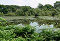
 Pond and Swannymote Wood - geograph.org.uk - 5888330.jpg 4,000 × 3,000; 5.44 MB
-
 Poultney Cottage Farm in Charnwood Forest - geograph.org.uk - 3515348.jpg 4,000 × 3,000; 4.95 MB
-
 Private track to Drybrook Lodge Farm - geograph.org.uk - 2103895.jpg 3,264 × 2,105; 2.67 MB
-
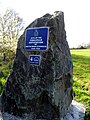 RAF Coalville Outstation memorial - geograph.org.uk - 4454277.jpg 3,240 × 4,320; 4.25 MB
-
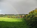 Rainbow over St James Church - geograph.org.uk - 1640722.jpg 640 × 480; 263 KB
-
 Ratcliffe on Soar power station - geograph.org.uk - 4454238.jpg 4,280 × 3,186; 4.02 MB
-
 Road at Whittle Hill - geograph.org.uk - 1470320.jpg 640 × 480; 100 KB
-
 Road Bridge over M1 near Copt Oak - geograph.org.uk - 5895380.jpg 1,024 × 544; 84 KB
-
 Road junction - geograph.org.uk - 5541760.jpg 1,600 × 900; 247 KB
-
 Road to Charley Hall - geograph.org.uk - 3515732.jpg 3,640 × 2,602; 3.15 MB
-
 Road to Charley Mill - geograph.org.uk - 3520136.jpg 3,711 × 2,649; 3.39 MB
-
 Road to Ridgefield Farm - geograph.org.uk - 3515645.jpg 2,315 × 1,827; 1.39 MB
-
 Rock Farm in Charnwood Forest - geograph.org.uk - 3515724.jpg 3,692 × 2,673; 3.64 MB
-
 Rock in a field - geograph.org.uk - 2105719.jpg 2,448 × 2,591; 2.81 MB
-
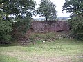 Rock outcrop - geograph.org.uk - 2021283.jpg 2,816 × 2,112; 2.83 MB
-
 Roe's Plantation - geograph.org.uk - 1470312.jpg 640 × 480; 136 KB
-
 Ruined stone building near Cat Hill Wood - geograph.org.uk - 3517268.jpg 4,000 × 3,000; 4.54 MB
-
 Sheep near Mount St Bernard Abbey - geograph.org.uk - 5243381.jpg 800 × 519; 106 KB
-
 Sheep near Mount St Bernard Abbey - geograph.org.uk - 5243387.jpg 800 × 536; 94 KB
-
 Sheep pasture near Charley Mill - geograph.org.uk - 3520090.jpg 3,111 × 2,433; 2.24 MB
-
 Sign for the Monastery - geograph.org.uk - 2105626.jpg 2,686 × 2,097; 2.22 MB
-
 Signpost at Abbey Road Oaks Road junction - geograph.org.uk - 3521698.jpg 3,663 × 2,864; 3.06 MB
-
 Small footbridge in Burrow Wood - geograph.org.uk - 3518493.jpg 2,981 × 3,626; 3.55 MB
-
 St James the Great - geograph.org.uk - 4454190.jpg 4,320 × 3,240; 5.85 MB
-
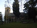 St James the Greater - geograph.org.uk - 5604929.jpg 4,000 × 3,000; 2.49 MB
-
 St Joseph's along Abbey Road - geograph.org.uk - 3521695.jpg 4,000 × 3,000; 4.6 MB
-
 St Joseph's Close, Charley - geograph.org.uk - 1640736.jpg 640 × 480; 290 KB
-
 Stile along the footpath - geograph.org.uk - 2105726.jpg 3,076 × 2,297; 2.96 MB
-
-
 The Abbey Church - geograph.org.uk - 6155143.jpg 2,592 × 1,936; 1.92 MB
-
 The B591 looking north east - geograph.org.uk - 5832592.jpg 4,000 × 3,000; 3.54 MB
-
 The B591 near Copt Oak in Charnwood Forest - geograph.org.uk - 4055585.jpg 1,600 × 1,200; 552 KB
-
 The Bomb Rocks, Charnwood Lodge SSSI, Charnwood Forest.jpg 1,600 × 1,063; 514 KB
-
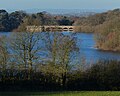 The dam at Blackbrook Reservoir - geograph.org.uk - 5243592.jpg 800 × 637; 139 KB
-
 The eastern arm of Blackbrook Reservoir - geograph.org.uk - 2103785.jpg 3,162 × 2,191; 2.01 MB
-
 The eastern arm of Blackbrook Reservoir - geograph.org.uk - 2103798.jpg 3,094 × 1,853; 2.05 MB
-
 The eastern end of Blackbrook Reservoir - geograph.org.uk - 2103743.jpg 3,035 × 2,100; 2.56 MB
-
 The eastern end of Blackbrook Reservoir - geograph.org.uk - 2103768.jpg 3,146 × 2,107; 2.6 MB


_building_-_geograph.org.uk_-_4454285.jpg)


