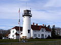
Category:Chatham Light
Jump to navigation
Jump to search
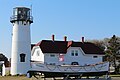
- round cast iron tower (brick lined)
| Object location | | View all coordinates using: OpenStreetMap |
|---|
lighthouse in Massachusetts, United States  | |||||
| Upload media | |||||
| Instance of | |||||
|---|---|---|---|---|---|
| Made from material | |||||
| Location | Chatham, Barnstable County, Massachusetts | ||||
| Heritage designation |
| ||||
| Service entry |
| ||||
| Inception |
| ||||
| Height |
| ||||
 | |||||
Media in category "Chatham Light"
The following 106 files are in this category, out of 106 total.
-
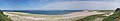 Chatham Beach Panorama.jpg 21,646 × 3,876; 13.4 MB
-
 Chatham Light (2061220401).jpg 2,304 × 3,072; 1.32 MB
-
 Chatham Light (2061222581).jpg 1,691 × 2,115; 762 KB
-
 Chatham Light at Night (2060909343).jpg 3,072 × 2,304; 1.32 MB
-
 Chatham Light at Night (2061179799).jpg 414 × 272; 30 KB
-
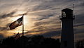 Chatham Light House sunset.JPG 4,608 × 2,592; 2.56 MB
-
 Chatham Light House, Main St. - panoramio (1).jpg 4,983 × 3,319; 3.02 MB
-
 Chatham Light House, Main St. - panoramio.jpg 3,381 × 5,075; 3.24 MB
-
 Chatham Light lens display (2061085719).jpg 2,592 × 1,936; 844 KB
-
 Chatham Light MA in 2007.jpg 3,072 × 2,304; 1.55 MB
-
 Chatham Light MA.jpg 3,072 × 2,304; 1.47 MB
-
 Chatham Light Station beach view.JPG 4,608 × 2,592; 3.19 MB
-
 Chatham Light Station beach view2.JPG 4,608 × 2,592; 3.16 MB
-
 Chatham Light Station.JPG 4,608 × 3,456; 3.12 MB
-
 Chatham Light through the trees (2062008334).jpg 2,304 × 3,072; 1.44 MB
-
 Chatham Light, 1807-1818 - NARA - 81128611 (page 1).jpg 3,492 × 4,176; 4.23 MB
-
 Chatham Light, 1807-1818 - NARA - 81128611 (page 10).jpg 5,292 × 3,156; 3.97 MB
-
 Chatham Light, 1807-1818 - NARA - 81128611 (page 11).jpg 3,293 × 5,204; 4.83 MB
-
 Chatham Light, 1807-1818 - NARA - 81128611 (page 12).jpg 3,216 × 5,184; 4.51 MB
-
 Chatham Light, 1807-1818 - NARA - 81128611 (page 13).jpg 4,529 × 3,443; 3.72 MB
-
 Chatham Light, 1807-1818 - NARA - 81128611 (page 14).jpg 3,348 × 5,376; 3.48 MB
-
 Chatham Light, 1807-1818 - NARA - 81128611 (page 15).jpg 3,319 × 5,362; 4.8 MB
-
 Chatham Light, 1807-1818 - NARA - 81128611 (page 16).jpg 5,364 × 3,348; 4.57 MB
-
 Chatham Light, 1807-1818 - NARA - 81128611 (page 17).jpg 3,521 × 4,511; 4.91 MB
-
 Chatham Light, 1807-1818 - NARA - 81128611 (page 18).jpg 4,512 × 3,468; 2.07 MB
-
 Chatham Light, 1807-1818 - NARA - 81128611 (page 19).jpg 3,376 × 5,325; 4.81 MB
-
 Chatham Light, 1807-1818 - NARA - 81128611 (page 2).jpg 4,200 × 3,480; 3.73 MB
-
 Chatham Light, 1807-1818 - NARA - 81128611 (page 20).jpg 4,498 × 3,335; 3.56 MB
-
 Chatham Light, 1807-1818 - NARA - 81128611 (page 21).jpg 3,652 × 4,572; 3.68 MB
-
 Chatham Light, 1807-1818 - NARA - 81128611 (page 22).jpg 4,596 × 3,624; 4.15 MB
-
 Chatham Light, 1807-1818 - NARA - 81128611 (page 23).jpg 4,620 × 3,708; 10.11 MB
-
 Chatham Light, 1807-1818 - NARA - 81128611 (page 24).jpg 3,496 × 5,479; 3.53 MB
-
 Chatham Light, 1807-1818 - NARA - 81128611 (page 25).jpg 3,306 × 5,337; 3.31 MB
-
 Chatham Light, 1807-1818 - NARA - 81128611 (page 26).jpg 4,140 × 3,336; 3.76 MB
-
 Chatham Light, 1807-1818 - NARA - 81128611 (page 27).jpg 3,401 × 5,504; 3.96 MB
-
 Chatham Light, 1807-1818 - NARA - 81128611 (page 28).jpg 3,388 × 5,273; 4.74 MB
-
 Chatham Light, 1807-1818 - NARA - 81128611 (page 29).jpg 3,374 × 4,438; 4.07 MB
-
 Chatham Light, 1807-1818 - NARA - 81128611 (page 3).jpg 3,456 × 4,164; 3.85 MB
-
 Chatham Light, 1807-1818 - NARA - 81128611 (page 30).jpg 4,500 × 3,468; 4.22 MB
-
 Chatham Light, 1807-1818 - NARA - 81128611 (page 31).jpg 3,720 × 5,448; 3.39 MB
-
 Chatham Light, 1807-1818 - NARA - 81128611 (page 32).jpg 5,316 × 3,636; 4.01 MB
-
 Chatham Light, 1807-1818 - NARA - 81128611 (page 33).jpg 4,452 × 3,444; 3.81 MB
-
 Chatham Light, 1807-1818 - NARA - 81128611 (page 34).jpg 3,156 × 5,424; 3.46 MB
-
 Chatham Light, 1807-1818 - NARA - 81128611 (page 35).jpg 5,448 × 3,168; 3.1 MB
-
 Chatham Light, 1807-1818 - NARA - 81128611 (page 36).jpg 3,552 × 4,980; 3.68 MB
-
 Chatham Light, 1807-1818 - NARA - 81128611 (page 37).jpg 3,564 × 5,028; 3.08 MB
-
 Chatham Light, 1807-1818 - NARA - 81128611 (page 38).jpg 3,600 × 5,184; 3.23 MB
-
 Chatham Light, 1807-1818 - NARA - 81128611 (page 39).jpg 3,696 × 4,464; 4.57 MB
-
 Chatham Light, 1807-1818 - NARA - 81128611 (page 4).jpg 4,208 × 3,517; 3.53 MB
-
 Chatham Light, 1807-1818 - NARA - 81128611 (page 40).jpg 4,008 × 3,540; 3.64 MB
-
 Chatham Light, 1807-1818 - NARA - 81128611 (page 41).jpg 3,294 × 5,482; 3.75 MB
-
 Chatham Light, 1807-1818 - NARA - 81128611 (page 42).jpg 3,722 × 4,804; 3.17 MB
-
 Chatham Light, 1807-1818 - NARA - 81128611 (page 43).jpg 3,324 × 5,472; 3.68 MB
-
 Chatham Light, 1807-1818 - NARA - 81128611 (page 44).jpg 4,575 × 3,470; 3.79 MB
-
 Chatham Light, 1807-1818 - NARA - 81128611 (page 45).jpg 3,264 × 5,364; 3.54 MB
-
 Chatham Light, 1807-1818 - NARA - 81128611 (page 46).jpg 3,486 × 4,766; 4.13 MB
-
 Chatham Light, 1807-1818 - NARA - 81128611 (page 47).jpg 4,775 × 3,432; 4.03 MB
-
 Chatham Light, 1807-1818 - NARA - 81128611 (page 48).jpg 3,492 × 4,680; 4.43 MB
-
 Chatham Light, 1807-1818 - NARA - 81128611 (page 49).jpg 3,552 × 4,692; 4.43 MB
-
 Chatham Light, 1807-1818 - NARA - 81128611 (page 5).jpg 3,569 × 4,391; 4.04 MB
-
 Chatham Light, 1807-1818 - NARA - 81128611 (page 50).jpg 3,672 × 4,584; 4.33 MB
-
 Chatham Light, 1807-1818 - NARA - 81128611 (page 51).jpg 4,584 × 3,648; 4.22 MB
-
 Chatham Light, 1807-1818 - NARA - 81128611 (page 52).jpg 3,359 × 5,468; 3.45 MB
-
 Chatham Light, 1807-1818 - NARA - 81128611 (page 53).jpg 4,584 × 3,360; 3.86 MB
-
 Chatham Light, 1807-1818 - NARA - 81128611 (page 54).jpg 3,340 × 4,768; 4.11 MB
-
 Chatham Light, 1807-1818 - NARA - 81128611 (page 6).jpg 4,360 × 3,551; 3.73 MB
-
 Chatham Light, 1807-1818 - NARA - 81128611 (page 7).jpg 3,543 × 4,389; 3.93 MB
-
 Chatham Light, 1807-1818 - NARA - 81128611 (page 8).jpg 4,404 × 3,504; 3.87 MB
-
 Chatham Light, 1807-1818 - NARA - 81128611 (page 9).jpg 3,194 × 5,258; 4.47 MB
-
 Chatham Light, Chatham, Cape Cod, Mass (72826).jpg 3,306 × 2,092; 2.74 MB
-
 Chatham Light, Chatham, Mass (84742).jpg 3,325 × 2,158; 2.71 MB
-
 Chatham Lighthouse + sign (13978789348).jpg 4,615 × 3,057; 7.41 MB
-
 Chatham Lighthouse - Chatham, Massachusetts, USA - September 30, 2023 01.jpg 8,028 × 5,352; 18.73 MB
-
 Chatham Lighthouse - Chatham, Massachusetts, USA - September 30, 2023.jpg 8,193 × 5,462; 18.34 MB
-
 Chatham Lighthouse 1877 tower original lantern MA.JPG 452 × 320; 20 KB
-
 Chatham Lighthouse 1877 tower replacement lantern MA.JPG 452 × 363; 32 KB
-
 Chatham lighthouse daytime.jpg 3,264 × 2,448; 1.55 MB
-
 Chatham LIghthouse on a cool spring day (13978772027).jpg 3,741 × 2,478; 4.49 MB
-
 Chatham Lighthouse two towers MA.JPG 464 × 228; 12 KB
-
 Chatham Lighthouse, Maine USA.jpg 2,425 × 1,791; 1.18 MB
-
 Chatham Lighthouse.jpg 1,500 × 1,000; 171 KB
-
 Chatham Lights, Chatham, MA.jpg 553 × 355; 33 KB
-
 ChathamLight1.jpg 2,560 × 1,440; 891 KB
-
 ChathamLight2.jpg 2,560 × 1,440; 881 KB
-
 ChathamLightandCoastGuard.jpg 4,032 × 3,024; 4.39 MB
-
 ChathamMassachusettsLight.jpg 516 × 345; 28 KB
-
 Chathams Twin Light (2061871826).jpg 1,936 × 2,592; 1.01 MB
-
 DSCF3097 (2060906993).jpg 3,072 × 2,304; 1.27 MB
-
 DSCF3098 (2061695292).jpg 3,072 × 2,304; 1.12 MB
-
 DSCF3100 (2061695974).jpg 3,072 × 2,304; 1.15 MB
-
 DSCF3101 (2061967514).jpg 1,996 × 1,297; 479 KB
-
 DSCF3107 (2061180179).jpg 2,304 × 3,072; 1,024 KB
-
 DSCF3320 (2061842054).jpg 3,072 × 2,304; 1.32 MB
-
 DSCF3323 (2061222195).jpg 2,304 × 3,072; 1.48 MB
-
 Gay Head Light, 1799 - NARA - 81128613 (page 1).jpg 3,564 × 4,368; 4.79 MB
-
 Gay Head Light, 1799 - NARA - 81128613 (page 12).jpg 5,208 × 3,288; 4.54 MB
-
 Gay Head Light, 1799 - NARA - 81128613 (page 14).jpg 4,428 × 3,552; 4.4 MB
-
 Gay Head Light, 1799 - NARA - 81128613 (page 4).jpg 3,708 × 3,084; 3.28 MB
-
 Gay Head Light, 1799 - NARA - 81128613 (page 6).jpg 4,476 × 3,492; 4.31 MB
-
 HPIM2552 (2061871254).jpg 1,936 × 2,592; 813 KB
-
 HPIM2554 (2061872344).jpg 2,592 × 1,936; 1.05 MB
-
 HPIM2555 (2061872948).jpg 2,592 × 1,936; 1.14 MB
-
 HPIM2556 (2061085123).jpg 2,592 × 1,936; 1.32 MB
-
 HPIM2558 (2061086215).jpg 2,592 × 1,936; 799 KB
-
 Lighthouse chatham.jpg 384 × 288; 111 KB
-
 Massachusetts - Chatham - DPLA - 499a778a807c685ee102e16550255b9f.jpg 4,040 × 3,102; 11.01 MB
.jpg)
.jpg)
.jpg)
.jpg)

.jpg)

.jpg)


.jpg)
.jpg)
.jpg)
.jpg)
.jpg)
.jpg)
.jpg)
.jpg)
.jpg)
.jpg)
.jpg)
.jpg)
.jpg)
.jpg)
.jpg)
.jpg)
.jpg)
.jpg)
.jpg)
.jpg)
.jpg)
.jpg)
.jpg)
.jpg)
.jpg)
.jpg)
.jpg)
.jpg)
.jpg)
.jpg)
.jpg)
.jpg)
.jpg)
.jpg)
.jpg)
.jpg)
.jpg)
.jpg)
.jpg)
.jpg)
.jpg)
.jpg)
.jpg)
.jpg)
.jpg)
.jpg)
.jpg)
.jpg)
.jpg)
.jpg)
.jpg)
.jpg)
.jpg)
.jpg)
.jpg)
.jpg)
.jpg)
.jpg)


.jpg)


.jpg)
.jpg)
.jpg)
.jpg)
.jpg)
.jpg)
.jpg)
.jpg)
.jpg)
.jpg)
.jpg)
.jpg)
.jpg)
.jpg)
.jpg)
.jpg)
.jpg)
.jpg)


Categories:
- Lighthouses on the National Register of Historic Places in Massachusetts
- National Register of Historic Places in Barnstable County, Massachusetts
- Lighthouses in the United States by name
- Buildings in Chatham, Massachusetts
- Lighthouses built in 1877
- Lighthouses by height, 11 to 20 meters
- Cast-iron lighthouses in the United States
- Lighthouses in Massachusetts
- White lighthouses in the United States
- Brick lighthouses in the United States
- Cape Cod lighthouses
- Lighthouses by range, 20 to 24 nm
- Landfall lights in the United States
- Lighthouses with fourth order Fresnel lenses